Tar Heel Snow
-
Posts
371 -
Joined
-
Last visited
About Tar Heel Snow

-
This is unreal. Only seen this much snow in my life one other time. And never this powdery!!
-
Why can’t big snows just stay big snows lol
-

Extreme Cold, Snow & Sleet: SECS 1/24 - 1/26
Tar Heel Snow replied to TriPol's topic in New York City Metro
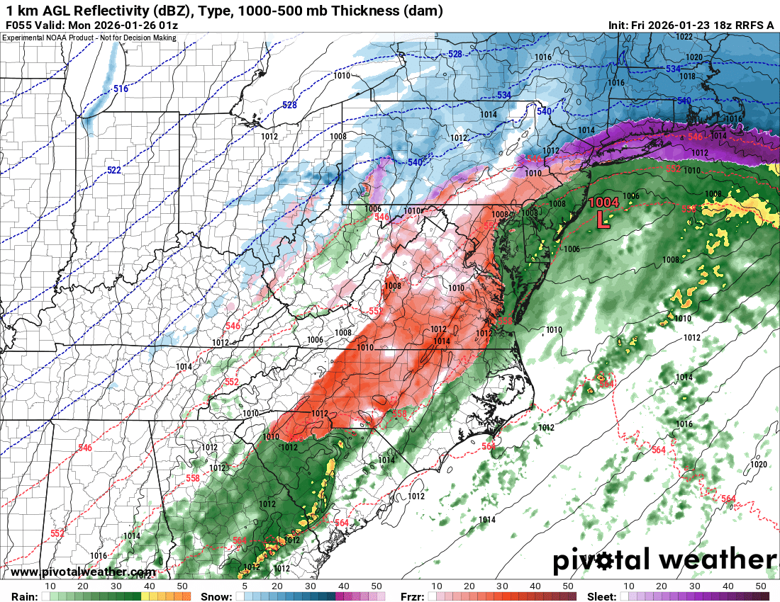
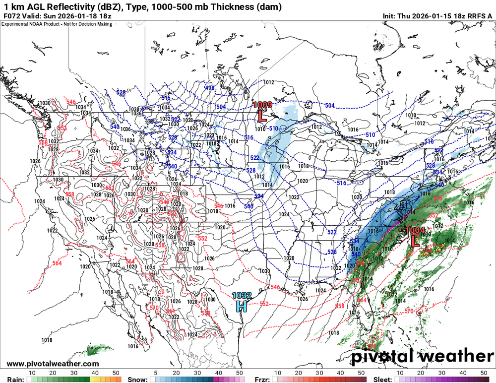
Shoot, sorry everyone. Not sure why pivotal defaulted to showing the old run when I clicked, but the 18z RRFS was a lot messier about 8-9 hours of snow and then 8-9 hours of IP/ZR. Ugh. Don’t like the direction this and the NAM went at all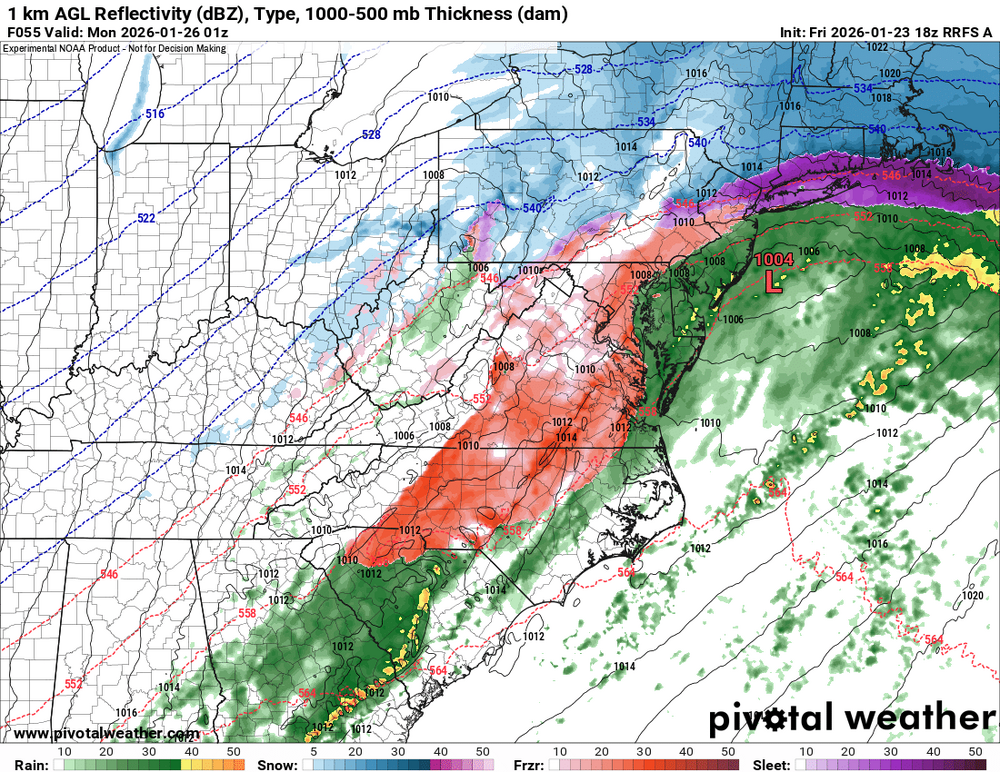
-
Extreme Cold, Snow & Sleet: SECS 1/24 - 1/26
Tar Heel Snow replied to TriPol's topic in New York City Metro
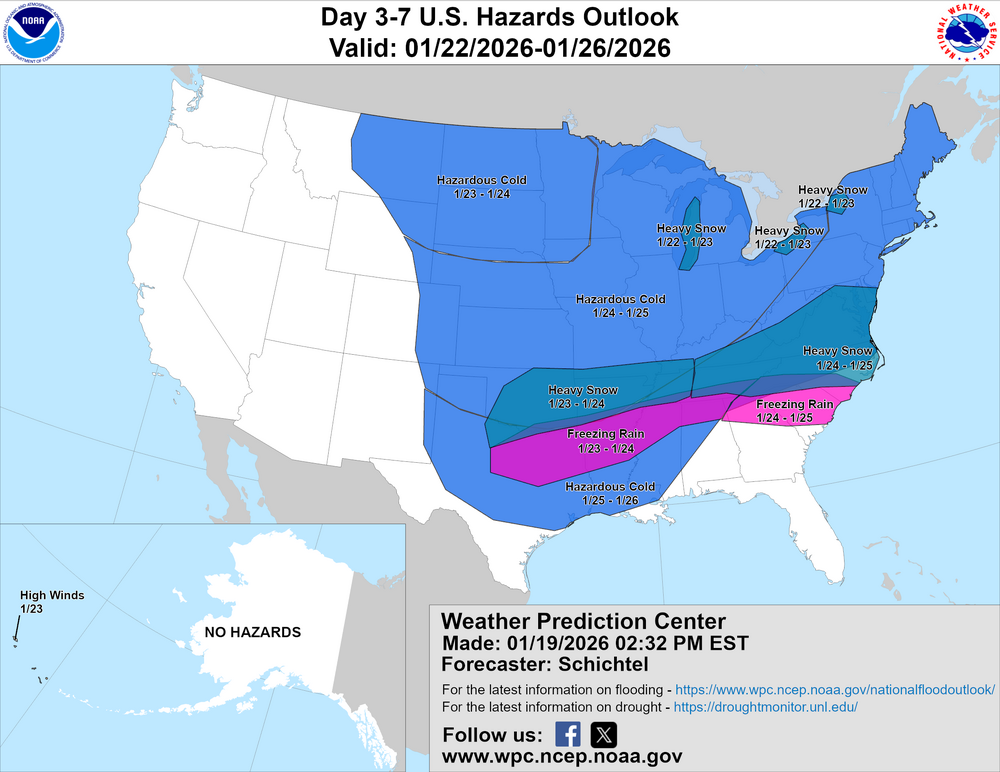
Yeah, warm noses always seem to rear their ugly heads earlier than modeled, at least they did back in NC. Not saying we’ve lost it or storm canceled, but it would be disappointing to lose a lot of this QPF to sleet. That said, hopefully we just stay where we are right now and don’t go in the wrong direction. Lucky to have what we have. -
Congrats Quebec City
-
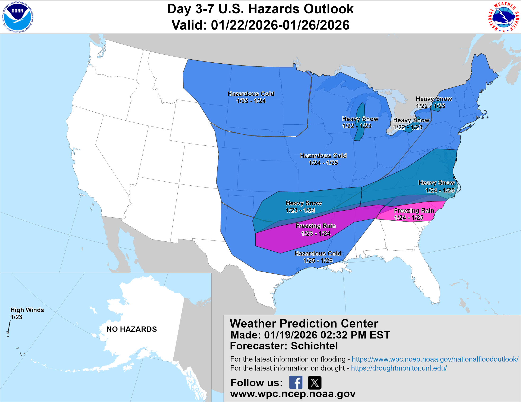
Well that’s straight up concerning. I do not like where we are rn. Know better than to overreact to where things stand at D3+, but with how relatively steady most models have been, I’d like to start seeing more movement in our favor soon. Parents back in central NC might get their most snow since January 2000
-
-
Storm potential January 17th-18th
Tar Heel Snow replied to WeatherGeek2025's topic in New York City Metro
This is a wildly difficult forecast. I mean it could literally be nothing outside of some Saturday mood flakes or we could see legitimate accumulations closer to the coast. I don’t envy the Mets who have to communicate this stuff to the public. -
Storm potential January 17th-18th
Tar Heel Snow replied to WeatherGeek2025's topic in New York City Metro
From Eric Webb (aka my current hopium dealer) There are positive feedbacks between warm advection, precip, latent heat release, and wave tilt/amplitude that a lot of, if not most, models are going to miss in setups like these, which make them especially tricky to forecast. It’s easy for a lot of people and forecasters alike to get caught up in the models and underestimate the effect these processes and the magnitude of impact they can have on even a short range forecast. This positive feedback loop involves warm advection and upglide aloft generating more precip and latent heating, which force -PVa ahead of our upper trough, causing the wave to slow and tilt the over more negatively/less positively. The increased wave tilt is able to advect more warm/moist air aloft over the Arctic front, which triggers more precip, etc.When your air mass is super marginal like this and the large-scale flow is diffluent downstream (ridging off Newfoundland), you’re even more vulnerable to this positive feedback running away in a hurry and amplifying the short-term changes in the models. This is just the kind of recipe that can lead to big forecast busts, especially on the north & west side of these systems where the warm advection is weaker but also closer to the snow growth zone aloft -
Storm potential January 17th-18th
Tar Heel Snow replied to WeatherGeek2025's topic in New York City Metro
Maybe so, I've seen this type of overrunning event really pump precip more than modeled due to WAA down south many times before. Might not be a thing here as much though. Probably putting too much hope into it at this point, but I was out of town for our two NY snows this year, and haven't seen a true winter storm in probably 4 years! -
Storm potential January 17th-18th
Tar Heel Snow replied to WeatherGeek2025's topic in New York City Metro
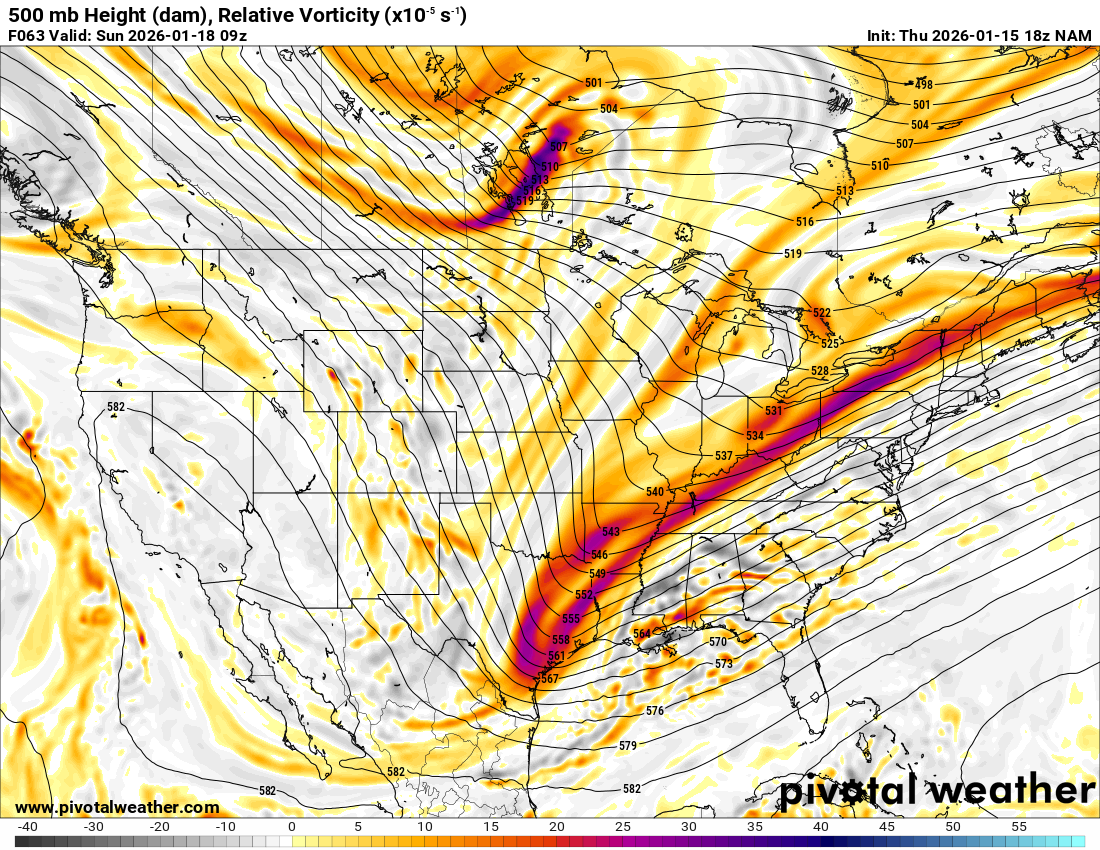
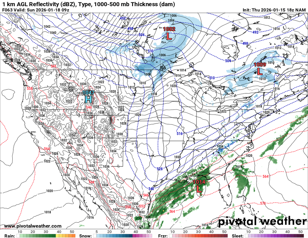
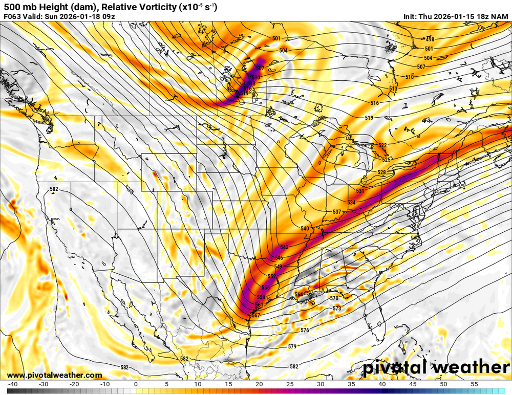
EDIT: Got a Rufus vort map from a friend on another forum and re-added the right NAM vort map Our problem on the NAM to my untrained eye is that piece of energy in Manitoba. It really rushes to push our wave out to sea (obviously not having any blocking probably hurts too) On our new buddy Rufus, our storm seems to be moving more quickly while the Manitoba wave lags behind, giving it a little more space to push west. FWIW, what Rufus is doing synoptically makes more sense to me given the type of storm for the climo I'm used to down in North Carolina. But that doesn't mean it's handling the timing particularly better than the NAM. This would be an interesting test for a model that sounds like will eventually replace the NAM Thi This is our reward on the back end^

-
Storm potential January 17th-18th
Tar Heel Snow replied to WeatherGeek2025's topic in New York City Metro
Big time, came in west downstream too. That's a terrific sign for that model, which has been otherwise rock-steady -
Storm potential January 17th-18th
Tar Heel Snow replied to WeatherGeek2025's topic in New York City Metro
lol it's gonna do it again. telling ya, this ain't done with west adjustments -
Storm potential January 17th-18th
Tar Heel Snow replied to WeatherGeek2025's topic in New York City Metro
Just a of miles N Just a few miles off from a VERY tasty looking FGEN band verbatim too. Very, very fickle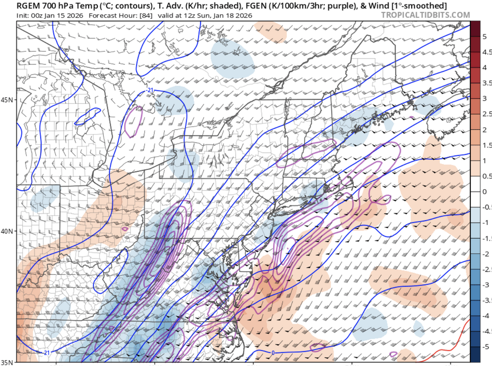
-
Storm potential January 17th-18th
Tar Heel Snow replied to WeatherGeek2025's topic in New York City Metro
Verbatim that’s snowing in the city for 9 straight hours during the day. Give me that 7 days a week and twice on Sunday.