CADEffect
-
Posts
109 -
Joined
-
Last visited
About CADEffect

-
Do you have a twitter account? -D .
-
So much for our "big dog" on the 31st.
-
You guys don't know how to handle this upcoming pattern change just like these models don't. Chill
-
For Guys I’m the RAH area. “We are sending out new WSW as we speak. The main change was to raise the storm total ice values for southern Davidson, Stanley, Randolph, Montgomery, Anson counties in particular. Values of .25 to .40 will be possible. Impacts will be numerous to potentially widespread power outages”
-
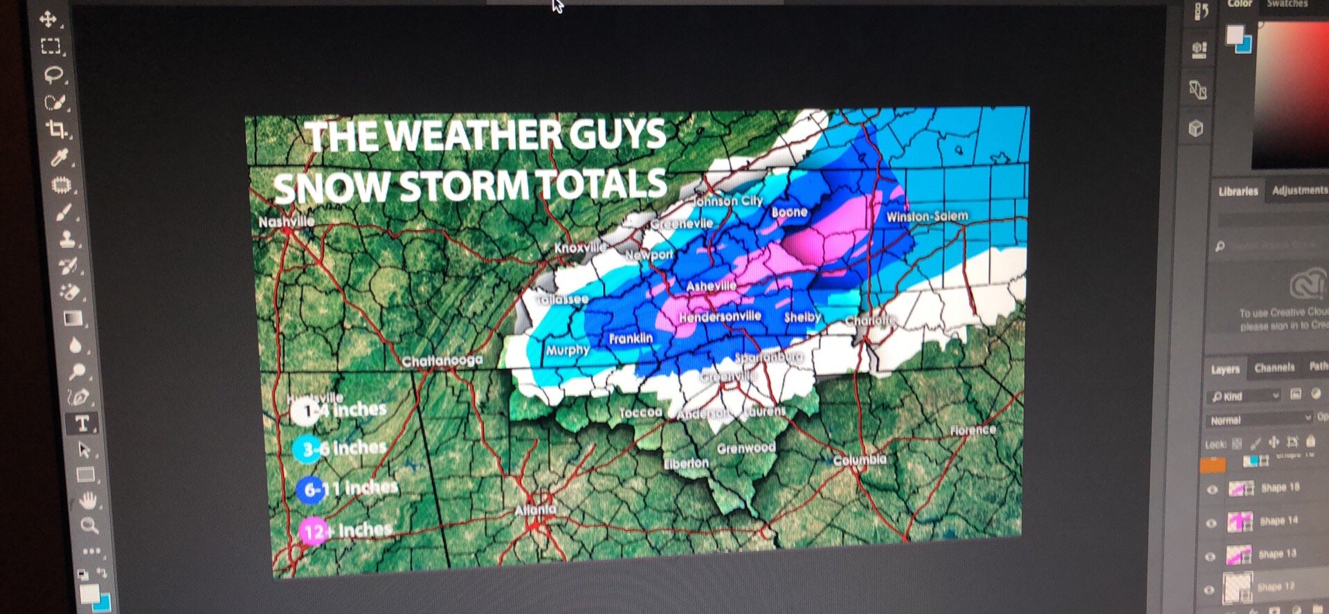
This was my forecast for last night. For SNOW

-
This was my forecast for last night.

-
I don’t know if there is a site or if this is available however, is there a place I can get live soundings anywhere?
-
What are you looking at? The soundings isn’t really under 32 the entire storm across the Upstate.
-
I think storm Vista is the only service right now with 6hr euro runs
-
Elevation?
-
Something to consider the convection along the Gulf Coast needs to stay in check. Anyone else seen if it will be a problem for QPF
-
I intend to agree with you. Checking upstream now
-
Heck of a warm nose though on soundings
-
How does GSP and Upstate look South Carolina thanks for the pbp
-
Yes I seen that. Hopefully FV3 will be similar