

ams30721us
-
Posts
670 -
Joined
-
Last visited
Content Type
Profiles
Blogs
Forums
American Weather
Media Demo
Store
Gallery
Posts posted by ams30721us
-
-
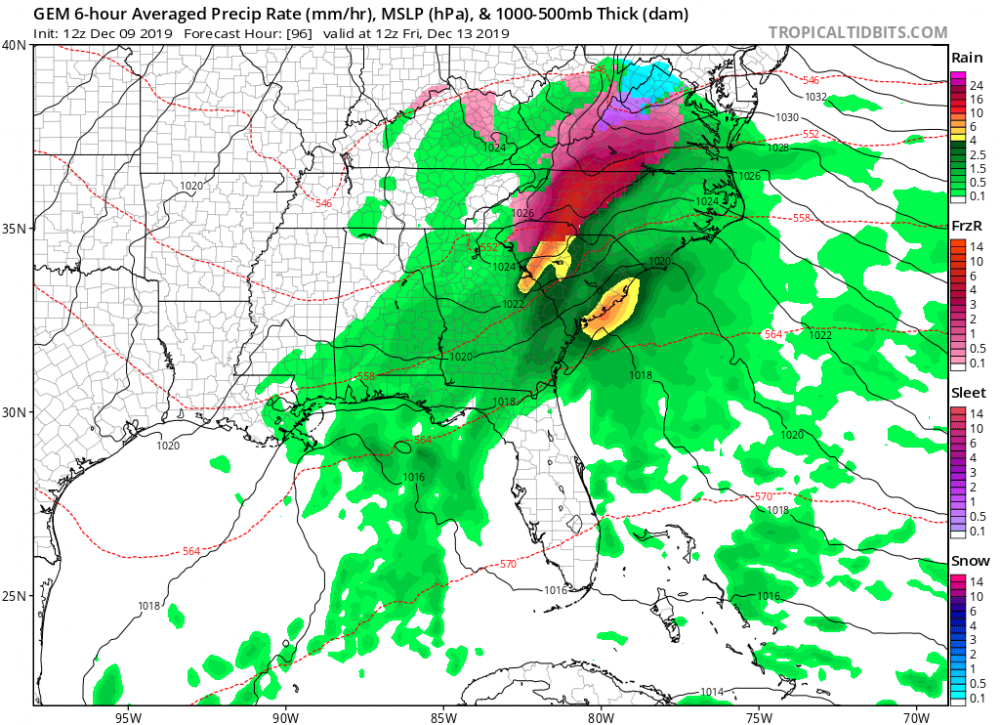
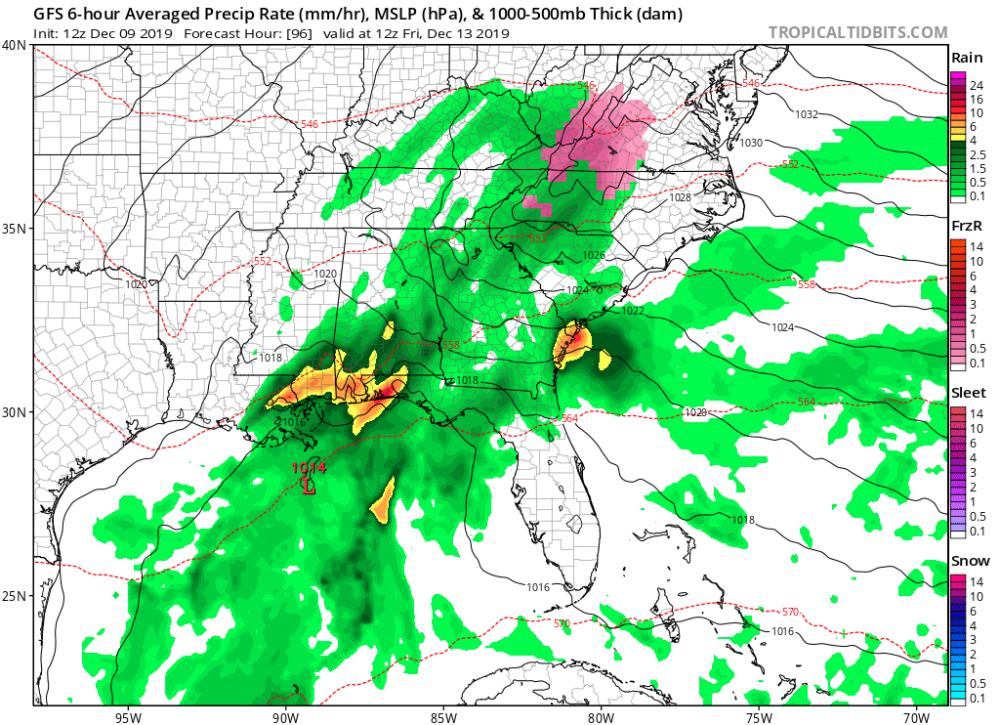
Timing is going to be big as usual with this type of setup. The past few days, most models were delaying the onset of precipitation till during the day Friday, and into Saturday.
Just noting the early 12z data today, has shifted back to an earlier onset, Thursday evening, leading to a colder/drier airmass, and allowing for a slightly better signal for some icy concerns by Friday morning.
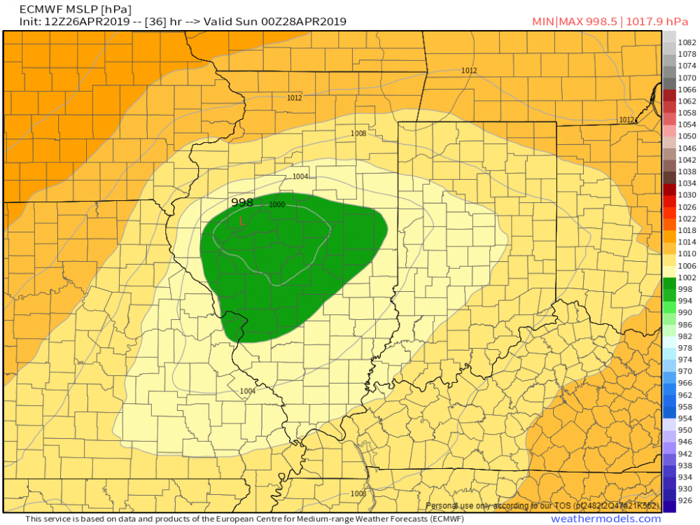
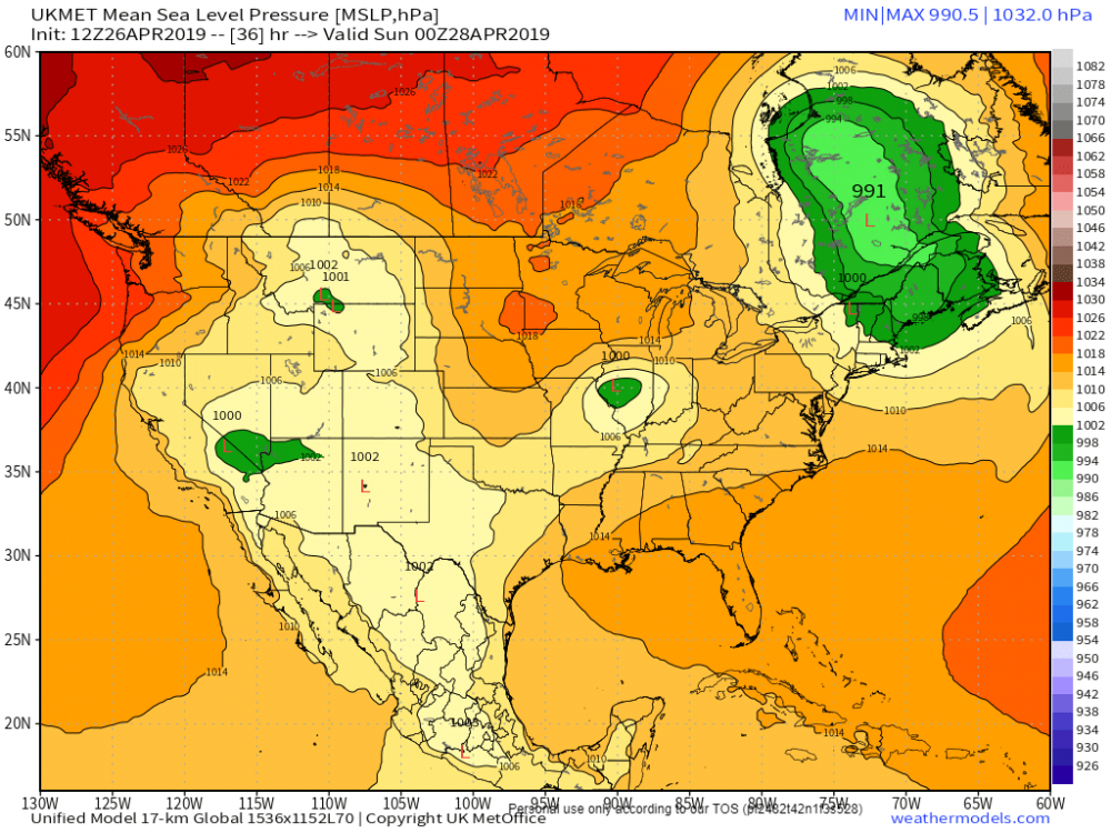
Also, the GFS seems to become quite amped up with an inland tracking surface low up closer to the Apps, while the other guidance is indicating a low tracking further east along the coast.
In the end, this may not matter much as the high slides out during the day, Friday leading to a narrow window of opportunity.
Just a few thoughts to monitor in the future trends.
-
1 hour ago, Chicago Storm said:
Won't even need much wind, given the leaf situation as of now.
Probably will be tree damage tonight alone if there is an axis of 3-6".
Yep, we had several large trees come down with the heavy, wet 1"-2" in Davenport this morning.
-
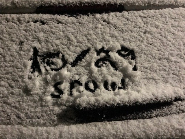
Just a few quick shots from earlier in the event around DVN.
-
 3
3
-
-
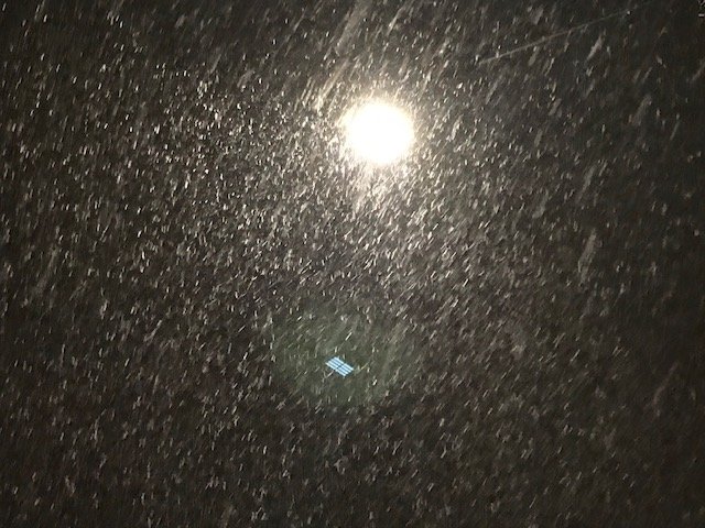
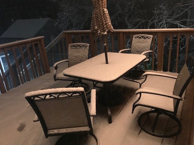
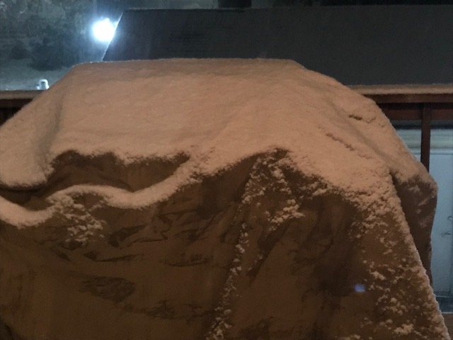
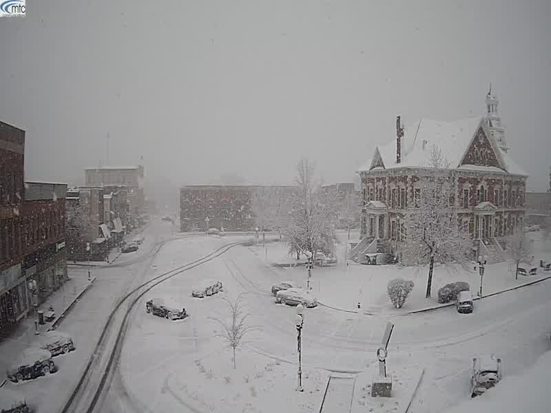
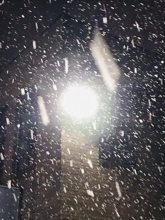
Man...it is literally pouring snow currently in Davenport. Very low visibility, main roads starting to become snow covered, and at least 1/2 to 1 on the grass, and decks/patios now. Nice early treat for sure!

-
2
-
-
17 minutes ago, hawkeye_wx said:
Dubuque has switched to mod/heavy snow.
-
1
-
-
Yep, a more very similar to Ukie, GEM, and RGEM today.

-
The Ukmet def. looks to be even a little more SW of the CMC.


-
4 minutes ago, CoalCityWxMan said:
GEM is pretty far south now too, gives 1” to areas north of I-80 in IL.

-
8 minutes ago, cyclone77 said:
Looks like a shutout here. Gonna blast east into the back edge of the snow and say my farewell to snow for the season. Should only be about a 30 minute drive.

Meanwhile in Macomb, IL
-
2
-
-
Pad dem stats! lol We still have all of May

Radar back in Oklahoma and Missouri looking nice this evening...
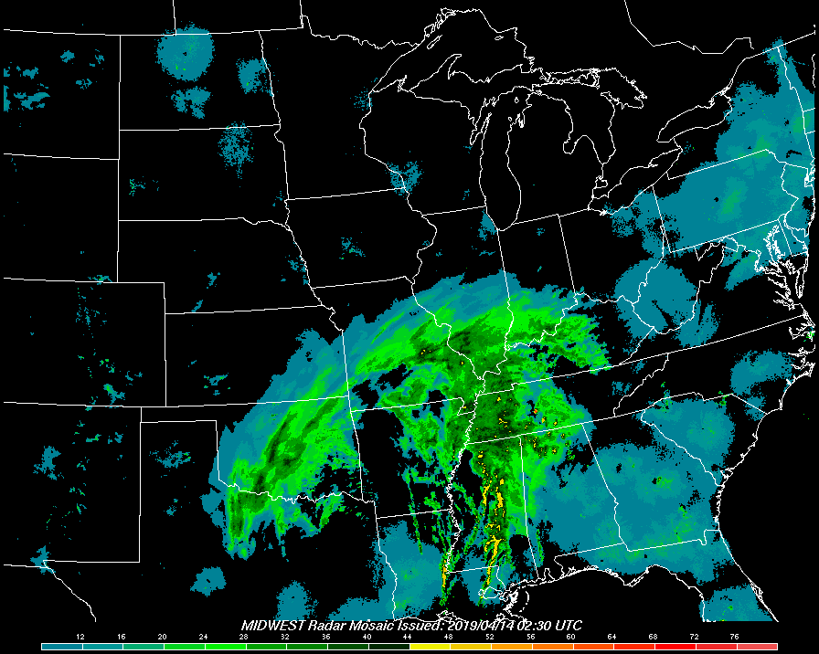
-
00z Hi-Res NAM and RAP starting to look a little more juicy again for areas back to the southwest too.
-
35 minutes ago, cyclone77 said:
RAP gives us 0.80" of precip, while the GFS shows a trace lol. Guess we'll have to see how radar trends evolve later tonight. Could be getting anywhere from a few inches of snow with some nice rippage, or a heavy overcast with a biting breeze.
Ha! Sounds about right. A literal nowcast, wait and see mode to how radar shapes up now.
-
1
-
-
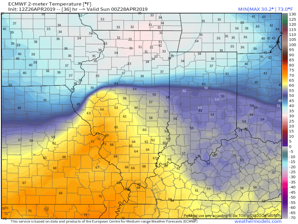
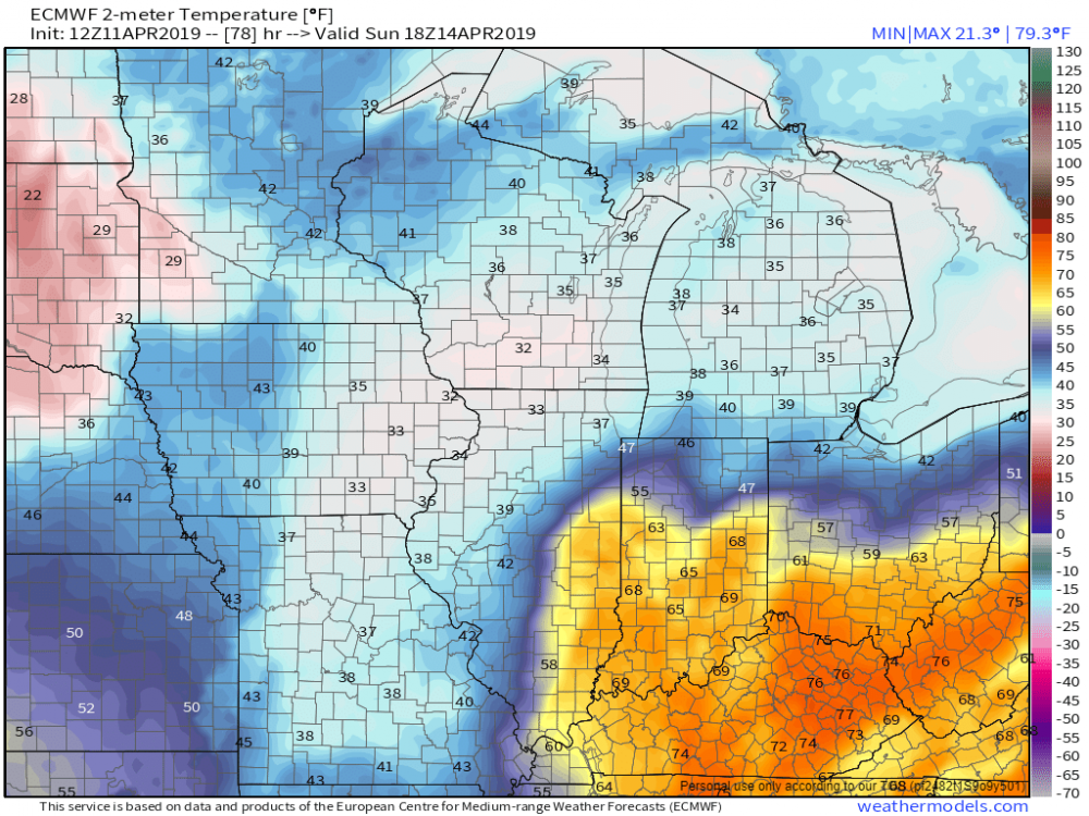
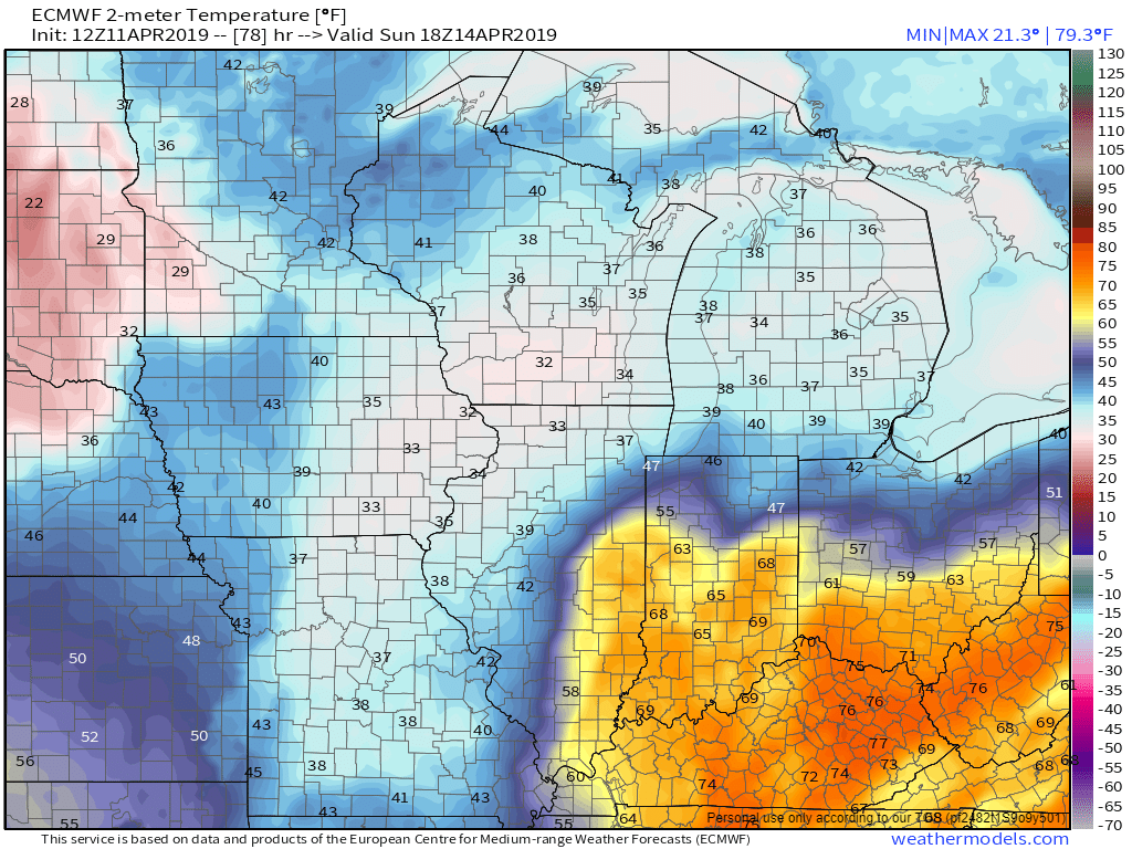
Pretty impressive that the Euro has been consistent the past few days with showing 2m temps in the low to mid 30s under whereever that band sets up the during the afternoon heating on Sunday. Then, Spring break just southeast.
-
1
-
-
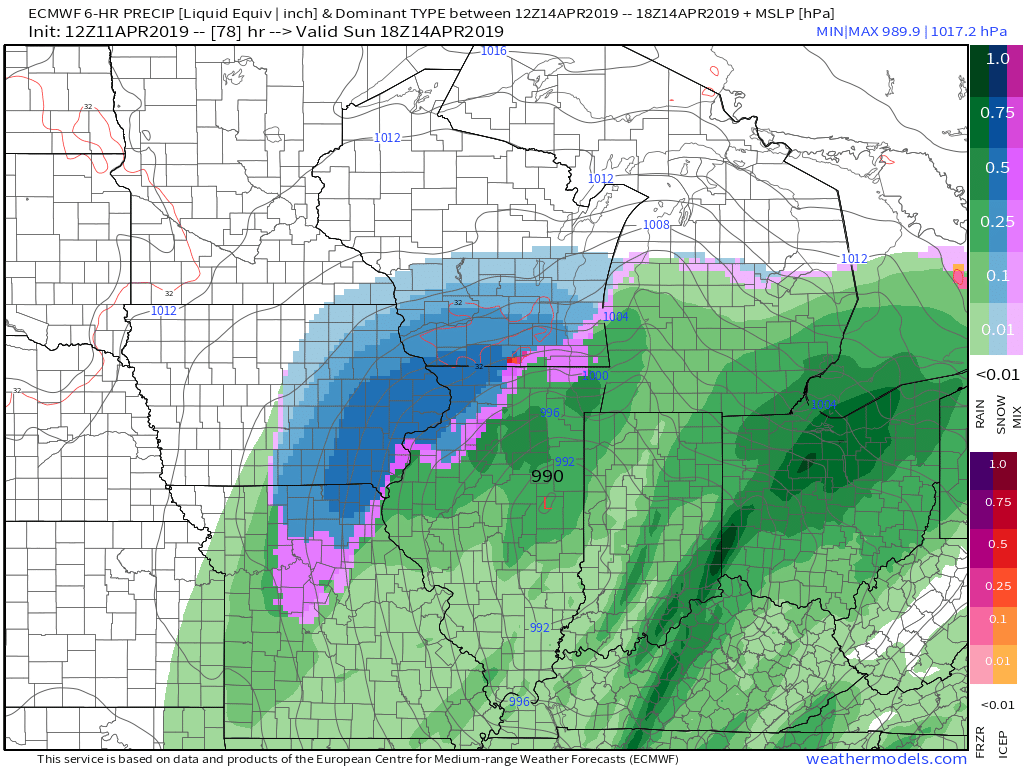
1 hour ago, Hoosier said:
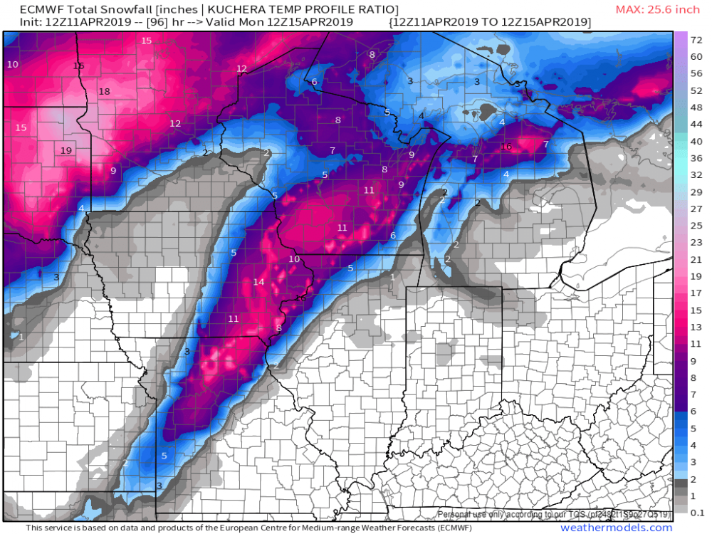
Maybe a bit early to be talking amounts but I think it's looking good for band of several inches in the heaviest band. The question is whether the several is 3-5" or more like 6+.
Raw 2m temps on multiple models are showing temps of 32-34 even during primetime warming on Sunday afternoon.
Well we still have 72 hours or so to see if these thermals hold, and where exactly that defo band looks to setup. 12Z Euro, fairly similar to its 00z counterpart from my quick glance.

-
1
-
-
Yep, either the GFS is going to score a big coup or the NAM/EURO camp is going to nail a very decent wet snow event somewhere in eastern Iowa, or Illinois. Yikes!


-
2 minutes ago, Hoosier said:

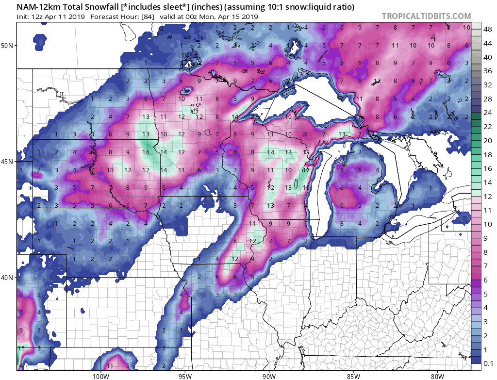
Did I really just post the 84 hr NAM for snow in mid April?
Only cause we still have a shot at breaking the all-time snowiest season ever, I will approve of this long range NAM post! Ha! At least the Euro is not the complete lonely outlier.
-
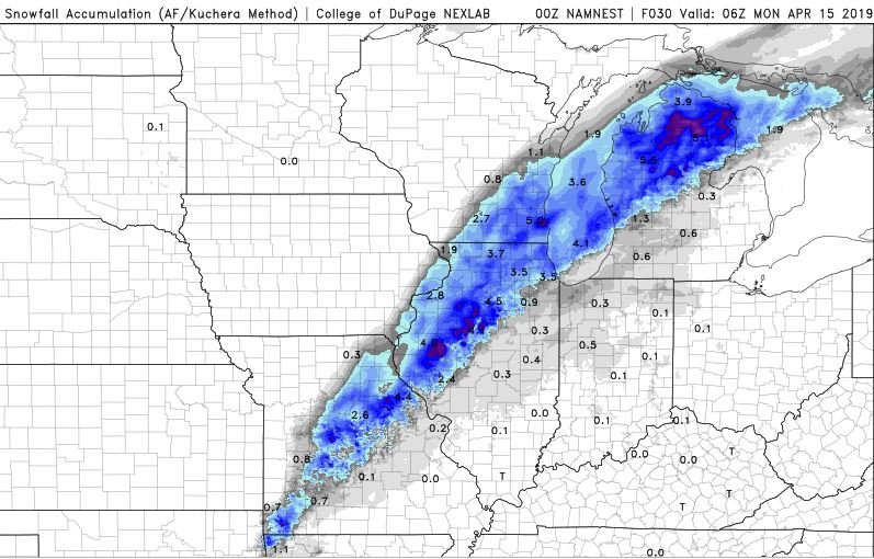
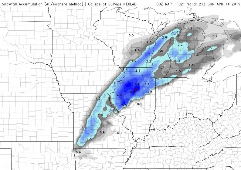
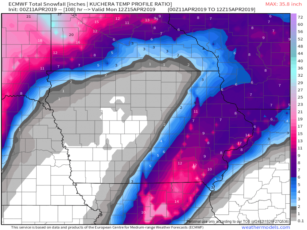
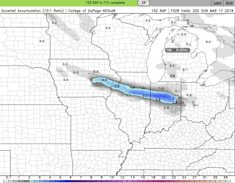
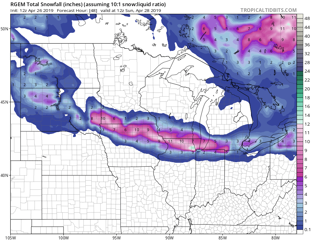
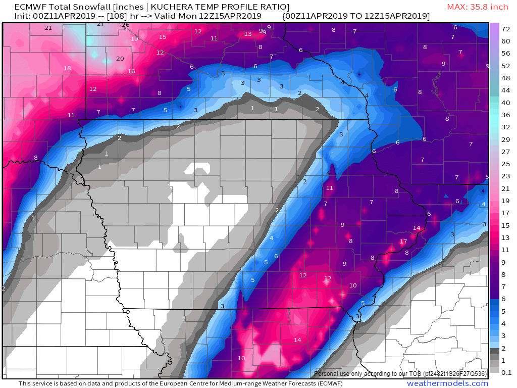
What a nice little system. Didn’t even pay any attention to it until yesterday. Picked up some very nice rates overnight. A few totals from around the QC:
Muscatine: 1.6”. MLI: 2.1”. DVN: 3.0”. Princeton 5.0”. Cambridge: 7.0”
*Now Top 5 Snowiest seasons in the QC.
Here’s a few picks I snapped around 4am:
-
3
-
-
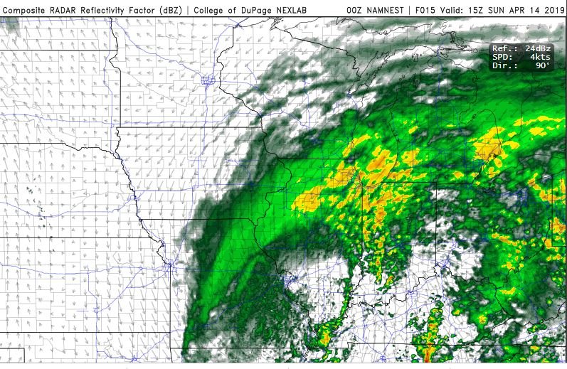
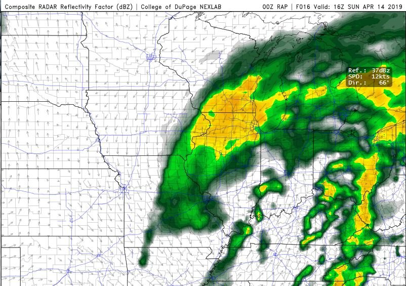
Uhm.. well hello, F-Gen band. Looks like folks a few miles on either side of the I-80 corridor has a chance to pick up a quick period of moderate to heavy snow tonight, as this compact clipper pivots across the region with some potential convective features.
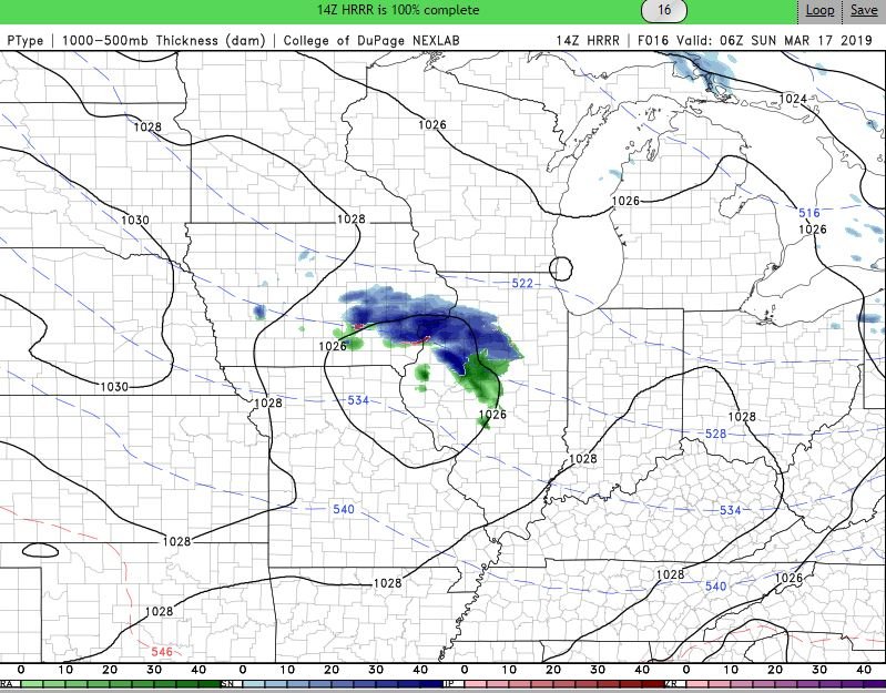
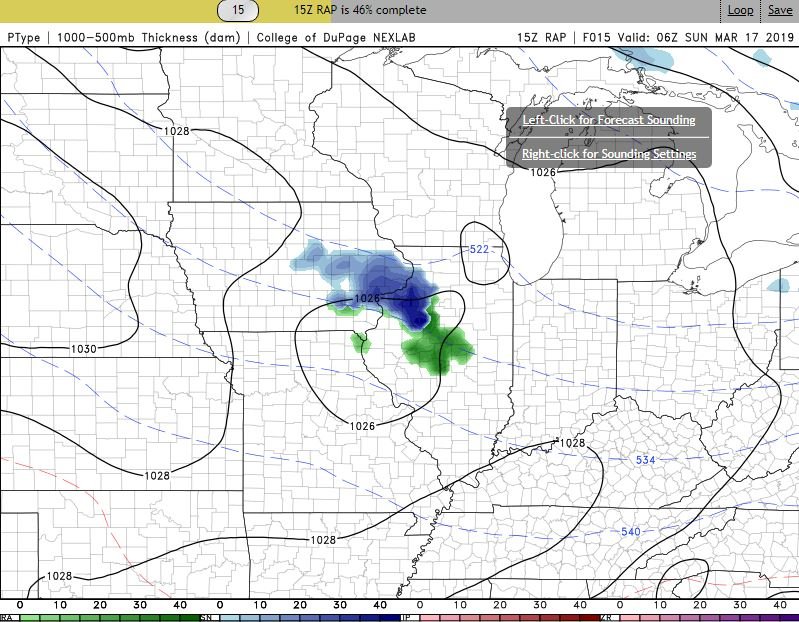
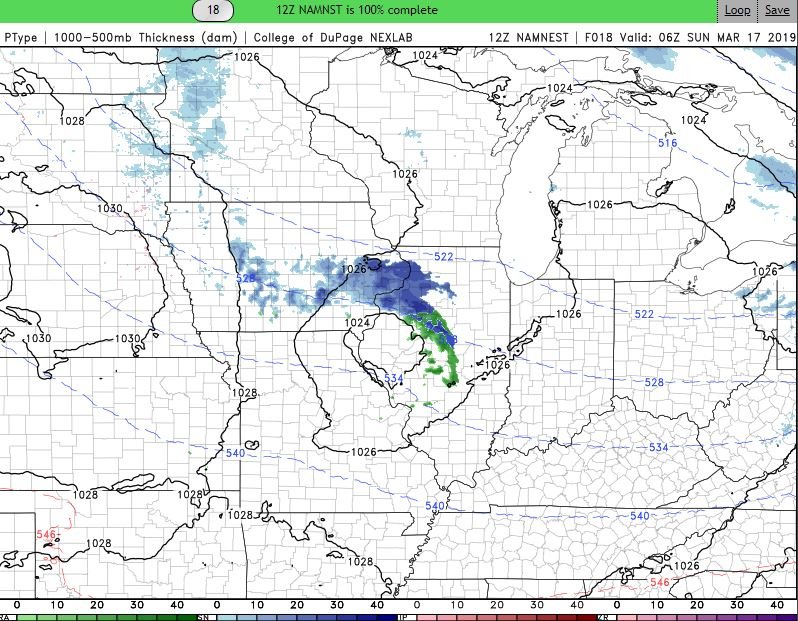
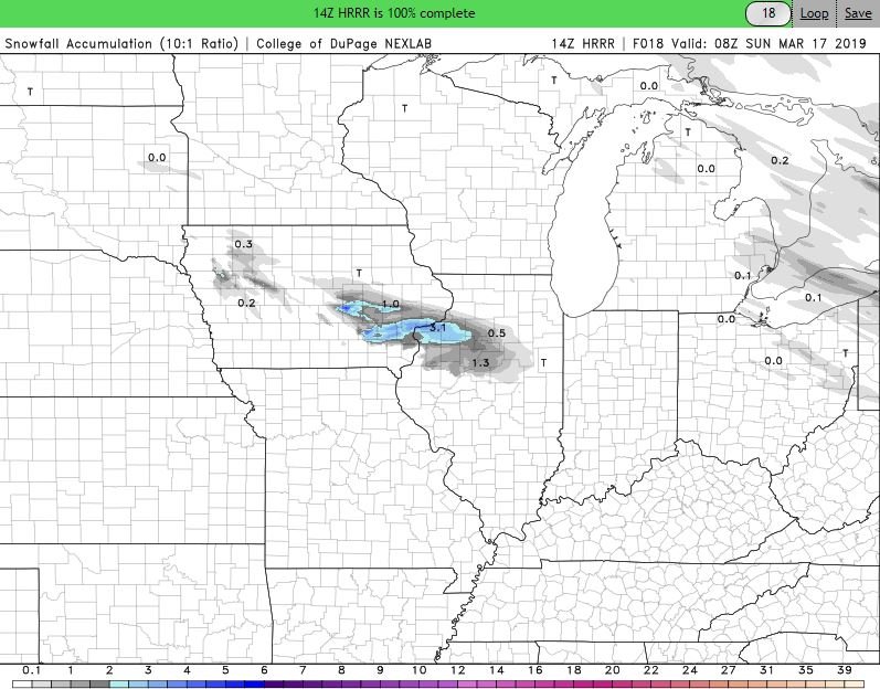
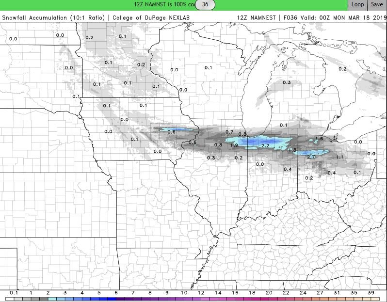
-
2
-
-
1 hour ago, cyclone77 said:
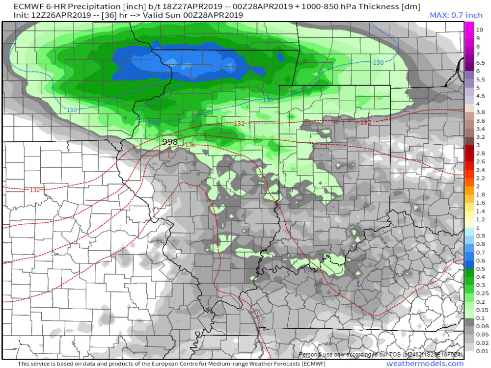
A substantial increase in precip for the QCA on the new Euro. Now shows around 0.4" of precip, which is a big jump from the 0.25" it's been forecasting for several cycles. UK is even more aggressive with over 0.6" precip. If this trend holds it's looking like a nice 4-5" event is on the way, and this time the snow will be more wet compared to the fluffy stuff yesterday.
Wednesday morning may feature some pretty decent snowfall rates. Here in the QC we go from just trace amounts around midnight, to around 5 inches between midnight-6am w/ an additional inch or so after sunrise per the 00z Euro.
-
1
-
-
On 2/14/2019 at 7:33 AM, ams30721us said:
After suffering through all this winter weather recently, and sitting at 52.4" for the season, I'm all about getting a quick 17.4" more fluffy inches to have the all-time snowiest winter ever, along with the coldest temperature ever in the same season! Ha...So with that being said if we can land a quick 4-5" here, that would really help increase the chances of this actually occurring!
")
I do like the faster start time, as models seem to have sped the system up a bit, with more of a nighttime/early Sunday morning event, locally.

Reposting because we picked up 5" of fresh pow pow, to get us within 2" of the top 5 snowiest Winters ever, and only about 12" away from the top spot with about two more systems on the way thru this weekend. Let it snow, Let it snow !
-
2
-
-
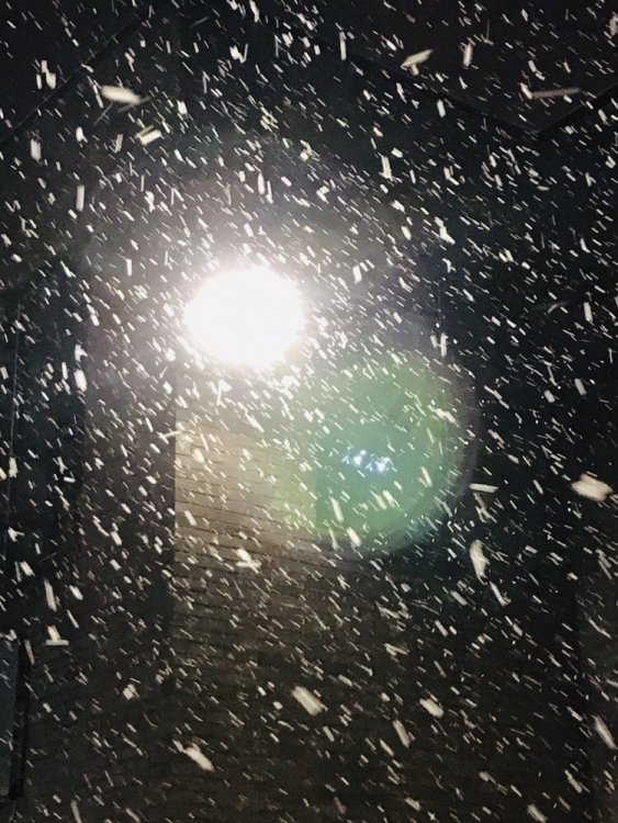
 Wow! Absolutely ripping snow right now! Easily the heaviest rates since the start of this event. Main roads quickly becoming snow covered again, and visibility is less than a 1/4 mile. This event has exceeded my expectations! This Winter is off da chain!
-
2
-
-
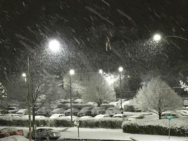
20 minutes ago, cyclone77 said:
Easily the best rates of the season right now. Absolute pound town out there underneath this enhanced banding. Wasn't expecting anything like this with this system, so a nice surprise.

This was actually after heaviest flakes move thru, by the time I got bundled up to go out to shoot! Just raining pancakes.
-
1
-
-
14 minutes ago, Thundersnow12 said:
I already had 0.7” at 7am from that initial wave of moderate heavy snow which is a good head start.
LOT, DVN, and DMX radar loops all look pretty solid right now. Starting to think this is an overachiever across some portions of this area. Good radar returns about to come back into parts of western metro and nice uptick looping DVN.
Latest hi res continues to suggest widespread 4-5” with higher amounts across far northeast IL from added lake enhancement/lake effect.
Yep, woke up and saw that first batch lifting north and got pretty nervous, but the radar has really blossomed over the past 1-2 hours. Much more optimistic for a 3"-5" event here!
-
12 minutes ago, cyclone77 said:
^
That's a constructive post. Thanks for the contribution.
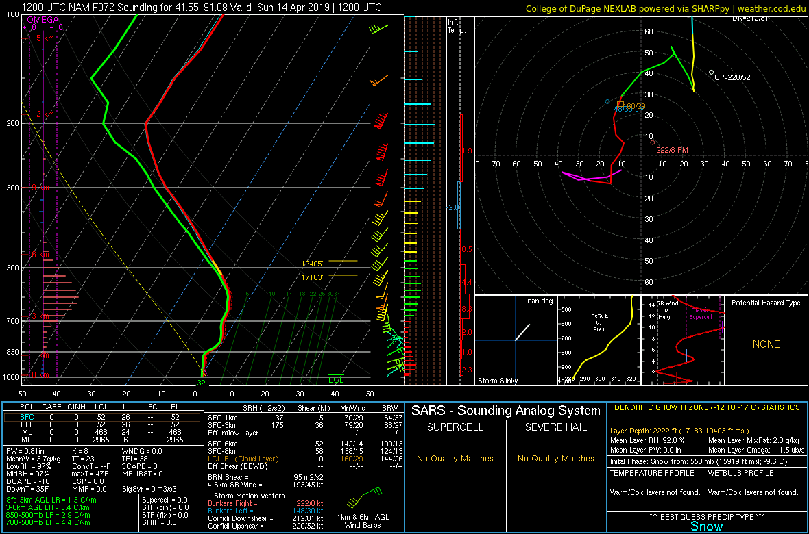
06z GFS improved quite a bit compared to the 00z, and drops 0.3-0.5" of precip over parts of Iowa into northwest IL/southern WI. DVN mentioned LSRs north of 15:1, so whatever falls should fluff up nicely. Obviously at this point Iowa looks like it has the best shot at the most precip, but hopefully it's a case where the models are weakening the system a bit too quick for areas further east. Still some time to see how this evolves.
After suffering through all this winter weather recently, and sitting at 52.4" for the season, I'm all about getting a quick 17.4" more fluffy inches to have the all-time snowiest winter ever, along with the coldest temperature ever in the same season! Ha...So with that being said if we can land a quick 4-5" here, that would really help increase the chances of this actually occurring!
I do like the faster start time, as models seem to have sped the system up a bit, with more of a nighttime/early Sunday morning event, locally.
-
3
-


Mid to Long Term Discussion 2020
in Southeastern States
Posted
Nothing to bang the drums about, but as a few others have mentioned, watching a few opportunities for some wintry mischief next week.
The first period to keep an eye on is a quick moving disturbance Tuesday, that could at the very least spark off a few snow showers. The vort is really not that far off from something a bit bigger, but would need to drift a little more west as it digs Monday night.
The second, more fun disturbance to watch could be the one towards the end of the week into the weekend.
Again, nothing to shout from the rooftops yet, but hey it's a few things we have to watch in the coming days imo!