

Henry's Weather
-
Posts
1,479 -
Joined
-
Last visited
Content Type
Profiles
Blogs
Forums
American Weather
Media Demo
Store
Gallery
Posts posted by Henry's Weather
-
-
5 minutes ago, 40/70 Benchmark said:
Can anyone guess which event I have in the back of my sick little mind? And no, not 1/7....
12/16/20
-
 2
2
-
-
17 minutes ago, 40/70 Benchmark said:
Here is the EURO H7 fronto...just north of that is your death band.

Lock it…
Spent the day passing flyers around for a snow shoveling side gig, hopefully this event gets me a client base
-
4
-
 1
1
-
-
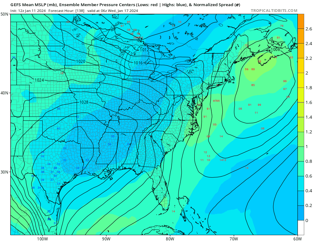
Back to reality… a storm of the magnitude of the GFS solution is rather rare. We must remember that the mundane outcome is still, despite high-octane guidance, the most likely outcome. Speed up 2 more days and that story changes
-
3 minutes ago, weathafella said:
It’s a bit colder out through 168-a legitimate second 2/3 crusher.
Where do you find?
-
-
1 hour ago, ORH_wxman said:
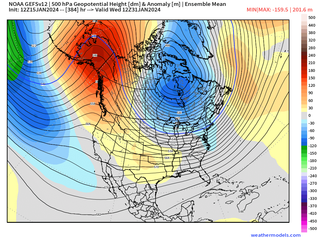
If you’re looking for a pattern shakeup compared to the last couple of years, then root for the ensembles at the end of the month.
This is the closest to a great pacific pattern we’ve had in a while. But good to remain skeptical until we’re closer. But that’s a look you want to see for big cold/snow threats.

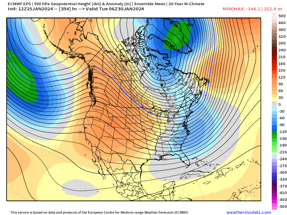
2015 vibes here
-
1
-
-
-
-
-
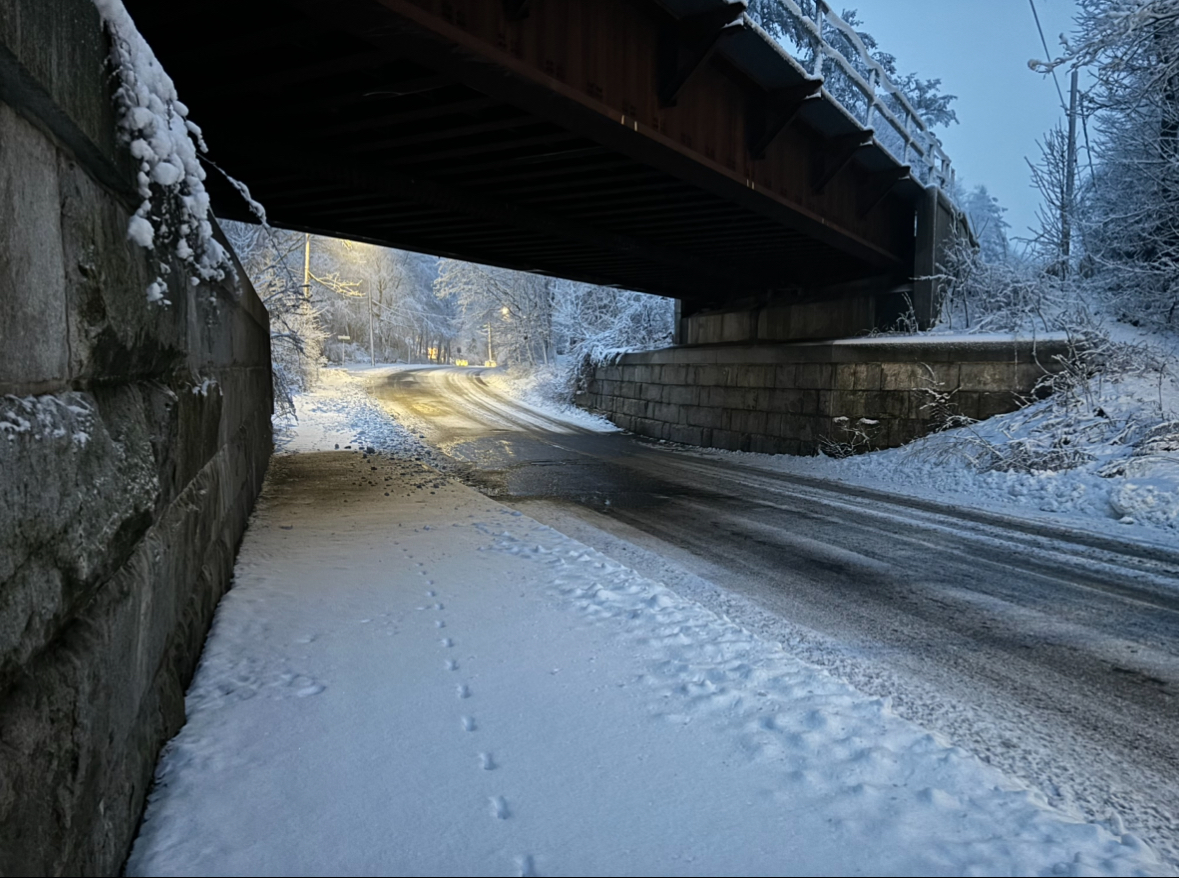
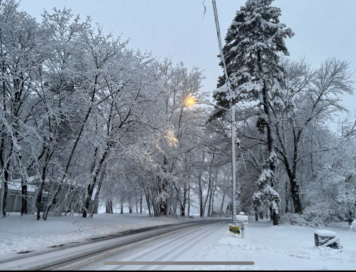
Huge globs of snow falling from the sky here
-
1
-
-
10 minutes ago, dendrite said:
The additional precip from the 3k after 9am.
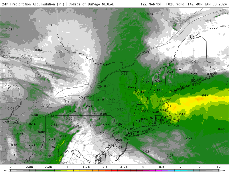
Maybe another 4-6” here.
Woah. Cut those in half and it’s still plowable amounts
-
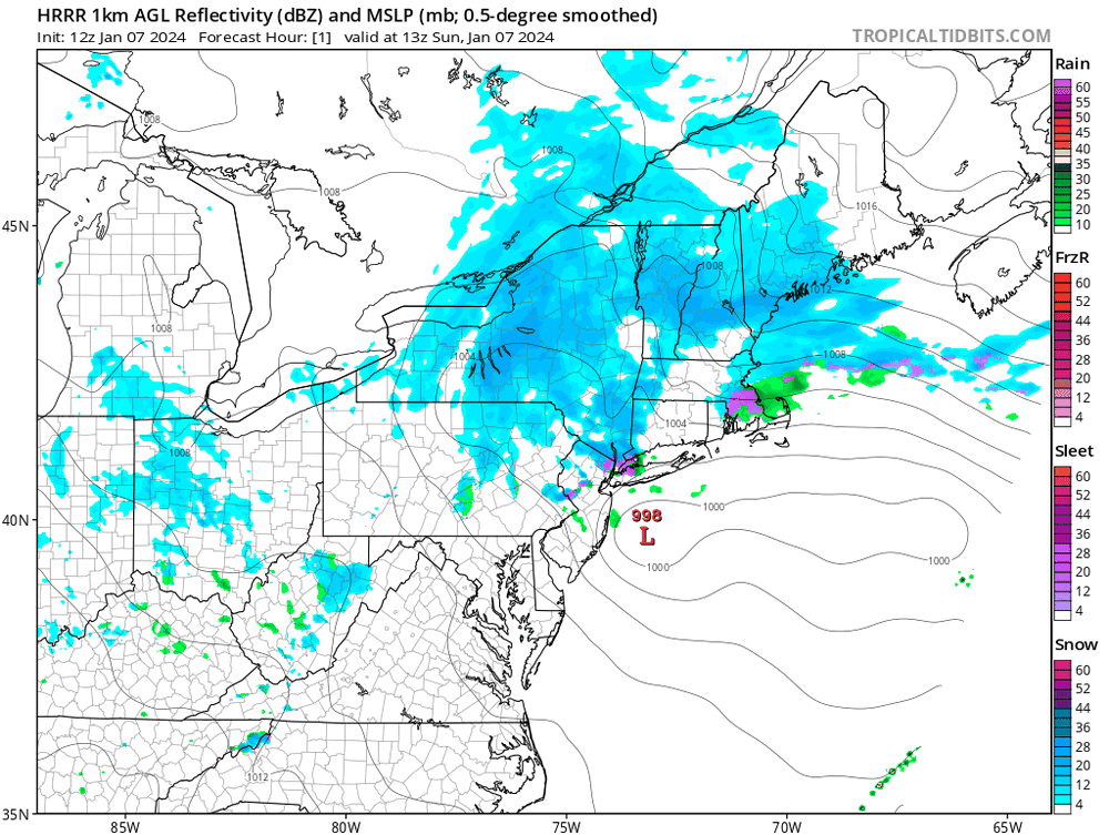
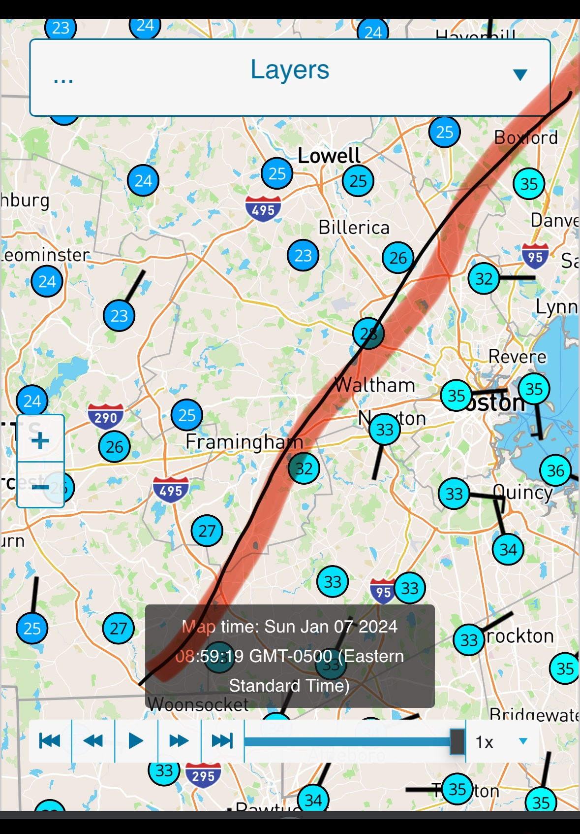
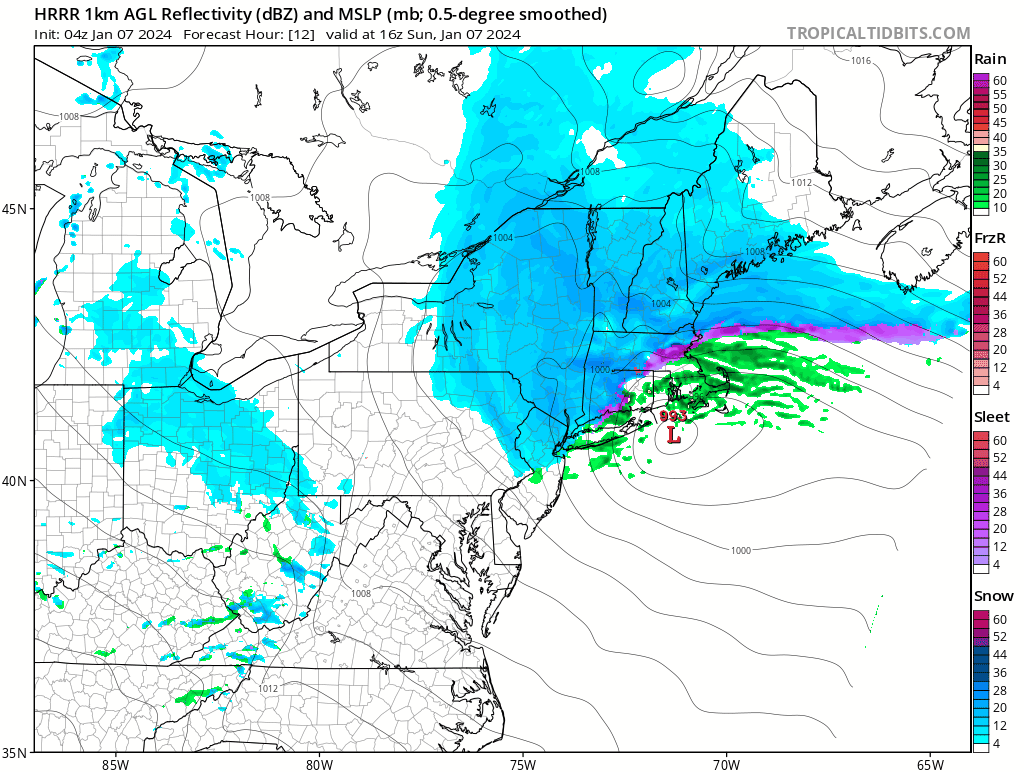
Current location of coastal front:

-
Just now, CoastalWx said:
It will also depend on coastal front timing. That depiction snows snow at like 34F which won’t do anything.
Even if upper levels are conducive to high-ratio dendrites? I don’t know all the science here unfortunately
-
1 minute ago, Henry's Weather said:
Perhaps logan might not climb out above 4 but I bet the city proper will see more than 4. Maybe I’m optimistic, but this progression is promising. Reminds me of Christmas day 2017?
Notice how the r/s line collapses. Coastal people are jumping the gun on cancelling this event, mark my words
-
2
-
-
1 minute ago, CoastalWx said:
I’m looking forward to it. Cstl front is well ahead of timing to. Metro west will clean up. Maybe 2 to 4ish BOS?
Perhaps logan might not climb out above 4 but I bet the city proper will see more than 4. Maybe I’m optimistic, but this progression is promising. Reminds me of Christmas day 2017?
-
2
-
-
Coastal people feeling sad are falling for the pump fake. No you won’t get a foot, but you should see several inches this afternoon. CCB has trended stronger as we continue through the event
-
1
-
-
2 minutes ago, BombsAway1288 said:
Dusting on the grass in Chelsea. Still flipping between fat flakes and drizzle here. I guess 2-3 was even too much here. Congrats to those NW of 95
No, you have at least 3 hours of CCB to look forward to, based on radar, 500 mb orientation, and modeling
-
HRRR indicates the CCB will become robust for ENE east of Springfield at around 1 or 2 pm. Based on modeling trends, I predict a general swath of an additional 3-6+ inches from the CCB east of the river, and more specifically, Worcester on east. Antsy coastal folks will have to wait for their taste
-
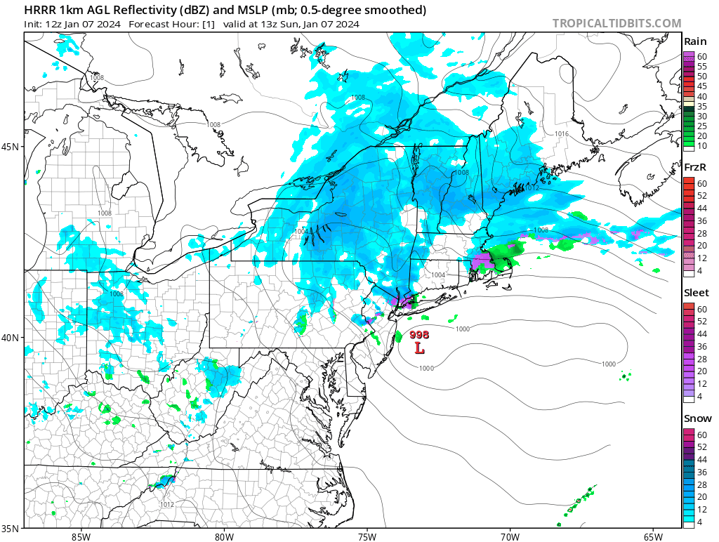
You can really see the cyclonic curvature tightening on radar. Ccb should be forming at around 10-11 today. Going to be a dendritic pats game
-
2
-
-
8 minutes ago, moneypitmike said:
are you uploading from your i phone? It's kind of tricky.....
add the picture.......you'll see something in the lower right that says 'actual size'. tap/scroll down and you can select other sizes. I usually do medium.
Realized I can screenshot the photo and reduce file size by roughly 60%
-
-
-
How do you guys compress your photos? Can’t get mine below 1.95 MB
-

Following a Miller A/B hybrid type coastal potential, Feb 13th ... As yet untapped potential and a higher ceiling with this one
in New England
Posted
In another 2 days maybe