
vman722
-
Posts
70 -
Joined
-
Last visited
Content Type
Profiles
Blogs
Forums
American Weather
Media Demo
Store
Gallery
Posts posted by vman722
-
-
Just now, harrisale said:
That's big time.
And earlier in the thread we had posts about SRH being the bust factor today!
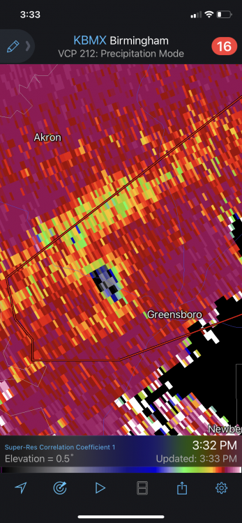
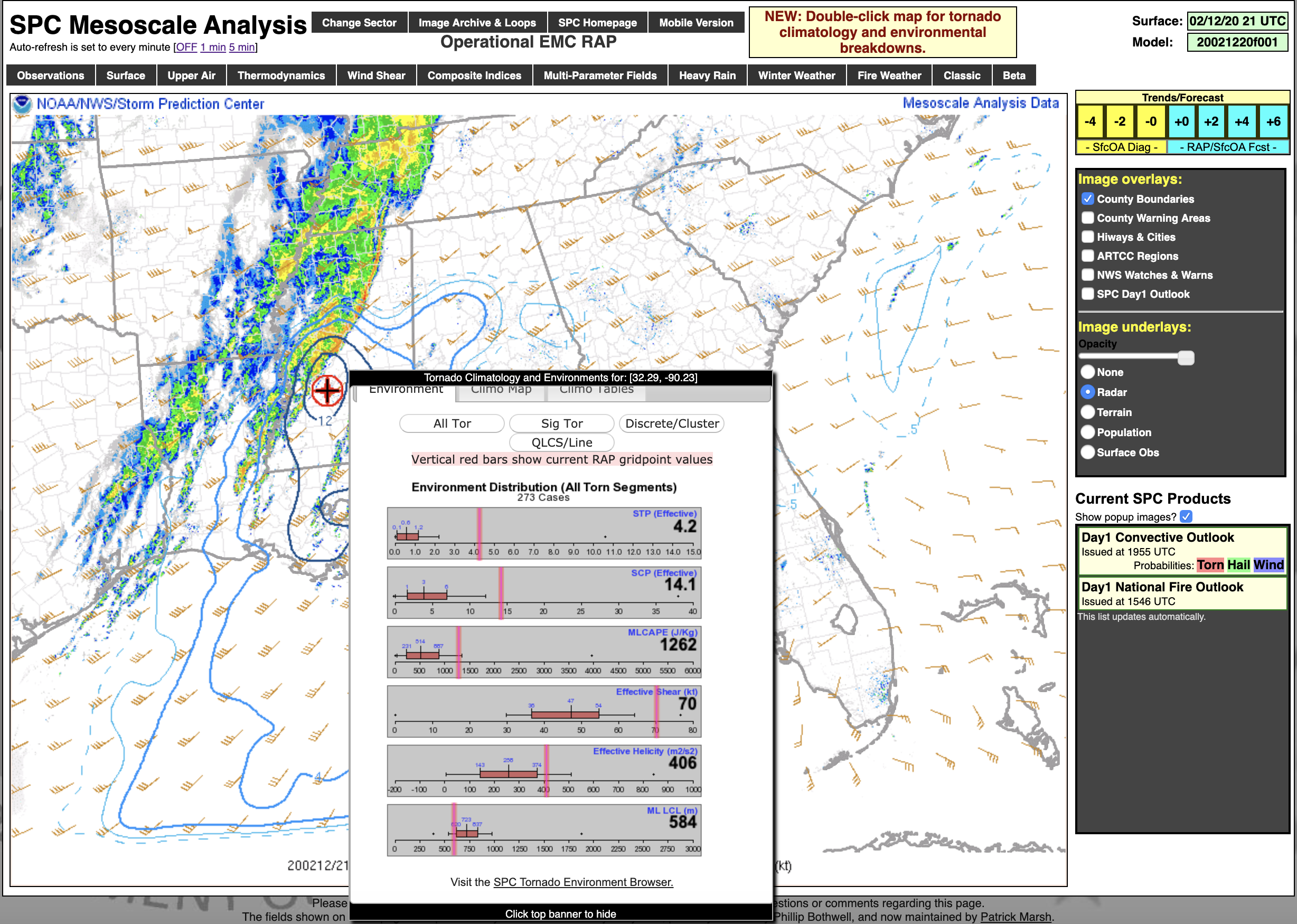
That seemed to be what held back the NE MS cells earlier but sure isn't the case with these AL monsters. These are beyond impressive. Effective shear for both cells per mesoanalysis up to 70-73kt.
-
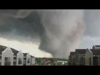
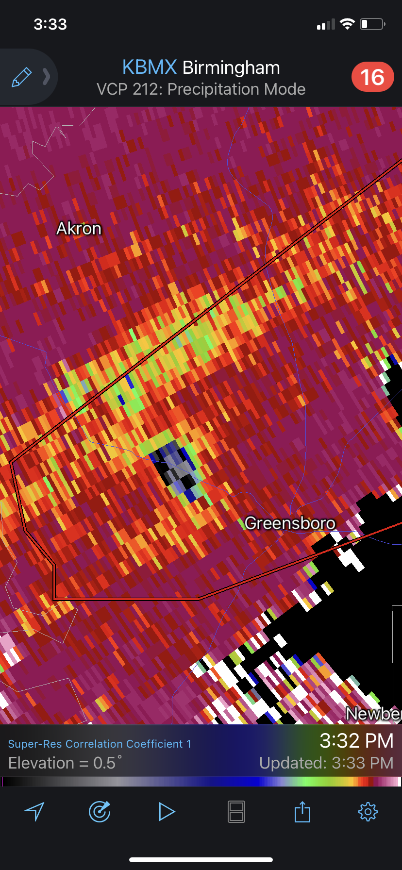
Incredible debris ball. So scary
-
Just now, nwohweather said:
Meh I'm not totally sold here. SRH is not what it should be for this
This seems to be the biggest issue, effective SRH and SRH in general is displaced much more east than expected so far.
-
Just now, NaoPos said:
Seems like positive trends to limit the ceiling on this event ....
Still forecast to deepen the next few hours...
-
Did Reed stop streaming?
-
Good spacing N of Columbus in MS though, Calhoun city cell could be a problem shortly. Definitely looks messy further south.
-
Just now, ALweather said:
Can't help but wonder how much of an effect all this cloud cover will have on the accuracy of this forecast. Last week it really seemed to keep things from forming and what did was pretty short-lived. The "high risk" from last week barely materialized.
Once again, this system is exponentially more dynamic than last weeks. And last week did end up verifying in the high risk area. There is plenty of clearing in the main expected initiation zone. Already extreme amounts of low level instability. I hope this busts as much as the next guy but these concerns are being tossed because of the real time observational data.
-
7 minutes ago, jojo762 said:
Anyone want to make predictions for tomorrow basing off of forecast guidance/gut feeling?
I’d personally go with dozens of tornadoes (take that as you will as far as raw #s) and several intense, long-tracking tornadoes.
I think we’ll have a mix between messy and several intense supercells. Sort of like the convective evolution of last week EXCEPT supercells/tornadoes will likely be much more intense. In my mind, even a messier outcome tomorrow still yields quite a few tornadoes, whereas a higher-end solution yields numerous intense tornadoes across a very large area (maybe super-outbreak type stuff??). Altogether think we’ll meet in the middle of the two. This will be a noteworthy day/analog to mention in the future, regardless of what happens (bust or outbreak).
I’m thinking a storm reports map similar to 4/28/14 with maybe a little more action into TN. Overall pretty aligned with your thinking. Praying for as little loss of life and property as possible.
-
Lol one slightly more tame run of the HRRR and the event ceiling gets mostly discounted immediately. Careful with that one folks. This still looks rock solid synoptically.
As always, setup of the outflow boundaries and mesoscale details day of will determine magnitude, but this and last weeks setup are not the same.
-
 3
3
-
 1
1
-
-
Was thinking the same. What an incredible storm.
Just now, Snowstorm920 said:Might have some twins
-
Appears to be picking a perfect time to cycle. Hope Jasper made out okay.
-
Confirmed large and extremely dangerous. Brutal.
-
Wowzers

-
44 minutes ago, nrgjeff said:
Need ENH along north of I-20 from JAN to BMX, including MSU and UAH (latter or universities not airports). Temps/Dews are way ahead of progged. Meh soundings on models are worthless. Winds ARE turning with height. CAPE with lifting WF going into evening in Dixie. What could go wrong? A lot!
Certainly seems like a pretty impressive environment right now given the slight risk. Interested in how this develops.

-
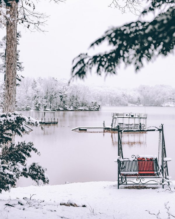
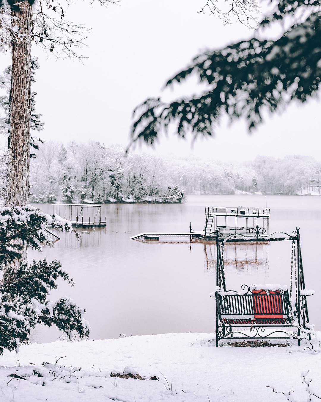
Here’s my favorite shot from the event. This is right as it wound down. In a winter that seemed absolutely doomed (sorry it still may be for some), this was a gorgeous day. Zero rain to deal with, high end rates throughout, didn’t have to deal with any driving, it really was a fantastic N GA winter day. Hope the tide turns for the people that missed out.
-
5
-
-
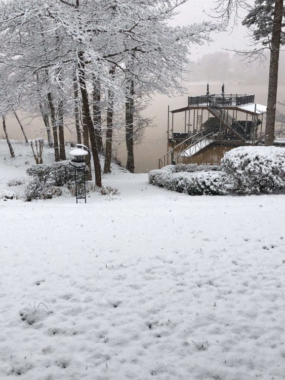
Radar says we’ve been done. Atmosphere says not yet and keeps delivering the same steady monster flakes we’ve seen all day. What a memorable one here. Should finish close to 5”
-
3.5” and counting. What a beautiful day. Can’t stop won’t stop, rates just picked up once again. Incredibly consistent.
-
3
-
-
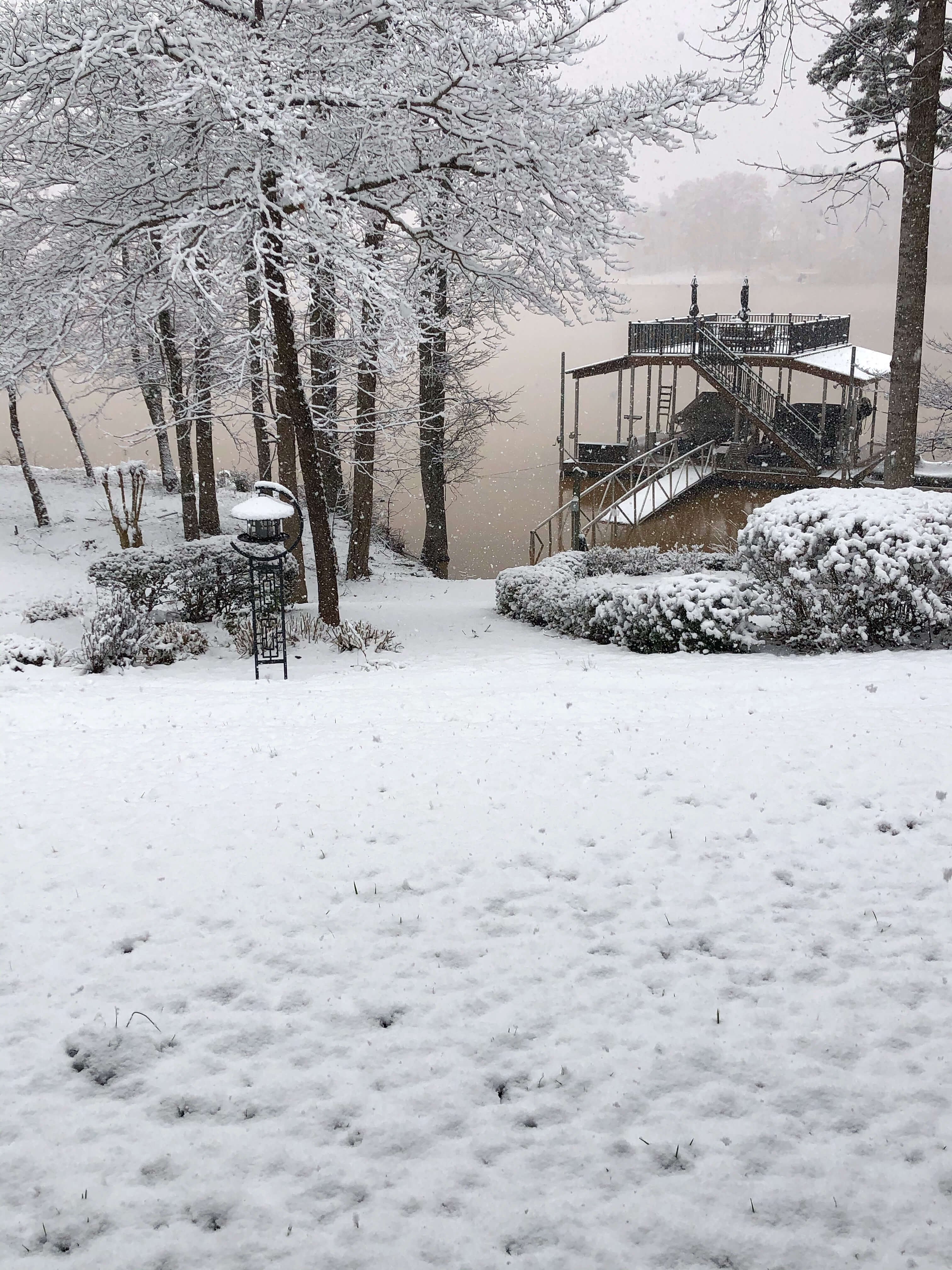
2” and counting so far in N Gainesville GA. Been ripping nonstop for over 2 hours now. Temp has been bouncing between 31-32. Some of the biggest flakes I’ve ever seen forsure. Looks like plenty more to go. Will take pics when it’s looking close to winding down.
-
Intensity has picked up very quickly here. You love to see it!
-
1
-
-
Finally seeing first flakes on the north end of lake Lanier in Gainesville. Returns look juicy back west, hope she comes through.
-
I will be heading up to Gainesville tonight and will report back with pics and obs hopefully as the event progresses. After being essentially blanked last year, a few inches would be a nice consolation prize for this "winter."
-
Parents have a house up there on the north end of Lake Lanier in Gainesville. May have to make the trip up tonight. Models last night had me interested, seems like it's game on. Not expecting a whole lot but could be some real pretty scenery.
-
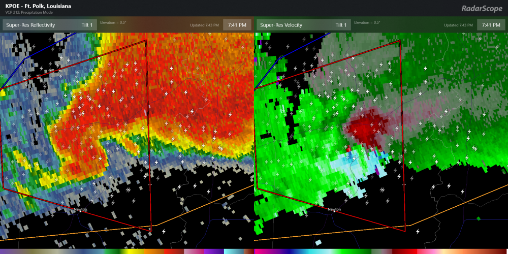
In SVR news, currently a tornado emergency in Alexandria, LA. This looks pretty devastating.
-
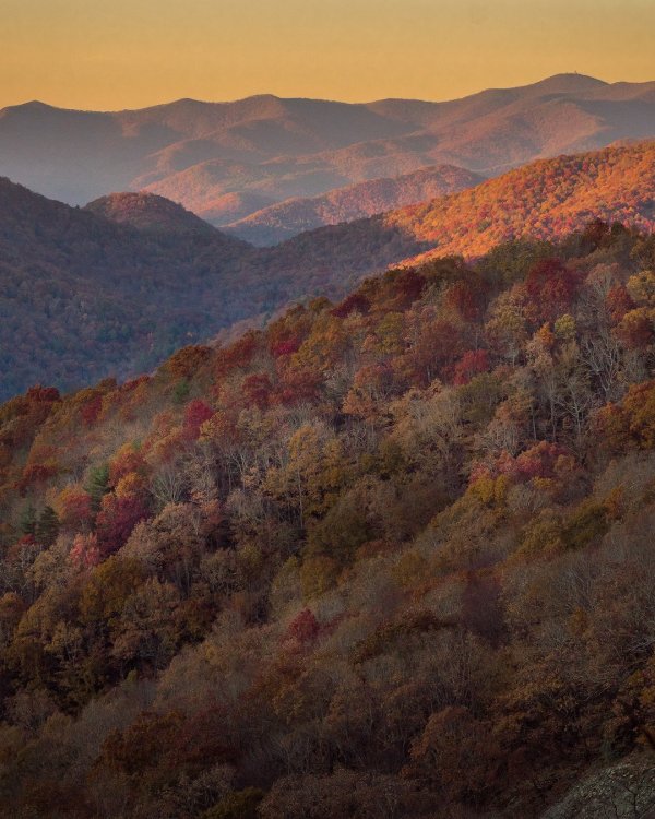
Made it up to Hogpen Gap yesterday up in N GA and was nicely surprised by the color still around. Perfect day too, almost 65 and not a cloud in the sky. Here's a shot I thought was worth sharing.
-
9
-
1
-


Severe Event March 25th 2021
in Southeastern States
Posted
Think I saw that too. Looked like the Hackleburg storm in terms of just being so massively wide. If that whole thing was indeed the wedge.