Silver Meteor
Members-
Posts
227 -
Joined
-
Last visited
About Silver Meteor

Profile Information
-
Four Letter Airport Code For Weather Obs (Such as KDCA)
KPGV
-
Location:
Greenville, NC
Recent Profile Visitors
The recent visitors block is disabled and is not being shown to other users.
-
Southern MD / Lower Eastern Shore weather discussion
Silver Meteor replied to PrinceFrederickWx's topic in Mid Atlantic
Watching the radar over Delaware last night I noticed "yellow sparkles" showing up with some of the most intense and persistent snow bands. They matched up well with the areas of highest reported snow, especially the Seaford to Laurel area. -
Feb 22nd/23rd "There's no way..." Obs Thread
Silver Meteor replied to Maestrobjwa's topic in Mid Atlantic
I've been keeping an eye on radar throughout the night. Was amazing to see Delaware getting dumped on non-stop. Storm has been slowly and steadily pulling away for a while now. Probably just flurries by daybreak. https://radar.weather.gov/station/kdox/standard -
Feb 22nd/23rd "There's no way..." Obs Thread
Silver Meteor replied to Maestrobjwa's topic in Mid Atlantic
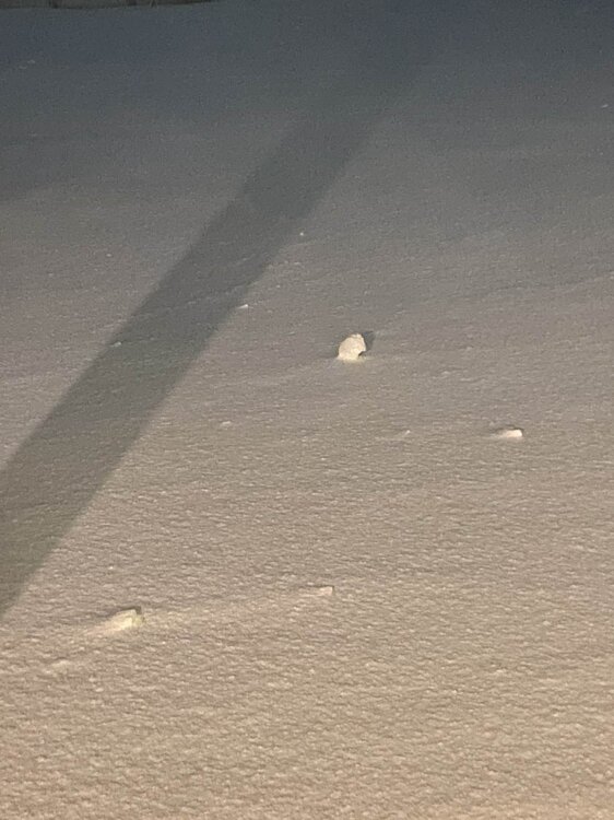
Laurel Delaware: Lady friend of mine in Laurel is a total snow freak. Not a weather geek but a snow freak. Anyway, she just told me the wind made snowballs in her backyard. I said that sounds pretty weird ... so she sent me this pic: -
Feb 22nd/23rd "There's no way..." Obs Thread
Silver Meteor replied to Maestrobjwa's topic in Mid Atlantic
Speaking of "incredible," I actually once lived in the tiny town of Fenwick, Delaware! Was in a small mobile home park called "Cape Windsor" on the left hand side just over the Rt. 54 bridge with canals along our few streets that opened to the bay giving a fantastic view of Ocean City. Long ago, I think early '90s? We had a bona-fide blizzard with heavy snow and storm force winds on the coast. Went to full white-out conditions. Small street in front was blown free of snow while a drift reached to my roof. Beach blizzards are at the top of the charts! -
Feb 22nd/23rd "There's no way..." Obs Thread
Silver Meteor replied to Maestrobjwa's topic in Mid Atlantic
Hello. Would appreciate it if you would comment on this website. It shows the swirling wind vortex near the coast yet at the same time shows a "Low" noticeably farther offshore. How are these dynamic graphics created? Accuracy? https://www.ventusky.com/wind-speed-map/10m-above-ground#p=37.74;-76.31;6&w=0xIAb9A9A -
Feb 22nd/23rd "There's no way..." Obs Thread
Silver Meteor replied to Maestrobjwa's topic in Mid Atlantic
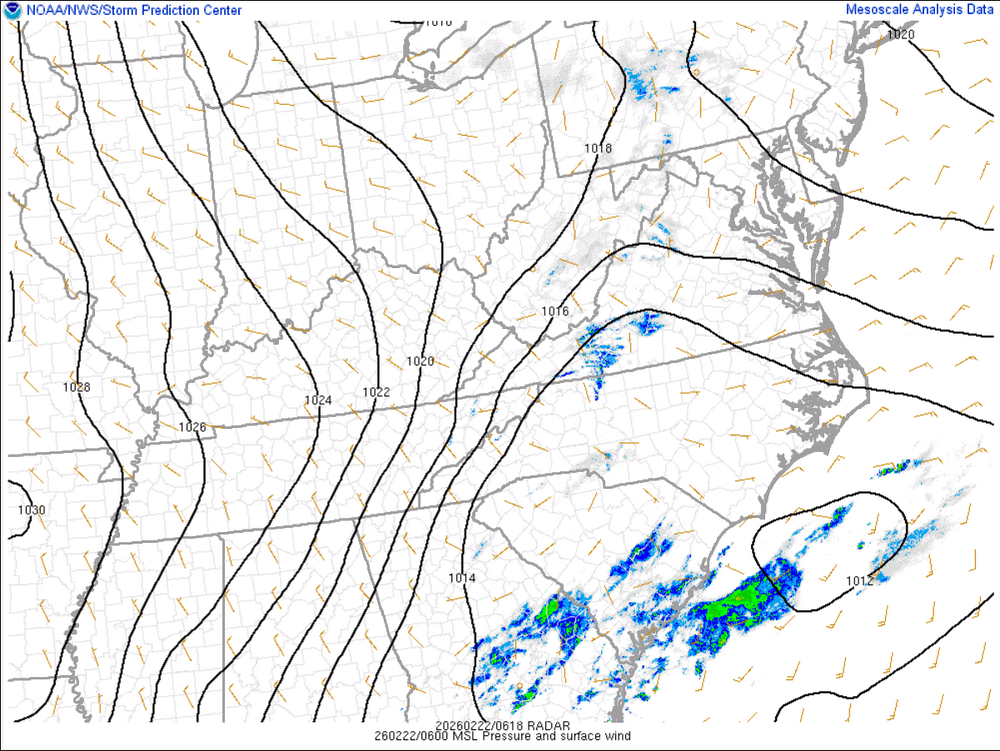
Seems to me the EURO was correct in not "tucking in" the surface low like so many other models did. It's well offshore and has been since leaving the Carolina coast. https://www.spc.noaa.gov/exper/mesoanalysis/new/viewsector.php?sector=17# -
Feb 22nd/23rd "There's no way..." Obs Thread
Silver Meteor replied to Maestrobjwa's topic in Mid Atlantic
-
2/22-23 "There's no way..." Storm Part 2
Silver Meteor replied to Maestrobjwa's topic in Mid Atlantic
What happened to all the heavy snow on the Delmarva? Did it all melt? -
2/22-23 "There's no way..." Storm Part 2
Silver Meteor replied to Maestrobjwa's topic in Mid Atlantic
I imagine DT is utterly apoplectic. -
2/22-23 "There's no way..." Storm Part 2
Silver Meteor replied to Maestrobjwa's topic in Mid Atlantic
It struck on a Sunday night. I was supposed to report for my first day of work at DTNSRDC in Carderock, Md (Potomac River near Bethesda) Monday morning but of course that never happened. In fact, it wasn't until the next Monday that work opened. Expecting a tolerable 4" of overnight snow I woke up to what I thought was fog outside. With the onset of daylight I about fainted when I realized that "fog" was torrential snow. Cars were completely buried and drifts were to the top of storefronts. Tractors were used to clear Georgia Avenue (Georgian Towers in Silver Spring.) https://vlab.noaa.gov/web/nws-heritage/-/unpredictable-the-president-s-day-storm-of-1979 -
The most snowfall ever recorded in a single winter in Maryland was during the winter of 2009–10, when 262.5 inches of snow fell at Keysers Ridge.
-
January 30th- Feb 1st ULL and coastal storm obs
Silver Meteor replied to JoshM's topic in Southeastern States
Storm chaser in Greenville, NC: -
January 30th- Feb 1st ULL and coastal storm obs
Silver Meteor replied to JoshM's topic in Southeastern States
Here in Greenville, NC I suspect we're going to beat the all-time record of 13" set in 1896. -
The “I bring the mojo” Jan 30-Feb 1 potential winter storm
Silver Meteor replied to lilj4425's topic in Southeastern States
Greenville, NC blizzard-like conditions here at 11pm. Snow & blowing snow with at least a foot on the ground. Couldn't open the front door of my apartment building because it was blocked by a drift. Quite insane over here.


