

Greg
-
Posts
1,873 -
Joined
-
Last visited
Content Type
Profiles
Blogs
Forums
American Weather
Media Demo
Store
Gallery
Posts posted by Greg
-
-
Definitely heavy snow here now. Looks great.

-
 1
1
-
 1
1
-
-
Started snowing at 9:35 PM in Wilmington, MA and already the driveway is coated. We'll see what the final results have in store for us here.
-
7 minutes ago, ORH_wxman said:
If it was supposed to happen earlier and prevent accumulations, then it was wrong.
It's delayed. Taint will still work in.
-
1
-
-
9 minutes ago, Sey-Mour Snow said:
already wrong for the NYC metro.. and will be wrong for SWCT
Not wrong just delayed with the taint.
-
3 minutes ago, Torch Tiger said:
point being; a lot of folks are missing out on the goods with this system, and it's a good one to miss -rather than a biggie.
Actually, for some this could be one of the biggest of the season. that's not too good if one misses out.
-
2 minutes ago, Sey-Mour Snow said:
50%
Actually, relatively higher.
-
 1
1
-
-
5 minutes ago, moneypitmike said:
Congrats, Ray!

Actually, the highest quantity is a little southeast of that.
-
19 minutes ago, Lava Rock said:
4-6" isn't really that exciting
Sent from my SM-S921U using Tapatalk
I just posted those.
-
-
-
I gave myself a "C" for my forecast. I ended up with about 5.0" here but that was a struggle to get to. My 4-7" worked out for the most part but the 7-10" I had in the Berks and Northshore did not materialize quite like I was predicting. Two things took that away, Temp and speed of the storm. This storm was fast moving. If the temps in the beginning were a little colder and the storm moved slightly slower, my predictions would have been much better. So again, C at best for my earlier forecast. Looks really pretty this morning with a crystal-clear blue sky over a pristine white landscape.
-
1
-
-
-
I see that dark green band coming in-between 128 and 495. That is what I need to happen up to just about 12:00 AM tonight. Keeping my fingers crossed.
-
12 minutes ago, 40/70 Benchmark said:
Once you get that CJ look where the band just sits in side of rt 128, its the kiss of death for us.
00z EURO had this look.
I see what you're saying. That is setting up just in and around 128. I'm on the very edge of it but also getting some of it. I feel you will fill in but would need to pound for a while to get the good stuff.
-
3 minutes ago, TauntonBlizzard2013 said:
Changing to snow here.
figured we’d have to change by 7p to get a plowable 3+ inches, but we’ll see
You'll pound for a little bit now. Let's see we're you end up in the early morning hours.
-
6 minutes ago, CoastalWx said:
Snowing at Logan now
Right on time.
-
1
-
-
5 minutes ago, 40/70 Benchmark said:
Been all snow here, but started as rain a bit inside of I495.
30.9
I had a bit of light snizzle (light rain and snow graupels) but at 5:45 PM was straight snow.
-
1 minute ago, Sey-Mour Snow said:
? lol go take a nap dude
Maybe you should instead.
-
 1
1
-
1
-
-
Just now, Sey-Mour Snow said:
Thank you , I’ve been trying to do this for greg with his 1980s NWS radar
Keep being a wise ass.
-
1
-
 2
2
-
-
-
8 minutes ago, Sey-Mour Snow said:
you aren't looking at the whole picture, the better radars when you piece the albany radar and regional radar show a large band forming and moving east, it's not missing CT
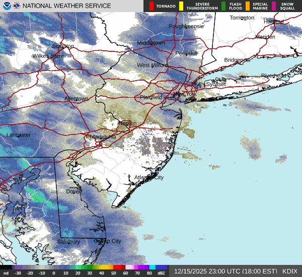
Not western CT just central and eastern areas will get that. I'm talking about the one down the coastline in New Jersey not the one. It's not going to come up straight north. Not the trajectory.
-
1
-
-
2 minutes ago, Sey-Mour Snow said:
There's an awesome band developing in Jersey headed towards us..
That down there is headed northeast not north/northeast. That will go to mostly central and eastern areas based on the trajectory.

-
It started snowing here about 5:45 PM. Well ahead of schedule. The mid-levels are colder than progged. This is a good sign for my neck of the woods. 36 degrees Wet steady snow.
-
1
-
-
10 minutes ago, HIPPYVALLEY said:
It’s a narrow band that stretches for me to you. I’m not sure I’ve ever seen an orientation like that which was so narrow. What causes that from a meteorological perspective?
That is a mesoscale feature.
-
1
-
Feb 8-9th Snow, Sleet, ZR OBS Thread
in New England
Posted