

SnowLover22
-
Posts
1,300 -
Joined
-
Last visited
Content Type
Profiles
Blogs
Forums
American Weather
Media Demo
Store
Gallery
Posts posted by SnowLover22
-
-
25 minutes ago, KamuSnow said:
Got up a little late due to being up till 2 am storm watching...my first reaction around 8 am was "where's the beef?". Was expecting more winds, but be careful what you wish for, looks like we're not done yet, although things are a couple of hours ahead of schedule as far as ending time. 2.35" here so far, occasional heavy showers and 72F.
Tornados warnings currently to the south of us btw with the storms moving north. The other Warned cell turned out to be nothing in my immediate area.
-
Tornado warning just issued for me
 wish me luck
-
Tornado watch just issued!
-
Premature time of death called by NHC? Since there last advisory the cyclone has maintained deep convection for the past few hours.
-
Confirmed
-
Positivity rate in PA has slowly been creeping up. Nearing 7% after today. Very concerning. Wouldn't be surprised if PA was added to NY Quarantine list soon.
-
 1
1
-
-
22 minutes ago, Hurricane Agnes said:
I'm about 4 miles to the SW of Cheltenham Twp. I know that my sis in the next door Springfield Twp (in Wyndmoor) just had her power go out on her street in the past hour. Transformer was sparking and then blew.
Your elevation is pretty high (400 feet) so I assume/hopefully your safe from the flash flood emergency?
-
Interesting this was included in the SVR warning that I got.
QuotePeople attending Covid-19 Drive through testing should seek safe shelter immediately!
-
16 minutes ago, Ralph Wiggum said:
More and more scientist studies reporting online and various news sources such as reuters and usa today that they are starting to get data that supports once you get covid19 it never leaves. Few reports now of triple infections in S Korea! I've seen comparisons to a herpes or aids type virus where it stays in the system but goes dormant at times even so as much to provide a negative test result. They are learning more and more about this every day.
Scary part is, it will continue to beat down the immune system and lungs. Reports are showing lung scarring on those who have 'recovered'. If these reports are true, this isnt good. Imagine aids being spread via respiratory droplets?
God I hope this is wrong.
-
trough on gfs is sharper/ higher heights at hr 36 should be an improvement based on h5 alone...
-
Divide this total by 2 and it would still be acceptable

-
 1
1
-
-
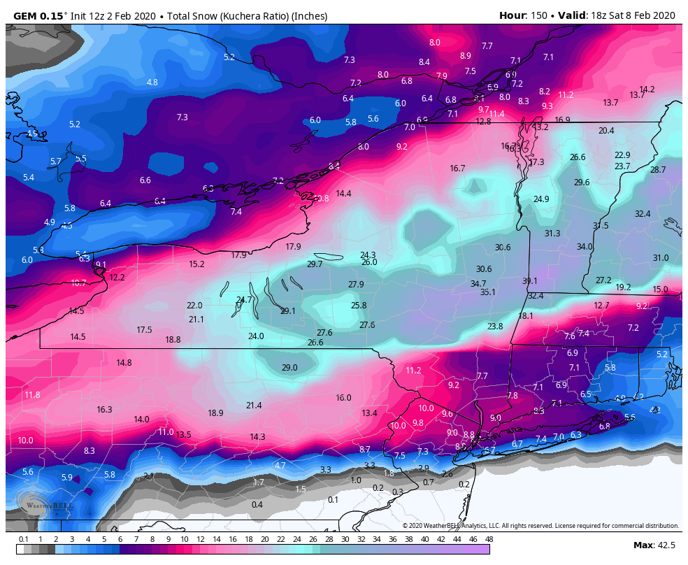
1 minute ago, PaulyFromPlattsburgh said:
NAM is a significant hit for many! HUGE. Really tucked in. 100 miles west and 5mb stronger than last run. better capture
You could tell early on, the trough was sharper/ higher heights
-
1
-
-
Per gfs snow starts in 84-90 hours.
from wave 2 that is
-
-
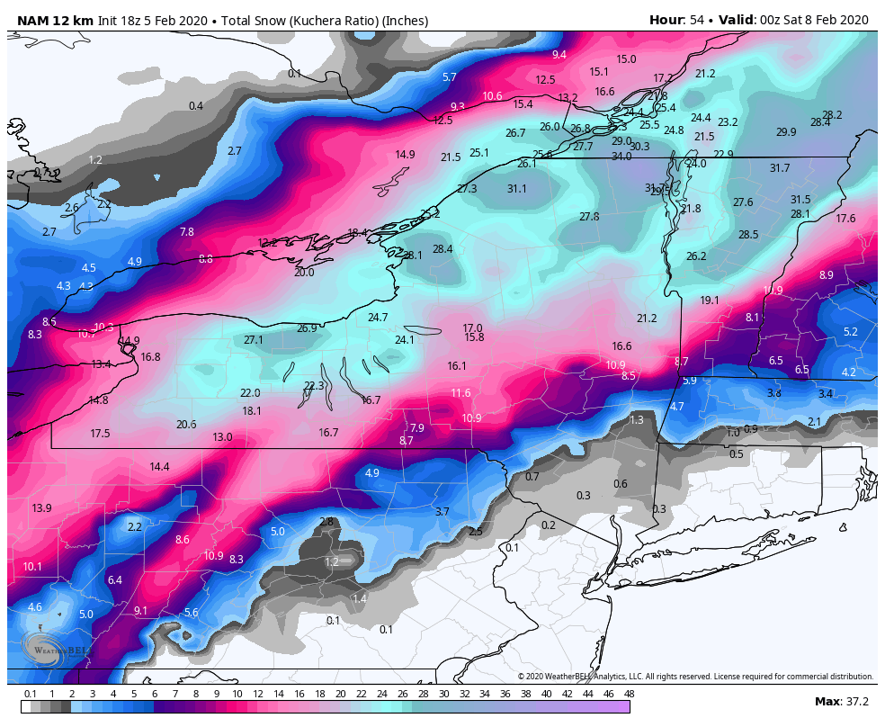
2 minutes ago, rochesterdave said:
BOOM

I guess the cmc is just a little slower?
-
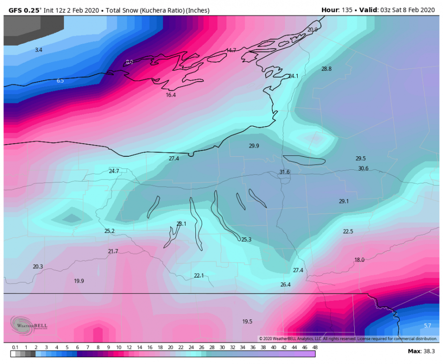
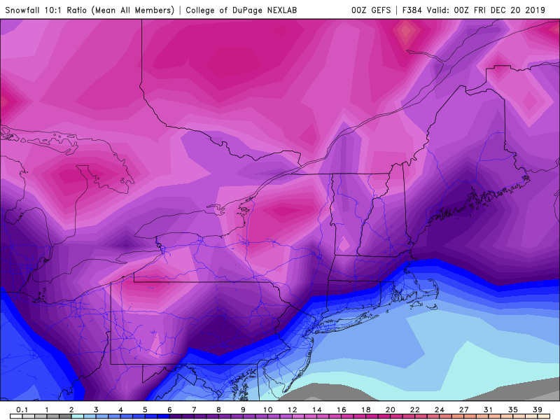
Zoomed in Snowfall map with ratios
If I'm not mistaken on the CCB, ratios would be higher than 10:1
-
1
-
 1
1
-
3
-
-
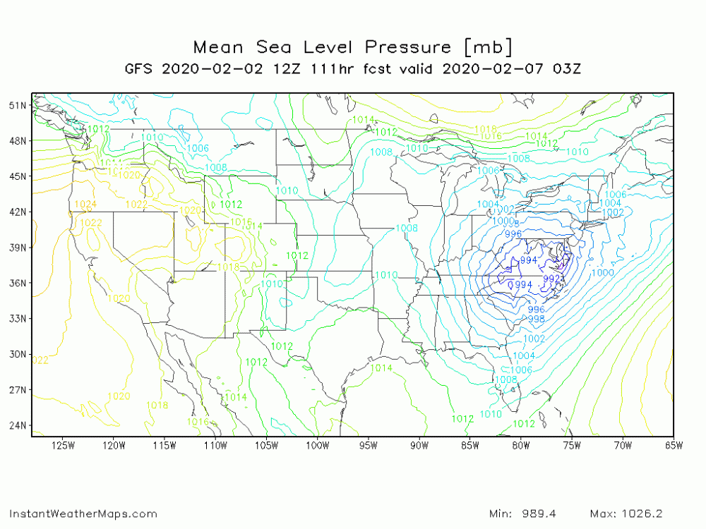
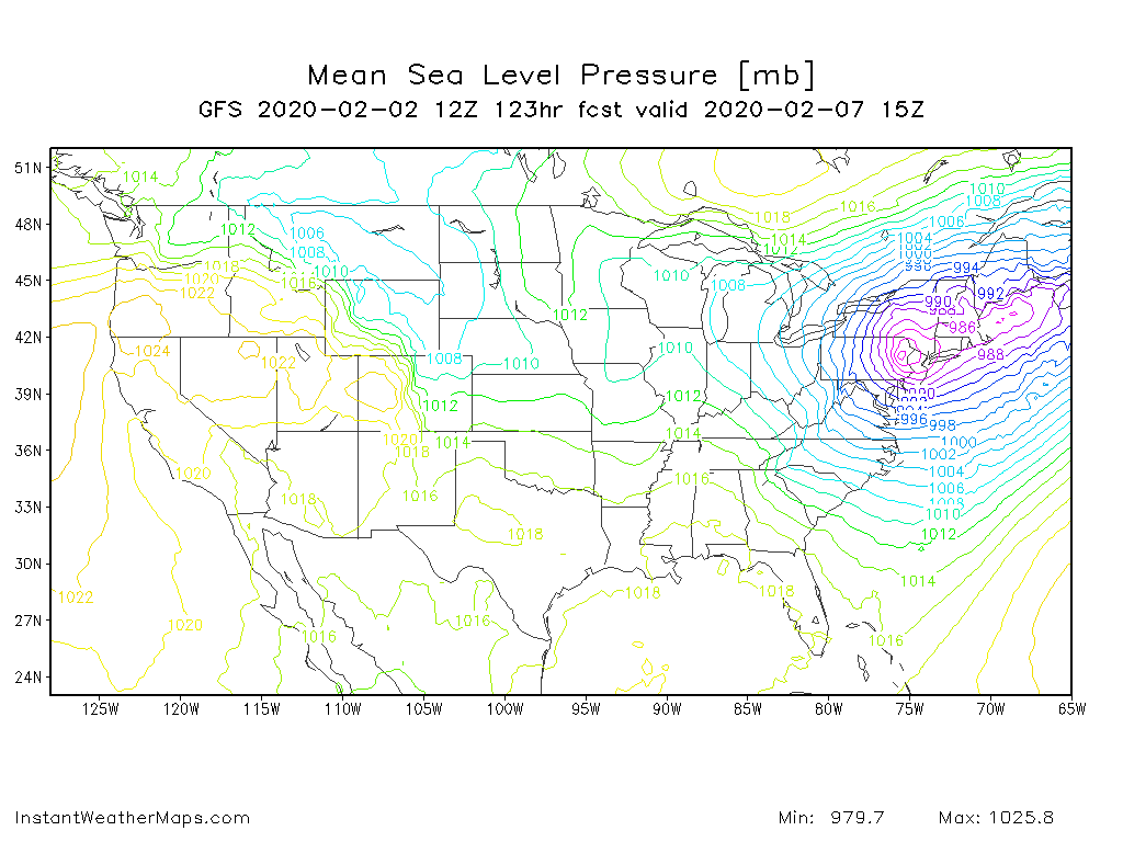
It gets down to 979mb
-
1
-
-
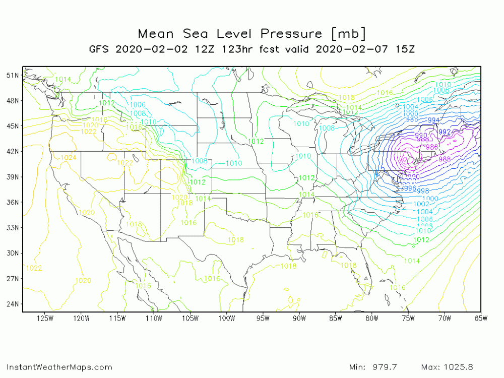
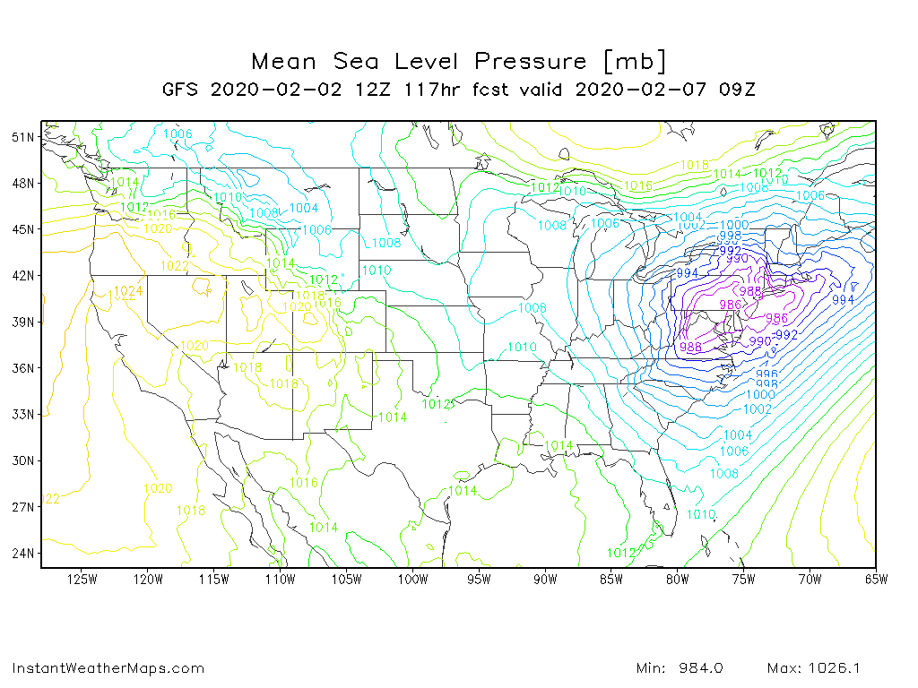
117 hours
Position actually looks good
-
1
-
-
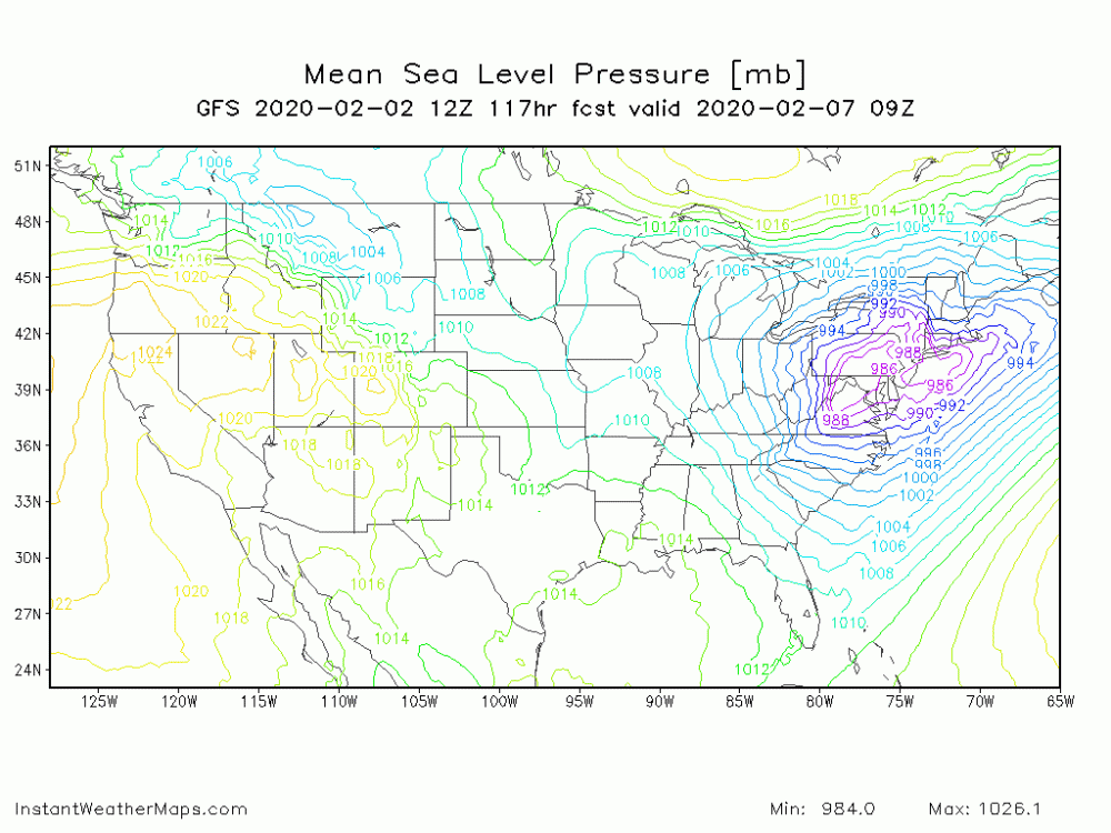
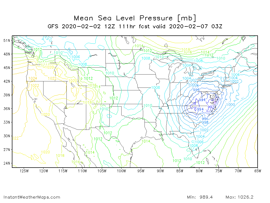
Through 111 hours
-
Don't like what I see early on the gfs. I think we won't like this run. Will be glad to eat my words.
-
I don't post a lot here. I thought I just share that the ukmet is now available for free on pivotal.
-
2
-
3
-
-
Nothing like getting a wake up call for a snow squall warning
-
Surprised. Picked up a quick 1-2 inches of snow here in Geneva from lake effect. Wasn't really expecting much.
-
4
-
-
5 hours ago, showmethesnow said:
There is just no way that this from wxbell can be the mean or median for snowfall. (note the circled area is mostly from the system that passed in overnight).

Not when I see this.

I would say that the top map may be the Control run of the GEFS but even that doesn't make sense. At this point I think something is just wrong with their coding.
Besides that, there are quite a few good hits in the mix. For those that keep track we are seeing the hits centered roughly on day 8, day 10-11, day 15-16.
Not sure but I think this site might give a better representation of the mean.
It is found at https://weather.cod.edu/forecast/
-
1
-


E PA/NJ/DE Summer 2020 OBS Thread
in Philadelphia Region
Posted
Winds are really picking up now.