

DownpourDave
-
Posts
1,341 -
Joined
-
Last visited
Content Type
Profiles
Blogs
Forums
American Weather
Media Demo
Store
Gallery
Posts posted by DownpourDave
-
-
2 minutes ago, the ghost of leroy said:
Just need recon to beat the ERC. Nobody should expect to wake up tomorrow morning to the present eyewall situation. Couple good passes then let this thing implode from its own wild energy.
it will be there in 30 min it will beat the ERC.
-
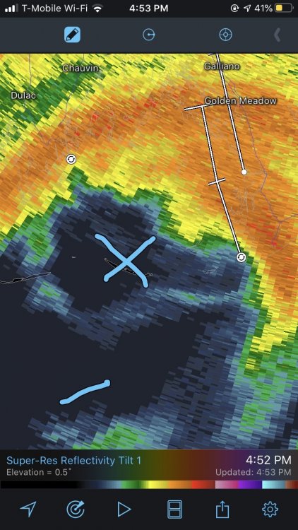
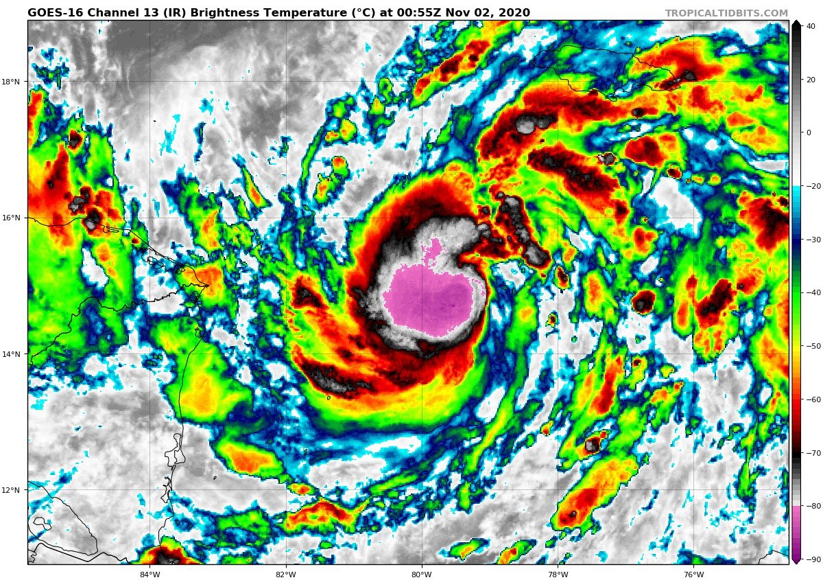
890mb, Wind Speed High-End EF4 Tornado. (180 mph)
-
if you want min by min updates
https://weather.cod.edu/satrad/?parms=meso-meso2-13-24-0-100-1&checked=map&colorbar=data
-
Just now, jpeters3 said:
That should shave off an hour from my estimate!
so they fly slower than commercial airlines it seems. Is that a correct take?
-
3 minutes ago, hawkeye_wx said:
Clearly at its peak right now.
Also, the recon plane is back up in the air and headed south over the gulf.

seems like there is a legit chance it can get a few passes in before landfall, assuming it does not turn back. for what its worth, HWRF seems to think this is a current 930mb storm with it getting down to 925mb before landfall.
-
maybe the "next" recon mission will be the one.
-
welp I guess the recon was canceled. Not updating on tidbits
-
 1
1
-
-
Just now, hlcater said:
Looking like it’s getting ready to undergo RI. Multiple impressive bursts rotating tightly around the center. In contrast to Delta and Zeta which could seemingly only fire one burst at a time.

do we know when the next recon flight is. Seems like now would be a perfect time to be getting data.
-
The structure still looks amazing. Wow!
Radar velocities still around 110-125mph. only 1,800 feet up in the atmosphere.
-
 3
3
-
-
1 minute ago, the ghost of leroy said:
You would’ve been a hoot an hour or two after Katrina blew through
how long after Katrina did the levees fail?
-
At least no sign of levee failure so far which is great news.
-
So will the eyewall be going over New Orleans. It is kind of hard to tell.
-
recon found 115 knot flight level winds.. might be enough for an upgrade.
-
1
-
-
2 minutes ago, SnowLover22 said:
btw it has made landfall it seems or nearly at that. Eye is clearly over one of the outer islands.
-
btw it has made landfall it seems or nearly at that. Eye is clearly over one of the outer islands.
-
 2
2
-
-
radar velocities up to 140 mph 8,000 feet up. 115 mph is definitely defendable for the surface.
-
1
-
-
1 minute ago, wolfie09 said:
Well that one went to shit pretty quick lol (us northerners)
Maybe ill drive to Albany and chase this. Nothing better to do anyway. They look to have a better chance at getting something good anyways
-
 1
1
-
-
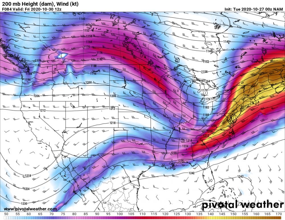
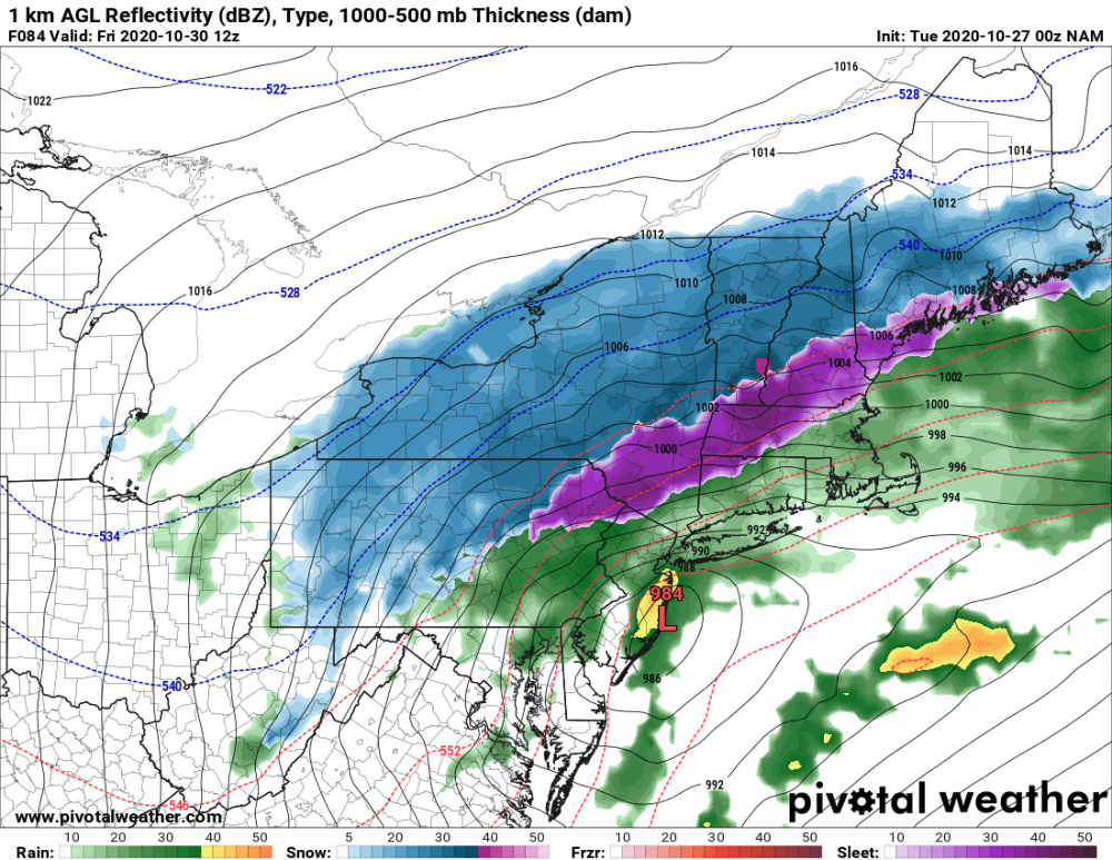
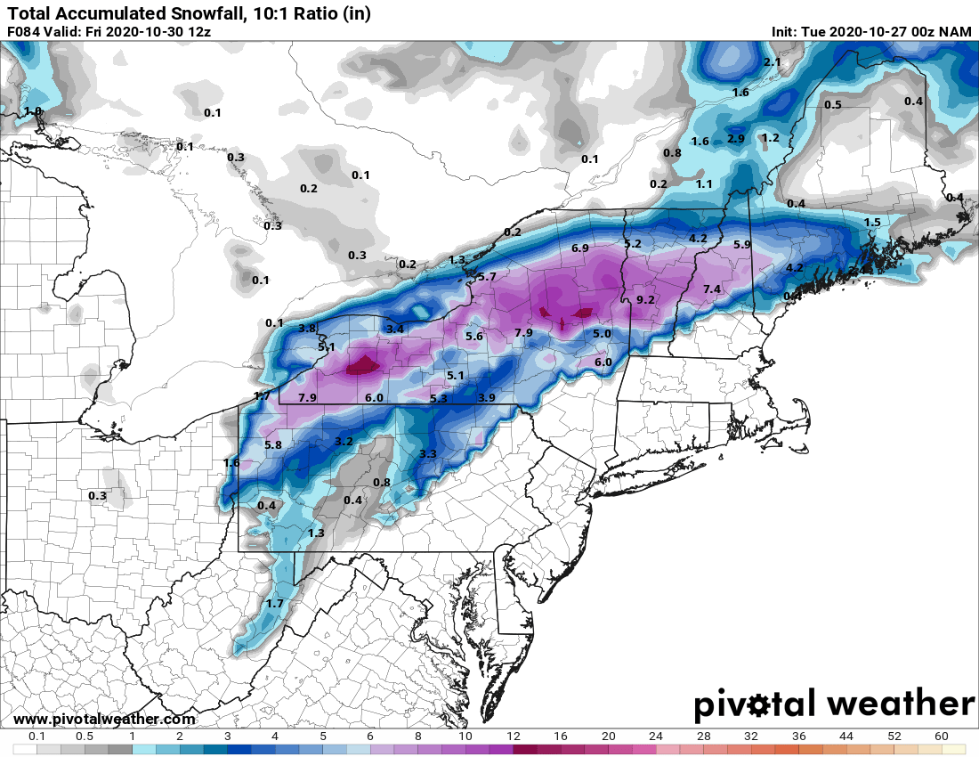
14 minutes ago, CoastalWx said:
NAM was about to go apeshit.
I wish there was a low location overlaying this panel. But you can clearly see the favorable positioning of the low pressure positioned to the right entrance of the jet streak promoting ascent. I have no doubt with the upper-level support, the low pressure system would have continued to strengthen if there had been more panels. after 84 hours.
-
2 minutes ago, BuffaloWeather said:
So we really using the NAM, ICON, PARA this year?

my post was not meant to be taken seriously. I thought it was pretty clear I was being facetious
-
cmon guys you all knew it was coming!
nam'd
Totals with the event still well-underway.

-
 2
2
-
-
1 hour ago, SnowLover22 said:
early, but thinking the gfs-p will be a big step down. Just looking what I am seeing so far. Could be wrong ofc.
so not a "big step down" but definitely a trend in the wrong direction. Weaker lighter precipitation vs 18z.
-
1
-
-
45 minutes ago, SnowLover22 said:
early, but thinking the gfs-p will be a big step down. Just looking what I am seeing so far. Could be wrong ofc.
almost an hour later and still stuck at 36 hours strange.
-
1
-
-
early, but thinking the gfs-p will be a big step down. Just looking what I am seeing so far. Could be wrong ofc.
-
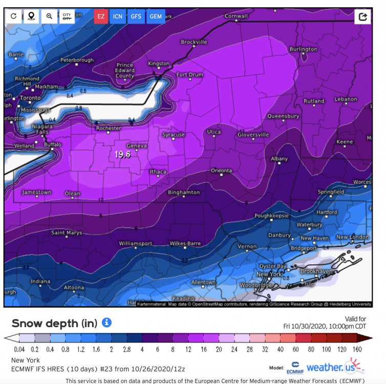
best map I could find from euro eps. Feel free to react

-
1
-


Tropical Storm Eta
in Tropical Headquarters
Posted
revising my guess same pressure as my guess before but ill up my wind guess to 200 mph (EF5 Tornado)