

Spaizzo
-
Posts
385 -
Joined
-
Last visited
Content Type
Profiles
Blogs
Forums
American Weather
Media Demo
Store
Gallery
Posts posted by Spaizzo
-
-
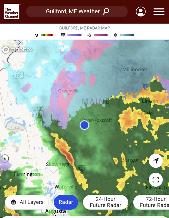
Sleeting in Port Jeff. we are still sitting at 24 and light snow here in Ansonia.
. -
Radar and HRRR look like crap.
It really does especially for ct.
. -
A tad over an inch here in Ansonia with a lovely dryslot… hoping we fill back in
. -
Light snow/l and 25 degrees here in Ansonia
. -
And we flurry down here in ansonia. Little earlier than expected
.-
 1
1
-
-
-
Yup, Deja Vu all over again.
.
The jacks tend to move closer to the event. Even if we are hours from start
.-
1
-
-
Radar says we've been in rain for a bit, was snowing up til about 2 mins ago as it had flipped back the past half hour, nice Wintery morning out there, two towns up the old man said they had about 9 inches when he left at 5am so guess closer to 10 by the time it's all said and done. Good starter storm for sure.
Sunday river at the base reported a foot or more before the switch around 7am. Bethel was all rain at that point, but top was still snowing. Thank god they don’t need another rain disaster after December!
.-
2
-
-
Big fail on the wind on my part. Always like to play conservative but did not do that this time. I felt pretty good we would
1) See a forced line of convection
2) That would be sufficient to mix winds down
Anyways, snow pack here wiped down but still looks like 3'' maybe 4'' left. And now there is fog developing
It got pretty windy early we gusted to 41 down here on and off in high 30s for wind until like 11. When the biggest line came through it wasn’t much maybe a few small gusts. It was louder here than Ind December before 11. Kinda glad we woke up with no power failures
.-
2
-
-
Gusts are near 40 here in Ansonia. I’m on a hill if that even matters but much louder than it was in December.
. -
-
Beer?
Totally fat fingered as I’m yelling at my kid…. lol just edited
.-
 2
2
-
-
Wind is kicking up down here in the valley gusts are howling
. -
We are down to 35 from 37 earlier feels a bit cooler with a mangled flake here and there in the rain....Not sure this even matters just wasn't expecting to drop in temp...
-
Started now as drizzle/light rain and mangled flakes here and there our temp is 36 not 33.
-
Have some stray flurries happening down here but our temps 33
.-
1
-
-
What time is the heaviest of rains about moving into ct? Need to plan on reaching family member as her area flooded the last time and she got nervous
. -
I'm kind of surprised (though I guess I shouldn't be) this thread isn't getting more attention. Perhaps it's because we're right on the heels of this past weekend's event and everyone is exhausted, but this is going to be a very high impact storm. The flooding, particularly river and stream flooding is going to be very bad. Looking at a widespread 2-4'' of rain and I'm sure we'll see a strip of 5-7'' totals.
Just finished Mikes weather pages morning live and was shocked that it hasn’t been much to read up on here yet he’s way to more vastly focused along the entire east coast. We basement flood during heavy rainers when the grounds saturated or frozen so I keep worrying
.-
1
-
-
So change in topic is it going to rain, deluge, or drizzle the next few days?
. -
I think our forum offers some of the most insightful met analysis in between the back and forth, which I don't mind. But to each their own, I guess.
Agree. Many who might be more of an audience member like myself maybe don’t understand the dynamics from the active members. They might be taking the playful banter as rude where me I’ve been here long enough to know it’s joking around or ball busting.
.-
2
-
-
CT Rhode Island SE MA up to BOSTON. BUST.
Most people live here. OOPS.
This is trending well into ratter already for these locations; not even considering the next two cutters.
Good luck [mention=100]40/70 Benchmark[/mention]
Hopefully all these people haven't been paying attention...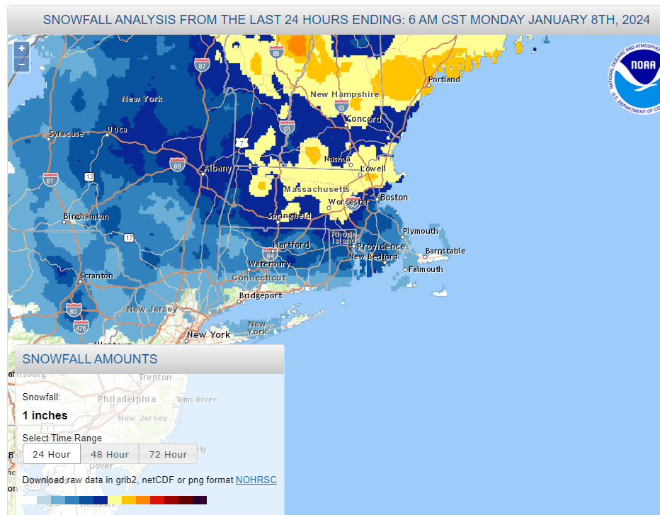
Most of CT seemed to line up with forecast. Most forecasts were straight forward with the what ifs. Lower CT had been I. The 2-10 range depending on trends and dynamics. Closer to event we were lowered to 3-6. We reached 3” before the rain and probably got another inch post the change over. Seems pretty spot on. People need to actually listen or read and not just get distracted by potential snowfall maps
. -
if anyone has any totals from Round 1 only in CT i can make a quick map to show we got so far.
We had 3” in Ansonia when I checked around midnight. It’s compacted due to rain.
.-
 1
1
-
-
We got drizzle and mangled flakes going on now in Ansonia. 33 degrees
. -
3” here in Ansonia moderate snow still. Wind has greatly picked up and is howling
.


At least it's something - Jan 16th Snow/Sleet/Ice OBS Thread
in New England
Posted
A little more than an 1.5 inches. We went from light fine flakes to fat flakes. I am assuming the warm air is close. We had really poor snow growth and was in a snow hole from like 3-6am.