AMZ8990
-
Posts
1,270 -
Joined
-
Last visited
Content Type
Profiles
Blogs
Forums
American Weather
Media Demo
Store
Gallery
Everything posted by AMZ8990
-

January 15th-17th 2024 Arctic Blast/Snow Event
AMZ8990 replied to John1122's topic in Tennessee Valley
-
January 15th-17th 2024 Arctic Blast/Snow Event
AMZ8990 replied to John1122's topic in Tennessee Valley
-
January 15th-17th 2024 Arctic Blast/Snow Event
AMZ8990 replied to John1122's topic in Tennessee Valley
I’m glad you cashed in, I feel for others who weren’t so lucky around the forum. The totals across the state are pretty remarkable honestly though. This event will definitely be one for the history books. This thread will be one for the history books too, lol. -
January 15th-17th 2024 Arctic Blast/Snow Event
AMZ8990 replied to John1122's topic in Tennessee Valley
Public Information Statement National Weather Service Memphis TN 911 PM CST Mon Jan 15 2024 ...SNOWFALL REPORTS... Location Amount Time/Date Lat/Lon ...Arkansas... ...Clay County... Piggott 2.4 in 0245 PM 01/15 36.38N/90.20W 1 E Piggott 1.3 in 1023 PM 01/14 36.39N/90.18W ...Craighead County... 6 E Bono 1.8 in 0813 AM 01/15 35.91N/90.69W ...Crittenden County... 2 W West Memphis 5.5 in 0200 PM 01/15 35.15N/90.21W 1 NE Marion 3.0 in 1012 PM 01/14 35.22N/90.19W ...Cross County... Wynne 1.3 ENE 3.5 in 1015 AM 01/15 35.24N/90.77W Wynne 2.3 in 1145 AM 01/15 35.23N/90.79W ...Greene County... 1 NNE Oak Grove Heights 1.5 in 1140 PM 01/14 36.14N/90.51W Lafe 1.8 W 1.0 in 0700 AM 01/15 36.21N/90.53W 1.7 SE Paragould 0.8 in 0700 AM 01/15 36.03N/90.50W ...Mississippi County... Blytheville 6.1 E 1.9 in 0700 AM 01/15 35.95N/89.82W ...Phillips County... 5 NW Watkins Corner 3.0 in 0200 PM 01/15 34.52N/91.02W ...Poinsett County... 1 NE Trumann 1.5 in 0836 PM 01/14 35.68N/90.51W ...St. Francis County... Forrest City 3.7 in 0300 PM 01/15 35.01N/90.79W ...Mississippi... ...Alcorn County... 4 ENE Glen 7.0 in 0800 PM 01/15 34.89N/88.44W 1 WSW Corinth 4.0 in 0727 AM 01/15 34.93N/88.53W 3 W Hinkle 2.5 in 1030 PM 01/14 34.78N/88.62W 1 WNW Corinth 2.3 in 0840 PM 01/14 34.94N/88.53W ...Benton County... Ashland 7.0 in 0130 PM 01/15 34.83N/89.18W ...Coahoma County... Clarksdale 2.9 SW 1.0 in 0700 AM 01/15 34.18N/90.62W ...DeSoto County... 3 SE Horn Lake 7.6 in 0130 PM 01/15 34.93N/90.00W Hernando 7.4 in 0120 PM 01/15 34.82N/89.99W 2 NNW Hernando 7.0 in 0300 PM 01/15 34.85N/90.00W Eudora 5.3 in 0430 PM 01/15 34.83N/90.15W 2 S Olive Branch 5.3 in 0430 PM 01/15 34.92N/89.83W 1 ENE Horn Lake 5.0 in 0430 PM 01/15 34.96N/90.02W 4 ENE Hernando 5.0 in 1200 PM 01/15 34.85N/89.92W Eudora 5.0 in 0215 PM 01/15 34.83N/90.15W 2 SW Horn Lake 4.5 in 0430 PM 01/15 34.93N/90.06W 4 SE Olive Branch 4.3 in 0900 AM 01/15 34.92N/89.78W 4 NNW Hernando 4.3 in 1115 AM 01/15 34.88N/90.01W Walls 1.4 NE 4.2 in 0800 AM 01/15 34.97N/90.13W 5 WNW Lewisburg 4.0 in 0430 PM 01/15 34.89N/89.90W 6 SW Byhalia 4.0 in 0430 PM 01/15 34.79N/89.75W 4 N Hernando 4.0 in 1215 PM 01/15 34.88N/89.99W 1 NNE Hernando 2.2 in 1141 PM 01/14 34.84N/89.98W 3 E Olive Branch 1.8 in 0701 PM 01/14 34.96N/89.77W 1 NNW Walls 1.0 in 0718 PM 01/14 34.96N/90.14W 2 SW Horn Lake 1.0 in 0718 PM 01/14 34.93N/90.06W 3 N Hernando 0.8 in 0718 PM 01/14 34.88N/90.00W 2 ESE Hernando 0.8 in 0718 PM 01/14 34.81N/89.95W 1 E Eudora 0.8 in 0718 PM 01/14 34.83N/90.13W 4 SE Horn Lake 0.6 in 0718 PM 01/14 34.92N/89.99W 1 S Lynchburg 0.5 in 0718 PM 01/14 34.95N/90.10W ...Lafayette County... 1 NNW Oxford 2.5 in 1255 AM 01/15 34.38N/89.53W 4 ENE Taylor 2.5 in 1126 AM 01/15 34.29N/89.52W ...Lee County... 3 NW Guntown 1.0 in 0800 AM 01/15 34.48N/88.70W ...Marshall County... 6 W Mt Pleasant 6.5 in 1245 PM 01/15 34.95N/89.62W 3 S Byhalia 5.8 in 0430 PM 01/15 34.82N/89.69W Potts Camp 5.0 in 0130 PM 01/15 34.65N/89.31W 4 SSE Red Banks 4.5 in 0430 PM 01/15 34.79N/89.55W 4 SSE Red Banks 0.5 in 0718 PM 01/14 34.79N/89.55W ...Panola County... 3 W Como 2.3 in 1215 PM 01/15 34.51N/89.98W ...Prentiss County... 1 SW Booneville 3.8 in 1237 PM 01/15 34.66N/88.57W 2 W Booneville 3.0 in 0235 PM 01/15 34.66N/88.59W ...Tate County... 5 WNW Independence 4.8 in 0430 PM 01/15 34.71N/89.89W 5 WNW Independence 0.3 in 0718 PM 01/14 34.71N/89.88W ...Tippah County... 3 S Walnut 6.0 in 0817 AM 01/15 34.90N/88.91W ...Tishomingo County... 1 NNE Iuka 6.8 in 0400 PM 01/15 34.82N/88.19W 3 N Burnsville 4.0 in 0935 AM 01/15 34.89N/88.32W 1 N Iuka 3.8 in 0845 AM 01/15 34.82N/88.20W ...Tunica County... Tunica 4.0 in 0340 PM 01/15 34.69N/90.38W Robinsonville 4.0 in 0340 PM 01/15 34.82N/90.31W Dubbs 3.0 in 0344 PM 01/15 34.57N/90.37W ...Union County... 4 NNW Ecru 1.4 in 0106 PM 01/15 34.41N/89.04W ...Missouri... ...Dunklin County... Kennett 2.5 in 0435 AM 01/15 36.24N/90.05W Hornersville 1.0 in 0148 PM 01/15 36.04N/90.11W ...Tennessee... ...Benton County... 6 E Camden 7.0 in 0230 PM 01/15 36.07N/88.00W 11 SE Buena Vista 5.0 in 0230 PM 01/15 35.87N/88.14W 7 SSW Camden 4.8 in 1100 AM 01/15 35.97N/88.14W Camden 8.2 S 4.5 in 0700 AM 01/15 35.95N/88.10W Big Sandy 3.3 in 0230 PM 01/15 36.24N/88.09W ...Carroll County... Clarksburg 4.5 in 0500 AM 01/15 35.88N/88.39W 4 NW Middle Fork 4.5 in 0248 PM 01/15 35.90N/88.55W Hollow Rock 3.8 in 0334 PM 01/15 36.04N/88.27W 3 NW Cedar Grove 3.0 in 0456 AM 01/15 35.85N/88.64W McKenzie 1.5 SSE 3.0 in 0700 AM 01/15 36.12N/88.50W Bruceton 3.0 in 0730 AM 01/15 36.03N/88.25W 4 WSW Vale 3.0 in 0745 AM 01/15 36.10N/88.34W 5 ENE Clarksburg 3.0 in 0900 AM 01/15 35.90N/88.31W 1 N Hollow Rock 2.5 in 0458 AM 01/15 36.05N/88.28W ...Chester County... Henderson 7.0 in 0116 PM 01/15 35.44N/88.65W 1 NE Henderson 6.0 in 0500 PM 01/15 35.46N/88.63W Henderson 2.2 SSE 3.8 in 0700 AM 01/15 35.41N/88.64W 1 ESE Henderson 1.5 in 0915 PM 01/14 35.44N/88.63W ...Crockett County... Bells 2.0 in 1038 PM 01/14 35.72N/89.09W ...Decatur County... 1 SW Decaturville 7.5 in 0229 PM 01/15 35.57N/88.13W Parsons 6.0 in 0229 PM 01/15 35.65N/88.13W Decaturville 4.1 in 0800 AM 01/15 35.60N/88.12W ...Dyer County... Dyersburg 2.0 in 0926 AM 01/15 36.04N/89.38W Newbern 1.0 WSW 1.7 in 0745 AM 01/15 36.11N/89.28W ...Fayette County... Moscow 7.1 in 0405 PM 01/15 35.06N/89.39W Oakland 6.0 in 0222 PM 01/15 35.23N/89.51W Somerville 10 N 4.4 in 0630 AM 01/15 35.39N/89.37W Moscow 2.5 in 0900 PM 01/14 35.06N/89.40W 1 N Piperton 2.0 in 0930 PM 01/14 35.04N/89.63W ...Gibson County... 1 WNW Humboldt 4.0 in 0300 PM 01/15 35.83N/88.92W 4 NNW Gibson 3.5 in 1155 AM 01/15 35.92N/88.88W 2 W Trenton 3.0 in 0709 AM 01/15 35.98N/88.98W ...Hardeman County... Middleton 7.3 in 1247 PM 01/15 35.06N/88.89W 4 SE Bolivar 7.0 in 0405 PM 01/15 35.22N/88.96W Bolivar 5.0 in 1116 AM 01/15 35.26N/89.00W ...Hardin County... 4 SSE Olive Hill 5.5 in 0401 AM 01/15 35.21N/88.00W Saltillo 4.0 in 0630 AM 01/15 35.38N/88.21W 1 WNW Savannah 3.5 in 0700 AM 01/15 35.23N/88.25W ...Haywood County... Brownsville 5.5 in 0850 AM 01/15 35.60N/89.26W 2 WNW Brownsville 3.0 in 0850 PM 01/14 35.60N/89.28W ...Henderson County... 3 N Lexington 5.6 in 0100 PM 01/15 35.70N/88.39W ...Henry County... Paris 4.3 ENE 3.5 in 0700 AM 01/15 36.33N/88.24W Paris 3.0 NNW 3.1 in 0800 AM 01/15 36.34N/88.32W ...Lake County... 2 ESE Tiptonville 1.2 in 0239 PM 01/15 36.37N/89.44W ...Lauderdale County... 1 N Halls 4.0 in 1030 PM 01/14 35.88N/89.40W ...Madison County... Jackson 6.1 SSE 6.5 in 0410 PM 01/15 35.56N/88.78W 4 NNW Jackson 4.0 in 0200 PM 01/15 35.68N/88.86W 4 NNW Mifflin 4.0 in 0400 AM 01/15 35.60N/88.61W Jackson 9.3 NE 3.5 in 0700 AM 01/15 35.73N/88.71W Jackson Experiment Stn. 3.2 in 0800 AM 01/15 35.62N/88.85W Jackson 5.6 NE 3.0 in 0600 AM 01/15 35.70N/88.77W Gadsden 4.9 SSE 3.0 in 0700 AM 01/15 35.71N/88.96W Jackson 4.3 N 2.8 in 0600 AM 01/15 35.70N/88.84W 4 E Adair 2.5 in 1040 PM 01/14 35.71N/88.90W 5 ESE Holly Grove 2.0 in 1130 PM 01/14 35.62N/89.04W ...McNairy County... Selmer 7.0 in 0113 PM 01/15 35.17N/88.59W Bethel Springs 6.0 in 1030 AM 01/15 35.24N/88.61W Adamsville 4.0 in 0340 AM 01/15 35.24N/88.39W 4 NW Stantonville 1.8 in 1020 PM 01/14 35.20N/88.47W ...Obion County... 2 ENE Union City 2.5 in 0605 PM 01/15 36.43N/89.02W 1 N Union City 2.5 in 0605 PM 01/14 36.44N/89.05W 4 WSW Woodland Mills 1.0 in 0800 PM 01/14 36.46N/89.18W Troy 1.0 in 0800 PM 01/14 36.34N/89.17W 1 NNW Union City 0.5 in 0800 PM 01/14 36.43N/89.06W ...Shelby County... Eads 7.3 in 0125 PM 01/15 35.20N/89.66W 1 E Collierville 6.5 in 0530 PM 01/15 35.06N/89.66W 2 NE Ellendale 6.4 in 0600 PM 01/15 35.26N/89.81W 3 NE Ellendale 6.3 in 1205 PM 01/15 35.27N/89.80W Bartlett 1.9 SSW 6.0 in 1215 PM 01/15 35.19N/89.85W 5 NNE Germantown 5.5 in 0820 AM 01/15 35.15N/89.77W 1 SE Arlington 5.5 in 1235 PM 01/15 35.28N/89.66W Memphis NWS 5.2 in 1200 PM 01/15 35.13N/89.80W 4 NNW Southeast Memphis 4.8 in 0945 AM 01/15 35.12N/89.90W 3 SE Germantown 4.6 in 1240 PM 01/15 35.05N/89.75W 2 N Downtown Memphis 4.6 in 0130 PM 01/15 35.16N/90.05W 1 NE Eads 4.5 in 0745 AM 01/15 35.21N/89.65W Millington 4.5 in 0317 PM 01/15 35.34N/89.89W 4 S Bartlett 4.3 in 0745 AM 01/15 35.16N/89.84W 1 SSE Midtown Memphis 4.2 in 0630 AM 01/15 35.12N/89.98W 3 NW Germantown 4.1 in 0430 PM 01/15 35.12N/89.84W 1 N Arlington 4.0 in 1043 PM 01/14 35.29N/89.66W Germantown 4.0 in 0715 AM 01/15 35.09N/89.79W 2.9 E Germantown 3.7 in 0700 AM 01/15 35.08N/89.74W 3 NNW Ellendale 3.5 in 1050 PM 01/14 35.27N/89.85W 2 S Arlington 3.5 in 1059 PM 01/14 35.26N/89.66W 4 NNE Germantown 3.5 in 1200 AM 01/15 35.14N/89.78W 4 NE Whitehaven 3.4 in 1200 PM 01/15 35.05N/89.98W 3 WNW Collierville 3.3 in 0745 AM 01/15 35.07N/89.73W 2 WSW Lakeland 3.0 in 1024 PM 01/14 35.22N/89.76W 3 ESE Frayser 2.7 in 0916 PM 01/14 35.20N/89.92W 3 ENE Ellendale 2.7 in 0929 PM 01/14 35.26N/89.79W 1 W Arlington 2.5 in 0853 PM 01/14 35.28N/89.69W 2 N Ellendale 2.5 in 0900 PM 01/14 35.26N/89.84W 2 W Frayser 2.5 in 0930 PM 01/14 35.22N/90.01W 3 NNE Germantown 2.0 in 0905 PM 01/14 35.12N/89.78W Midtown Memphis 2.0 in 1000 PM 01/14 35.13N/89.98W Bartlett 1.6 in 0651 PM 01/14 35.22N/89.84W ...Tipton County... 6 NNE Mason 3.5 in 0430 PM 01/15 35.50N/89.51W 3 SW Dixonville 3.0 in 0800 AM 01/15 35.40N/89.77W Mason 1.3 in 0639 PM 01/14 35.41N/89.54W ...Weakley County... Sharon 3.0 in 0157 PM 01/15 36.23N/88.83W Dresden Water Plant 1.5 in 0950 AM 01/15 36.28N/88.70W ...SLEET REPORTS... Location Amount Time/Date Lat/Lon ...Mississippi... ...Calhoun County... 3 SE Paris 0.1 in 0530 AM 01/15 34.15N/89.42W ...DeSoto County... 4 NNW Hernando 1.3 in 0818 PM 01/14 34.88N/90.01W ...Lee County... 2 WNW Plantersville 1.0 in 0400 PM 01/15 34.23N/88.70W ...Panola County... 2 NW Batesville 0.3 in 0725 PM 01/14 34.34N/89.96W ...Pontotoc County... Furrs 2.5 in 0345 PM 01/15 34.24N/88.86W ...MINIMUM WIND CHILL REPORTS... Location WC Temp. Time/Date Lat/Lon ...Arkansas... ...Clay County... Corning -11 F 0755 AM 01/15 36.40N/90.65W 1.7 NE Peach Orchard (UPR) -13 F 1250 PM 01/15 36.30N/90.64W ...Craighead County... Jonesboro -2 F 0225 PM 01/15 35.78N/90.76W Jonesboro -8 F 0653 AM 01/15 35.83N/90.65W 1 NE Jonesboro -14 F 0735 AM 01/15 35.84N/90.67W ...Crittenden County... West Memphis -7 F 0915 AM 01/15 35.16N/90.15W 0.9 E Earle (SCAN) -8 F 0900 AM 01/15 35.28N/90.45W West Memphis -10 F 1109 AM 01/15 35.14N/90.23W I 555 And I 55 Interchange -11 F 0910 AM 01/15 35.39N/90.27W ...Cross County... 5.7 W Wynne (UPR) -7 F 0802 AM 01/15 35.23N/90.89W 5.9 W Parkin (UPR) -12 F 1051 AM 01/15 35.26N/90.66W ...Greene County... BEECH GROVE -10 F 0645 AM 01/15 36.19N/90.63W PARAGOULD -10 F 0745 AM 01/15 36.03N/90.49W Delaplaine -11 F 0855 AM 01/15 36.16N/90.76W ...Lee County... Marianna -1 F 1239 PM 01/15 34.76N/90.72W 3.0 W Marianna (SCAN) -5 F 1200 PM 01/15 34.78N/90.82W Marianna -6 F 0940 AM 01/15 34.77N/90.76W ...Mississippi County... Blytheville -11 F 0855 AM 01/15 35.93N/89.83W I 55 And Hwy 150 Overpass -15 F 0840 AM 01/15 35.99N/89.88W ...Phillips County... Helena-West Helena -7 F 0925 AM 01/15 34.57N/90.68W ...Poinsett County... Harrisburg -7 F 0910 AM 01/15 35.57N/90.71W Trumann -8 F 0835 AM 01/15 35.60N/90.50W Harrisburg -8 F 0900 AM 01/15 35.47N/90.75W Waldenburg -12 F 0835 AM 01/15 35.55N/91.00W ...Mississippi... ...Alcorn County... Glen 5 F 1245 PM 01/15 34.94N/88.47W Corinth -1 F 1015 AM 01/15 34.92N/88.60W ...Benton County... 0.5 SW Michigan City 4 F 0230 PM 01/15 34.98N/89.26W ...Coahoma County... 4 ESE Bobo 2 F 1155 AM 01/15 34.10N/90.61W Home Cypress Farm -2 F 0230 PM 01/15 34.07N/90.48W 2.2 N Lyon (MS-DELTA) -6 F 1000 AM 01/15 34.25N/90.54W Clarksdale -7 F 1115 AM 01/15 34.30N/90.52W DAVIS 05218 -8 F 1235 PM 01/15 34.13N/90.52W ...DeSoto County... 3 SE Southaven 1 F 1130 AM 01/15 34.94N/89.96W Olive Branch -7 F 1150 AM 01/15 34.98N/89.78W ...Lafayette County... Oxford -1 F 0855 AM 01/15 34.38N/89.53W Oxford -3 F 0900 AM 01/15 34.37N/89.53W ...Lee County... Sherman 10 F 0100 PM 01/15 34.34N/88.80W BLUE SPRINGS 10 F 0135 PM 01/15 34.45N/88.78W 1.8 S Verona (MS-DELTA) 4 F 0230 PM 01/15 34.16N/88.72W Tupelo 2 F 0204 PM 01/15 34.27N/88.77W ...Marshall County... Barton 8 F 0115 PM 01/15 34.93N/89.66W Potts Camp 1 F 0309 PM 01/15 34.70N/89.30W ...Monroe County... 5 E Aberdeen 13 F 0314 PM 01/15 33.79N/88.35W Aberdeen 11 F 0355 PM 01/15 33.87N/88.48W Prairie (MS-DELTA) 9 F 1215 PM 01/15 33.80N/88.66W ...Panola County... 2.5 E Courtland (SCAN) 9 F 1100 AM 01/15 34.23N/89.90W 4.7 S Endville (SCAN) 4 F 0900 AM 01/15 34.25N/89.87W Batesville 2 F 1035 AM 01/15 34.36N/89.89W Como 2 F 1145 AM 01/15 34.53N/89.94W Batesville 2 F 0335 PM 01/15 34.36N/89.89W COMO 1 F 1105 AM 01/15 34.51N/90.00W Sledge 1 F 0145 PM 01/15 34.42N/90.13W ...Quitman County... Marks -4 F 1215 PM 01/15 34.27N/90.31W Sledge -4 F 0235 PM 01/15 34.44N/90.28W ...Tate County... Ms Delta 2023 5 F 0330 PM 01/15 34.66N/90.08W Ms Delta 2032 0 F 0100 PM 01/15 34.66N/90.08W ...Tippah County... Falkner 2 F 0316 PM 01/15 34.84N/88.97W ...Tishomingo County... Iuka 3 F 0114 PM 01/15 34.78N/88.17W Iuka 3 F 0115 PM 01/15 34.77N/88.17W ...Tunica County... Tunica -7 F 1200 PM 01/15 34.68N/90.42W Tunica -8 F 0215 PM 01/15 34.68N/90.35W Ms Delta 2024 -10 F 1130 AM 01/15 34.73N/90.40W ...Yalobusha County... 7 W Coffeeville 8 F 0109 PM 01/15 33.99N/89.80W ...Missouri... ...Dunklin County... 3.6 NE Campbell (UPR) -6 F 0802 AM 01/15 36.52N/90.02W Malden -7 F 0835 AM 01/15 36.60N/90.00W Kennett -11 F 0755 AM 01/15 36.23N/90.04W Hornersville -12 F 0855 AM 01/15 36.04N/90.15W Clarkton -13 F 1020 AM 01/15 36.49N/89.96W Kennett -15 F 0808 AM 01/15 36.21N/90.07W ...Pemiscot County... Caruthersville 4 F 0315 PM 01/15 36.18N/89.65W 1 S Portageville -8 F 0600 AM 01/15 36.41N/89.70W Peach Orchard -10 F 1015 AM 01/15 36.37N/89.94W Hayward (Lee Farm) -11 F 0605 AM 01/15 36.40N/89.61W Gideon -13 F 0805 AM 01/15 36.37N/89.93W ...Tennessee... ...Benton County... Big Sandy 2 F 1205 PM 01/15 36.24N/88.08W Camden -1 F 0107 PM 01/15 36.07N/88.17W ...Carroll County... Huntingdon 0 F 1145 AM 01/15 36.02N/88.43W Huntingdon -5 F 1235 PM 01/15 36.08N/88.47W ...Decatur County... Parsons 8 F 0246 PM 01/15 35.65N/88.13W ...Dyer County... Dyersburg -8 F 0856 AM 01/15 36.00N/89.40W Dyersburg -9 F 0907 AM 01/15 35.99N/89.41W ...Fayette County... Williston 7 F 0236 PM 01/15 35.14N/89.49W Rossville -2 F 1109 AM 01/15 35.03N/89.53W MOSCOW -2 F 0315 PM 01/15 35.06N/89.40W Somerville -5 F 0215 PM 01/15 35.20N/89.38W ...Gibson County... Trenton -5 F 0830 AM 01/15 35.97N/88.94W ...Hardeman County... Chickasaw St Forest 1 F 1107 AM 01/15 35.37N/88.83W Bolivar 1 F 0329 PM 01/15 35.29N/89.02W Bolivar -4 F 0140 PM 01/15 35.22N/89.05W ...Hardin County... Shiloh NMP 9 F 0807 AM 01/15 35.16N/88.32W Saltillo 6 F 0116 PM 01/15 35.38N/88.22W Savannah 4 F 0155 PM 01/15 35.21N/88.26W Savannah 0 F 0130 PM 01/15 35.17N/88.22W ...Henderson County... Parsons -1 F 0350 PM 01/15 35.65N/88.20W SCOTTS HILL -3 F 0116 PM 01/15 35.60N/88.27W ...Henry County... Paris -2 F 0730 AM 01/15 36.36N/88.28W ...Lauderdale County... 2 NNW Ripley -4 F 1010 AM 01/15 35.78N/89.54W ...Madison County... Jackson 4 F 0501 AM 01/15 35.74N/88.86W Medon 4 F 0145 PM 01/15 35.51N/88.83W WBBJ 0 F 0740 AM 01/15 35.64N/88.81W Jackson -1 F 0244 PM 01/15 35.71N/88.82W 4 SSW Fairview -5 F 1104 AM 01/15 35.70N/88.89W Jackson -7 F 1053 AM 01/15 35.60N/88.92W ...Obion County... UNION CITY -7 F 0935 AM 01/15 36.46N/89.19W Rigdley -8 F 0305 PM 01/15 36.23N/89.44W ...Shelby County... Lakeland 6 F 0310 PM 01/15 35.26N/89.72W COLLIERVILLE 4 F 0130 PM 01/15 35.05N/89.67W Bartlett 3 F 1045 AM 01/15 35.22N/89.87W Arlington 3 F 1215 PM 01/15 35.27N/89.69W Rosemark 0 F 0658 AM 01/15 35.38N/89.77W Cordova 0 F 0115 PM 01/15 35.20N/89.76W Arlington -2 F 0620 AM 01/15 35.25N/89.84W Germantown -2 F 0745 AM 01/15 35.07N/89.77W 2 ESE Midtown Memphis -2 F 1150 AM 01/15 35.12N/89.94W Germantown -3 F 0635 AM 01/15 35.10N/89.80W Germantown -3 F 1030 AM 01/15 35.10N/89.81W 3 SE Bartlett -4 F 1119 AM 01/15 35.18N/89.79W Memphis -4 F 1212 PM 01/15 35.07N/89.98W Frayser -5 F 0715 AM 01/15 35.20N/90.05W General Dewitt Spain Airport -5 F 0715 AM 01/15 35.20N/90.05W 3 SSE Germantown -5 F 1159 AM 01/15 35.04N/89.78W Millington -6 F 1150 AM 01/15 35.35N/89.87W Drummonds -8 F 0905 AM 01/15 35.30N/90.00W ...Tipton County... Atoka 4 F 1136 AM 01/15 35.42N/89.76W Burlison 3 F 1215 PM 01/15 35.55N/89.78W Gilt Edge 2 F 0345 PM 01/15 35.53N/89.81W Covington -5 F 1019 AM 01/15 35.59N/89.59W Mason -5 F 1129 AM 01/15 35.45N/89.63W Covington -7 F 1110 AM 01/15 35.58N/89.58W ...Weakley County... Palmersville 1 F 0955 AM 01/15 36.36N/88.57W Martin 0 F 0847 AM 01/15 36.36N/88.90W Greenfield -1 F 0705 AM 01/15 36.16N/88.80W Martin -5 F 0815 AM 01/15 36.33N/88.83W Dukedom -5 F 0907 AM 01/15 36.49N/88.72W Greenfield -7 F 0645 AM 01/15 36.18N/88.84W && -
January 15th-17th 2024 Arctic Blast/Snow Event
AMZ8990 replied to John1122's topic in Tennessee Valley
https://x.com/AlisonLocal3/status/1746996734914347032?s=20 -
January 15th-17th 2024 Arctic Blast/Snow Event
AMZ8990 replied to John1122's topic in Tennessee Valley
Saw somebody on twitter mentioning a similar scenario in Blount county. -
January 15th-17th 2024 Arctic Blast/Snow Event
AMZ8990 replied to John1122's topic in Tennessee Valley
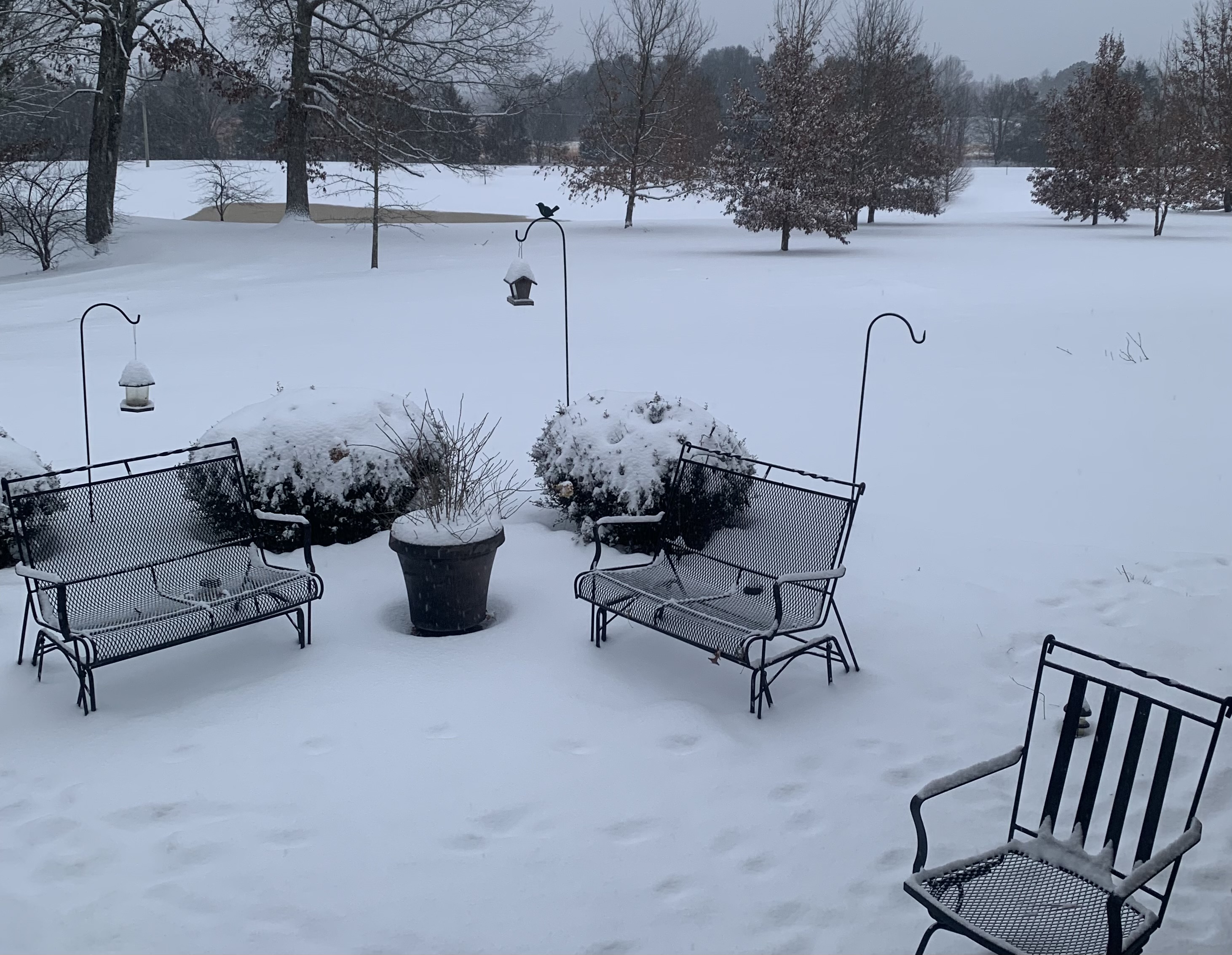
Same here. It’s my first time in 24 years living here that I’ve witnessed it snow that long (24hrs). Slow and steady but it never let up. I did have some waves on the backend that produced some decent sized flakes though. Currently sitting at a balmy 10 degrees. -
January 15th-17th 2024 Arctic Blast/Snow Event
AMZ8990 replied to John1122's topic in Tennessee Valley
Heck yeah! -
January 15th-17th 2024 Arctic Blast/Snow Event
AMZ8990 replied to John1122's topic in Tennessee Valley
Yeah, it really is. I feel bad for the truckers driving down I-40 today through Tennessee. It’s snow from Memphis to Knoxville the whole way basically. -
January 15th-17th 2024 Arctic Blast/Snow Event
AMZ8990 replied to John1122's topic in Tennessee Valley
Did you see the freaking video on twitter of a dude being pulled on a car hood behind a truck on I-240 last night in Memphis? -
January 15th-17th 2024 Arctic Blast/Snow Event
AMZ8990 replied to John1122's topic in Tennessee Valley
Bummer, on the bright side you’ve still got plenty of time/precip headed your way. -
January 15th-17th 2024 Arctic Blast/Snow Event
AMZ8990 replied to John1122's topic in Tennessee Valley
You guys should be really good in the east side of the state. It snowed for nearly 24 hours on the west side of the state so you guys are in for a long and steady snowfall. Sitting at 5 1/2 inches in bolivar -
January 15th-17th 2024 Arctic Blast/Snow Event
AMZ8990 replied to John1122's topic in Tennessee Valley

-
January 15th-17th 2024 Arctic Blast/Snow Event
AMZ8990 replied to John1122's topic in Tennessee Valley

-
January 15th-17th 2024 Arctic Blast/Snow Event
AMZ8990 replied to John1122's topic in Tennessee Valley
Still snowing in west Tennessee. Fat flakes at a light to moderate rate. -
January 15th-17th 2024 Arctic Blast/Snow Event
AMZ8990 replied to John1122's topic in Tennessee Valley
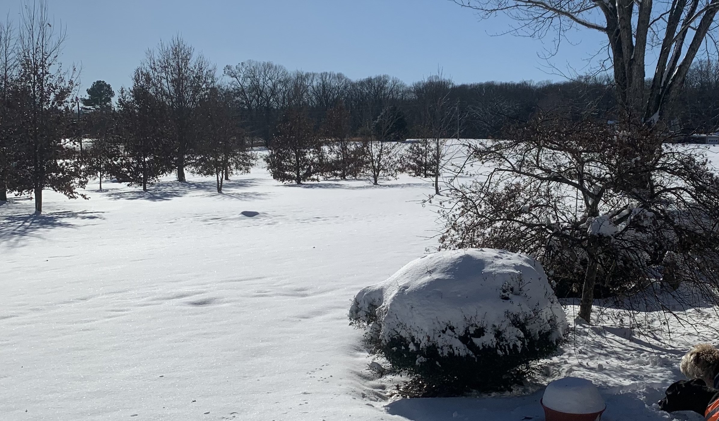
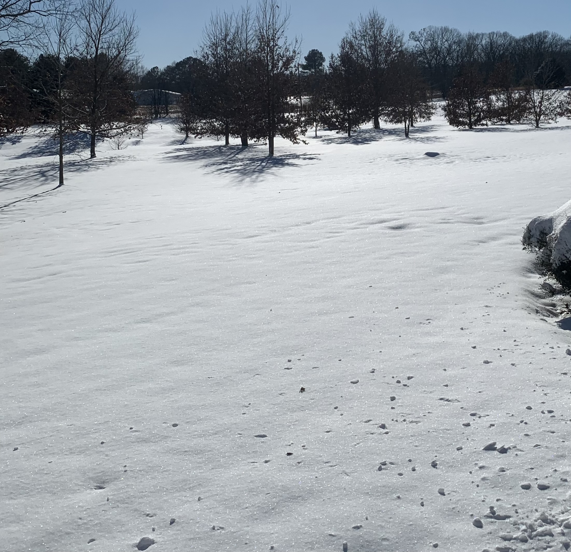
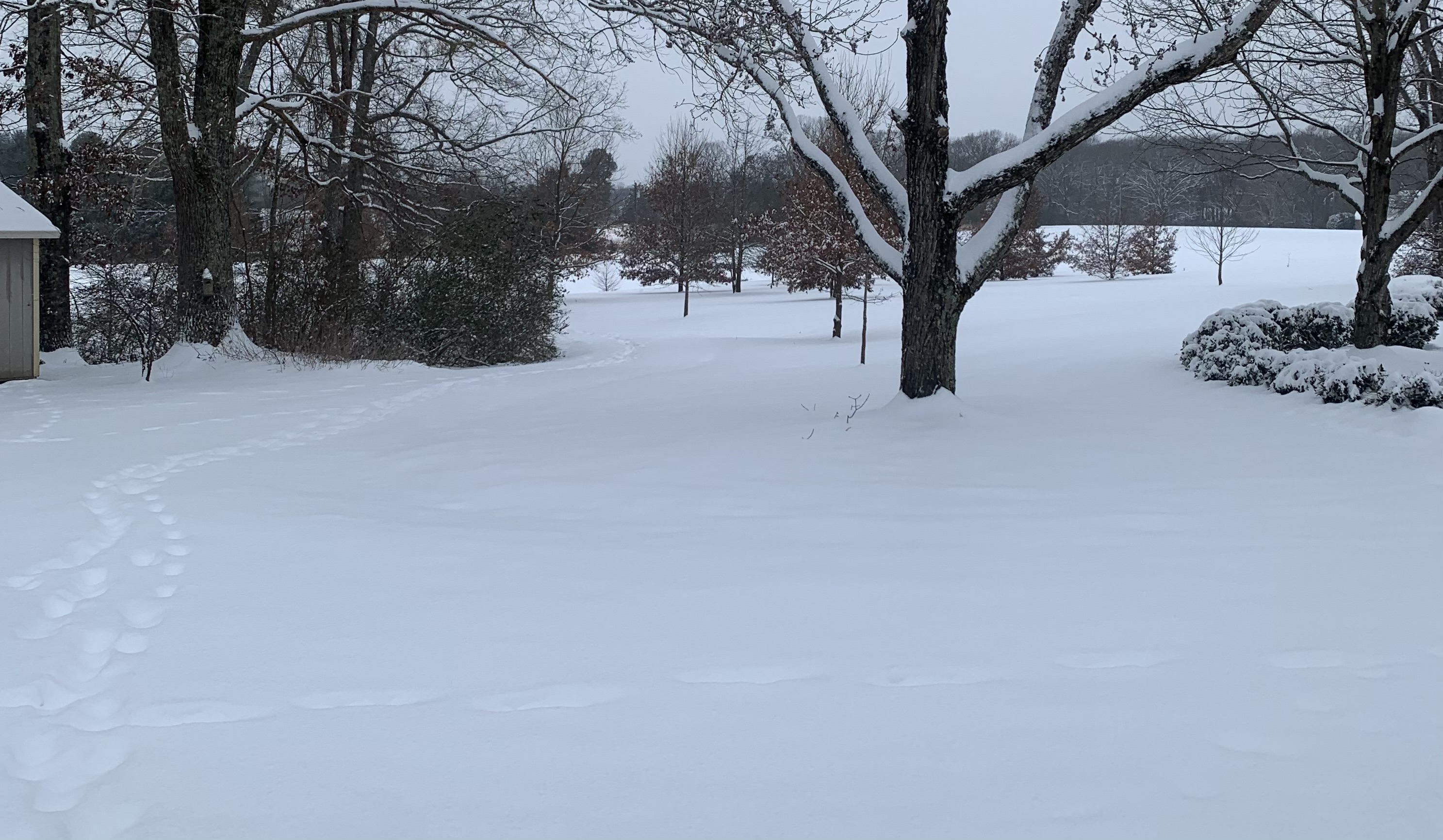
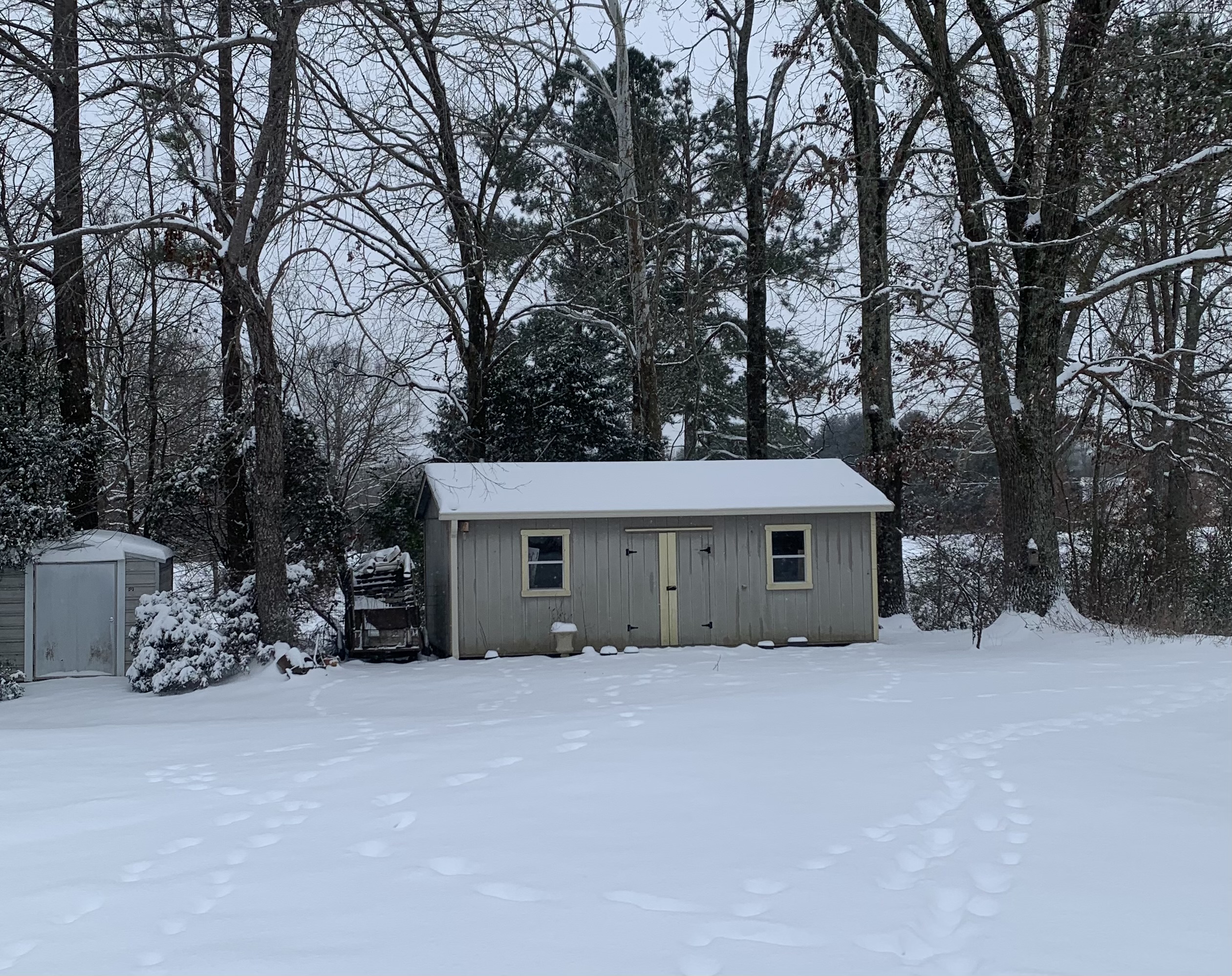
Still snowing in Bolivar this morning on the west side of the state. A nice band has set up in west Tn this morning. We’ve got about 5 inches on the ground so far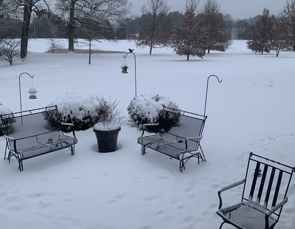
-
January 15th-17th 2024 Arctic Blast/Snow Event
AMZ8990 replied to John1122's topic in Tennessee Valley
Same here in bolivar to the south of you. Roads are already solid white now. Sounds like things should ramp up around 6pm -
January 15th-17th 2024 Arctic Blast/Snow Event
AMZ8990 replied to John1122's topic in Tennessee Valley
Thanks brotha, same to you! -
January 15th-17th 2024 Arctic Blast/Snow Event
AMZ8990 replied to John1122's topic in Tennessee Valley
Currently 22 degrees with a windchill of 11. Light snow falling. Local met Joey Sulipeck in Memphis seems to like the HRRR 3KM forecast -
January 15th-17th 2024 Arctic Blast/Snow Event
AMZ8990 replied to John1122's topic in Tennessee Valley
Good luck brotha. Hope you and the family are doing well! -
January 15th-17th 2024 Arctic Blast/Snow Event
AMZ8990 replied to John1122's topic in Tennessee Valley
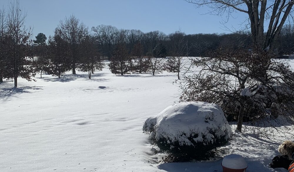
It really has man, I’m definitely thankful for it. We’ve had some pretty memorable winter weather the past 5-6 years. One of those systems kept snow on the ground for over a week which is unheard of in these parts. Last year wasn’t great but it was like that for everyone. How about how the models nailed this system/ cold from all the way back around new years. It’s crazy to think how long we’ve been tracking this system. -
January 15th-17th 2024 Arctic Blast/Snow Event
AMZ8990 replied to John1122's topic in Tennessee Valley
Im cautiously optimistic, Im guessing 2-4 imby but The Winter storm warning is calling for 3-5’ so we will see. It would be awesome if we could get to or above that 5 inch mark but you know how hard that is to accomplish on this end of the state -
January 15th-17th 2024 Arctic Blast/Snow Event
AMZ8990 replied to John1122's topic in Tennessee Valley
Light snow now falling in hardeman county 60 miles east of Memphis -
January 15th-17th 2024 Arctic Blast/Snow Event
AMZ8990 replied to John1122's topic in Tennessee Valley
Well said, and I agree. I think that’s one of the biggest things that separates our forum from the others on this site. I appreciate conversing with all you guys and gals! -
January 15th-17th 2024 Arctic Blast/Snow Event
AMZ8990 replied to John1122's topic in Tennessee Valley
URGENT - WINTER WEATHER MESSAGE National Weather Service Memphis TN 248 PM CST Sat Jan 13 2024 ARZ036-048-049-058-MSZ001>005-007-008-010-TNZ021-022-049-050- 052>055-088>092-140545- /O.UPG.KMEG.WS.A.0001.240114T1800Z-240116T1200Z/ /O.NEW.KMEG.WS.W.0001.240114T1800Z-240116T1200Z/ Crittenden-St. Francis-Lee AR-Phillips-DeSoto-Marshall-Benton MS- Tippah-Alcorn-Tunica-Tate-Coahoma-Carroll-Benton TN-Tipton- Haywood-Madison-Chester-Henderson-Decatur-Shelby-Fayette-Hardeman- McNairy-Hardin- Including the cities of West Memphis, Forrest City, Marianna, Helena-West Helena, Southaven, Olive Branch, Holly Springs, Ashland, Ripley MS, Corinth, Tunica, Senatobia, Clarksdale, Huntingdon, Camden, Covington, Brownsville, Jackson, Henderson, Lexington, Parsons, Decaturville, Bartlett, Germantown, Collierville, Memphis, Millington, Somerville, Oakland, Bolivar, Selmer, and Savannah 248 PM CST Sat Jan 13 2024 ...WINTER STORM WARNING IN EFFECT FROM NOON SUNDAY TO 6 AM CST TUESDAY... * WHAT...Heavy snow expected. Total snow accumulations of 4 to 6 inches. * WHERE...Portions of East Arkansas, North Mississippi and West Tennessee. * WHEN...From noon Sunday to 6 AM CST Tuesday. * IMPACTS...Plan on slippery road conditions. The hazardous conditions could impact the morning or evening commute. PRECAUTIONARY/PREPAREDNESS ACTIONS... If you must travel, keep an extra flashlight, food, and water in your vehicle in case of an emergency. The latest road conditions for the state you are calling from can be obtained by calling 5 1 1.