

ajr
-
Posts
379 -
Joined
-
Last visited
Content Type
Profiles
Blogs
Forums
American Weather
Media Demo
Store
Gallery
Posts posted by ajr
-
-
-
Just now, griteater said:
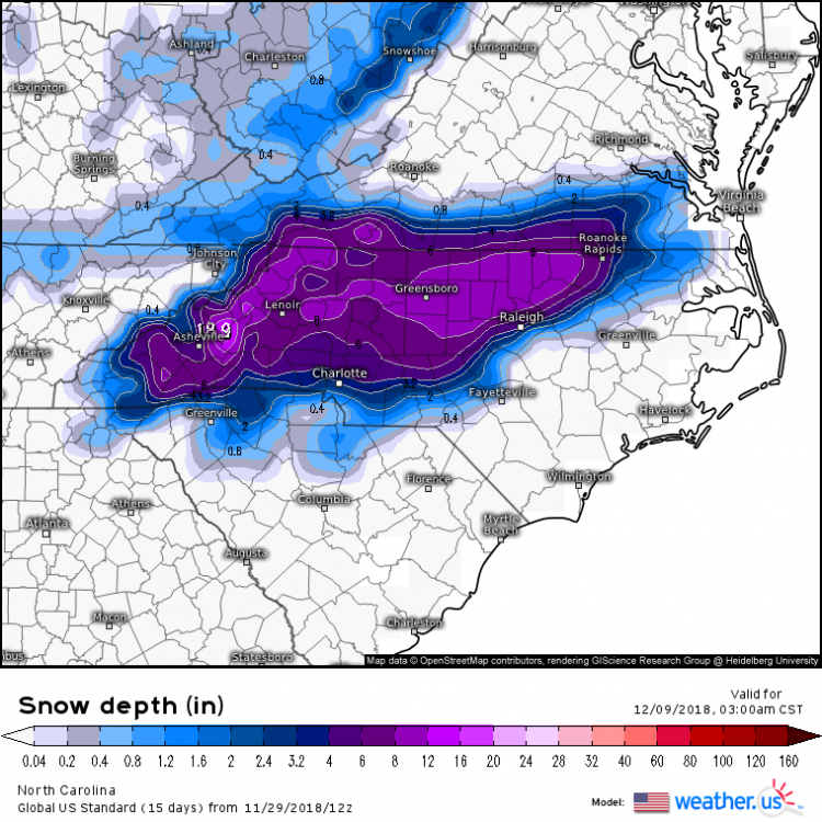
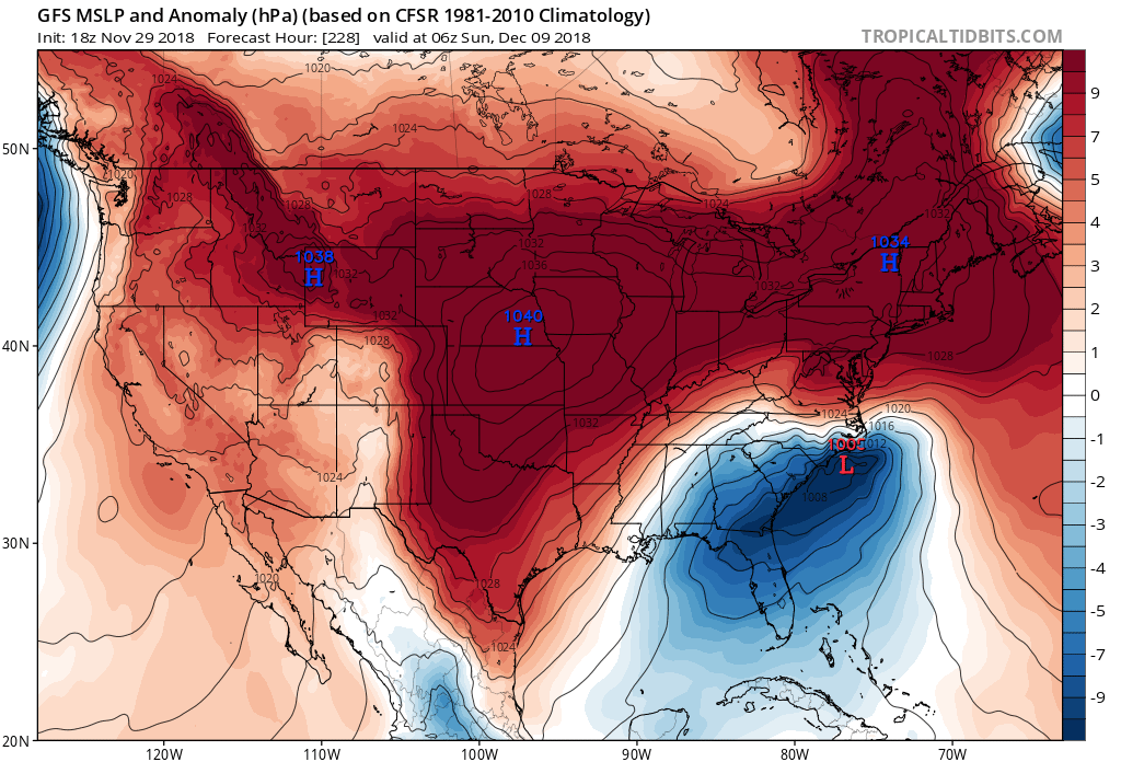
Looks like the 18z run is going to be quite wintry on Dec 8th. Low in Louisiana and 1040+ high over upper midwest
And a more amped PV in SE Canada
-
5 minutes ago, Thor said:
Positive sharp Wake County gradient sign
-
2 hours ago, mackerel_sky said:
The EPS looked great to me!?
I only saw the mean... looks like individual members are interesting though!
-
6z GEFS favoring a southern NC plains track with our d8/9 system (and cold air is already cleared out by the time the LP comes around). EPS has the system but also too warm for anything interesting. Still lots of run-to-run variability though.
-
The past two runs of the GFS have a potentially interesting setup around Dec 5
-
 3
3
-
-
GFS showing something around 11/30 and 12/3.. something to keep an eye on at least
-
Despite the cold rain in our area, hard not to get excited at the overall pattern... these kinds of storms would be nice hits for our area come late D into JF.
-
No one in wake county look at the 18z ICON..
-
25 minutes ago, PackGrad05 said:
The soundings don't really support snow until lunch/afternoon and that's when the system is moving out... Cold rain until the cold air is established at which point most of the QPF is gone.
I should clarify this is for the Raleigh area.
...and it will always switch over later than expected
-
Meanwhile HRRR is making things interesting for RDU...
-
9 minutes ago, Queencitywx said:
A few other EPS means:
Davidson: 2.6"
Lexington: 3"
Asheboro: 3.7"
Raleigh: 2.5"
CLT: 2.8"
I just don’t see how Raleigh’s temp profile supports anything the models are spitting out
-
11 minutes ago, Queencitywx said:
Can anyone vouch for the accuracy of this tool on pivotal?

I remember that tool (among others) being an epic bust last January.
-
1
-

Mid to Long Term Discussion 2018
in Southeastern States
Posted
Can’t remember the last time there was a signal like this in early December - it’s nice to see