
CNY-WXFREAK
-
Posts
3,872 -
Joined
-
Last visited
Content Type
Profiles
Blogs
Forums
American Weather
Media Demo
Store
Gallery
Posts posted by CNY-WXFREAK
-
-
In order for us to not get affected by upper lvl warmth nosing in, is a quicker transfer or a weaker parent, which we all know and I just don't see it happening so I'm hoping on a prayer, lol. Here in CNY we warm too quick with a South screaming wind so I don't know what their looking at..
-
GFS just came in a tick nor 2 warmer so I wouldn't be surprised if we switch over even here in Oswego county for at least 6 hrs before a switch back to some kind of frozen precip.
-
If anyone is expecting double digit snows from this event is gonna be surely disappointed even before it begins so I'd lower your expectations dramatically, lol!
-
Just now, rochesterdave said:
As usual, ICON has the best handle on it.

How do you know what has a better handle on it? Are you serious?
-
I gotta be honest the event after the event is gonna be the real show as we'll be hard pressed to get a few inches before we flip to whatever we flip to and then the wrap around which will amount to more than the front end thump with better dynamics, snow growth and lapse rates with a well aligned WNW-NW flow for about 18hrs.
-
7 minutes ago, tim123 said:
If things become clearer issue a wwa
I agree
-
41 minutes ago, TugHillMatt said:
Speaking of downsloping, the HRWs are showing it....over....Oswego county.
Lol
UM we don't downslope so thats just idiotic but whatever I guess as that's why they get thrown out the window and are never regarded as useful guidance. Most of the meso's aren't even used during most synoptic events but everyone seems to jump on them all the time. Alls I know is this, if I get 8" of snow with a few 1/10's of ZR then ill be happy cause we can't seem to get anything to work out this season so a 6" plowable snowfall is nice to me, lol as beggers can't be choosey!
-
 2
2
-
-
You guys are gonna see more liquid than anything so I think their not posting Watches further West was definitely a good call IMO.
-
44 minutes ago, tim123 said:
Kinda silly wny is at least not in a watch. Imo.
It's real easy to understand, don't know why you don't?
-
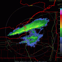
You see the RGEM, yuk, lol, but its still way out of its range so......
-
3 minutes ago, wolfie09 said:
1st guess map..
.thumb.png.b77c243b1452e45c95ec4c771d1317f5.png)
WOW!! But now do we start the upward trend or downward? my doughs on down for sure, lol!
-
The next event is starting to look more and more promising as its no more a cutter but more like a Spring time bowling ball that sneaks in under the block. At this point it still looks like a good deal of warmer air rushes in but I think that changes with subsequent runs as the models are still catching on to that idea. Vary active pattern incoming for the foreseeable future!
-
1
-
-
I do gotta say its a tricky situation but I think we see 8-12" either way. Finger Lakes West is a tougher, situation as with all S-SW wind events, downsloping kills and warm air comes racing Northward. We are lucky as our winds usually stay out of the E-ENE before the occluded front arrives and by then all the warm air is washed out.
-
I hope you both get crushed.
-
1
-
-
Nam has the most mixing right now.
-
Just now, wolfie09 said:
Maybe me and matt can finally see a decsent west wind event on the backside, embedded within the wrap around moisture..


I 100% disagree with the Euro on its wind direction once the system redevelops and heads NE but I may be wrong but I'd bet on a WNW-NW flow so we'll see I suppose as it nailed that WSW flow event up in KWRT.
-
 1
1
-
-
8" of snow fell in the Seattle area yesterday and last night.
-
4 minutes ago, wolfie09 said:
Euro was hardly any mixing, with trace amounts of ice/sleet..
Max 850mb temps are now 0c instead of +2c and max surface is mid-upper 20s..
We're good, WSW up tomorrow morning!
-
GFS OP looks great

-
KBGM basically the same, cold air doesn't make it before the parent LP occludes, lol!
A Winter Storm Watch has been issued for Oneida, Cayuga,
Onondaga, Madison, Cortland, Chenango and Otsego Counties in
CNY.

Monday night snow moves in from the southwest into the central
southern tier and NEPA after midnight, then the rest of the area
Tuesday morning. Snowfall rates could be heavy with deep moisture
and lift into the dendrite zone. This enhanced rates will be a few
hours into the event and well ahead of a warm front. Potential for 3
to 6 inches of snow in south central NY and NEPA before a changeover
to sleet and freezing rain during the afternoon. A coating of ice is
likely before temperatures warm enough. Further north precipitation
will stay snow longer so amounts should be higher. Have issued a
winter storm watch for Tuesday and Tuesday night first for 5 to 9
inches of snow followed by around a tenth of an inch of freezing
rain. Temperatures north of I88 and east of I81 may not get above
freezing until Wednesday morning close to the occluded front. The
main low will pass to the west of the area.

For temperatures a wide range of temperatures Monday night with
single digits in Oneida County to low 20s along the Susquehanna
River in NEPA. Tuesday highs from mid 30s west to around 30 far
east. Tuesday night lows mid 20s far east to around 30 west.
-
-
The ICON which was the worst of them all now looks the best wrt snowfall and temps. Basically all globals now get us into double digit snows with a minimal amount of mixing and with still a couple days left of trending I hope we continue to go in the right direction which is down, lol!
-
13 minutes ago, wolfie09 said:
Could be some 20" amounts in there given ratios on the backside..


Dude we need to get that snowline to drop at leasts 25 miles or so and we'd all be happy but thats a nasty snow cutoff because of the amount of warm air so I hope it trends a bit colder the next couple days so we'll see.
-
2
-
-
I looked over the Euro EPS and they seem to be diminishing snowfall with each successive run while the op is highering them so somethings up.
.png.8ab3bf3e934f65ca7e44401f581399ee.png)


Upstate/Eastern New York
in Upstate New York/Pennsylvania
Posted
I don';t even think we get to WSW but rather WWA but thats just me but this it their current thinking.