
NJwx85
-
Posts
15,545 -
Joined
-
Last visited
Content Type
Profiles
Blogs
Forums
American Weather
Media Demo
Store
Gallery
Everything posted by NJwx85
-
Saturday I would agree is a relatively nice day. Sunday is a completely different ballgame.
-
I would still be cautious about Memorial Day weekend. The Euro could be weakening the ULL too fast with not much time to spare.
-
It's a beautiful thing. And don't have to worry about waiting to see if a day 10 heat wave verifies.
-
LOL GFS OP has another big ULL parked over the East days 8-16.
-
Central air works wonders. I will probably have it on Thursday.
-
Exactly, strong signal in that time period for a gradual cool down followed by another blocking regime, albeit weaker than this one and another above average rainfall period.
-
But it does have a correlation to blocking and both the EPS and GEFS have below average 850mb temps building into the East during this time period.
-
NAO and AO are forecasted to plummet again just in time for Memorial Day weekend. Poor Kevin.
-
You make it sound like it was an ultra dry run. Boston still gets a lot of rain.
-
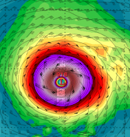
Nothing run of the mill about a baroclinc forced SLP in mid May. If nothing else it's pretty cool to see a well developed CCB. This same run in January produces a blizzard.
-
You can add the UKMET to that, although I love the rain hole right over Mt. Tolland as if Kevin hacked it.
-
NAM is a soaker for most. Luckily for most of New England the heaviest rains fall overnight into Sunday morning. As the ULL closes off the NYC area gets plenty of wrap around moisture on Sunday afternoon.
-
Looks like the nice stretch of weather arrives the middle of next week and lasts about 6-7 days before the next trough moves in.
-
18z GFS is very wet for Southern and Eastern New England with a stripe of 3"+ over Eastern MA. The mid-level centers close off in a really good spot for New England. Reminds of a typical miller B.
-
18z NAM said not so fast on the East push and it looks like the 18z GFS is going to follow suit. Models may have overcorrected East.
-
Also if you just wanted to compare the 00z GEFS mean to the 06z mean, the 06z was clearly wetter, which tells me that it most likely had fewer progressive members.
-
I think we've seen too much flip flopping to have confidence in any particular evolution. I've noticed with the last few systems that the 00z runs seem to trend progressive while the 12z runs have trended slower so we'll have to see if the seesaw continues today.
-
The 00z Euro was much more progressive, but it was one run, and the GFS is sticking to its guns.
-
The NAVGEM is on board
-
It's not a phantom operational run. The ensembles continue to show a brief 1-3 day warm up around the 20th followed by a return to normal or slightly below normal. It's all a matter of how far East the building trough sets up.
-
Ignore the guidance at your own peril. That massive warmup, if it does come looks transient.
-
The 12z EPS mean looks mainly below normal temperature wise throughout the period. Even though a ridge does try to move East around the 20th it gets mostly shunted Southwest of NYC with a backdoor moving in for places East of the Hudson River.
-
The EPS disagrees
-
The EPS mean really hits Eastern New England with lots of wet weather days 5-10. About another 1-2" of rain from Hartford North and East.
-
It's amazing how each time it appears the ULL is getting ready to move out on the EPS it just keeps reloading. In any event, temperatures look well below normal for at least the next ten days, possibly longer.

