BornAgain13
-
Posts
4,468 -
Joined
-
Last visited
Content Type
Profiles
Blogs
Forums
American Weather
Media Demo
Store
Gallery
Everything posted by BornAgain13
-
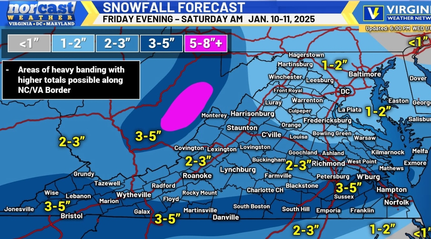
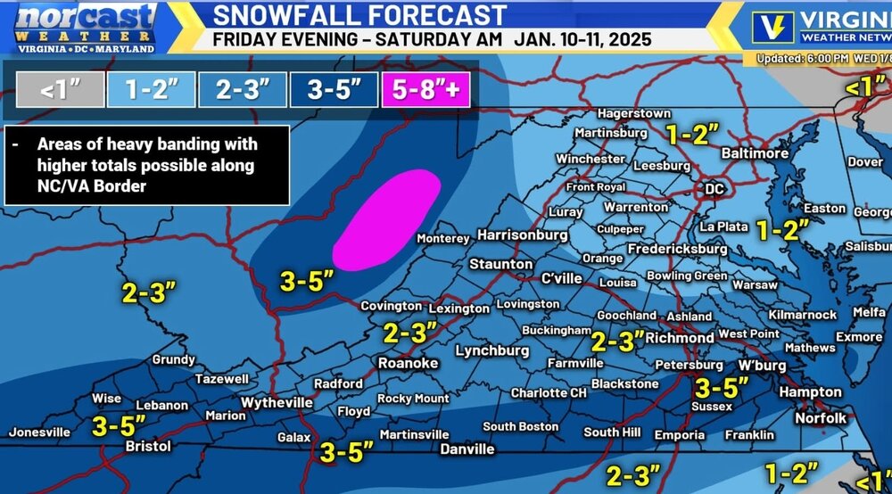
 The 0z CMC increased totals in southern VA and central and Northern NC. Showing 3-5"
 -
How did the 18z EPS look compared to the OP?
-
Would love for these numbers to be right up my way but I think this is aggressive for sure...
-
So obviously the short range models are trying to bring in some warm air... But the Low that develops looks like it enhances the moisture where in runs last night and earlier today, the models were moisture starved
-
18z GFS with another increase in QPF. Showing 3-5" in southern VA and points North a little.
-
Any chance the QPF can beef up anymore as we get closer?
-
No doubt about it. The ground is frigid!
-
Barney making an appearance again ?
-
18z RGEM went up in Precip as well!
-
Has anyone noticed in the long range their are no signs of much warmth? Staying cold for quite some time!
-
18z ICON ticked back up in Precip! Let's go!!
-
3k still isn't done yet but it's not nothing big anyway
-
12k NAM still just showing 2-3" for mby.
-
Now that's embarrassing!
-
18z HRRR looks sooo good ... But I know it will shear out the further it moves east but man that's a pretty look at HR 38
-
In other news, just for fun for some, especially @Buddy1987, Day 11-12 delivers a significant Snow Storm to the Mid Atlantic
-
Just curious... Does several inches mean 2, 3 or 4?
-
I really don't know how to feel about this. This system looks like a classic winter weather event and I don't recall ever seeing one fizzle out like this the way the models are showing..
-
Who pulled the plug on the Canadian?
-
It looks like the bleeding from overnight has stopped... Hopefully we see things trend back upwards today
-
Ughhh... The 0z UK is very dry
-
As expected, the 0z GEFS is a big step down from 18z.
-
I guess the RGEM gave up and didn't want to run tonight.
-
The way things look man, I would side with the lower end of things... The Euro has been very stubborn and consistent... Just to much dry air and to much positive tilt as well.
-
The trough continues to trend more positive and the dry air is shearing out the moisture. It still has enough for light amounts but if this keeps trending like it's going, it's gonna be a dud unfortunately