BornAgain13
-
Posts
4,468 -
Joined
-
Last visited
Content Type
Profiles
Blogs
Forums
American Weather
Media Demo
Store
Gallery
Everything posted by BornAgain13
-
If I go on a snow chase just to my north, that may be the better pictures I get. Mby might be better pictures of ice lol
-
Winter Storm Watch has been issued up this way.
-
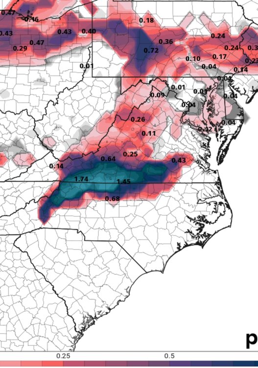
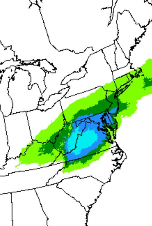
Big time ice showing on the models up this way Tuesday and Wednesday. Some south shift has happened today to.
-
Yeah I hate we lost a lot of the snow to the north but your area may still get it.
-
0z RGEM
-
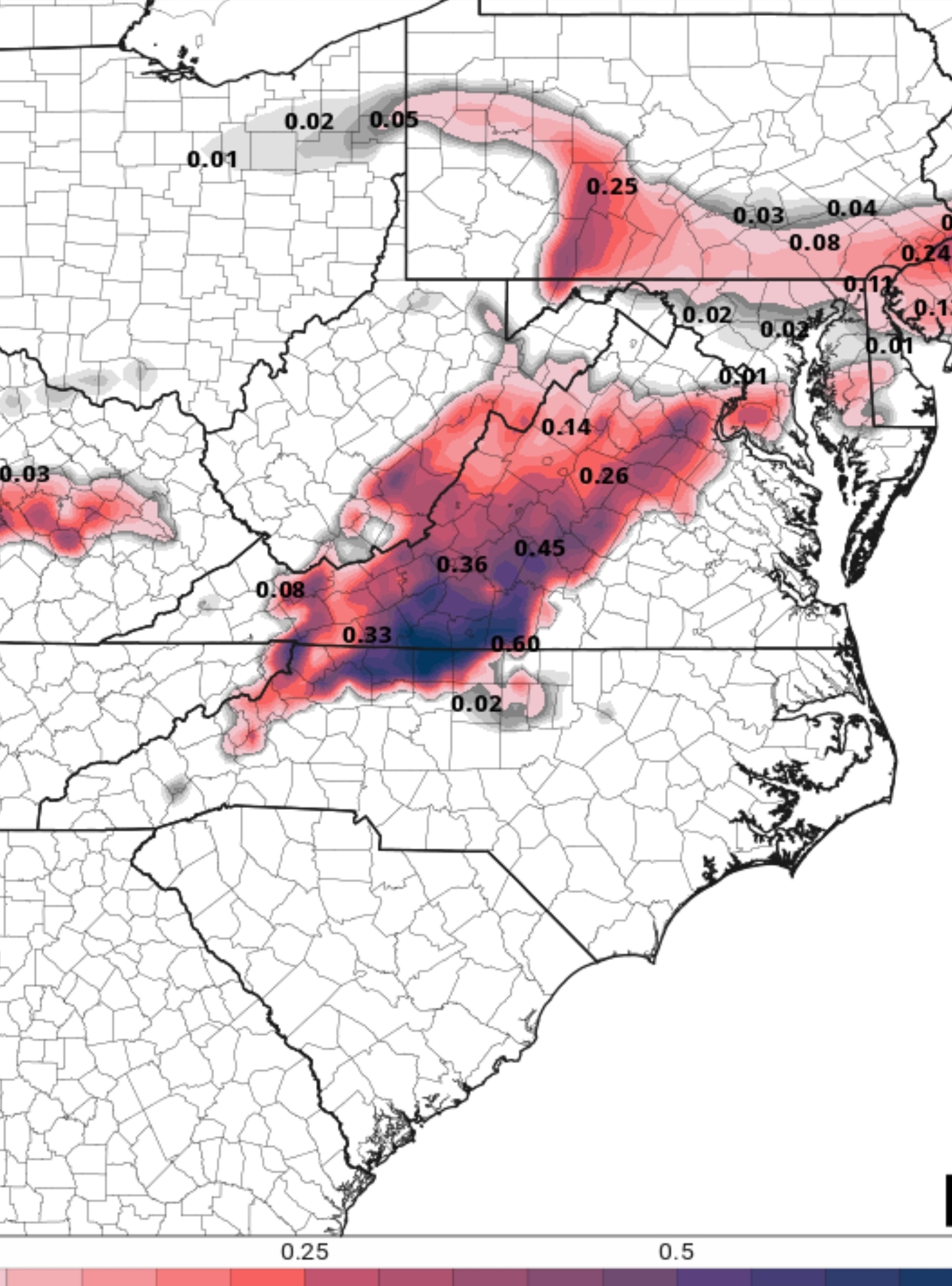
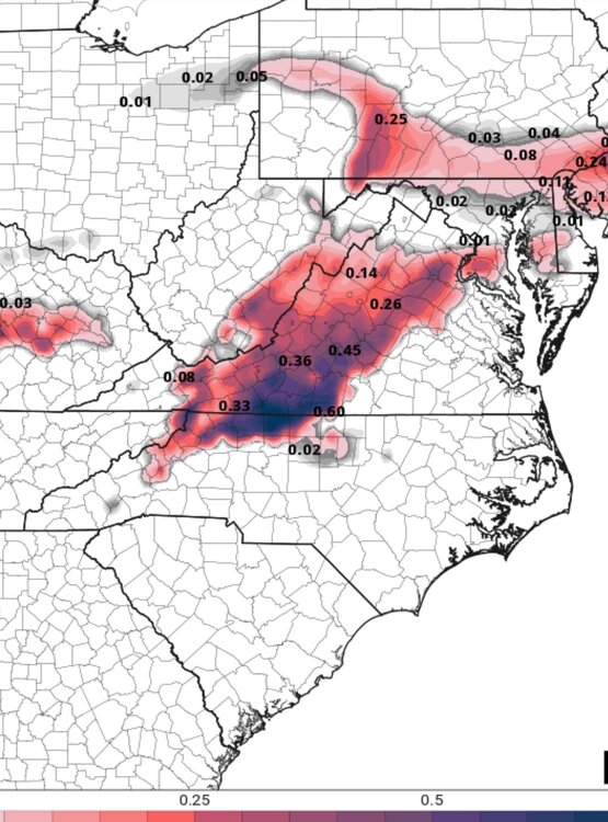
0z NAM is a Major ICE Storm for Northern NC and Southern VA. Still going at the end of the run.

-
18z Euro went right much further north. This is getting kinda funny as close as we are to this and the models aren't converging just yet
-
Thank you. Yeah that's definitely a good shift for yall further north!
-
Anyone got a snow map for us folks in central and southern VA?
-
I hope yall get it man!
-
18z GFS is a Major Snow for Roanoke to Lynchburg, with moderate snow south of that and still significant icing.
-
@Buddy198718z GFS is a monster snow storm for your area. The heaviest did shift south slightly from 12z.
-
Well go ahead and write that period off lol
-
12z EPS with a jog to the south as well.
-
12z EURO with a fairly significant shift south from 6z.
-
12z GFS literally has an 6"+ snow line to my north by maybe 30-40 miles. If that's true, i definitely may Snow Chase lol
-
12z GFS ZR
-
12z GFS went back south. Light to moderate snow in southern VA with a Big ICE event..
-
12z NAM is much further south from 6z. The flip flop continues.
-
Very tight gradient up this way
-
6z ICON did shift it's snow line north... it may be a day of correcting north. We will see. 6z Euro is almost identical to 0z.
-
It won't north, but the precip shield must of been expanded more north. Still a solid snow and ice storm for central and southern VA
-
Significant icing in CAD areas on Wednesday per cmc.
-
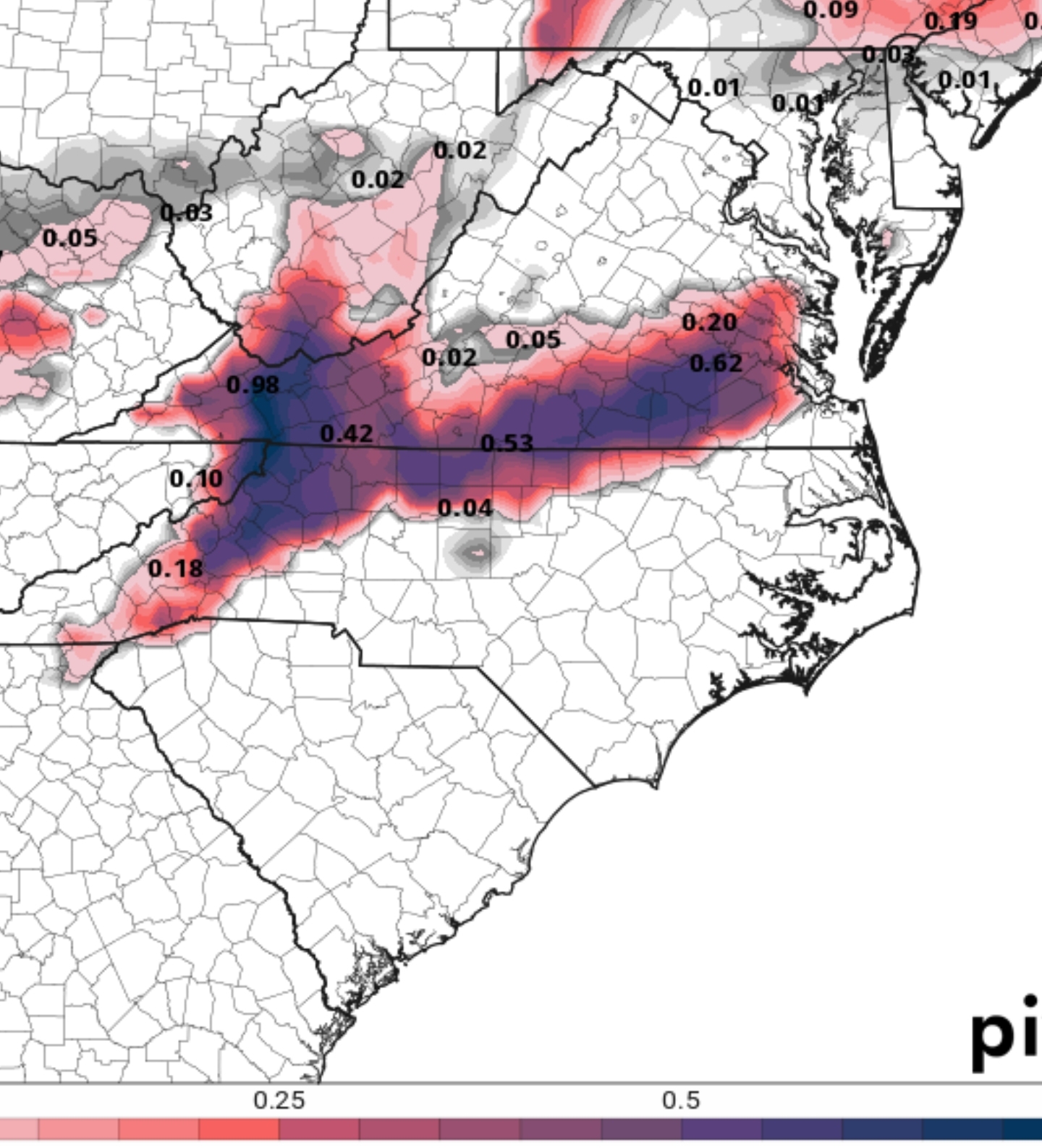
0z CMC with a significant shift south from 12z.
-
0z GFS just keeps ticking colder and has a long duration event Tuesday into Wednesday of wintry weather in Northern NC into VA