BornAgain13
-
Posts
4,468 -
Joined
-
Last visited
Content Type
Profiles
Blogs
Forums
American Weather
Media Demo
Store
Gallery
Everything posted by BornAgain13
-
15"+
-
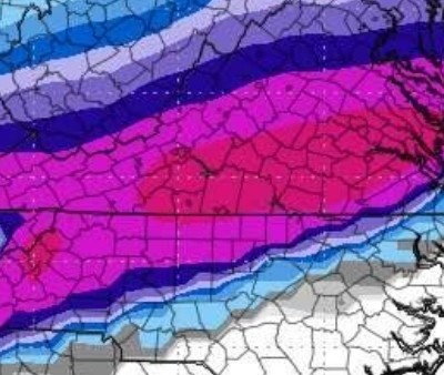
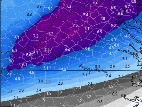
The 12z AI was an absolute bomb... now obviously this is way out but just taking this 1 model verbatim, that's 18"+ in the pink lol
-
Very active pattern coming up. Just need the timing to be right with the cold air that won't be to far to the north. Some folks on this board could get some good stuff the next 2 weeks. Time will tell but folks shouldn't throw the towel in this early.
-
That's to the morning of the 15th.
-
-
It also keeps increasing after this....
-
So even though the OP flipped a little, the EPS is very similar for the northern part of this board...
-
So the Euro went more GFS like at 12z with an ICE Storm.
-
12z CMC maybe was about to deliver at 240 but that's pretty far out.
-
12z CMC keeps the idea of a Major Winter Storm for Central and Southern VA
-
Major ICE Storm per 12z GFS for CAD areas on Day 8
-
That's a big signal for CAD areas.
-
Some of the guidance overnight hammers NC/VA and so does the Euro AI. We continue to track.
-
18z GFS is a cutter for the 12th.
-
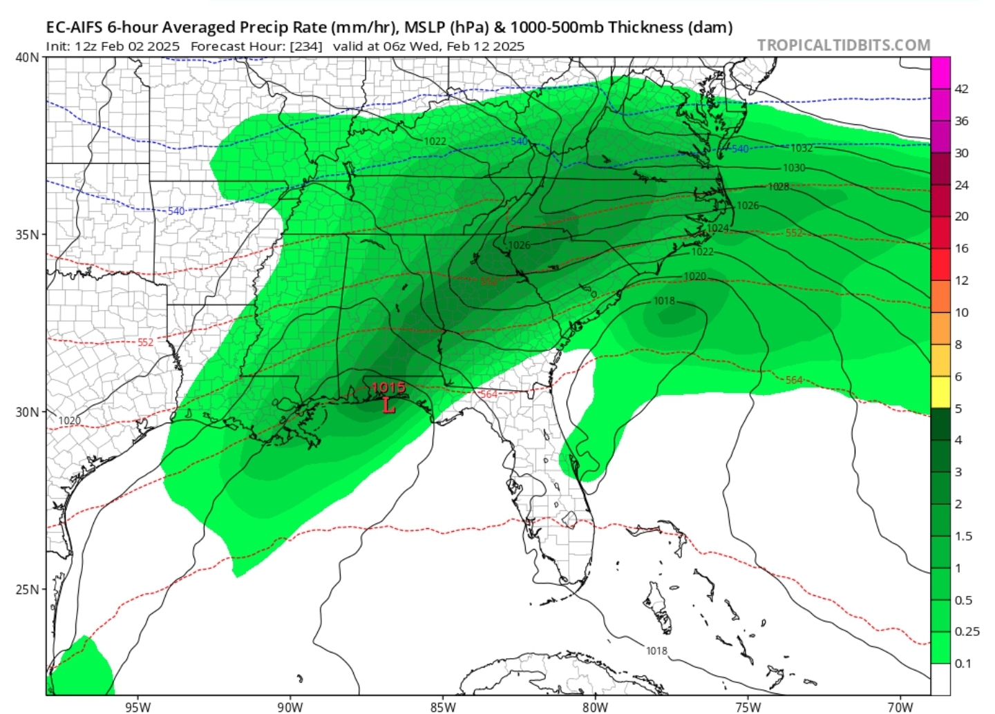
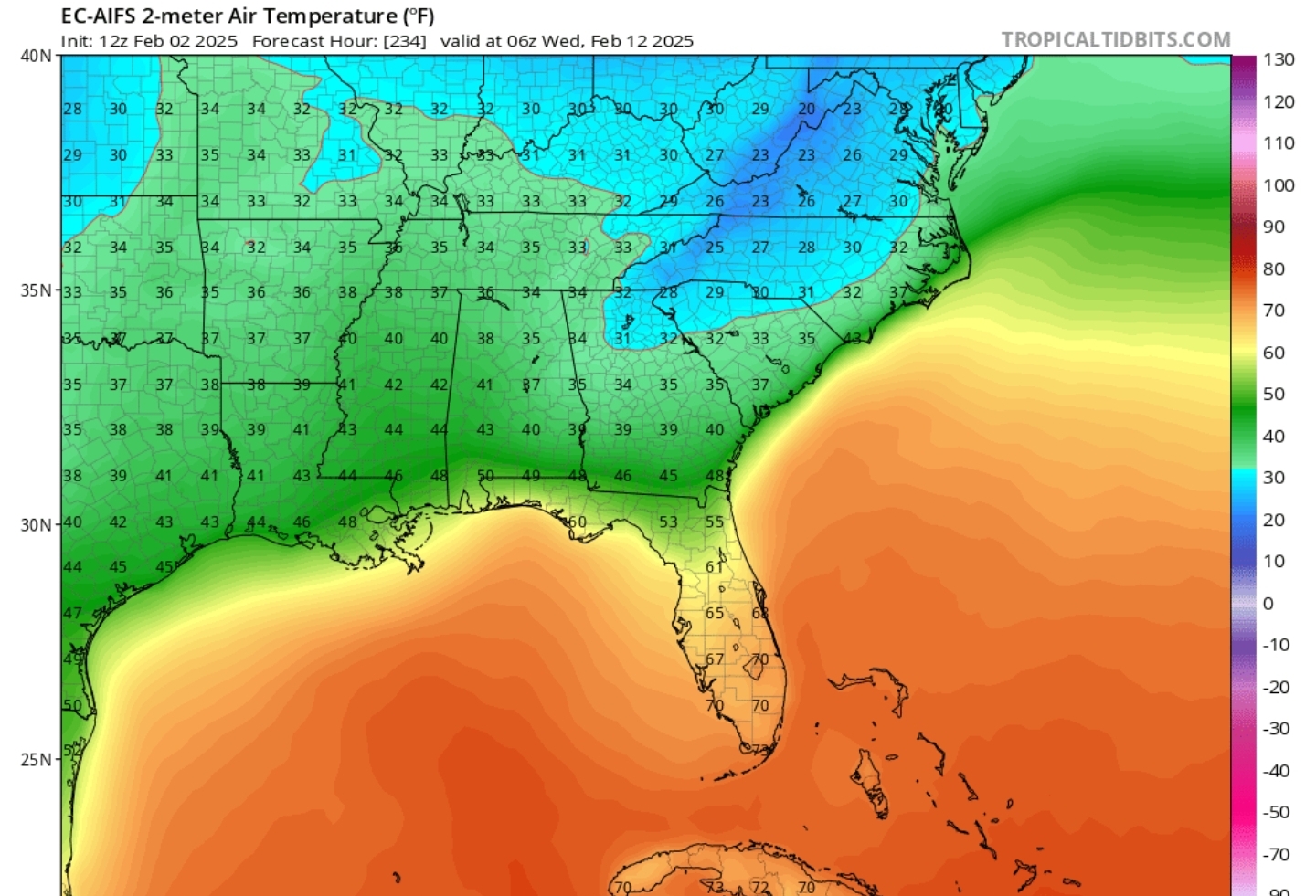
12z EURO AI is Starts around Day 9/10


-
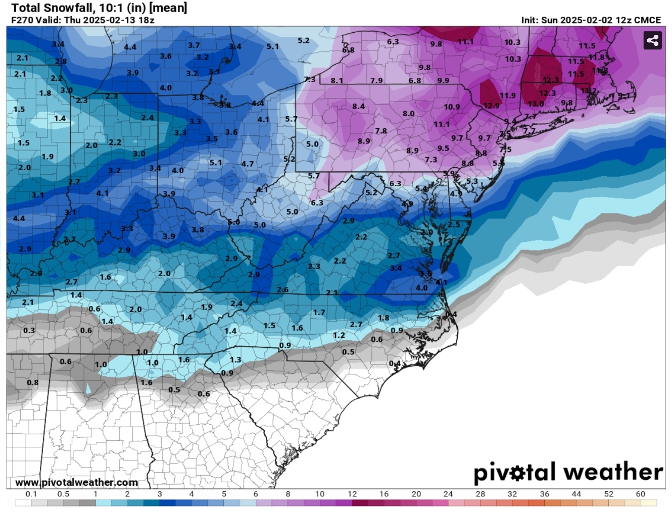
The 12Z CMC doesn't go out far enough but it's ensembles do and they show the storm signal as well

-
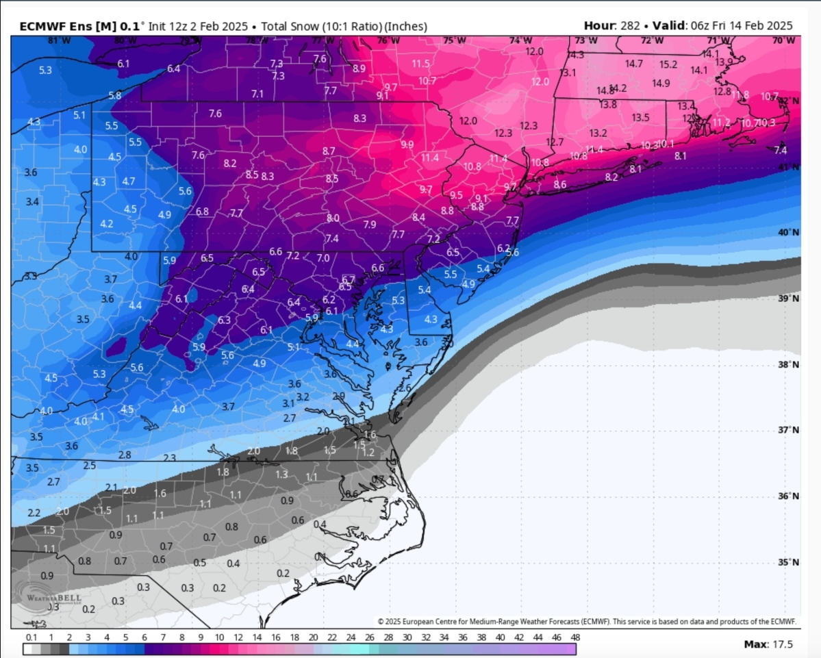
12z EPS thru HR 282

-
12z EURO with a Major Winter Storm again for around that Day 10 period, especially NC and VA
-
12z GEFS agrees with the OP around that time period. Good signal!
-
Massive Winter Storm up this way during that period taken verbatim. @Buddy1987, GFS giving you 30" + lol
-
Big time.
-
It's the end of the icon run but it has a monster storm coming from Texas with plenty of cold air in place.
-
18z GFS with a big snow/ice storm at Day 10. Several runs in a row showing a winter storm.
-
GFS shows an ICE Storm 2 runs in a row now around day 10/11. Just something to watch.
-

1/21-1/22 Winter Storm OBS Thread
BornAgain13 replied to metalicwx367's topic in Southeastern States
This is awesome guys!! Glad yall are getting it!