

dj3
-
Posts
634 -
Joined
-
Last visited
Content Type
Profiles
Blogs
Forums
American Weather
Media Demo
Store
Gallery
Everything posted by dj3
-

Western PA/Pittsburgh Winter 2021/22 Discussion
dj3 replied to meatwad's topic in Upstate New York/Pennsylvania
11 degrees outside. I love being outside when it becomes overcast and grey with snow approaching. Enjoy the day everyone. -
Western PA/Pittsburgh Winter 2021/22 Discussion
dj3 replied to meatwad's topic in Upstate New York/Pennsylvania
Go bills -
Western PA/Pittsburgh Winter 2021/22 Discussion
dj3 replied to meatwad's topic in Upstate New York/Pennsylvania
We are closing in on a no fail solid storm. I’m happy either way. Honestly I feel like ji where the tracking has been half of the fun for me seeing us in awesome colors. Let’s get this -
Western PA/Pittsburgh Winter 2021/22 Discussion
dj3 replied to meatwad's topic in Upstate New York/Pennsylvania
I thought the hrr was good ? -
Western PA/Pittsburgh Winter 2021/22 Discussion
dj3 replied to meatwad's topic in Upstate New York/Pennsylvania
We need a small shift east -
Western PA/Pittsburgh Winter 2021/22 Discussion
dj3 replied to meatwad's topic in Upstate New York/Pennsylvania
No not really -
Western PA/Pittsburgh Winter 2021/22 Discussion
dj3 replied to meatwad's topic in Upstate New York/Pennsylvania
Yea was most of Allegheny county except south East. Dry slot was in westmoreland according to his forecast map -
Western PA/Pittsburgh Winter 2021/22 Discussion
dj3 replied to meatwad's topic in Upstate New York/Pennsylvania
We would normally kill to be in the 7-12 range 36 hours out from a storm. Let’s enjoy it -
Western PA/Pittsburgh Winter 2021/22 Discussion
dj3 replied to meatwad's topic in Upstate New York/Pennsylvania
Ron has the dry slot -
Western PA/Pittsburgh Winter 2021/22 Discussion
dj3 replied to meatwad's topic in Upstate New York/Pennsylvania
All good man just kidding around. Don’t sweat the nam too much. It’s been a fun track and we’re in as good of a spot as anyone for this. -
Western PA/Pittsburgh Winter 2021/22 Discussion
dj3 replied to meatwad's topic in Upstate New York/Pennsylvania
Kpit will poo poo this to double digits. It’s why we love him -
Western PA/Pittsburgh Winter 2021/22 Discussion
dj3 replied to meatwad's topic in Upstate New York/Pennsylvania
They shouldn’t have upgraded it. I want the old nam. On the other hand how did it give us 6+ when we’re in a dry slot for 6 hours of the height of the storm haha -
Western PA/Pittsburgh Winter 2021/22 Discussion
dj3 replied to meatwad's topic in Upstate New York/Pennsylvania
The entire storm is sleet on nam. There isn’t snow anywhere lol -
Western PA/Pittsburgh Winter 2021/22 Discussion
dj3 replied to meatwad's topic in Upstate New York/Pennsylvania
Yes pattern looks loaded. And we get a good period of cold. -
Western PA/Pittsburgh Winter 2021/22 Discussion
dj3 replied to meatwad's topic in Upstate New York/Pennsylvania
Best Gfs run there in a little while. Really gets the deform cranking at 66 -
Western PA/Pittsburgh Winter 2021/22 Discussion
dj3 replied to meatwad's topic in Upstate New York/Pennsylvania
Starting to see some convergence. 8-12 starting to look more and more solid. -
Western PA/Pittsburgh Winter 2021/22 Discussion
dj3 replied to meatwad's topic in Upstate New York/Pennsylvania
Nice bullseye over your house -
Western PA/Pittsburgh Winter 2021/22 Discussion
dj3 replied to meatwad's topic in Upstate New York/Pennsylvania
Watching the weather channel now. I miss how the extended forecast used to have that BIG snowflake when it was going to snow. The extended now just says pm snow showers lol. That’s when you new a big storm was coming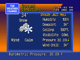
-
Western PA/Pittsburgh Winter 2021/22 Discussion
dj3 replied to meatwad's topic in Upstate New York/Pennsylvania
Yea almost identical to rgem -
Western PA/Pittsburgh Winter 2021/22 Discussion
dj3 replied to meatwad's topic in Upstate New York/Pennsylvania
I feel like the rgem owes us one -
Western PA/Pittsburgh Winter 2021/22 Discussion
dj3 replied to meatwad's topic in Upstate New York/Pennsylvania
Looked way warmer despite not much of a shift in track. Let’s see what Reginald has to say -
Western PA/Pittsburgh Winter 2021/22 Discussion
dj3 replied to meatwad's topic in Upstate New York/Pennsylvania
Precip totals are really low west of the low everywhere on that run compared to other models -
Western PA/Pittsburgh Winter 2021/22 Discussion
dj3 replied to meatwad's topic in Upstate New York/Pennsylvania
Yea I agree. Like I said before it locks into that from this far out tip your cap. -
Western PA/Pittsburgh Winter 2021/22 Discussion
dj3 replied to meatwad's topic in Upstate New York/Pennsylvania
Yep dry slotted again with perfect track lol. -
Western PA/Pittsburgh Winter 2021/22 Discussion
dj3 replied to meatwad's topic in Upstate New York/Pennsylvania
Rgem would be a huge hit if it went out further I think. I like gfs and Canadian precip swath better than the spotty crap the Nam threw out there. This is a pretty dynamic system you’d think someone is getting really good rates
