
.jpg.67f28df2070fc75e73be06c3c21a8371.jpg)
McDowell_Weather
-
Posts
371 -
Joined
-
Last visited
Content Type
Profiles
Blogs
Forums
American Weather
Media Demo
Store
Gallery
Posts posted by McDowell_Weather
-
-
Born and raised Jonas ridge area 181 no place like home!
-
30 minutes ago, downeastnc said:
Yeah the Tropical forum thread is a disaster....usually is. In the short term I think the thing to look for is how fast or slow Dorian takes reaching 28N....that about 100 miles from the current location of the center, current track says it wont get there for roughly 30 hrs....that means over the next 30 hrs this storm is not going to move more than 100 miles.....if it does move faster than that then the door opens for a more direct hit on NC.....
Yeah what it does in the near term can have huge implications as to the track down the road landfall, wind field expansion, ext alot of variable's at play.
-
Geez And I thought emotions ran high during snowstorms I'ma track this thing in this thread with more level headed people lol back to regular programming......
-
 1
1
-
-
Can I start the next winter storm thread too??? Lol
-
1
-
-
Looks like a lil snow trying to develop south of chesterfield s.c any posters in that area?
-
Just now, calculus1 said:
Brad P is talking about the possibilities. Nothing too significant, but...
I like GSP'S morning afd it said to keep an eye on the forecast for the next 24 hrs for possible signfigant changes lol
-
I think I'm to far west but upstate peeps and along 85 in nc I'm rooting hard for you guys.
-
1
-
-
I'll eat crow. Lol
-
1
-
 1
1
-
-
3 hours ago, Tyler Penland said:On 3/29/2019 at 3:30 PM, Tyler Penland said:I'm good with it showing this for now. If we don't see a NW trend in April I'll be extremely surprised.
Well this is aging well.
We got the NAM and were guna ride it till the wheels fall off the lugs are already loose were guna crash and burn for sure who cares. Lol
-
52 minutes ago, FallsLake said:
This would be nice...
If and BIG if here that verified wonder what the top analoges would be. I don't like how the cold air has to play catch up and the fact its late March.
-
1
-
-
Its a ULL not your typical southern system but interesting.
-
27 minutes ago, SnoJoe said:
Low Temp - 23.5
Wind - W@6
Skies - Clear
Ground - Frozen mud
Yeah not looking too good on the mud I would have already got the garden plowed but ain't getting my tractor stuck in this mess of sh!t lol How's my buddy doing we got a meet up for a burger at bonnie and clydes this summer let u meet the fam.
-
1
-
-
2 hours ago, BlueRidgeFolklore said:
Hunnerd year flud?
We're heading straight for the Old Testament, gather the goats and load the boat if this keeps up.
I'll tell my son Noah to build us an ark!
-
2
-
-
1 hour ago, Met1985 said:
We are expected to get some heavy rainfall here in the SW mountains. No surprise as we are continuing to run well above normal in precipitation this year alone. We are some 4 to 7 inches above normal already.
We're due for a hundred year flood if we continue the rain through the summer and get a tropical storm to roll throu.....yikes is all I'm guns say. Next week looks interesting for us mtn folk too. Winter's last gasp probley.
-
1
-
-
The Tuesday threat or whatever all depends if a meso low sets up in upstate South Carolina ive been watching this for several days. Wouldn't be surprised to see snow showers break out along and north of 85 on tuesday at some point.
-
1
-
-
Moderate sleet 38° Marion, NC
-
1
-
-
Moderate sleet 38° here at the base of short off mtn lake James nebo area in McDowell county getting ready to hop in the yoter for a spin up the mtn.
-
Patiently waiting for my glaze of ice with a pinger mixed in if I'm lucky I'll be out tonight up on top Linville mountain on hwy105 somewhere along the escarpment is guna be the battle zone.
-
1 hour ago, FallsLake said:
^^That would be funny to end up getting the two big winter storms in December and March, but basically nothing in January and February.
It wouldn't surprise me with today's climate. Breaking new records every year is the norm I guess.
-
5 minutes ago, Blue_Ridge_Escarpment said:
Definitely trended colder/more wintry so far today our way. I expect GSP to extend the watch to cover the entire immediate foothill counties of Caldwell, Burke, and McDowell. Probably Alexander as well.
That's what I was thinking 12z runs have trended in our favor. The more sleet the better I'm not expecting to much if any snow just depends if the 700s are still below when the precipitation moves in witch is what the RGEM was showing threading the needle like always.
-
1
-
-
Just now, Buddy1987 said:
For me the GFS and FV3 are basically a carbon copy of their 6z counterpart. For northern NC zones and southern VA you cannot get a better placed high than what these models show. 1039 anchored up in central NY. Just opening the St Lawrence Valley and Canada wide open to funnel down some very cold air.
I agree perfect spot just wish we had cold air in place before hand then us peeps further south would be in a whole other ball game.
-
How good is the RGEM at 36+ hrs out?
-
I guess this is my yearly rant lol There's no need to be jealous of people that live NW of 85 due to more snow because it's not always the case I've got just as many variables against me as people who live down east when it comes to snow downsloping elevation dependent blah blah blah the list goes on. I live directly at the base of the Linville gorge Google it and come visit it's awesome Grand canyon of the east but idk how many times if looked out my window and watching snow pour above 2000 feet it drives me nuts I get one good storm a year on average and been several years in a row with none. Point is we all love snow no need to be jealous or sarcastic if you don't like we're you live move it's that simple.
-
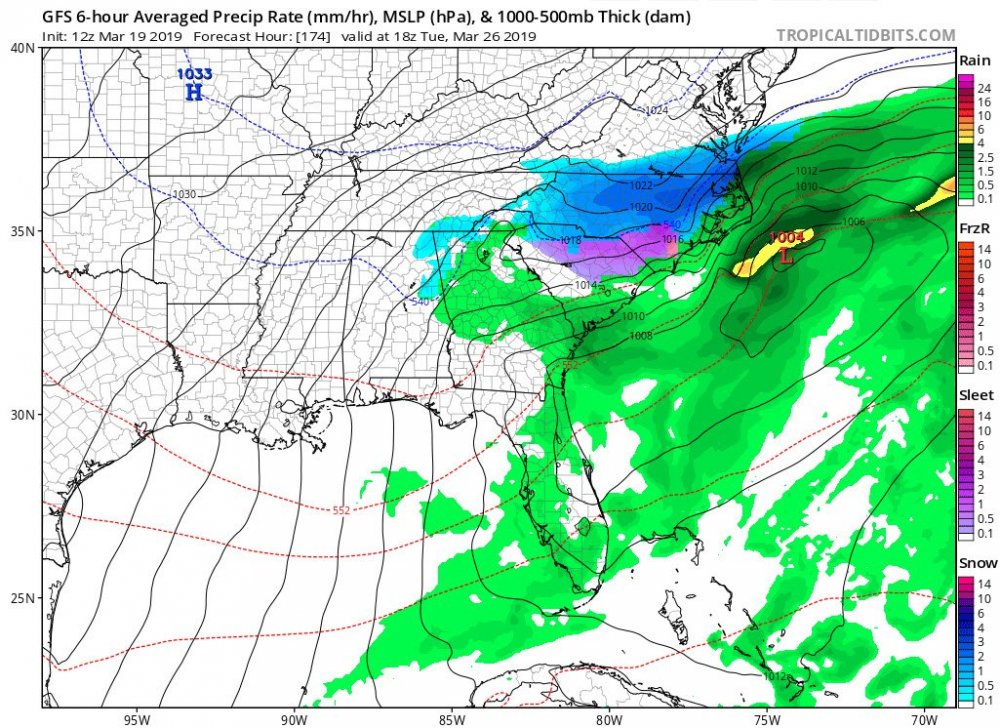
2 minutes ago, Hvward said:
12z GFS says heavy precip switches to snow Tuesday night around WNC. It’s a long shot, but certainly still within the realm of possibilities.
I was just looking at that hopefully it will trend more toward the fv3 its been consistent with something wintry in that time-frame.
-
1
-

2019/2020 Mountains and Foothills Fall/Winter Thread.
in Southeastern States
Posted
Great shot you can see almost all of mcdowell county in this. I can almost see my house i live at the foot of the gorge bottom of 105.