

StormchaserChuck!
-
Posts
2,274 -
Joined
-
Last visited
Content Type
Profiles
Blogs
Forums
American Weather
Media Demo
Store
Gallery
Posts posted by StormchaserChuck!
-
-
-
It's like.. the pattern defaults, and the NAO is a sub-index at this point. It would be nice to see that change. I say that too about the 10mb PV, it just seems par for the course for the pattern of late and the Nina is weak around -0.7.
-
Nina/+QBO is strong 10mb PV, it will probably downwell given the weak atmospheric conditions.
-
Looks like another +NAO Winter.. just horrible.
Arctic ice melt pattern.
-
I'd say the expectations now are that we have some warmer subsurface waters starting in March 2021. We may go Weak or Moderate El Nino, but I don't think anything strong will develop. It could also die out as that is the environment right now, but March-May 2021 is a warm subsurface ENSO signal.
-
Good stuff. definite weak La Nina. I don't think anything major will fluctuate.
-
More of this stuff guys (ridge in the West)
-
4 hours ago, snowman19 said:
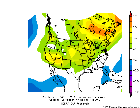
95-96 was a weak Niña with a +PDO (strong positive at that), which is very unusual when you have a La Niña. You also were in the midst of a strong +AMO cycle with very warm North Atlantic SSTs, which favor -NAO and positive feedback into that -NAO
Not really right about the AMO.
-
Yeah, I'll take La Nina. It seems that otherwise it bubbles warm by default.
-
Some legitimate La Nina here, Long range models were showing a +PNA until today it switched to -PNA
I have that theory about subsurface trend = PNA state.
-
I notice that we are in stuck climate pattern.. not like the 1990s. Meaning, big global oscillations are not oscillating. Only melting arctic sea ice, and even this is 20-30 years behind imo. I also notice that we are in a stuck economics with Google, Facebook, etc trillion dollar companies lol. I'm thinking we break through but it could take time. in the meantime, I notice much "filling in" a larger spectrum. It's an interesting theory, I would love to see how it verifies this Winter.
-
 1
1
-
-
It certainly looks like a negative ENSO in Atlantic tropics right now.
-
I can give you good analysis...
I have been following larger climate/global pattern indicators such as the Stock market, Crude Oil, NCEP climate pattern indicators researched extensively going back to 1948...
I had seen a clear "cutoff" from norms or progression starting around 2017. This, for example, made a Strong El Nino unlikely without real catalyst or change. It was a "dead" pattern. Also, things were being "bought up ahead of time" in some cases (ie derivatives).
The Pacific Jet has displaced way north. starting around 1995, you see a drier pattern in the SW, and around that time droughts started hitting California. In 2016, normal snows are now an anomaly in northern California. That pattern has not broke, and has only come back this Summer. Without a normal Pacific Jet hitting the West coast, we no longer have Alberta clippers here, etc. I am worried that it's already to start a "global warming Winter". just a dead pattern...
ENSO has also been dead and accelerating toward Neutral around the middle of last year. I had wondered about new climate patterns, which have kind of started but they have not yet taken hold. We currently have a Weak Nina which is the best we are going to get and this could, at the very least, bring an early Spring.
I was surprised that despite the Summer conditions a cold pool has developed over the favored spot in the Northern Atlantic for next Winter's -NAO. 34 Winter months of +NAO in a row, going back to 2013, will be very hard to break, but for the 2nd year in a row this indicator is favorable... I was interested in this because I had noticed a lot of things "filling out larger pattern" in regards to stats, even weather related, going back to 2018 and 2019 (I think this also happened in the 1960s and 70s). Given last Winter, I would see that "new pattern" in a 2 year pattern for that kind of condition to continue (ie +NAO-+EPO).. and because of stocks like AMZN (lol) I expect a "More opposite" this Winter, compared to last year., I just see how it sometimes fills out. If things like ENSO and PDO SSTs were kicking I would say a different thing..
I expect a few chances at 12" storms this Winter, because of thunderstorm season and rainfall anomaly patterns frankly, but an early warm late Winter-Spring. Overall a slightly above average temperature Winter, with average or slightly above average snowfall. Best chance is January for snow. We can pretty intimately track the storms.
-
2
-
-
No Super-El Nino watch for next year, I think. We've got a little bit out of "dead pattern" but still have a long way to go I think before anything greater than ~0.7 develops. Maybe we will transition to warmer waters in the Spring though. Pretty interesting.
-
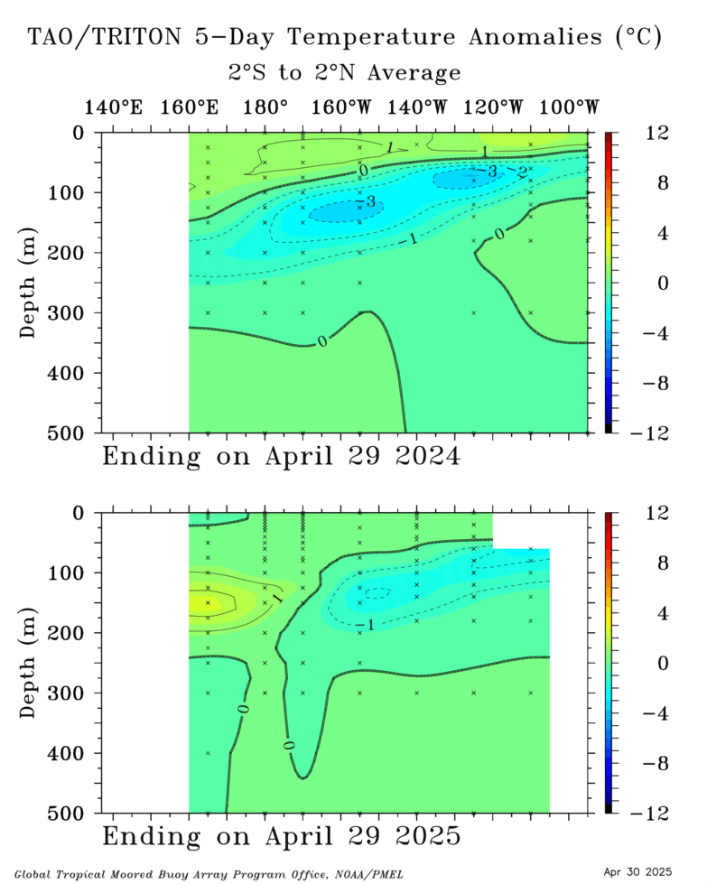
Subsurface definitely looks like a Weak Nina it usually drifts greater through October/Nov so maybe it will break -0.5.
-
We actually have a -NAO signal here(, about -0.90 so far)
-
 1
1
-
-
I still think we'll see something like this.. expect a good Winter.
.gif.be43866e0ab8a655c88877f14550a58f.gif)
-
Another drought for California, doesn't bode well for our Winter with the Pac Jet displaced all the way in Alaska.
-
 1
1
-
-
On 7/25/2020 at 3:38 PM, CAPE said:
LOL last winter. The antithesis. We should probably get used to it.

I've been studying various global indicators right now.. I'd say expect the opposite of this, greater than 70-75%. We are in a "mixing within a large bowl" long term pattern, and you see this with the stock/currency market, how they are taking turns rising to percentages to even out, etc. I've seen this in observation of ENSO over the past 2 years, Hurricane seasons. (Sorry it starts off crappy, I've been meaning to say that for a while- much stock market analysis related to the greater climate phenomena.) It's a "dead" pattern right now, in a manner of speaking, for comparison, and I'm experiencing a big intuitive hit on opposite to even out. Pacific jet really far north has been a real climatological trend though over the past 5-10-15 years, and it is legitimately linked (I think) to melting arctic ice. We'll see.
-
Believe it or not, there's more Atlantic tropical storms in negative-Neutral vs La Nina. We are already on "I" in July, which I think is a record. It keeps the strong currents more neutral.
-
Globals a little more solid now.
-
Yeah, the global system is not going to go La Nina below -0.8c 3.4 ONI. Weird. Invest in stocks.
-
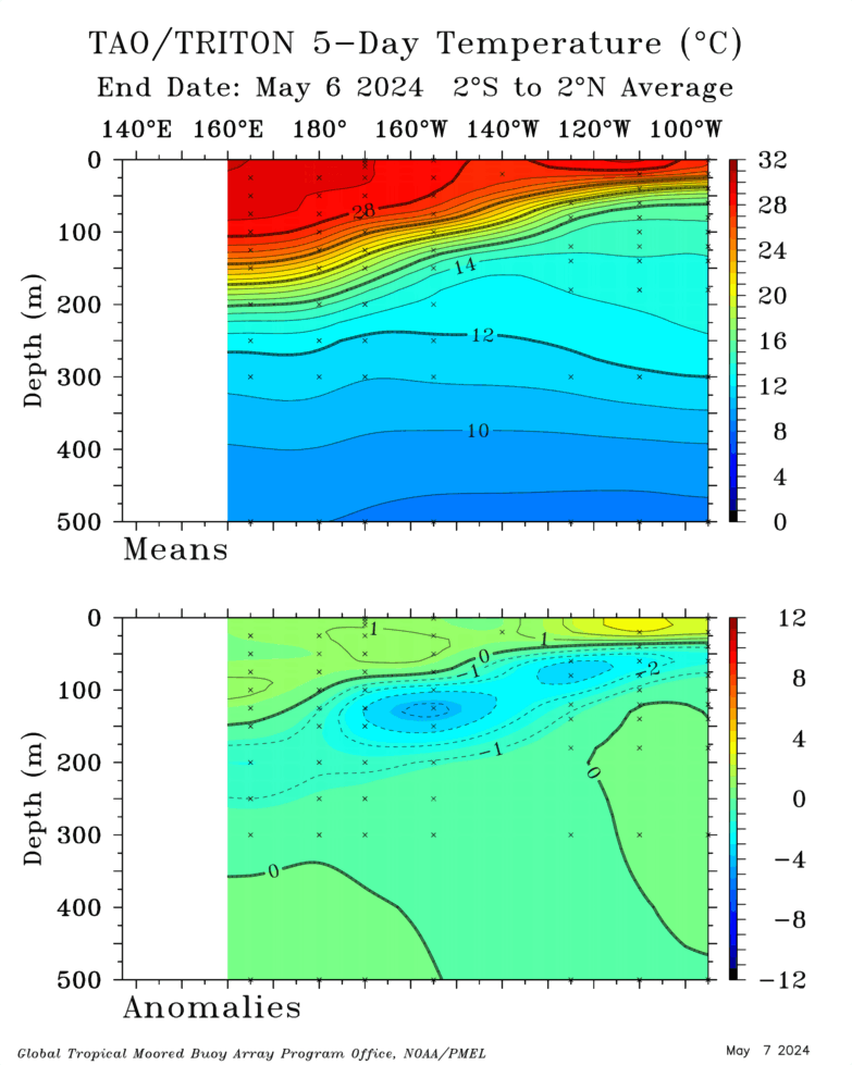
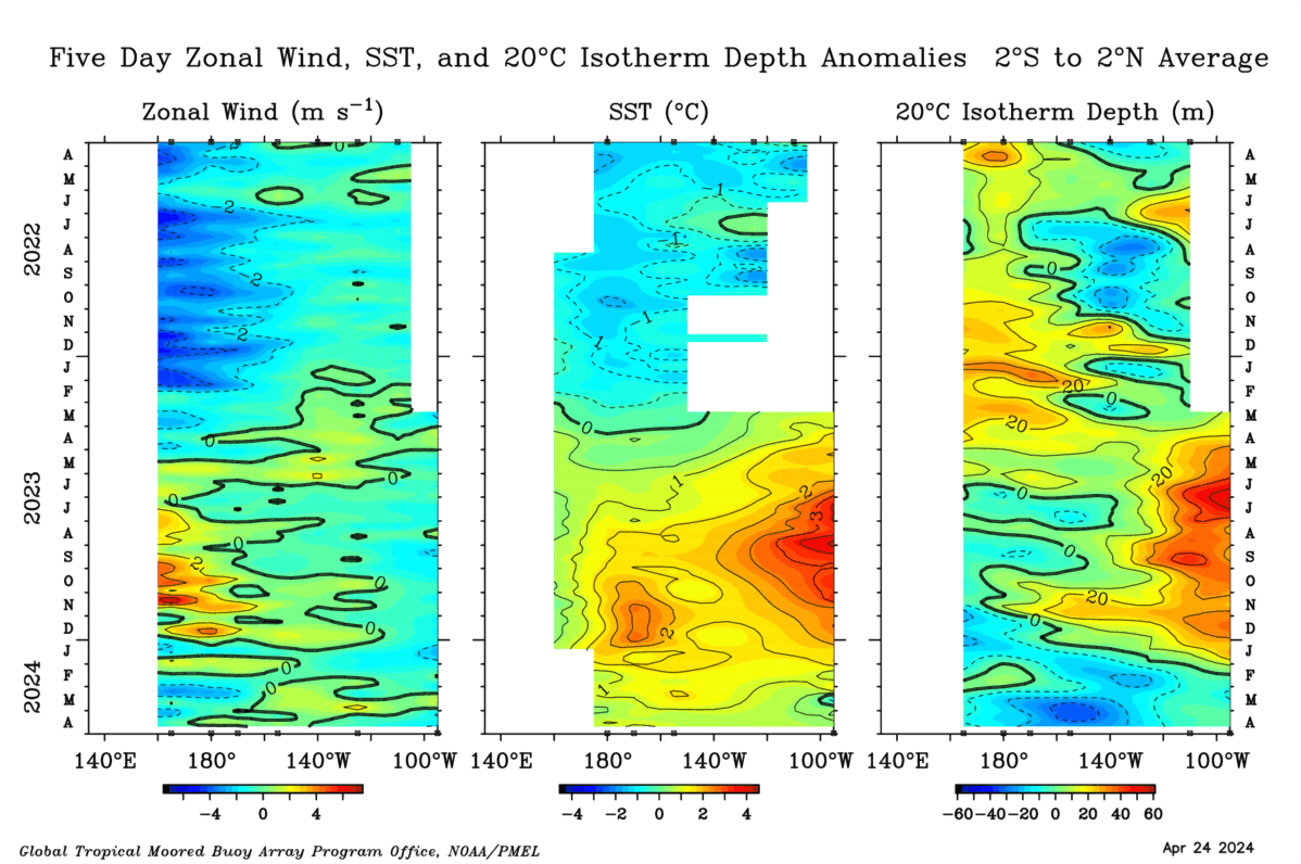
^Looks like a Moderate Nina coming, as per the subsurface. Will be interesting to see if the surface 3.4 breaks -0.7 now or in the next 3 years.
(Tao/Triton isn't as strong, I've found better correlation in TAO/Triton).
-
36 minutes ago, powderfreak said:
Some good cloud porn today though on the whole.

Had that sky-cloud pattern here about 7 days ago. It's been tropical now.


Denver: High of 37 Snow Tuesday, 100 degrees today
in Weather Forecasting and Discussion
Posted
Technically 99*.
https://w1.weather.gov/data/obhistory/KBJC.html
Winter Storm Watch in Denver metro!
https://forecast.weather.gov/showsigwx.php?warnzone=COZ040&warncounty=COC031&firewxzone=COZ240&local_place1=2 Miles W Denver CO&product1=Winter+Storm+Watch&lat=39.768&lon=-104.873#.X1TGTnlKhPY