

StormchaserChuck!
-
Posts
2,274 -
Joined
-
Last visited
Content Type
Profiles
Blogs
Forums
American Weather
Media Demo
Store
Gallery
Posts posted by StormchaserChuck!
-
-
Happy 50th birthday Aunt Ang
-
Georgia
-
1 hour ago, bluewave said:
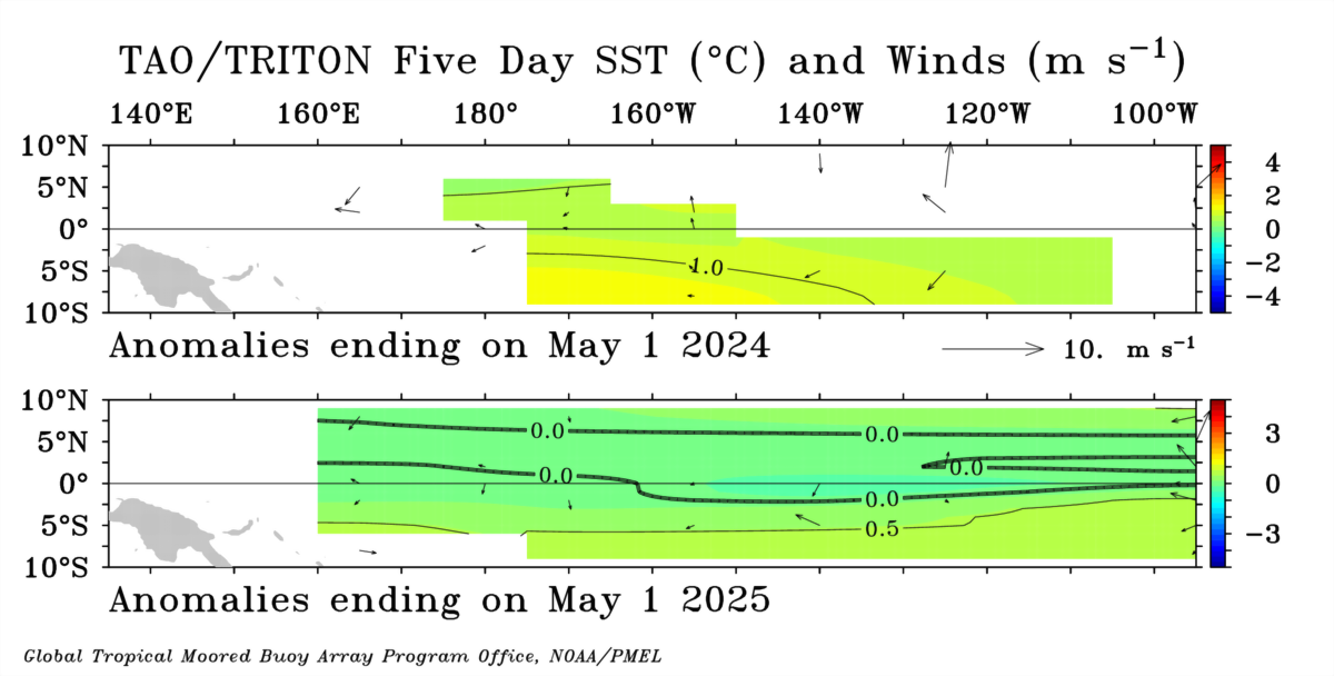
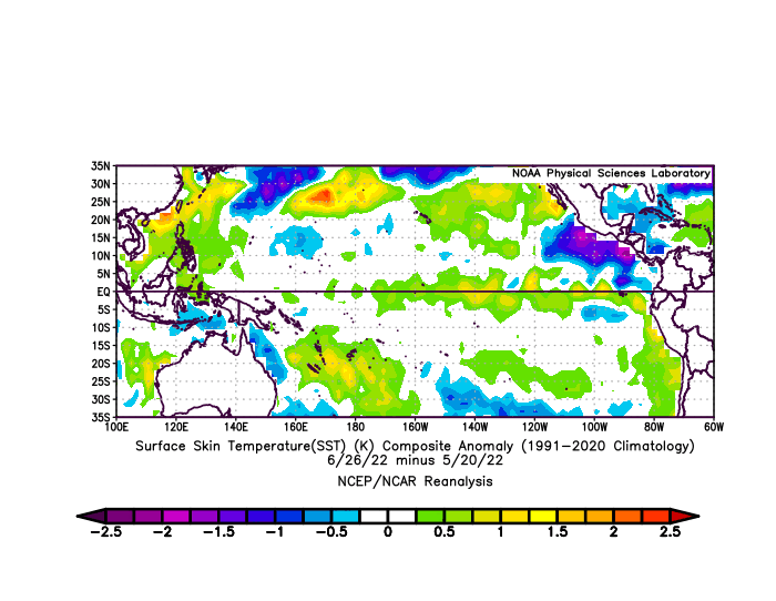
The West Pacific warm pool is also the warmest that it has ever been this time of year.
Love that north of Hawaii Hadley Cell. could flex Atlantic Hadley Cell down the road.
-
6 hours ago, CAPE said:
And it continues. After a couple days of warm and muggy this week, heat gets knocked back as another trough digs in over eastern Canada, with an upper ridge building well to our west. Looks a bit unsettled Friday with a potential disturbance moving along the front, possibly lingering into Saturday. Potentially a really nice weekend with temps in the low 80s.

That's going to verify warmer.. I love +EPO's, especially with 591dm ridge under it.
-
It's actually been a straight correlation in the 3,000 mile region of North Pacific, when the subsurface center went warm, >0.0, -PNA stopped completely,
That will probably continue into Winter. surface doesn't really matter for the 30N-90 Jet
-
Short-lived La Nina burst in the Northern Hemisphere. It's not really holding right now. 3/15 days.. something like 3/last 100 days too.
-
We'll do it something like 5/7 or 5/8 of next Winter's, unless there is volcano explosion or something. +10-year signal. lalala
-
 1
1
-
-
Still like the idea of the SW High pressure spilling NE. We are entering +10 year range of that UM/GL's cold anomaly to be a mathematical anomaly-exponentially if it continues.
mathematics.
-
Yeah, it's been record +SOI. They show it's going to last next 4 weeks, until Aug 1 just as strong. N. Hemisphere is disconnected right now though. I think CanSHIPS shows what it is in stability. After following weather for so long and doing research, somethings start to show up.
-
What's really going on down there??
-
2 hours ago, CAPE said:
I've seen worse patterns heading into the heart of summer. This look would likely produce temps around average for the MA.
Actually, it would evolve pretty above average.
-
Yeah, that 4-6-month SOI was only matched by 2011 (apr 23.9), which was the Dec 2010 I keep comparing too, as a significant anomaly correlation to this last Winter. Then 1994 (reverse)
1994 4 -19.9
93,92,91 were all <-10 .. so we are reverse-early 1990s. Wierd because that was a 5-year subsurface El Nino, but surface was Neutral. we are + in the subsurface now, which does not match. Showdown I guess lol.
-
1940s into 1950s is the best match to now long cycle-wise. I really like the stretch actually from 1948-1951 as a pretty good matching event sequence.
-
As usual
with these things, it's about a 60-70% match
-
-
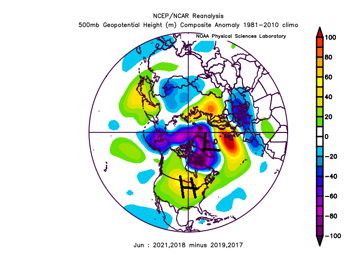
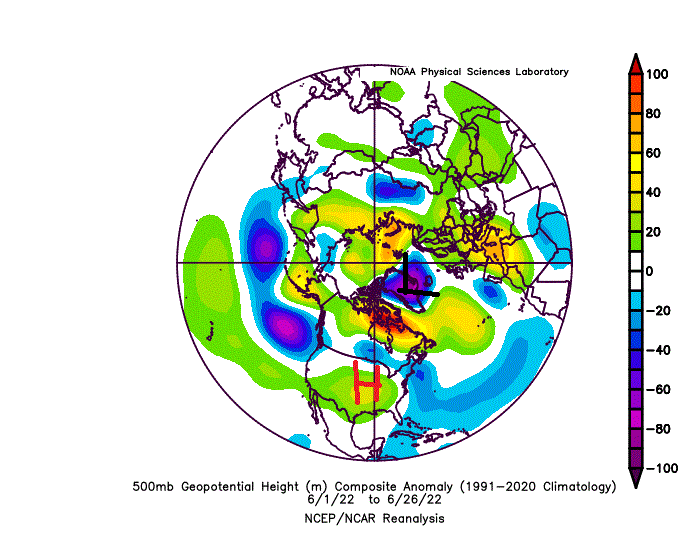
I like the general signal of -PDO/-NAO
-
-
DCA _ NYC _ BOS __ ORD _ ATL _ IAH ___ DEN _ PHX _ SEA
2.7 2.8 2.5 3.0 1.8 0.8 2.5 2.0 1.5
-
 1
1
-
-
Let's see if we hit this pattern
-
It will neutralize the La Nina at least
-PNA will cool the subsurface, but we should go +ENSO by August and September.
.thumb.gif.cbd0c22573e5211b16643c27d37185eb.gif)
Flirting around low-Weak El Nino for the Fall is still my guess.
-
Never hit -3

-
I don't know who pays attention, because there are like 2 posts on this forum a day, do different people see different things?
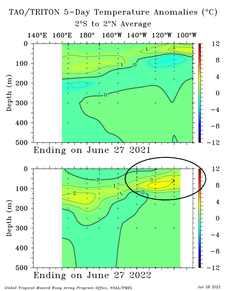
The surface warming hasn't yet begun. I expect some Northern Hemisphere 500mb patterns when that does happen. There is a +3c bubble just below the subsurface.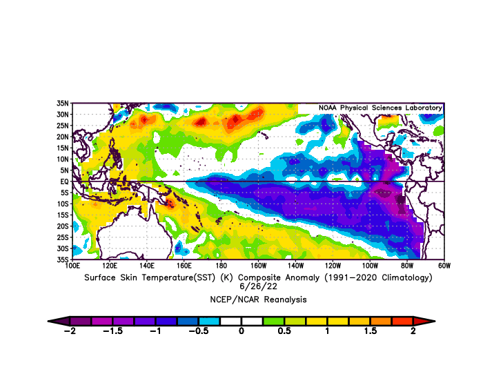

-
one more.. SOI+anomaly evened out
-
It's been cooler than that.. July will probably be very +above average.
I was also looking at this
.gif.807916b800758924f5d56bc9ccedc1a4.gif)

Winter 2022-23
in Mid Atlantic
Posted
It's going to be a -PNA January and -PNA February, so here's a starting point (v reverse), I think we'll go reverse-this in the UM/eastern Rockies area because of ENSO subsurface warming