

MazooWeather
-
Posts
3,866 -
Joined
-
Last visited
Content Type
Profiles
Blogs
Forums
American Weather
Media Demo
Store
Gallery
Everything posted by MazooWeather
-
Now officially a Hurricane
-
IWX just confirmed an EF1 in Hillsdale
-
Delayed reports into the NWS makes me think we might've had a brief touchdown here last night, multiple houses with roofs torn off
-
Observed a very brief funnel cloud with it at its strongest, it tried
-
Chicago proper looks like it's gonna get missed unless that gap fills in
-
Line is starting form back into Illinois
-
Still a slight risk
-
"isolated elevated storms" meanwhile 15 warnings in effect
-
New Day 1 is pretty much unchanged from Day 2 except to trim the tornado probs and expand 15% wind back to Chicago and extreme NW Indiana
-
SPC didn't even introduce a marginal lol
-
-
-
https://twitter.com/k8roulette2/status/1432172862903832577?s=21
-
https://www.severestudios.com/storm-chasers/jokko.williams.html If you need a new stream, this guy is about to be in the eyewall
-
RIP the camera
-
They missed the strongest part
-
140 knots suspect SFMR
-
This is the same person who also just posted that the western eyewall was weakening not realizing it was just radarscope having an issue
-
Look in velocity mode, Radarscope is just obscuring the western eyewall
-
Radar showing 160 mph winds in the eastern eyewall for the first time
-
140 flagged SFMR, 932 mb
-
This is a NHC met saying this
-
Yeahhh I think that pretty much confirms this plane is having pressure instrumentation issues
-
131 KT SFMR 145 KT flight level
-
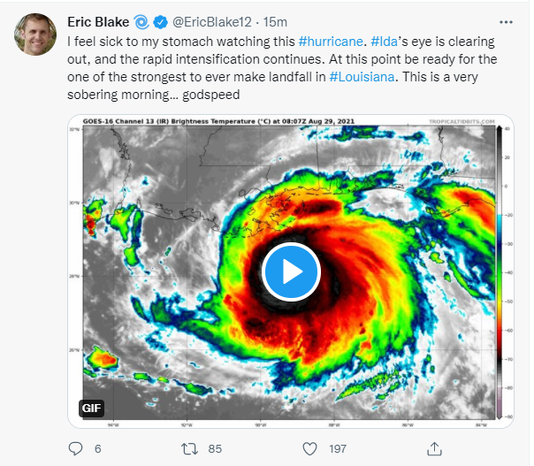
Looks like the eye is opening up more on satellite, might give her another boost


