Phelps
-
Posts
81 -
Joined
-
Last visited
Content Type
Profiles
Blogs
Forums
American Weather
Media Demo
Store
Gallery
Posts posted by Phelps
-
-
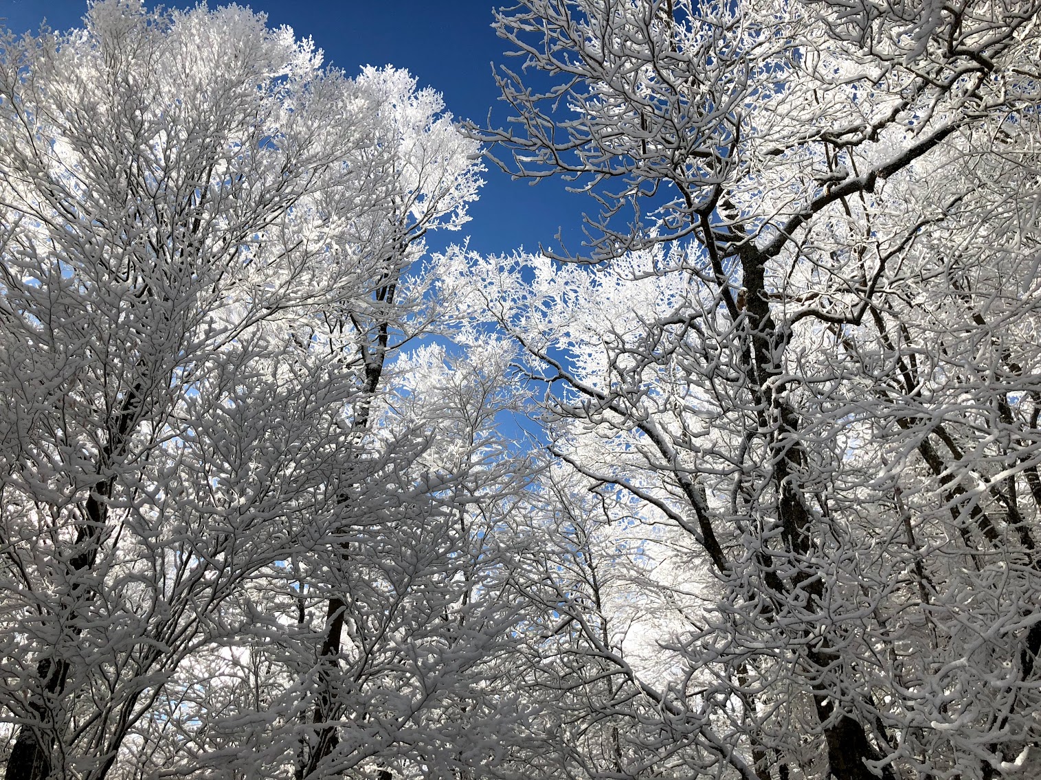
Flakes are flying up on Beech (via the webcams). Weather.com has them with 8-12. Blacksburg office going 2-4. We'll see. Hate this couldn't line up better with Thanksgiving. I'll be watching this one from afar.
-
Not saying the setup is the same here (maybe it is I don't know) but this feels a bit like last year right after Thanksgiving. That event underperformed and set the tone for the season. Maybe this year will be different!
-
1 hour ago, Buckethead said:
Here's hoping I can get more than 3" of snow at one time this season.
Last season was weird.
Sent from my SM-G970U using Tapatalk
Agree. Anecdotally it felt like it warmed up during the week with rain Friday turning to snow overnight ushering in a colder weekend with an inch or 2 of snow at the high elevations. Never really got a storm of any substance.
-
 1
1
-
-
Kinda disappointing up here on Beech. Basically wrapped up about the time I got up here around 7:30. Thought we would pick up some accumulation overnight. Grauple coming through Boone. So it goes with NWF.
Probably about done for the winter although I’m sure one or two more little events are likely for the highest elevations.
-
1
-
-
18 minutes ago, WeatherHawk said:
Looks like its moving in-within the next 5 to 6 hours...maybe more than 4 above 4000'
Surprised there's not more chatter about this...guess everyone is ready for spring
I know I'm trying to get pumped for a 4 incher and everyone is talking about fly fishing lol. It's all good of course. This one looks decent (i'm selfishly focused on NW mountains) but upside potential seems a bit limited and it looks to be wrapping up quick tomorrow night. Not sure what the ski resorts did to appease the snow gods but they get rain on the weekdays and snow and cold at the end of the week. Pretty remarkable actually.
-
4 minutes ago, SnowDeac said:
I mean, this thing has warm nose/no real accumulation for CLT proper and south written all over it. How many times have we seen it in recent years, even when GSP is actually calling for measurable accumulation? I think I've had 8+ inch snowfalls turn into an inch or so of slop each of the last 3 winters. And normally the warm nose doesn't even show up as much of an issue until much closer to the event.
Hate to be a downer, but this just doesn't look good. Now, my in-laws up north/west of Huntersville (and several on the board well north of 85) will probably get some decent snowfall.
Yep. I'm obviously not a met so this is really unsophisticated analysis but I have lived in Charlotte my whole life and I could easily see us sitting around waiting for a changeover that doesn't happen until it's too late. When things look borderline for us it hasn't gone well in recent memory and this looks borderline. Would love to be wrong.
-
1 hour ago, eyewall said:
It is over. Time for severe season
Go do this crap in the other thread. It's not that you're wrong. It's just that it's intolerable.
-
Sucks for the ski resorts. They had such good conditions last weekend. They can deal with warm but 5 inches of rain is tough.
-
Looks like quite a morning up on top of beech!
-
3
-
 1
1
-
-
3 minutes ago, BhamParker said:
Leaving Birmingham now, trying to decide to drive through north Georgia or Chattanooga to Knoxville. Sure would love to see the snow on the way. I’m sure surface temps should be fine.
Drive straight for the snow man. You've been jonesing hard for days. Enjoy it!
-
2
-
-
Was worried we were losing the NW flow event this weekend but GSP seems to be leaving the door open.
While it looks to be a relatively prolonged period of NW
flow snow, the guidance doesn`t agree on if the snowfall amounts
will be significant. The wind speeds and directions and the CAA are
good but not great. However, there area multiple short waves
dropping through the flow across the area and weak low level
instability which are favorable. Keep low PoP across the usual areas
through the period and will have to keep an eye on the situation for
any potentially significant snowfall.
-
3
-
-
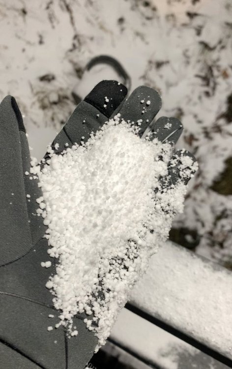
This snow looks like Dippin Dots.
-
5
-
-
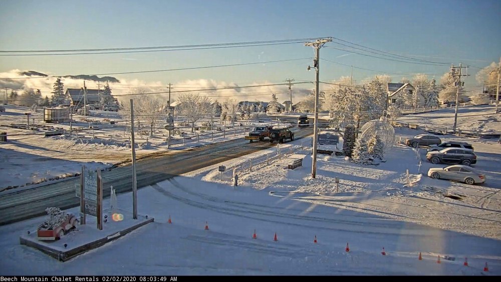
Low to mid 20s and the snow guns on Sugar and Beech are quiet. Guess they're throwing in the towel.
-
I know winter isn't over in the high country yet and we'll see what happens the rest of February but right now it isn't looking too promising. If the next 2 weeks are anything like the last couple then it will be the 2nd February in a row with very little snow, even in the highest elevations. Frustrating.
-
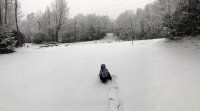
Really fine (as in small) flakes up where I am on Beech. Blow and drifting so it's hard to know how much I've got. It's not even accumulating on the elevated surfaces really, just blows away. Hoping to see some fatties at some point today. No snowmen will be created in this stuff.
-
Yeah I'm headed up to Beech on Saturday. I'm not "worried" but I think there is a possibility the juicy part of the storm just doesn't make it up to that corner of the state. At least right now it doesn't look like mixing will be an issue. Plenty of time to hone in. Still pumped.
-
Compared to the mets and others on this board i don't know anything about the weather. But here in Charlotte this feels like deja vu. Sitting here waiting for the rain to change over to snow. Watching a stronger than expected warm nose give us sleet. Wondering why the radar returns don't look good any more (maybe not an issue with this particular storm). It just seems like no matter how good things look leading up to the event we revert to climo. It's snowing in the mountains. It's snowing north of 85. 85 (maybe 40 to the east) is the rain/snow line. We can watch models for days but is all seems to always come back to this.


2020/2021 Fall/Winter Mountain thread
in Southeastern States
Posted
Not to skip over today's event but any chance the Wednesday storm could be snow for the highest elevations? We've got a gulf low tracking up the coast and some cold air nearby. Just glancing at the global though and it doesn't look cold enough. Can't tell how close we are to something good.