dilly84
-
Posts
4,041 -
Joined
-
Last visited
Content Type
Profiles
Blogs
Forums
American Weather
Media Demo
Store
Gallery
Everything posted by dilly84
-
Hes so optimistic he's sharing his own post lol
-
Disregard. Still sleet. Got quite a bit if freezing rain, however
-
The issue is nws says the 2nd wave arrived sooner than thought, which to me translates that the colder air didn't have as much time to push east. Idk we'll see. Not liking reports I'm getting
-
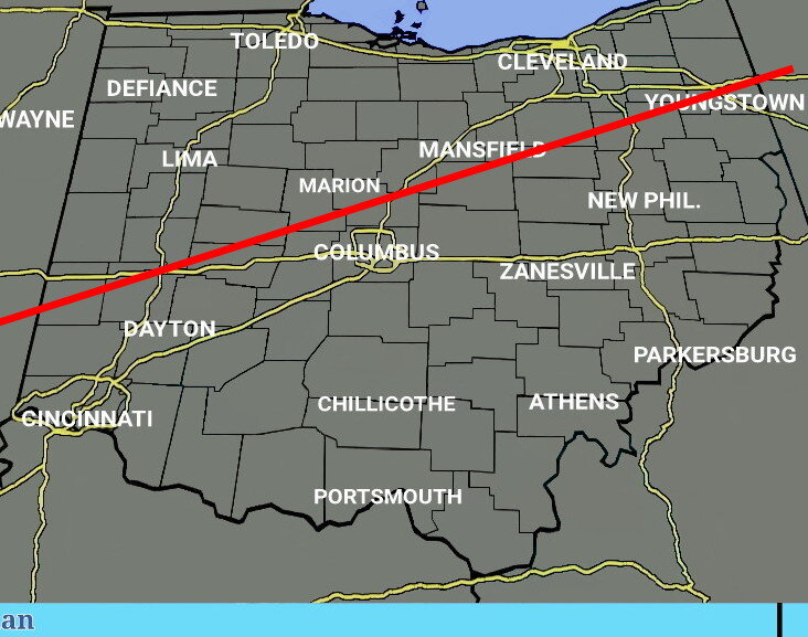
I'm just not seeing it. We need the cold to shift se about 20 miles to get close to this and soon.

-
You hush your mouth Mr pessimist lol check my page. You can see user reports and get an idea of the sleet line.
-
Per user report galena(Delaware area) is still sleet.
-
Not accurate. I can see mount vernon up there. Can confirm it's very light sleet here.
-
Based on reports on my page, this is roughly where
-
Kinda funny that nws upped their totals. I mean if it's still sleeting in by 10am that's when I'll officially call it.
-
Report that it's still sleet even in morrow County. Hang it up. That's the county west of me so they're even further in the snow on radar.
-
Radar showing me as all snow, but its sleet and light sleet at that. All while nws cle ups my totals citing a quicker changeover
-
It's apparently snowing in marysvilMarysville, but radar shows them sleeting
-
I'm roughly 20 miles from the rain snow line on radar, so will soon get to see how accurate radar is, if it's picking up on sleet etc
-
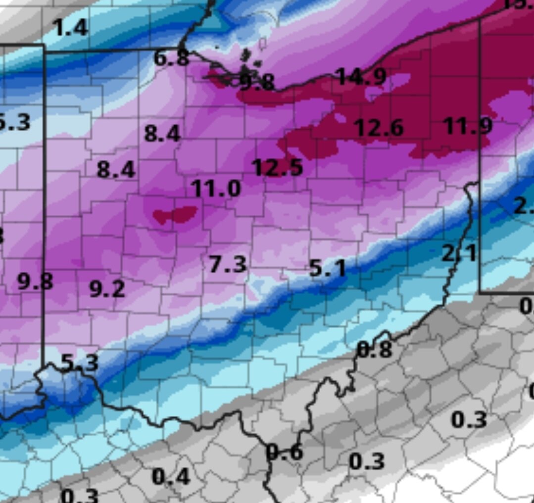
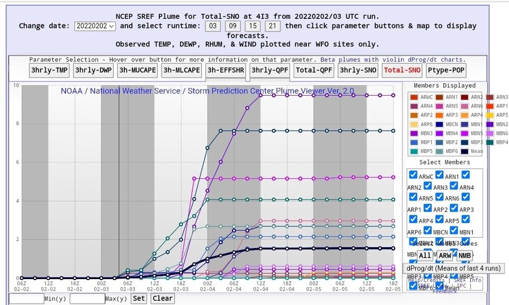
Yesterday my location it had 1 over 8" this was 03z
-
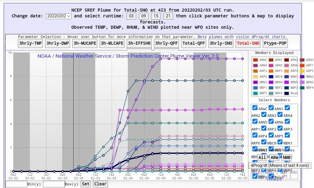
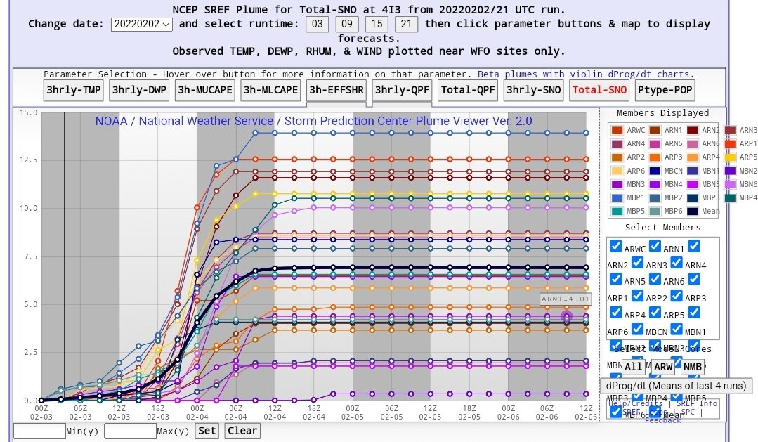
Sref plumes. Several members over 10"

-
Nam was going great then a dry slot appears and changes i71 corridor back to sleet..
-
0z Hrrr has me switching to snow at 6am see how accurate that is. I'm also curious if it'll be one of those deals where it's snows for an hour then sleets for an hour then snows etc.
-
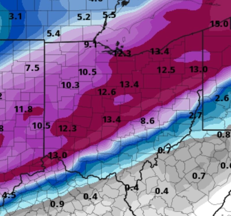
I have cleveland in 12-18"
-
Who's staying up to track it? I'll be up til at least 3a
-
No but it's still a weak system with a pressing high. Idk. We'll see. I'm sticking with my sleet line lol
-
My map was for 6-8 for us.
-
I know, but we've never gotten to the modeled temps today, and I just dont think that waa is string enough to overcome that cold front. I think it'll be close and the sleet line will be around eastern coshocton/Guernsey county and southwest from there.
-
It was better than 12z.
-
21z rap and 18z gfs both showing over a foot now.
-
Only model to be consistent. I went with a lowered version of the gfs. Wont be surprised if it's not more. We've not even gotten close to the modeled high.