Buffalo Bumble
-
Posts
1,613 -
Joined
-
Last visited
Content Type
Profiles
Blogs
Forums
American Weather
Media Demo
Store
Gallery
Posts posted by Buffalo Bumble
-
-
Most wintry early November period incoming since the Little Ice Age...

-
Lake shadow has been stout in my area the last 6 weeks. Pretty amazing at times actually watching the radar and seeing how L Erie both energizes (lake breeze boundaries) and deflects (shadow) rain and thunderstorms.
-
 1
1
-
-
Yeah, lakes probably close to their peak temps now. Erie is a toasty 75 deg, Ontario not far behind at 74.
-
1
-
-
Spent the day in Kingston, ON (great little city...lots of pubs, outdoor restaurants, shops, and incredible views of the St Lawrence River and L Ontario - ferry ride across the mouth of the St Lawrence from Wolf Island was fantastic too). Anyhoo...amazing watching all the rain and storms get shunted to the north and south all day, just like back home off L Erie.
-
36 minutes ago, BuffaloWeather said:
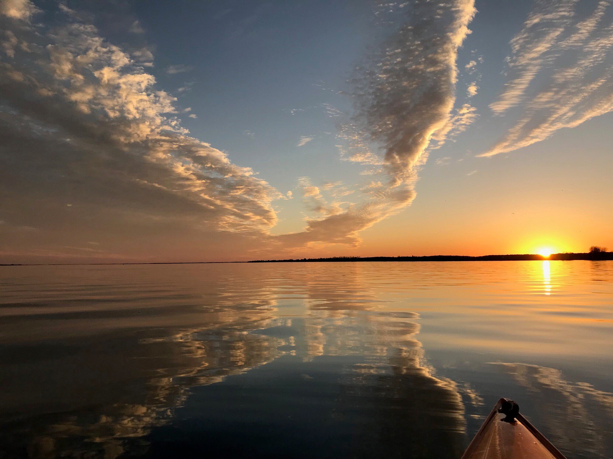
This weather is the best. I could enjoy this for 6-7 months. BBQ, pool parties, night fires, beach. It’s fantastic. The sunset this evening.

I’m with you man. I think we’re closet southerners trapped in WNY bodies. I love the snow and changing seasons, but I could settle into this for the majority of the year.
-
1
-
-
54 degrees and pouring rain here right now at 11:15 am on June 16, yikes! We’ve lost the lawn at our cottage on Chaumont Bay to Lake Ontario. Water is now at the cottage steps. On the plus side, I can launch my paddle board right from the porch!
Climate change, bad luck, biblical scourge...?
-
1
-
-
Another beautiful April day here. Sun is shining with temps in the 50’s and a stiff breeze. What, it’s June 14th? No way!!!
I’ll stand on the year without a summer train until the pattern we’ve been in since March changes. Until then, rain, cool, and gray dominates with temporary teases of summer.
-
3
-
-
It’s been 9 months since we’ve had 4 straight days of no measurable rain or snow.
-
2
-
 1
1
-
-
The weather from about Syracuse up to Saranac Lake looks like it's been especially shi#$y today. Hours and hours of rain with temps in the low 40's in the north to low 50's in the south.
-
Interesting note thrown into the forecast discussion by BUF today (bold text below). It does seem like zonal flow is a rarity nowadays. Always seems to be an anomalous trof or ridge somewhere in CONUS, no matter the season.
The most impressive part of this upcoming pattern is not the
blocking, its evolution, nor anything of that nature...as the
pattern over the CONUS has been largely a slowly-evolving block
for the majority of a matter of years now. Instead, the shear
magnitude of upper ridging with some members of the GEFS family
eclipsing 590 dam over WNY by Sunday is reminiscent of a latter
half of July scenario rather than a late spring scenario. That
said, it is difficult to find any solution from operational or
ensemble guidance that fails to yield at least 584 dam over WNY
by Sunday, when the strongest concurrence for a continuation of
dry weather exists. That said, MOS guidance can largely be
thrown out the window as it will be far too dependent upon its
sun angle calculation (which many refer to as its climatology
component), and a more straightforward examination of mixing
profiles will need to be undertaken. We should easily mix out
through 850 mb, if not higher, so mid 80s (at least) seem like a
good bet most areas away from the immediate lakeshores, with
inland warmer areas probably locally approaching 90F.
-
1 hour ago, BuffaloWeather said:
Last year had a slow start to summer too I believe? June was much cooler then normal. July-September was just ridiculously hot for this area. May was almost as warm as June was.
Appreciate the optimism, but last May was 8 deg above normal and June came in 1 deg above normal. We’ll be about 7 deg below normal for June after today.
-
Too early to question if a year without a summer incoming? I know that sounds fatalistic and likely the byproduct of sitting here in early June going on 72+ hours with the Mercury not once topping 60 degrees, but...it’s not without precedent. We’ve had other summers where “summer” never launched. Just weeks and weeks of damp, cool weather interspersed with very brief heat spikes.
Forgetting for a second the incessant cold and wet we’ve endured since “spring” started on April 1, just look at what lies ahead. What should be a few mild (not warm/hot) fair days starting Friday is squashed on the modeling by yet another deep trof in SE Canada.
Until and unless our predominant flow stops coming from a polar bears ass frolicking on the ice of Hudson Bay I’ll keep questioning if summer will come to these parts this year.
-
1
-
-
Looking at the sky all day wondering why it looks white despite sun being out. Just saw mention in BUF discussion that smoke from fires in NW Canada is moving over the area. The atmosphere is officially doing everything possible to ensure no blue sky in upstate NY. Don’t get me wrong, it’s a nice enough day with mild temps and filtered sun. But still, WTF.
-
1
-
-
3 hours ago, BuffaloWeather said:
That's well into June, so sad.
Really quite frustrating at this point. Struggling to break 60 for 2+ days this close to June is pretty brutal, not to mention the perpetual darkness from the dense gray cloud deck. Just an incessant W/NW flow into our area from the permanent Low pressure near James Bay. Thanks Canada.
-
TOR warning just popped near Belmont
-
Just now, DeltaT13 said:
All the summer lovers (myself included) should love Sunday. It will be the first truly hot day since last September. One of the latest, first 80 degree years in quite some time too so it will really feel unique to winter conditioned bodies. Also looks like a chance for some discrete severe storms in the afternoon.
Music to my ears. Hopefully lake chilled breezes don’t get too far away from the shores. I was in downtown BUF for a bit this evening. Temp dropped from 64 at my house to 50 down at canal side.
-
1
-
-
From 72 hours of rain and temps in the 40s here to thunderstorms and torrential rain less than 24 hours later. Deluge ongoing right now with frequent lightning. I mean, can the weather be any more of a sh%+ show here?
-
We’ve had a short respite here in WNY. Sun broke out yesterday afternoon and full sun to start today. Looks short lived though. Bummer you guys out east are still stuck in the gloom.
-
2 hours ago, southbuffalowx said:
Apparently the flooding in Montreal is forecast to crest higher than 2017, which means they outflows off Ontario will have to be less than they were around the same time in 2017. Apparently that's causing a (relatively) rapid rise in Ontario's lake level.
And interestingly enough lake Erie is at a record high for the month of May right now. Or at least is above the record high average for May, so there could be some discrepancy there.
-
Good to see, hope it holds up! Persistence of this pattern has been remarkably annoying. Haven’t checked online, but have to think L Ontario water levels could be a problem like we had a couple years ago.
-
7 hours ago, BuffaloWeather said:
Hawaiis weather next week.
 MONMAY 6
Sunny 81°70°0%W 11 mph 58% TUEMAY 7Mostly Sunny 82°72°0%SW 11 mph 61% WEDMAY 8Mostly Sunny 83°73°0%SW 10 mph 65% THUMAY 9Mostly Sunny 85°73°10%W 10 mph 66% FRIMAY 10Mostly Sunny 85°73°10%W 9 mph 64% SATMAY 11Mostly Sunny 84°73°20%WSW 9 mph 66% Lucky you!! Here's our forecast next week:
Monday - Cloudy with showers. 5 minutes maximum of sunshine. Temperatures between 45 and 59 degrees.
Tuesday through Sunday - See Monday.
-
Got lucky and busted into the warm sector here early this afternoon. BUF was up to 78 at 4pm. Feels fantastic.
Upstate/Eastern New York
in Upstate New York/Pennsylvania
Posted
Spot on! I was amused at first, then found it hard to keep reading without getting angry.
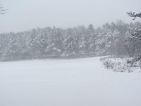
Anyway..."real" snow falling in Lancaster. Pretty good size flakes and sticking on vegetation nicely. Evergreens are frosted.