

burgertime
-
Posts
11,147 -
Joined
-
Last visited
Content Type
Profiles
Blogs
Forums
American Weather
Media Demo
Store
Gallery
Everything posted by burgertime
-
I'm probably going to shave it over the weekend. I have to be on camera for work in the upcoming weeks and the higher ups are calling me "John the Baptist" because of it. Haha they don't want me looking like a mountain man when possibly millions of people can seem me!
-
Just got a webcam at work

-
Only bi-sexual black nerds!
-
lol for some reason I always picture the posters here as white and nerdy.
-
Me photobombing the gf's family picture!
-

Weather References and Newbie Information
burgertime replied to burgertime's topic in Southeastern States
Added Wunderground and Meteocentre links for the model maps. -
Yea Mark but you're keeping in trimmed during the school year right? My girl likes it wild and grown out haha. I'm going to try to go until March but someone might say something at the office since I occasionally have to do video for work.
-
Thanks. Doing it for the girlfriend she loves the beard and because of work I only grow it out during Winter when I have an excuse. Haha. Yea I was pretty drunk at the party and they were calling me Mr. Matchmaker!
-
You would think but my friend is a total dumbass. I got him to get her phone number and he messed his phone and somehow couldn't get her number back. I think he is just afraid to call.
-
I'm growing the beard. This was at our company Christmas party and I was trying to get my two friends to go on a date.

-
Weather References and Newbie Information
burgertime replied to burgertime's topic in Southeastern States
Added information on blocking. -
Weather References and Newbie Information
burgertime replied to burgertime's topic in Southeastern States
Added your links -
Weather References and Newbie Information
burgertime replied to burgertime's topic in Southeastern States
Added additional model pages and maps. -
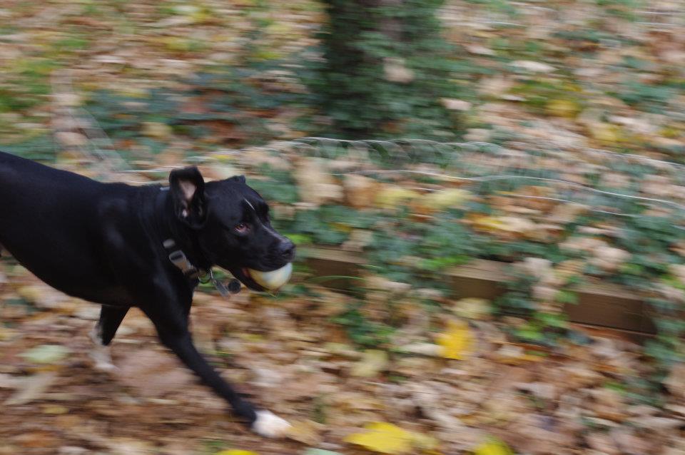
This is my pup! He is a Great Dane mix supposedly. Certainly has a dane head but that's it. The ball he has in his mouth is his fav toy. The worst part is one day I was out watching him play and he peed on it then put it right back in his mouth. If we don't take it away he will not go anywhere with out.
-
Somehow I'm becoming an expert on social media in the electronic cigarette industry. Scary!
-
Weather References and Newbie Information
burgertime replied to burgertime's topic in Southeastern States
Always in the signature! It's almost time for it to get a workout! -
Weather References and Newbie Information
burgertime replied to burgertime's topic in Southeastern States
Haha I guess I am. I'm taking the week off before Christmas and last year doing the same thing allowed me to do PBP at all hours of the night for the big Christmas Miracle of 2010. I got to thinking how so many new members showed up with tons of questions and since I was awaiting an email for work why not? -
Weather References and Newbie Information
burgertime replied to burgertime's topic in Southeastern States
Those write up's would be wonderful. I'm a little worried about it getting too long of a read for a newbie, but if you just want to put your posts down I'll link to them like I did with Jon's post. -
Weather References and Newbie Information
burgertime replied to burgertime's topic in Southeastern States
Thanks and added, with links to the individual maps as well. -
Weather References and Newbie Information
burgertime replied to burgertime's topic in Southeastern States
Done and done! -
Weather References and Newbie Information
burgertime replied to burgertime's topic in Southeastern States
Good catch, I was hoping no one would notice since I'm a weenie Added including links to what they are Dang, I was racking my brain at work trying to remember it's nickname! Thanks! Those summers make me forget. Done, this is why you're the professional sir! -
Since winter is coming up I figured it might be good to have a little database for new SE posters. I know someone did this before but I couldn't find it. This is very basic so if I make any mistakes please let me know. Also feel free to add links you would like me to add to this or other information that can come in handy. If I screwed anything up don't feel bad about hurting my feelings, just tell me what is wrong and I'll change it. Maps: There are a few things to know about maps in general if you are new to weather watching. One of the most important things to realize is how weather models create the maps hobbyist and professionals use to forecast the weather. Weather models which create the maps are super computers. Before a map is made, this super computer takes information from the atmosphere (via airplanes, weather balloons, etc..) and use math to create thousands of different scenarios. It then takes the scenario that comes up the most and creates the map. So it's a statistical output based on math using the information it has about our atmosphere at that given time. For that reason a storm that is on a weather map may not happen since there is no way to 100% predict something as unstable as our atmosphere. Of course no true professional takes a map totally at face value, they use their education and experience in tandem with weather models to make a prediction they feel will be the most accurate. GFS - Global Forecast System (weather map) AKA GooFuS (joke phrase for GFS) (Long Range) The GFS runs at the following times: 6z - 5 A.M. 12z - 10:30 A.M. 18z - 4:30 P.M. 00z 10:30 P.M. these times typically represent when you can go on the board and will see analysis as the maps roll out. The GFS goes out to 384 hours at which point it is typically not very accurate. LINK TO FREE GFS MAPS (GFS 850mb map) Euro - European Centre for Medium-Range Weather Forecasts (ECMWF) AKA Euro AKA European Model AKA Dr. No (medium range) AKA Eurotrash 12z - 12:30 P.M. 00z - 12:30 A.M. The Euro only runs twice per day. Wunderground now has a great free Euro map that runs to 180 hours out! It even shows snow totals. It can be found HERE use the panel on the right hand side of the screen to control maps. LINK TO FREE EURO MAPS (Euro map) NAM - North American Model (short range) 6z - 4 A.M. 12z - 9:00 A.M. 18z - 2:30 P.M. 00z 9:00 P.M. the NAM has the same layout as the GFS LINK TO FREE NAM MAPS GGEM - This is the Canadian Model AKA Canadian (medium range) LINK TO FREE GGEM MAPS These are the four main maps used on the board. Additionally here are links to more resources AmericanWX Maps - Now AmericanWx has models! These are awesome and inexpensive. Not only that but you support the board by using these maps. I strongly suggest you subscribe to this service! Instant Weather Maps (best source for GFS/NAM maps) NCEP MODEL GUIDENCE RALEIGHWX WEATHER DATA PAGE PSU E-WALL MAPS PAGE WEATHERONLINE.CO.UK MeteoBlue RUC MAPS HRRR MAPS Wunderground Model Maps (best source for free Euro maps) Meteocentre Maps 850mb zero degree isotherm/line - This refers to the 850mb line which typically is used to determine where snow will fall. You want to be above this line and not below it (when looking at a map). Often this is what we first look for when trying to get snow. This line typically works like a rain snow line, again you want to be north of this line when looking at a map for snow. The 850 temp is at around 5000 ft, so the surface temps can often be above freezing when the 850 temps would normally indicate snow. Also, a warm layer during sleet events often develops above 850mb. So the point is, in order get snow a lot has to go right then just having the blue line in your favor. (thanks to members schlontz and usedtobe for additional info) (GFS 850mb map) Cold Air Damming (CAD) (from weatherprediction.com) Cold Air Damming occurs when a low-level cold air mass is topographically trapped on the east side of a mountain range. An area of high pressure at the surface will be positioned to the north of the region and the clockwise flow around the high means the low-level winds coming into the region will have an easterly component. These easterly winds will push up against the east side of the mountain range. Air moving up the mountain range ends up cooling at a greater rate than the dry-adiabatic lapse rate and this causes the upslope flow to slow down allowing the cold air to build up on the eastern slopes. When looking at a surface chart, a CAD setup will often be noted by a distinct “wedging” pattern of cool temperatures trying to push their way down the mountain range spine which can clearly be seen on the East Coast in the image below. Blocking (from weatherprediction.com) Atmospheric blocking leads to a stagnation of weather patterns. As you are well aware, atmospheric patterns tend to repeat themselves. In the case of blocking, the same pattern repeats for several days to even weeks. This can lead to flooding, drought, above normal temperatures, below normal temperatures and other weather extremes. It is important to recognize a blocking pattern in its initial development. With this awareness, you will be able to forecast out to several days in advance with a high degree of accuracy. Atmospheric blocking is best seen on upper air analysis and forecast charts. Blocking over large regions is most common with high-pressure since high pressure covers a large spatial area and tends to move slower than low pressure. In some instances, low pressure can also cause an atmospheric block. The five types of blocks that will be represented in this section are the Omega block, the Rex block, the Ring of Fire, Split flow and the Cut-off low. Each is detailed separately. For more information on blocking see: http://www.theweathe...n.com/blocking/ Phasing This happens when branches of the jet stream combine or "phase" to create one large storm. The best example of a system phasing is the superstorm of 93. Here is a look of what the superstorm looked like on a weather model http://www.meteo.psu.edu/~fxg1/NARR/1993/us0313.php Miller A - This is a track most in the SE favor for snow. A low forms in the gulf and goes along the FL pan handle and heads north just off the coasts of NC/SC. Often this allows cold air in and the spread of moisture across the SE. Miller B - This is a storm that generally favors those along and west of the Apps. A low will form in the gulf coast and track along the apps many times spawning another low going up the coast. Generally this keeps temps too warm for those south and east of the Apps. These also typically favor the north east section of the US. Upper Level Low (ULL) - These type of storms can be tricky. As energy from the west moves east it essentially becomes stronger and tighter and begins to rotate. Think of it as a very tiny hurricane going across the SE. When an ULL is coming you want to be on the north west side of the low as this often has the best lift and dynamics for snow. ULLs can drop large amounts of snow in a short period of time as they can create their own cold core. Soundings (thanks to Queencitywx for this) if you're new, you're going to hear alot about soundings from the models. I've found a snow sounding from an airport in Michigan to use as an example: Date: 48 hour Eta valid 18Z THU 17 NOV 11 Station: KMBS Latitude: 43.53 Longitude: -84.08 ------------------------------------------------------------------------------- LEV PRES HGHT TEMP DEWP RH DD WETB DIR SPD THETA THE-V THE-W THE-E W mb m C C % C C deg knt K K K K g/kg ------------------------------------------------------------------------------- 0 1000 144 SFC 995 187 0.9 -7.2 55 8.1 -1.9 270 16 274.5 274.8 271.5 280.7 2.23 2 950 551 -3.8 -8.6 69 4.8 -5.4 272 21 273.3 273.6 270.6 279.1 2.09 3 900 975 -8.1 -9.5 89 1.4 -8.5 273 22 273.2 273.5 270.5 278.9 2.06 4 850 1415 -12.2 -13.2 92 1.0 -12.4 282 23 273.4 273.7 269.9 278.0 1.63 5 800 1875 -15.7 -19.1 75 3.4 -16.4 283 24 274.4 274.5 269.5 277.4 1.05 6 750 2358 -18.8 -25.1 57 6.3 -19.8 290 27 276.2 276.3 270.0 278.2 0.66 7 700 2871 -20.0 -30.1 40 10.1 -21.4 281 34 280.3 280.4 272.2 281.7 0.45 8 650 3416 -23.9 -34.6 37 10.7 -25.1 280 36 281.9 282.0 272.8 282.9 0.31 9 600 3995 -27.7 -37.1 40 9.4 -28.6 281 36 284.0 284.1 273.9 284.9 0.26 10 550 4615 -31.8 -43.0 32 11.2 -32.6 282 38 286.3 286.3 275.0 286.8 0.16 11 500 5282 -35.7 -47.9 28 12.2 -36.4 282 41 289.5 289.5 276.6 289.8 0.10 12 450 6009 -38.5 -57.9 11 19.5 -39.1 282 44 294.9 294.9 279.1 295.0 0.03 13 400 6813 -41.4 -69.3 3 27.9 -42.0 283 48 301.2 301.2 281.8 301.2 0.01 14 350 7712 -44.7 -71.3 4 26.5 -45.2 285 54 308.4 308.4 284.7 308.4 0.01 15 300 8737 -46.8 -69.5 6 22.6 -47.3 284 58 319.3 319.3 288.5 319.4 0.01 16 250 9942 -47.4 276 60 335.6 17 200 11414 -48.1 268 66 356.6 18 150 13301 -49.3 265 52 385.1 19 100 15940 -50.7 255 44 429.8 TRP 0 If your sounding looks like that, I can almost guarantee what falls from the sky will be snow. Of course, there are nuances to reading this sounding like noticing if the column is significantly saturated that you'll learn with time. Text soundings can be found at this address: http://vortex.plymouth.edu/make.html Please, no matter whatever you've learned elsewhere, believe this(http://68.226.77.253...FC/NAM_KCUB.txt) is a sounding. That is what's called model extraction data. While it can give you some of the specifics you get in a sounding, it is NOT a sounding. Freezing Line - This refers to the 850mb line on a weather map. AO - Arctic Oscillation http://nsidc.org/arc...scillation.html NAO - North Atlantic Oscillation http://www.cpc.ncep....ledoc/nao.shtml PNA - Pacif/North American Patter http://www.cpc.ncep....ledoc/pna.shtml PDO - Pacific Decadal Oscillation http://www.wrh.noaa....science/pdo.php MJO - Madden Julian Oscillation http://en.wikipedia....ian_oscillation The combination you want for the NAO, AO and PNA in the southeast during winter is: - AO + PNA - NAO Board Slang RN - Rain SN - Snow SN+ - Heavy Snow IP -Ice Pellets AKA Sleet ZR - Freezing Rain QPF - Quantitative Precipitation Forecast. This basically means how much liquid should fall typically in a total for the storm but will also be broken down per hour increments. SFC - Surface, usually in relation to surface temps. So someone might say, "sfc temps are too warm for snow accumulation". Storm Mode: This happens when a large storm is approaching and the board is under heavy load from users. Remember in storm mode that the moderators are much stricter and non weather posts belong in the correct (banter) thread. If you're new and aren't sure of what you're posting your best option is to ask politely or simply do not post and attempt to learn. MET - Meteorologist MOD - Moderator who maintains no user gets out of hand Admin - Generally handles any technical issues arising on the board, which usually happens during big storms Bust - This refers to when a system underperforms. For instance the maps and professionals are calling for 5 inches and you get a dusting to one inch. This would be a bust Jackpot - This typically refers to an area that receives the most snow during weather or a zone that a map has getting the most snow. Weenie - This refers to someone prone to wild swings in emotion because of a lack of knowledge when it comes to weather. Weenies also often create totally baseless pseudo scientific reasons to back up their claims about future and present weather events. Red Tagger - Meteorologist who posts on AmWx. You will know a poster is a verified MET when their username is red and they have "Meteorologist" in red under their name. See an example by clicking here PBP - This stands for play-by-play which happens during the build up to big storms. Typically a few members of the board will monitor weather maps and give a description for those who do not understand the maps or do not have access to them. Cliff Diving - (AKA jumping off the cliff AKA Lookout's cliff) Cliff diving is almost always referred to when a model or series of model runs downgrade a storm or make it non existent. Many times posters will "abandon ship" for the storm and become very negative about it. Model Madness - This is usually used when the Euro/GFS/Canadian and other models are all at odds or swing wildly from one run to another with totally opposite scenarios. Verbatim -This term is often used when explaining what the model/map literally shows. Many Meteorologist use their knowledge, experience, and past storms to make an educated guess as to what will actually happen sometimes going against what a model may show. Many however just read the maps "verbatim". Analog- Often certain years are used to draw comparisons to the current winter season. For instance if 1878 was an El Nino (I didn't look this up) and this year is an El Nino and both had similar Summer/Fall seasons this can be used as an analog to help make a seasonal forecast. For a list of links to help you learn more about weather see the following threads and posts http://www.americanwx.com/bb/index.php/topic/29651-weather-references-and-newbie-information/?p=2505699 http://www.americanw...ng-to-learn-wx/ OU Weather Roundup UNISYS Additional Links CR's Handy List O' Links: Model Guidance: PSU eWall (GFS, NAM, EURO, CMC, UKMET, DGEX, SREF): http://www.meteo.psu...fxg1/ewall.html Earl Barker's Model Page (JMA): http://wxcaster.com/models_main.htm Instant Weather Maps: http://www.instantweathermaps.com/ Canadian Model Center: http://weather.gc.ca...st/index_e.html European Model Center (Euro and Euro Ensemble Mean): http://www.ecmwf.int/ NCEP (American Model Center): http://mag.ncep.noaa.../appcontroller/ Rap Model: http://weather.rap.u...x.php?model=gfs CFSv2: http://origin.cpc.nc...wang/cfsv2fcst/ Unisys Weather: http://weather.unisys.com/ HRRR Model: http://rapidrefresh.noaa.gov/HRRR/ Twister Data: http://www.twisterdata.com/ College of DuPage Weather Lab: http://weather.cod.edu/forecast/ Weather Underground (Forecast maps and Obs): http://www.wunderground.com/ CPC Data (Indexes and Outlooks) Index Data (AO, NAO, PNA, MJO): http://www.cpc.ncep....ndex_ensm.shtml CPC Outlooks: http://www.cpc.ncep....ts/predictions/ Other NWS Sites: Weather Prediction Center: http://www.hpc.ncep.noaa.gov/ Storm Prediction Center: http://www.spc.noaa.gov/ National Hurricane Center: http://www.nhc.noaa.gov/ NWS Home Page (find your WFO here): http://www.weather.gov/ Hydrologic Prediction Service (Rainfall info): http://www.water.weather.gov/precip/ Aviation Weather Center (Satellite Imagry): http://aviationweath...adds/satellite/ Other Obs and Data Sites: Cool Weather: http://coolwx.com/ The Burkfit Warehouse (Meteogram Generator and GFS and NAM text output): http://www.meteor.ia...en/bufkit/data/ MeteoStar: http://wxweb.meteostar.com/ Wind Data: http://hint.fm/wind/ Blogs/Commentary: Hurricane Track: http://hurricanetrack.com/ Matthew East (Charlotte area): http://mattheweast.blogspot.com/ WxSouth (Robert Gamble): www.wxsouth.com WxRisk (DT): www.wxrisk.com Kirk Mellish (Atlatna area): http://www.wsbradio....her-commentary/ Weather Bell (Joe Bastardi Saturday Summary -- free): http://www.weatherbell.com/ WxJordan: www.wxjordan.com Miscellaneous Sites: Solar Data: http://www.solarham.net/ Airport Codes: http://www.world-airport-codes.com/ Bear Paws (Tropical Weather page): http://www.bearpawsw...ical/index.html Weather Pick-up Lines: http://www.weather.f...ckup_lines.html Weather Learning Tools: http://www.theweatherprediction.com/
-
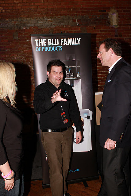
Here I am looking like a rabbit talking to a lady from Churchill Downs and a VP at Cigna about our product at a CMA gifting event...
-
He did; then went, "I've made a huge mistake" GOB style.
-
Haha thanks, trust me I get the eye rolls when I run home from being out exclaiming about how I have to see what the Euro or the GFS said. Last year we were in Gaffany at the outlets trying to shop and I was stuck to my phone trying to read a GFS map the size of a damn postage stamp...but yet she puts up with me.
