canderson
-
Posts
25,294 -
Joined
-
Last visited
Content Type
Profiles
Blogs
Forums
American Weather
Media Demo
Store
Gallery
Everything posted by canderson
-
Central PA Summer 2026 Discussion/Obs Thread
canderson replied to Voyager's topic in Upstate New York/Pennsylvania
All good! -
Central PA Summer 2026 Discussion/Obs Thread
canderson replied to Voyager's topic in Upstate New York/Pennsylvania
Never did get more rain. .05” for the day. -
Central PA Summer 2026 Discussion/Obs Thread
canderson replied to Voyager's topic in Upstate New York/Pennsylvania
The humidity surge didn’t win out quick enough so no clearing around here. Almost like a negative CAD event to me. I am more disappointed in the total lack of rain. I never expected severe here today but thought we’d get at least .25”. Depressing! -
Central PA Summer 2026 Discussion/Obs Thread
canderson replied to Voyager's topic in Upstate New York/Pennsylvania
I thought it popped past the county. mea coupa I am more surprised MD didn’t see more severe today. -
Central PA Summer 2026 Discussion/Obs Thread
canderson replied to Voyager's topic in Upstate New York/Pennsylvania
I never saw a cell in LanCo that looked remotely severe. Weird. Not doubting you at all, but I never saw anything remotely sketchy. -
Central PA Summer 2026 Discussion/Obs Thread
canderson replied to Voyager's topic in Upstate New York/Pennsylvania
This was a bust as clear as day. I never saw what SOC saw anywhere W of Chester county. Overhead mixing means nothing with no cape and no trigger. Ans chances of ashore overnight is slim at best. Water restrictions coming soon to some municipalities. -
Central PA Summer 2026 Discussion/Obs Thread
canderson replied to Voyager's topic in Upstate New York/Pennsylvania
It appears they finally dropped the t-storm watch for the south central counties. -
Central PA Summer 2026 Discussion/Obs Thread
canderson replied to Voyager's topic in Upstate New York/Pennsylvania
.05” today for me -
Central PA Summer 2026 Discussion/Obs Thread
canderson replied to Voyager's topic in Upstate New York/Pennsylvania
I am incredibly skeptical on why Dauphin is included. -
Central PA Summer 2026 Discussion/Obs Thread
canderson replied to Voyager's topic in Upstate New York/Pennsylvania
Considering the thick cloud deck and now rain, severe won’t be an issue for Harrisburg today. -
Central PA Summer 2026 Discussion/Obs Thread
canderson replied to Voyager's topic in Upstate New York/Pennsylvania
Oh sorry I meant the axis loos like it might miss a decent part of our region with the bulk of precip with the SW to NE axis. The WC games in Philly and NJ tomorrow will be interesting -
Central PA Summer 2026 Discussion/Obs Thread
canderson replied to Voyager's topic in Upstate New York/Pennsylvania
.1” last night. So lucky. In shocking news Monday’s rain is headed south. -
Central PA Summer 2026 Discussion/Obs Thread
canderson replied to Voyager's topic in Upstate New York/Pennsylvania
Brb gonna go buy a lottery ticket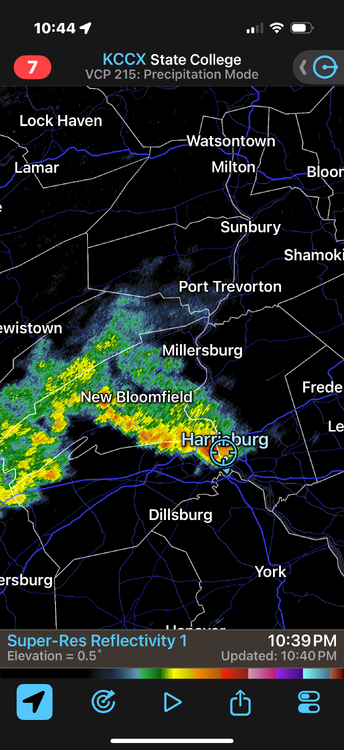
-
Central PA Summer 2026 Discussion/Obs Thread
canderson replied to Voyager's topic in Upstate New York/Pennsylvania
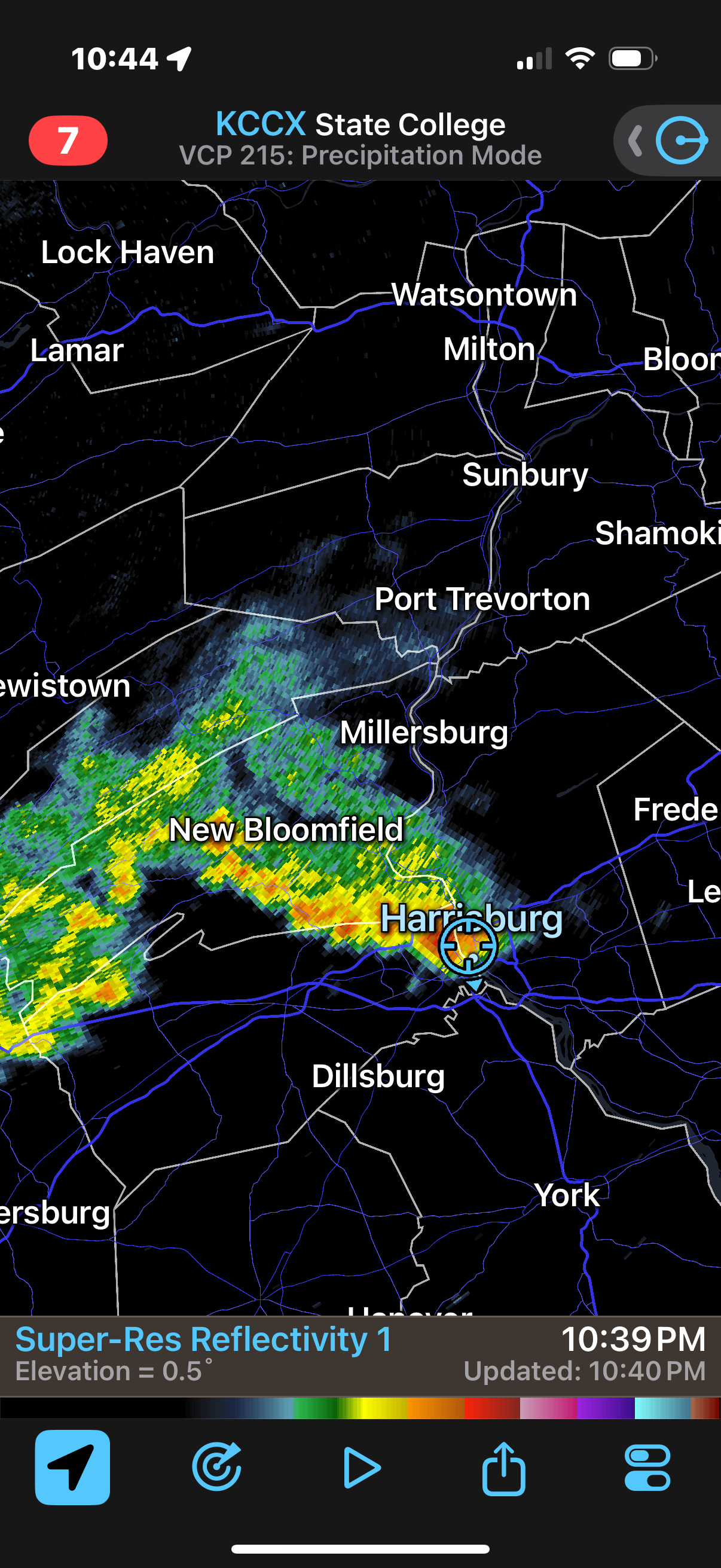
Holy smokes - some actual rain! -
Central PA Summer 2026 Discussion/Obs Thread
canderson replied to Voyager's topic in Upstate New York/Pennsylvania
Driving around with the folks today - same thing I noticed. -
Central PA Summer 2026 Discussion/Obs Thread
canderson replied to Voyager's topic in Upstate New York/Pennsylvania
It’s dying too unfortunately (though we expected no precip today so can’t be too sad I guess) -
Central PA Summer 2026 Discussion/Obs Thread
canderson replied to Voyager's topic in Upstate New York/Pennsylvania
Surprised it didn’t die out before you. Nothing in the city. -
Central PA Summer 2026 Discussion/Obs Thread
canderson replied to Voyager's topic in Upstate New York/Pennsylvania
Well true but if that stuff is what makes you to feel horrible at least you know! -
Central PA Summer 2026 Discussion/Obs Thread
canderson replied to Voyager's topic in Upstate New York/Pennsylvania
Brightside: You have a diagnosis and can learn triggers and all and feel better going forward! -
Central PA Summer 2026 Discussion/Obs Thread
canderson replied to Voyager's topic in Upstate New York/Pennsylvania
It is desperately needed -
Central PA Summer 2026 Discussion/Obs Thread
canderson replied to Voyager's topic in Upstate New York/Pennsylvania
Parents are here this weekend. They’ve been here during the Halloween blizzard, Sandy, Irene and several 100 degree, humid as Houston days. Nice they get a taste of what true PA summer should be. -
Central PA Summer 2026 Discussion/Obs Thread
canderson replied to Voyager's topic in Upstate New York/Pennsylvania
Heat index at my parents house today hit 118. -
Central PA Summer 2026 Discussion/Obs Thread
canderson replied to Voyager's topic in Upstate New York/Pennsylvania
.02 rain and max wind was 44 mph -
Central PA Summer 2026 Discussion/Obs Thread
canderson replied to Voyager's topic in Upstate New York/Pennsylvania
Looks like the winds will stick around through Sunday. Lovely. -
Central PA Summer 2026 Discussion/Obs Thread
canderson replied to Voyager's topic in Upstate New York/Pennsylvania
It’ll be higher in the NW area but big winds for sure