

canderson
-
Posts
25,278 -
Joined
-
Last visited
Content Type
Profiles
Blogs
Forums
American Weather
Media Demo
Store
Gallery
Everything posted by canderson
-
Central PA Summer 2026 Discussion/Obs Thread
canderson replied to Voyager's topic in Upstate New York/Pennsylvania
Dews have to be in the 70s. -
Central PA Summer 2026 Discussion/Obs Thread
canderson replied to Voyager's topic in Upstate New York/Pennsylvania
We are doing a pet delivery service from the store to employee and friend homes. -
Central PA Summer 2026 Discussion/Obs Thread
canderson replied to Voyager's topic in Upstate New York/Pennsylvania
I’d assume the warning was for urban runoff -
Central PA Summer 2026 Discussion/Obs Thread
canderson replied to Voyager's topic in Upstate New York/Pennsylvania
The full sun is ominous today -
Central PA Summer 2026 Discussion/Obs Thread
canderson replied to Voyager's topic in Upstate New York/Pennsylvania
From CTP Rare Heat at Harrisburg: 3 consecutive days with maxT >= 100F from July 2-4, 2026. The last time this streak occurred was July 1999 (2x) and is only the 6th time on record going back to 1888. -
Central PA Summer 2026 Discussion/Obs Thread
canderson replied to Voyager's topic in Upstate New York/Pennsylvania
@Jns2183 Wegmans and the entire silver spring commons has powerI believe. You can kill a lot of time there. -
Central PA Summer 2026 Discussion/Obs Thread
canderson replied to Voyager's topic in Upstate New York/Pennsylvania
It doesn’t but is on generator power. It’s a war zone in HBG and Camp Hill. I think widespread tree damage is more than 2009. We went for a drive to church (Trinity) and realized it has no power of course. -
Central PA Summer 2026 Discussion/Obs Thread
canderson replied to Voyager's topic in Upstate New York/Pennsylvania
Harrisburg with an official wind gust of 63. I think my 68 actually is a bit less than it was just to my S. -
Central PA Summer 2026 Discussion/Obs Thread
canderson replied to Voyager's topic in Upstate New York/Pennsylvania
Reminds me of that storm in 09 that tore up all those trees on the river around the gov mansion -
Central PA Summer 2026 Discussion/Obs Thread
canderson replied to Voyager's topic in Upstate New York/Pennsylvania
2 people died at a campground in Cumberland county - a tree fell into tents. Horrific -
Central PA Summer 2026 Discussion/Obs Thread
canderson replied to Voyager's topic in Upstate New York/Pennsylvania
They have front end loaders on 83 pushing debris out of the lanes -
Central PA Summer 2026 Discussion/Obs Thread
canderson replied to Voyager's topic in Upstate New York/Pennsylvania
The river front is carnage -
Central PA Summer 2026 Discussion/Obs Thread
canderson replied to Voyager's topic in Upstate New York/Pennsylvania
.45” rain Tre crashed into a friend’s truck. That sucks. -
Central PA Summer 2026 Discussion/Obs Thread
canderson replied to Voyager's topic in Upstate New York/Pennsylvania
The PPL outage map is down lol -
Central PA Summer 2026 Discussion/Obs Thread
canderson replied to Voyager's topic in Upstate New York/Pennsylvania
Had a 68 mph wind gust here -
Central PA Summer 2026 Discussion/Obs Thread
canderson replied to Voyager's topic in Upstate New York/Pennsylvania
I just heard a bunch of explosions and our power cycle a ton - thankful for the whole house surge box -
Central PA Summer 2026 Discussion/Obs Thread
canderson replied to Voyager's topic in Upstate New York/Pennsylvania
A significant gust front and heavy rain ongoing. Our power blinked and that never happens No hail -
Central PA Summer 2026 Discussion/Obs Thread
canderson replied to Voyager's topic in Upstate New York/Pennsylvania
Razaaaaaaaaaaaaain False alarm. Had a few sprinkles. Radar lies. Sunny now.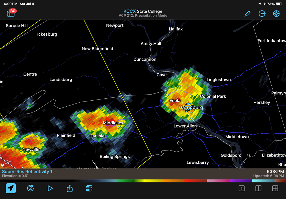
-
Central PA Summer 2026 Discussion/Obs Thread
canderson replied to Voyager's topic in Upstate New York/Pennsylvania
Ohhhh duh. I must have heat stroke today -
Central PA Summer 2026 Discussion/Obs Thread
canderson replied to Voyager's topic in Upstate New York/Pennsylvania
https://www.weather.gov/wrh/timeseries?site=kmdt -
Central PA Summer 2026 Discussion/Obs Thread
canderson replied to Voyager's topic in Upstate New York/Pennsylvania
Edited because I can’t read a chart -
Central PA Summer 2026 Discussion/Obs Thread
canderson replied to Voyager's topic in Upstate New York/Pennsylvania
MDT had already hit 100 today -
Central PA Summer 2026 Discussion/Obs Thread
canderson replied to Voyager's topic in Upstate New York/Pennsylvania
96 at noon. KMdT is at 95. -
Central PA Summer 2026 Discussion/Obs Thread
canderson replied to Voyager's topic in Upstate New York/Pennsylvania
89 at 10:30 am but in feels so much better ahh yesterday at this time. My low was 79. -
Central PA Summer 2026 Discussion/Obs Thread
canderson replied to Voyager's topic in Upstate New York/Pennsylvania
Yeah it’s absolutely miserable. The last two years we have had a hotter summer peak than Austin. Completely normal.


