

dryslot
-
Posts
60,648 -
Joined
-
Last visited
Content Type
Profiles
Blogs
Forums
American Weather
Media Demo
Store
Gallery
Posts posted by dryslot
-
-
-
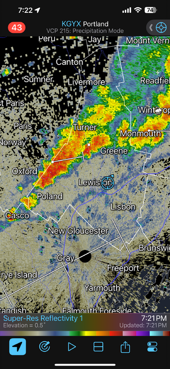
The only cell around and its overhead, Another crappy Saturday.

-
 2
2
-
 1
1
-
-
Been more in then out on sun here today, 75/68°F, TS came thru north of here early this morning and was fringed, Only received 0.04", Been rather dry.
-
On 6/22/2025 at 10:28 AM, alex said:
They also opened a new tramway connecting Cervinia on the Italian side to zermatt on the Swiss side, giving easy access to the ice cave. Very cool!
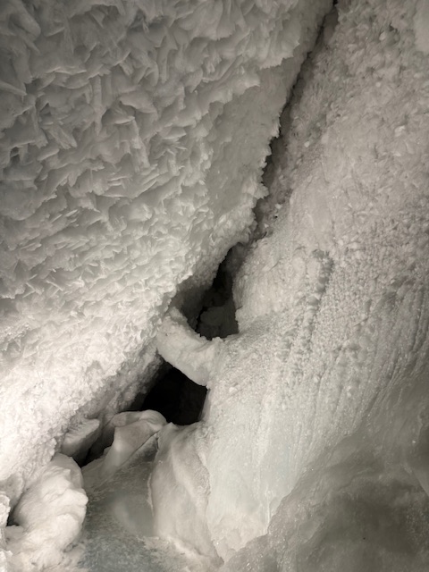
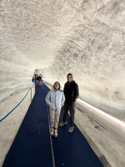
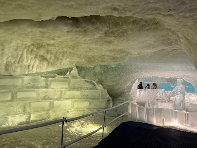
Looks like a very cool place.........
")
-
17 hours ago, CoastalWx said:
S Wey came about from the old naval air base (KNZW) decommissioned in 1997. Used to have obs and all. It was in the southern part of town. There’s N Wey and E Wey and people literally say this when you ask them where they’re from. It’s the same dam town. I’m in the nrn part of town.
No way?
-
 3
3
-
-
EMATT just like winter.
-
1
-
-
66/60F, Very comfortable evening.
-
 1
1
-
-
2 minutes ago, HoarfrostHubb said:
80.2F here for my high.
you are in a torchy spot this yearEMATT.
-
Another failed severe region threat, I am just shocked how this can happen after all the heat humping that’s gone on in here to support it.
-
3
-
 1
1
-
1
-
-
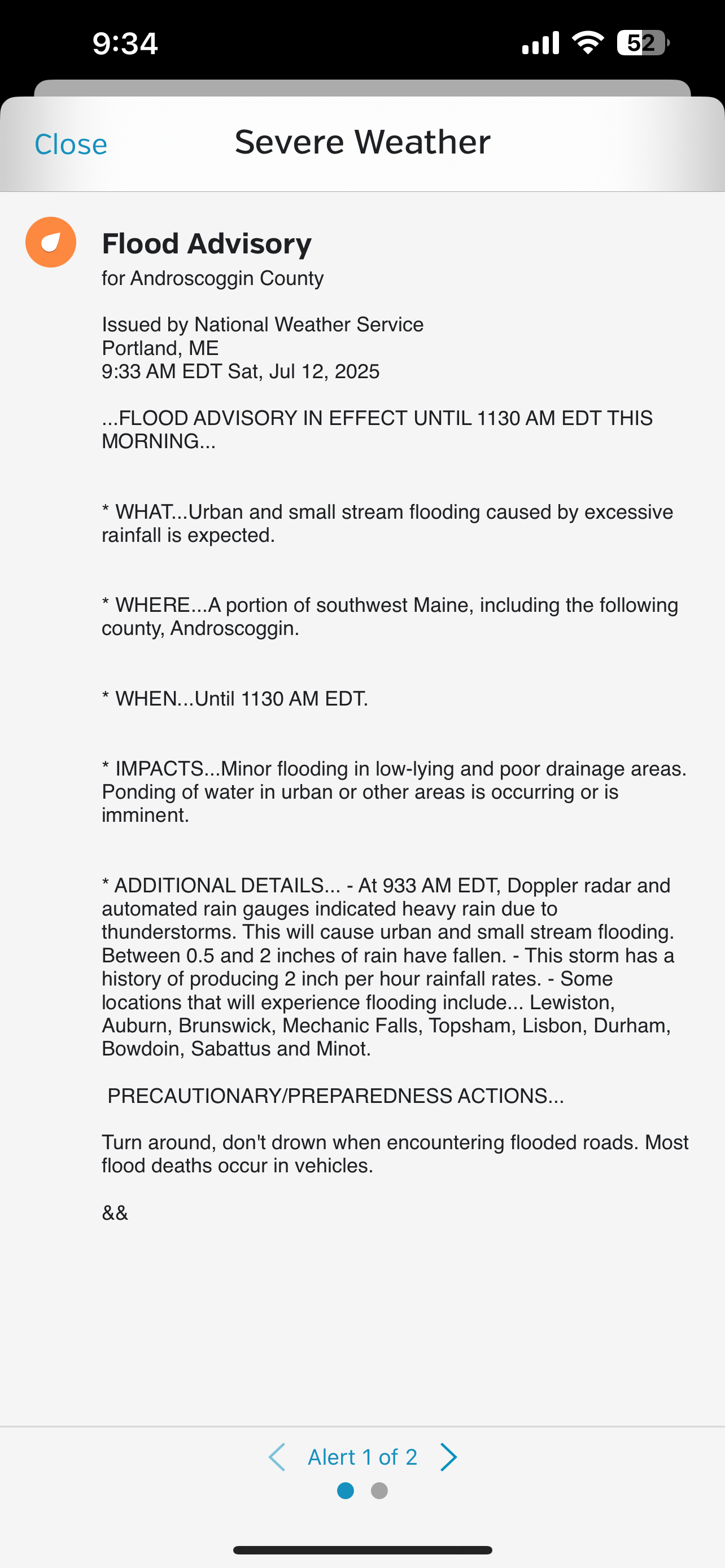
0.11", Pretty meh overall other then some lightning and some strong winds out ahead of the dying cells as it moved thru, Temps took a tumble into the low 60's, 64/61°F.
-
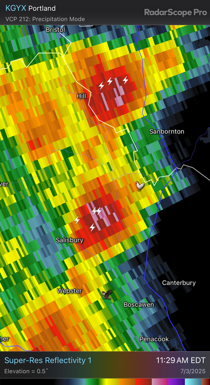
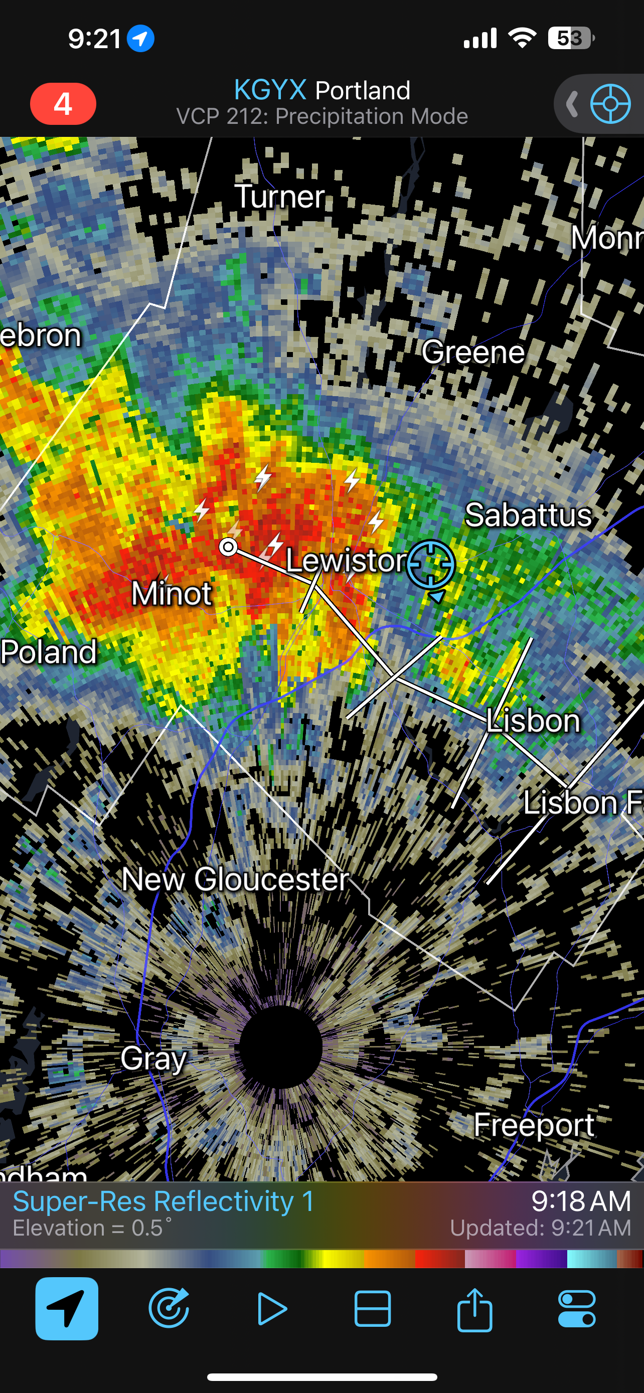
Under a warning now for those cells over the Lakes region moving east.
-
I hope we 7-10 here.
-
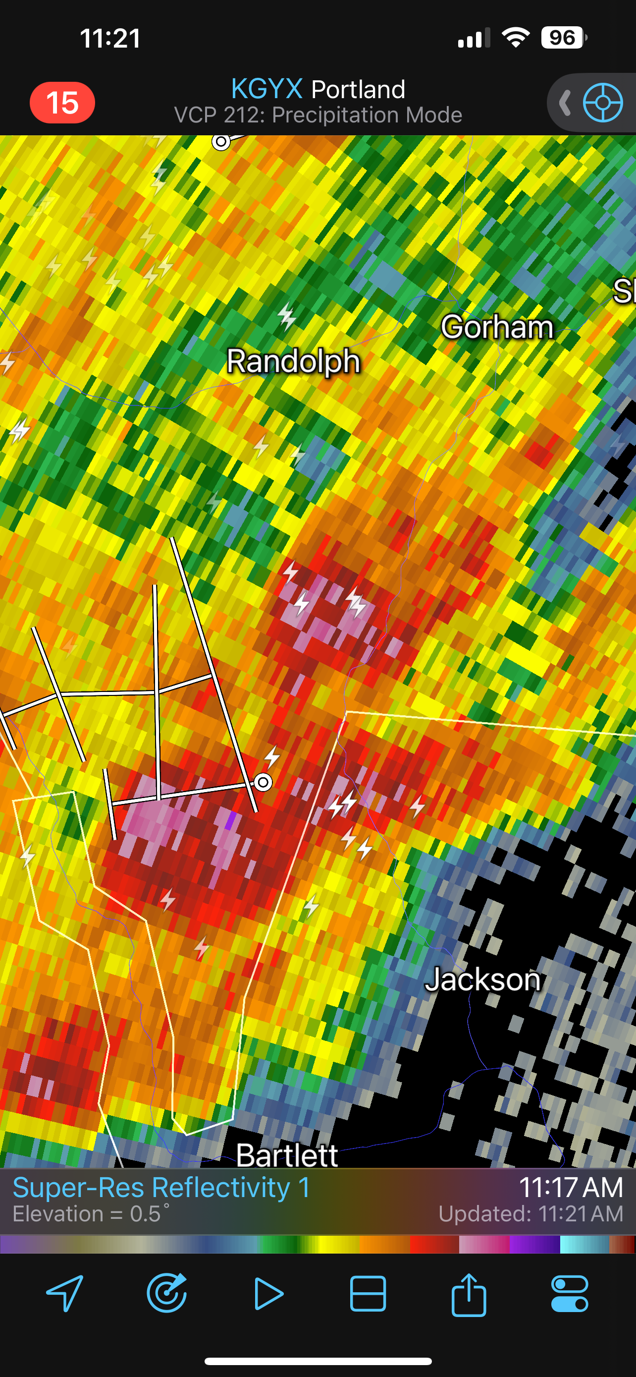
Bethel-Rumford corridor now warned, Healthy cell too near Bartlett NH.
-
1
-
-
5 minutes ago, dendrite said:
Shit I don’t need hail
No we don't need hail.
-
Those cell's near Berlin went severe with some hail in them.

-
Watches hoisted up here.
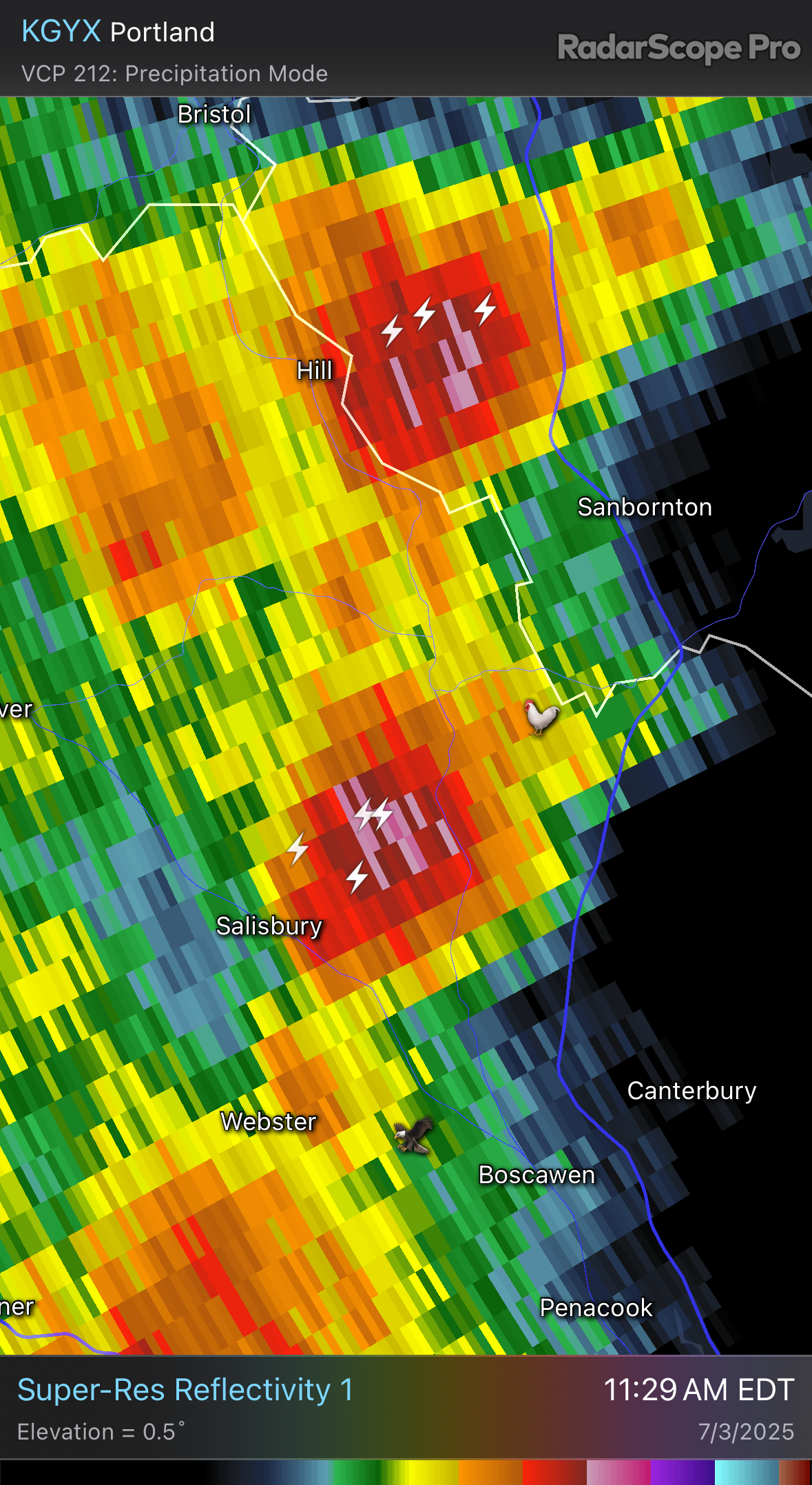
DISCUSSION...Two areas of ongoing convection, one along the ME/QC
   border and the other near the NY/VT border vicinity, should
   intensify as they spread east across parts of New England into
   midday. 12Z CAR sounding sampled a moderate combination of MLCAPE
   and effective bulk shear with convective temperature in the upper
   70s. 14Z surface temperatures have warmed into the upper 70s to low
   80s with abundant insolation ahead of both convective areas. While
   the 12Z HRRR appears to be poorly handling the near-term scenario,
   it does suggest another round of strong to potentially severe
   convection may emanate eastward from ongoing storms across the Saint
   Lawrence Valley near northern NY. A mix of isolated severe hail with
   a predominant threat of scattered strong to localized severe gusts
   producing damaging winds seems probable.
-
1
-
 1
1
-
-
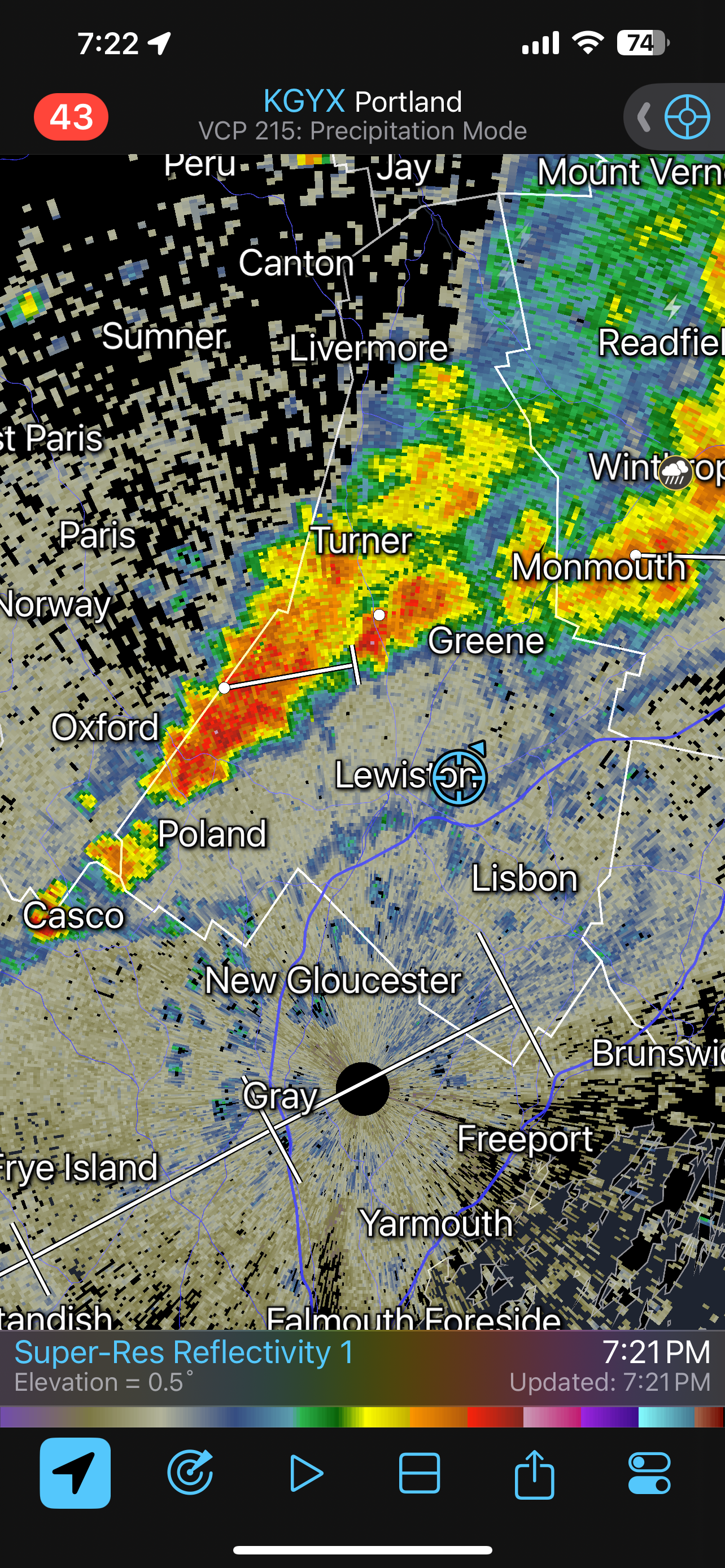
A line of weak cells already pushing into SVT moving E.
-
-
Gust front just came thru ahead of this line about to move thru.
-
85/77°F, Rather Dewey.
-
1 hour ago, CoastalWx said:
I'd rather have every insect gnaw my face off than sit through a Red Sox game. Unless you watch other games.
Its feast or famine and unbearable.
-
GYX, +1.1 departure, A real scorcher for June.
-
1
-
1
-
-
Dragon flies are your friend, They even pick off the horseflies too, It was a mostly cloudy day here with a high of 76°F, Looks like a warm week with some showers up here.
-
3
-
-
My youngest out in the old port with Breton.

-
5
-
1
-

July 2025 Obs/Disco ... possible historic month for heat
in New England
Posted
Best storm of the season, Frequent lightning, Thunder and no warning.