

ILSNOW
-
Posts
1,433 -
Joined
-
Last visited
Content Type
Profiles
Blogs
Forums
American Weather
Media Demo
Store
Gallery
Posts posted by ILSNOW
-
-
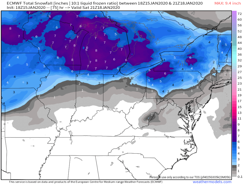
18z euro
-
 1
1
-
 2
2
-
-
8 minutes ago, Chicago Storm said:
wut?
To low for Chicagoland???
-
1
-
 2
2
-
 1
1
-
-
-
12z euro


-
1
-
2
-
-
12z CMC. Tainted with mixed precip
-
1
-
-
6z Euro

-
1
-
-
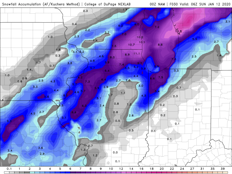
Oz CMC
I think that it includes sleet and is overdone!!!

-
1
-
-
-
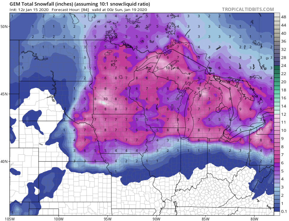
CMC is a little different
-
1
-
-
2 minutes ago, janetjanet998 said:
slow?
Yes and that would not be good
-
18 minutes ago, RogueWaves said:
Believe 18z ticked north. Might be noise level tbh..
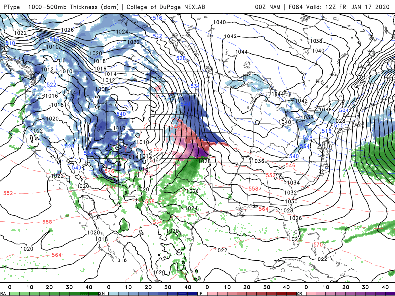
84 hr 0z NAM
-
3 minutes ago, mimillman said:
You need to look at the set up, not just what the 10:1 prints 100+ hours out
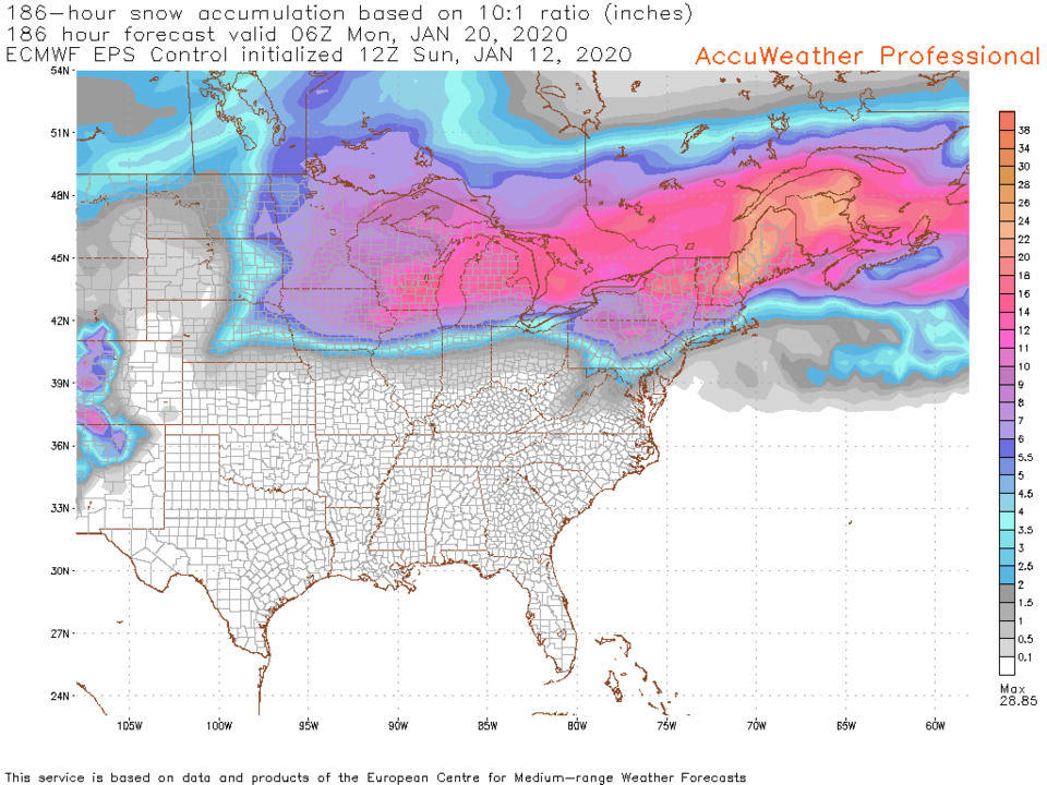
Not making a prediction or a call just sharing a snowmap!!!!
-
3
-
1
-
-
6 minutes ago, StormChaser4Life said:
Yea definitely could slow down.
Well even with it's current track on models today it's still getting accumulating snow well south of I80. But for significant accumulations this south I agree a much more south track would be needed

-
1
-
-
9 minutes ago, Hoosier said:
More or less honing in on a general solution it seems. Thump snow chances best near/north of I-80, fairly wide area gets some ice due to northward progress

-
1
-
-
1 minute ago, A-L-E-K said:
DAB

-
1
-
-
12 EPS
-
1
-
1
-
-
8 minutes ago, A-L-E-K said:
Garbage model
The other garbage model
-
2 minutes ago, A-L-E-K said:
Ride whatever shows a rainer

-
1
-
-
12 minutes ago, SchaumburgStormer said:
Stop me if we’ve seen this before...
A wise old prophet named ALEK would look at this a say 1 word RAINER!!!!
-
National Weather Service Chicago/Romeoville, IL
305 PM CST Sat Jan 11 2020


.SHORT TERM...
305 PM CST

Through tonight...

...Winter Weather...

Our period of heavy snow this evening continues to be main focus
of the forecast this afternoon.

A band of moderate to heavy snow has been ongoing over parts of
western MO the last couple hours. This is the the area in which
the strongest large scale and mesoscale forcing for ascent are
coinciding as the main mid/large scale impulse shifts eastward.
This heavy snow has produced up to 1" inch per hour rates for the
past few hours at KMCI (Kansas City), with a total of 3 inches of
snow within only as mainly hours. Visibilities were also reported
to drop briefly to 1/8 of a mile in heavy snow. Given these
upstream trends, I see no reason why our area will not experience
similar conditions this evening as the main upper level impulse
moves over our area. In fact, the dynamics over our area this
evening could even end up being a bit stronger than those observed
over western MO. This is because the main mid-level trough is
expected to begin to take on a bit of a negative tilt as it
approaches the area this evening. This in turn should help sharpen
the lower level circulation pattern, and result in an enhanced
band of low-mid level frontogenesis. The strong dynamics will
also coincide with a corridor of steeper mid-level lapse rates,
which will also aid in heavier banding.

Overall, while light precipitation has been ongoing across the
area for much of the day, expect more substantial precipitation
to rapidly blossom over the area over the next few hours, as the
better dynamics begins shifting over the area. The precipitation
will likely begin as a wintry mix of sleet, snow and possibly
some rain, especially along and east of the I-55 corridor. The
snow will be moderate to heavy at times, especially between 6 and
9 pm this evening, when 1" per hour rates are likely. North-
northeasterly winds are expected to ease a bit during the period
of heavy snow, though they will likely remain gusty up around 30
to 35 mph, especially near the lake. For this reason, some blowing
and drifting snow could aid in significantly reducing
visibilities for a period this evening. Total snowfall amounts of
3 to 5 inches are likely, with the highest amounts expected right
across northeastern IL. Lighter amounts are likely farther to the
south and east into northwestern IN. The snow is still expected to
tapper off from southwest to northeast shortly after midnight.
-
1 minute ago, Cary67 said:
Light sleet here
Light snow here
-
-
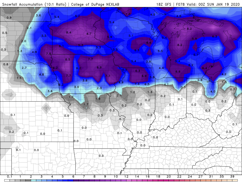
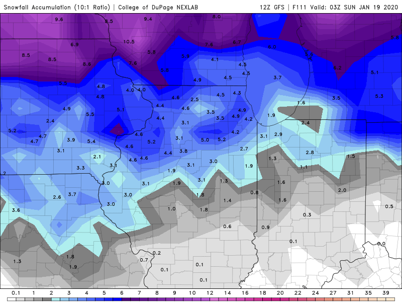
18 GFS
-
1
-
2
-
-


January 17-18 Winter Storm
in Lakes/Ohio Valley
Posted
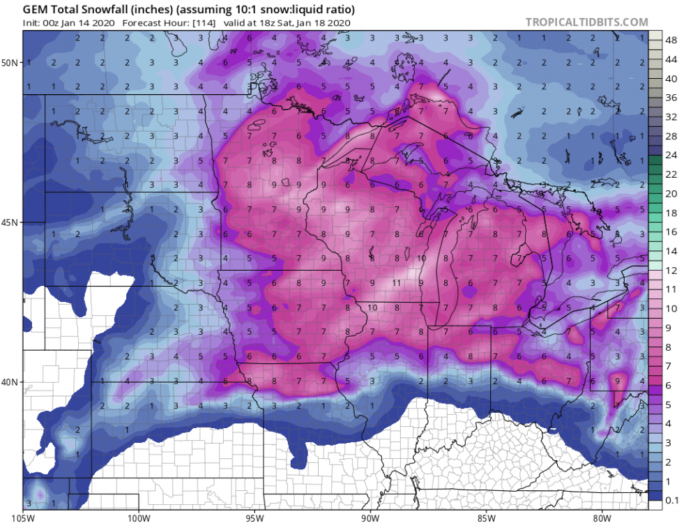
0z CMC going a little crazy