
Ocean Effect Snow Breakout and a Clipper/Coastal Storm next week

Entry posted by USCAPEWEATHERAF ·
1,163 views
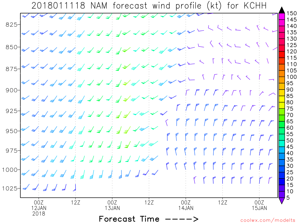
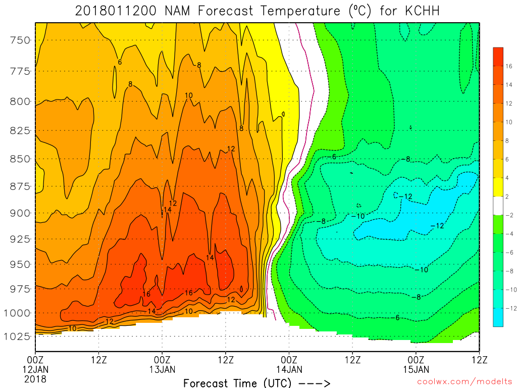
Latest NAM run 00z shows a strong potential for ocean effect snow event from the Cape Cod Canal eastward to Provincetown on northerly winds, also unidirectional wind flow from 900mb to the surface indicates a single band event is probable along with a strong instability burst from 850mb to surface ocean temperature differential (Delta Ts) of 18-20C which is sufficient enough to produce heavy snows over the Cape and Islands. Also the flow is stronger than 10mph which should be sufficient enough for consistent band developing as we transition into a clipper low for the next few days. Big storm potential if the clipper low slows down its movement like the latest 12z guidance suggests at H5 with the low developing and closing off the H5 flow over the Northeast US. This will prolong the snow chances from Sunday morning to Wednesday afternoon for overall snow chances. Stay tuned!
0 Comments
Recommended Comments
There are no comments to display.
Create an account or sign in to comment
You need to be a member in order to leave a comment
Create an account
Sign up for a new account in our community. It's easy!
Register a new accountSign in
Already have an account? Sign in here.
Sign In Now