

tim123
-
Posts
6,682 -
Joined
-
Last visited
Content Type
Profiles
Blogs
Forums
American Weather
Media Demo
Store
Gallery
Posts posted by tim123
-
-
Gfs v3 looks good at hr 30 1 mb deeper over arkansas
-
Keeps roc the same 10 inches at 10 to 1.
-
Gfs looks almost same
-
Gfs pretty much same
-
Nav gem is the worst model I think. It's always out to lunch
-
Icon Looks like euro actually
-
Icon actually gives roc a .25 bump in precip. 1.25 from 1 inch last run
-
Icon looks better than last run
-
I notice sometimes the nam plays same cha cha as globals from a day or 2 before.
-
 1
1
-
-
It looks like ukmet from 2 days ago.
-
Toggle the precip map from this run to last one huge difference in precip field. It comical
-
Not to worried. Even that crap run still gives roc near a inch of liquid
-
Nams goin to nam.
-
These short range models tend to jump around alot after 36 to 48 hours.
-
23 minutes ago, CNY-WXFREAK said:
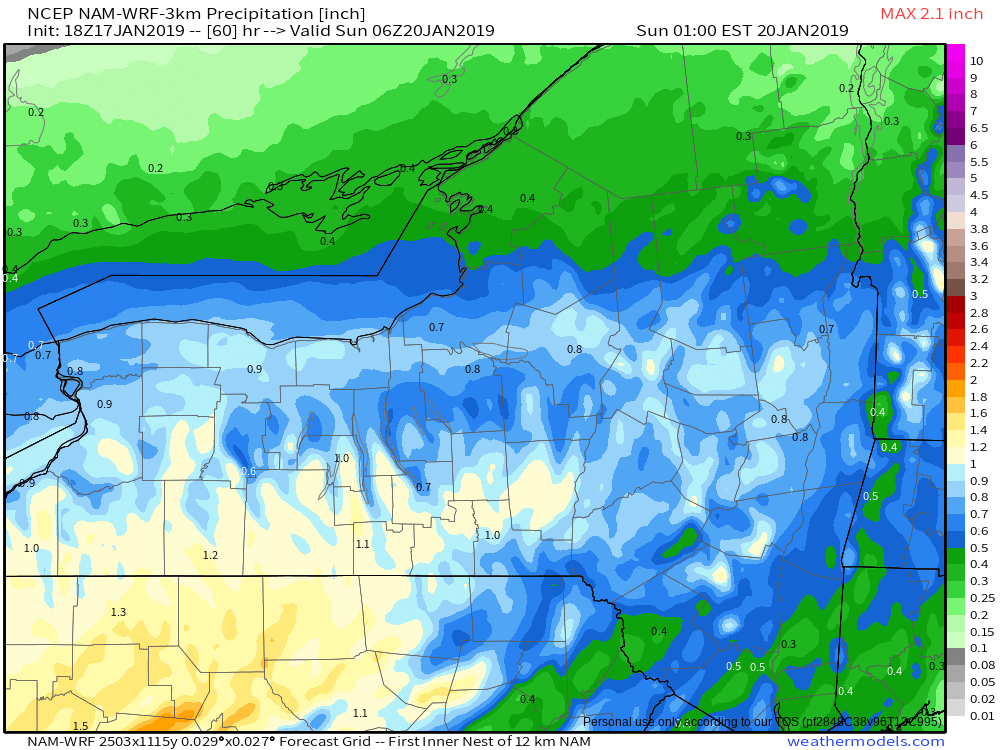
My bad wrong image. Here it is.
Can you post 00z run when it's out?
-
Ok. Thanks. Wow yeah could double those numbers
-
Is o6z sunday 12 am sunday?
-
Good luck to all first big one of season. Hope for many more. My first call buf 17 roc 22 syr 20
-
 1
1
-
-
I know ontario is upper 30s to 40. Tons of fuel for ne winds
-
Yeah sit for a couple days over Burlington vt.
-
1 hour ago, brentrich said:
Hi guys, I'm new to this forum. I wanted to see how is it looking in Henrietta, NY for this storm. Any idea how much we will be getting? (in Rochester, NY area)
Welcome. Walworth her good to have a fellow Rochester poster
-
Kuchera method. Oh ok. The ku method is what confused me
-
4 minutes ago, CNY-WXFREAK said:
And another 3-6 on Monday, nice!
For who?
-
1 minute ago, CNY-WXFREAK said:
Who has the KU method for the EURO Wolf cause it applies in this case?
Whats ku method and why does it apply
-
1
-
Upstate/Eastern New York
in Upstate New York/Pennsylvania
Posted
Hate the way the gfs v3 loads. Skips frames. Important ones. Lol