
lookingnorth
-
Posts
473 -
Joined
-
Last visited
Content Type
Profiles
Blogs
Forums
American Weather
Media Demo
Store
Gallery
Posts posted by lookingnorth
-
-
While the heat has eased up somewhat the past few days (thankfully), we could really use some rain. Most of the state has not seen a drop of rain in the past two weeks. Most of the OKC metro has seen less than an inch of rain in the past seven weeks. We haven't even had a cloudy day in quite some time. The long stretches of hot, dry, sunny weather really get to me after a while.
-
 1
1
-
-
The lower humidity today made it feel almost nice, despite a temperature of 96° and dewpoint still at 66°.
It's been a hot summer in the OKC area, but not as bad as last year. We're only at thirteen 100-degree days, compared to last year's 24, and far from the 2011 record of 63.
-
Regardless of whether or not the sea ice values are normally distributed in a natural climate state (it's not something I've really looked into), this year is still clearly below all the other years in the satellite dataset for this time.

-
 1
1
-
-
I like the topic idea. I am enrolled in a course on atmospheric radiation currently, and it is interesting learning about how aerosols influence atmospheric conditions. I have heard it claimed that the May 20, 2019 severe weather outbreak was weakened due to dust aerosols from further west. But I'm not a huge expert on the topic.
I've also heard it said that switching from coal to natural gas may not be as beneficial in reducing climate change as people had hoped, because the aerosols from coal combustion help cool the climate and counteract some of the CO2 emissions from burning coal. But those aerosols still have negative direct effects on human health, so it is still better to switch.
-
It looks like Raleigh and Greensboro both wound up with a trace as per the official records.
-
16 hours ago, Chinook said:
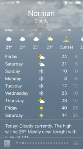
confirmed tornado passed US77 highway on the south side of Norman
That thing hit about a mile from my house. I know some people who sustained minor damage from the tornado. Luckily I was okay and avoided any damage and didn't even lose power.
-
1
-
-
Dewpoints are pushing 60 across most of Oklahoma currently. That's solid moisture for this time of year.
-
I got a slight glaze but nothing substantial.
-
It looks like the most recent runs of the NAM and HRRR have cut back somewhat on the precipitation amounts for the OKC area tomorrow night.
-
1
-
-
For the Monday event, the NAM has been consistent in showing snow over western Oklahoma, with less in the OKC and Tulsa metros. NWS Norman mentioned a lot of uncertainty in their morning forecast discussion.
QuoteAn early season winter weather event still appears on track to affect the area on Monday, but there are still a number of key details to be worked out regarding where and how much snow will fall. Models agree that a compact shortwave will move quickly eastward into west Texas Monday morning, with ascent increasing rapidly in our area as it does so. The shortwave will be weakening over time as it phases with broader closed low to our north, with forcing decreasing quickly near or after 21z Monday across much of the area. Therefore, the vast majority of precipitation is expected to fall during the daytime on Monday, with a fairly brief (3-6 hour) window for snowfall at any one location. There has been a southward shift in much of the model guidance over the last 24 hours, along with a trend towards a weaker shortwave as it crosses into Oklahoma. Most hi-res model guidance has converged on a swath of heavier QPF from western/west-central OK southeastward into southern OK, while the ECM/GFS and their respective ensembles remain a bit further north and east centered more along the I-40 corridor. With thermal profiles initially too warm for snow outside of northwest Oklahoma and surface wet-bulb temperatures at or above freezing, heavy precipitation rates will be needed to cool the column sufficiently for accumulating snow. Therefore, the placement of this band will likely be the key determining factor for who sees several inches of heavy wet snow and who sees little more than a light rain/snow mix with minimal accumulation. We have adjusted our snowfall forecast southward from the previous forecast and increased amounts within the band of heavier precipitation, though our forecast is likely too broad with accumulating snow (especially across north-central Oklahoma) and may be too conservative on maximum amounts due to remaining uncertainty. As of now our highest amounts (2-3") are across northwestern OK southeastward into central OK, but it is possible further adjustments southward will be needed if trends continue. Of note, many of the latest hi-res models produce little to no snow accumulation for portions of central and north-central Oklahoma, including parts of the OKC metro, as the heavier precipitation fails to make it north and east during the day Monday before forcing wanes. All in all, forecast confidence remains low and users are advised to check back for further updates.
-
Some places might be close to record highs tomorrow, for the second time this month.
-
On 8/27/2021 at 11:56 AM, Powerball said:
How many other years, besidea 2004, has OKC not hit 100*F+?
DFW has only had 6 so far, and they all occured in that late July / early August period.
I now know better than to say it won't happen for sure, especially with the help of subsidence behind Ida next week, but it is getting increasingly less likely that DFW will see any more 100*F+ days this year.
19 other years
-
1
-
-
On 7/22/2021 at 8:03 PM, Powerball said:
Yeah, this won't age well. Going down in flames (figuratively and literally).
It still hasn't happened in OKC. It would be the first time since 2004 if we make it the whole summer without hitting 100.
-
1
-
-
4 hours ago, TimB84 said:
But isn’t Chelan County in Washington? Even so, 119 would still be a state record.
I didn't even see that the second half of the list was for places in Washington.
-
1 hour ago, donsutherland1 said:
000
NOUS46 KOTX 300126
PNSOTX
IDZ001>004-026-027-WAZ031>038-041>044-301326-

Public Information Statement
National Weather Service Spokane WA
626 PM PDT Tue Jun 29 2021

...PRELIMINARY HIGH TEMPERATURE REPORTS...

Location                     Temp      Time/Date       Provider

...Idaho...
...Chelan County...
3.6 SE Ardenvoir             119 F     0130 PM 06/29   HADS
1.2 S Peshastin              119 F     0345 PM 06/29   HADS
If those 119's are verified, that would be a state record for Idaho, right?
-
1
-
-
18 hours ago, donsutherland1 said:
Weather summary
for British Columbia
issued by Environment Canada
at 5:36 p.m. PDT Monday 28 June 2021.

Discussion.

The following data is preliminary and will be updated later tonight

The following areas will have set a daily maximum temperature record
on June 28, 2021:

Abbotsford Area (Abbotsford A)
Preliminary new record of 42.9
Old record of 32.4 set in 2008
Records in this area have been kept since 1944

Dawson Creek Area (Dawson Creek A)
Preliminary new record of 38.1
Old record of 27.8 set in 2015
Records in this area have been kept since 1926

Gibsons Area (Sechelt Aut)
Preliminary new record of 40.1
Old record of 29.6 set in 2008
Records in this area have been kept since 1949
Looks like some places broke their daily records by over 10°C!
-
1
-
-
It looks like the hot Northwest/cool Southern Plains setup will continue for the next couple weeks.
-
It looks warmer than average and uneventful for the near future.
-
On 2/19/2021 at 12:46 PM, jojo762 said:
After the time period that JoMo mentions, it sure looks like winter could just about be over. Longer-range guidance, as well as CPC indicates that we’re in store for some nice above-average temps in March.
What was the CPC showing for February?
-
1
-
-
It's bizarre seeing it run 15-25 degrees warmer than the GFS from 96-168 hours out. It would be a pretty wimpy cold snap if the Euro verified, not even the coldest we've seen this winter.
-
On 12/13/2020 at 10:46 AM, Leitwolf said:
The adiabatic lapse rate is the key component of the GHE. Regrettably I do not seem to fully understand it and so I need to ask for help.
The average lapse rate on Earth is about 6.5K/1km. The "dry" lapse rate however is said to be 9.8K/km. So vapor (and the latent heat it transports) reduces the lapse rate significantly, in this way it also serves as a kind of anti-GHG. I mean if we understand the GHE as a combination of an elevated emission layer (photosphere) where we have 255K and the adiabatic lapse rate, which produces higher temperatures at the surface. Anyhow, the exact impact of vapor on the lapse rate is a key question.
Now I found this sightly confusion chart on the subject on wikipedia. There are some things I understand, and some things I don't. For instance we have lines for altitude (scale on the right) which are sloped. That is to be understood relative to the left scale of pressure, meaning with cold air pressure will decrease faster with altitude, as it has a higher density.
https://en.wikipedia.org/wiki/Lapse_rate#/media/File:Emagram.GIF
Now if I look at the bold line for the dry adiabat, for instance the one starting at 20°C, it intersects the 5km line at roughly -24°C. That are 44K for 5km, or 10.8K/km, significantly more than the 9.8K quoted before. Assuming the chart is right, what causes this difference? Is it because the troposphere is naturally unstable and heated at the surface, so to say?
Then the "wet" lapse rate starting at +15°C intersects the 5km line at about -14.5°C, meaning a delta of 29.5K or 5.9K/km. +15°C roughly corresponds to the actual surface temperatures on Earth, yet 5.9K/km is significantly less than the quoted 6.5K. Why is that? Is it representing a more theoretical perfectly wet atmosphere with a 100% H2O saturation??
I have no idea why the dry adiabatic lapse rate is so great in the chart. I've only ever used Skew-T log-P charts, not emagrams. However, the moist adiabatic lapse rate varies significantly based on temperature, and 5.9K/km is well within the range of possibility. The average environmental lapse rate is not the same as the average moist lapse rate because sometimes the atmosphere will be dry adiabatic, sometimes there will be an inversion, etc. But since the atmosphere is often moist adiabatic, the two happen to be similar.
-
On 11/1/2020 at 12:56 PM, bdgwx said:
It's complicated. First understand that this is not entirely unexpected. In fact, the IPCC AR5 WG1 prediction for SH sea ice, although significantly more uncertain than predictions for the NH, shows a slight preference for increases through about 2030 with the possibility of record highs persisting even through 2060 before things turn south (pun intended) down there too. I must caveat that by saying the uncertainty envelope does include the possibility of the secular decline starting around 2020 as well. The unfortunate state of affairs with SH sea ice is that our understanding of its behavior in a warming world is still quite nebulous compared to our understanding of NH sea ice behavior. Second understand that the see-sawing of temperatures and sea ice between hemisphere has been shown to occur during previous significant climatic change events so it is not unprecedented nor is it inconsistent with climatic shifts.
Anyway here are some things to consider...
- The NH is characterized by ocean surrounded by land whereas the SH is land surrounded by ocean. This trivial fact accounts for the bulk of the differences between NH and SH sea ice behavior. The consequences of this can be quite dramatic and contradictory between the NH vs. SH.
- A positive phase of the Southern Annular Mode (SAM) is associated with increasing SH sea ice. Global warming tips the SAM toward a positive phase.
- ENSO negative/positive phases reinforce positive/negative SAM phases.
- The Montreal Protocol through its ban of CFCs, repair of stratospheric ozone, associated cooling tendencies and other effects on weather patterns has been linked to SH sea ice increases.
- Increasing GHGs actually have a cooling effect on the Antarctica continent itself especially during the SH winter when the upper atmosphere is often warmer than the surface. Remember, GHGs act like a thermal barrier preventing IR radiation from passing through. This causes the warm/cool side of the barrier to warm/cool further. Positive/negative lapse rates get more positive/negative. Antarctica often has a negative lapse rate during the winter so GHGs cause cooling at the surface and warming in the upper atmosphere. This effect (among others) suppresses polar amplification in the SH.
Disclaimer...I'm not well informed regarding SH sea ice so hopefully others who know more about the behavior down there can chime in on points I've missed or mischaracterized.
The main take away here is that sea ice is mainly a NH issue right now. Most scientists do not expect NH-style declines in sea ice down in the SH anytime soon. And the fact that the SH responds differently than the NH is probably more the rule than the exception.
I'm not an expert either, but I did a class project on it last spring and that's basically what I found. The change in lapse rates thing is new to me, but it makes total sense.
-
I'd say a rough value would be a few hPa (few hundred Pa) per hour.
Here's a good resource to download ASOS data from a variety of sites around the world. https://mesonet.agron.iastate.edu/request/download.phtml
I suppose this might be a little late for your project, but you may find it helpful for future reference.
-
On 6/17/2020 at 8:29 PM, WinstonSalemArlington said:
When is the earliest fall high in the 50s?
September 13.
Texas/Oklahoma 2023 Obs and Discussion
in Central/Western States
Posted
It's up to 102°F in OKC and 103°F in Norman, the hottest September temperatures here since 2012, and the hottest I have personally experienced as I was living in North Carolina back in 2012.