

snowdude
-
Posts
755 -
Joined
-
Last visited
Content Type
Profiles
Blogs
Forums
American Weather
Media Demo
Store
Gallery
Posts posted by snowdude
-
-
22 minutes ago, CAPE said:
Must have done pretty well with the anafrontal deal yesterday. Barely a coating here but the radar looked better down that way. Hopefully you see an inch or 2 at least. Snow at the beach is pretty cool.
Yeah from Salisbury to OC and points south got about 1-2 inches of snow with that front yesterday. More tonight!
")
-
 1
1
-
-
Good idea to issue the advisory tonight to be safe. Even if temps climb above freezing which they’re supposed to do very late tonight, any rain/drizzle that falls can still freeze on contact since ground temps are now below freezing due to snow cover. Especially on untreated areas.
Also, I’m hoping for more snow Thursday night! I like what models are showing so far. I’ll take the 18z GFS.
")
-
3
-
-
2 minutes ago, alexderiemer said:
Did you see the snow map? Total crap o know, but something like 17" for GED
Sent from my SM-G975U using Tapatalk
Yeah I saw. Haha. A lot of tonight’s runs are showing high totals like that. That tells me it’s going to rip! Although some of that in SBY is sleet. But I’m excited! Hopefully temps crash.
-
1
-
-
New 00z GFS! Geez! This is going to put down some great rates when that deformation band gets going.

-
1
-
-
I’m getting excited!
-
3
-
-
Not holding my breath, but we should also watch the potential for backend snow Friday evening as the coastal low pulls away. RGEM showing a death band, and the Euro shows a similar scenario. Lol.
Before that though, lots of sleet looks likely Thursday AM before changing to rain.
-
3
-
-
35 minutes ago, PrinceFrederickWx said:
I was growing up in Glen Burnie for the '94 ice storms- I know there were several, but the big one for us was the January one followed by the "Big Chill of '94" which made it impossible to clear the ice or even leave the house. I was off school for almost two weeks.
The big one in Southern MD and the Eastern shore was in February, which was even worse from what I read (it actually got a federal disaster declaration).
I grew up in northern VA and I remember a couple good ice events in the 90s. Can’t remember exact dates but I’m pretty sure ‘94 was one of them.
-
3
-
-
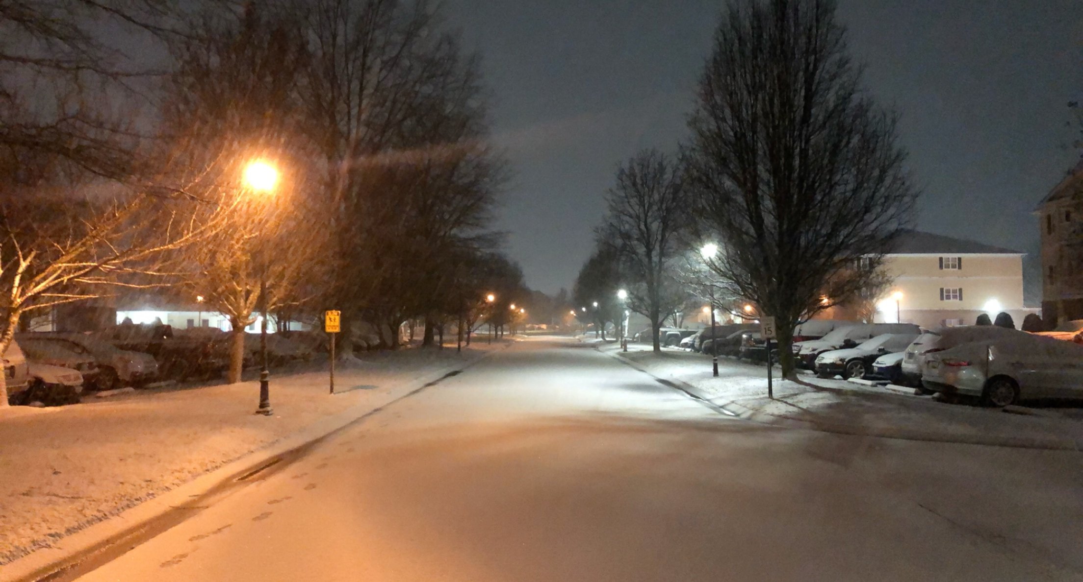
Gorgeous snow here in Salisbury. Went for a stroll at 2am.

-
2
-
-
Just now, alexderiemer said:
Maybe it's the main thread rubbing off on me, but I'm getting frustrated
Sent from my SM-G975U using Tapatalk
I’m frustrated too! It’s really unbelievable how bad the models have been..
-
2
-
-
It’ll probably snow. And I’m hoping the Thursday night system bumps a bit more north. Definitely possible. I have Salisbury in 1-2 inches, and areas south 2-4.
-
1
-
-
00z Euro holds course!

-
3
-
-
00z run of the NAM lookin good. And still snowing...
-
1
-
-
5 minutes ago, alexderiemer said:
Glad to have you back bud! Bring it home, I'll even switch from wboc for this!
Sent from my SM-G975U using Tapatalk
HAHA! You BETTER! We’ve nailed pretty much every storm so far! Very proud of our team!
-
I’m here, I’m here, I’m here! Sorry for being MIA. Total snow for the season in Salisbury is around 7 inches now! Let’s add more to it! Wednesday night-Friday is looking intriguing! The EURO and NAM look kind of similar. When they agree, that’s good. The good ol’ EE rule. EURO & ETA (now the NAM).
-
3
-
-
New 00z EURO.
-
1
-
-
Time to wake up southern Maryland and eastern shore! ❄️
-
1
-
-
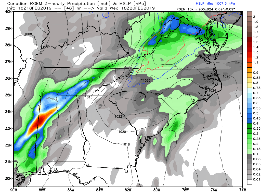
NONE of the models are catching on to how juiced the radar is and how far east the moisture has made it already. Mount Holly mentioned this in their discussion and I posted it earlier. Radar looks very good right now. Definitely something to keep watching in terms of snow intensity and arrival time of moisture.
-
7
-
 1
1
-
-
3 minutes ago, yoda said:
Would this mean an earlier start or heavier precip at the start due to increased banding? If it meant something?
I believe they’re hinting at an earlier start. But I can also see a more organized system meaning more precip. But again we’ll see.
-
1
-
-
Interesting observation from Mount Holly. Maybe models underdoing the initial banding lifting north, especially eastern edge? Or maybe it means nothing.
...930 AM Update: No changes made yet to the forecast for this
period, as we are waiting to see more of the 12Z guidance.
However, it is interesting to note that the current
precipitation shield extends further east (across the Carolinas)
than what the models had depicted. I am not sure this will
result in any significant changes for our area as models already
had the precip extending across our region by late tomorrow. We
will have a complete update on this system with the 4 PM update.
-
2
-
-
30 minutes ago, Wonderdog said:
Isn't this just an expanse of the precipitation field?
Yes. The snowfall totals and precip shield shifted.
-
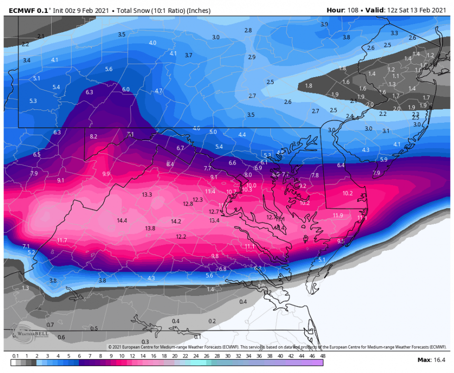
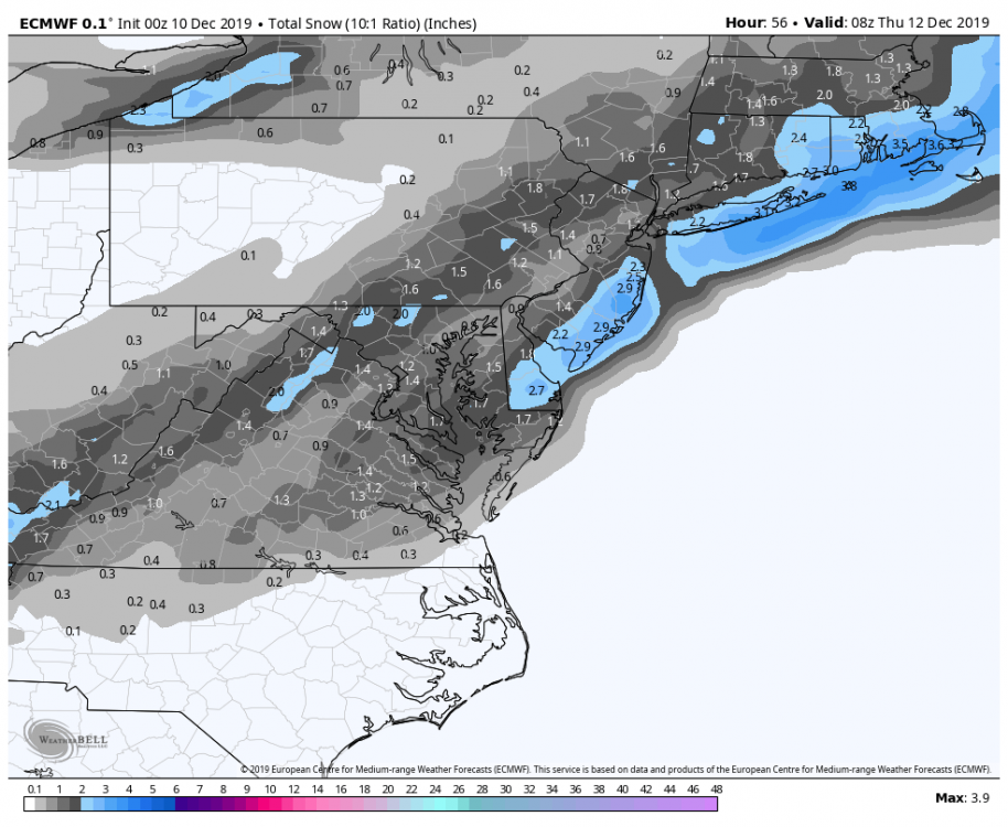
26 minutes ago, BornAgain13 said:
Can you show southern VA from this map?
-
5 minutes ago, Deck Pic said:
18z ECMWF came south, even if not significantly
I'd say that's a pretty decent shift south and east.
12z and 18z below:

-
11
-
3
-
-
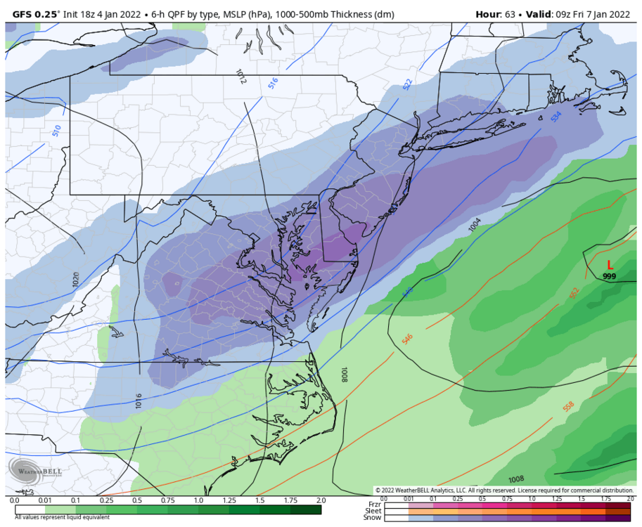
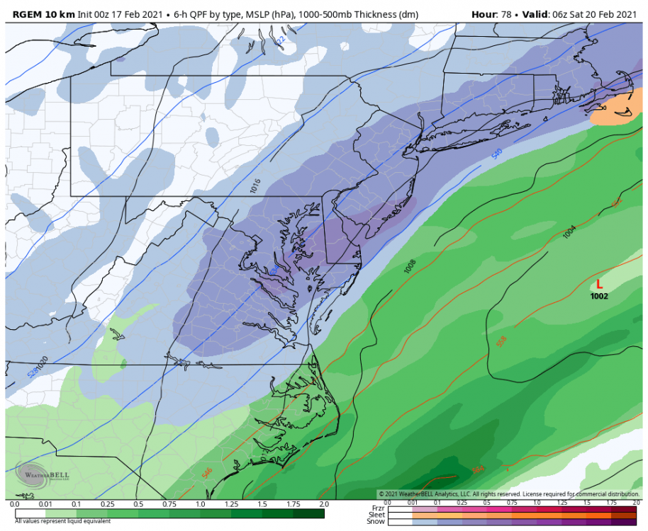
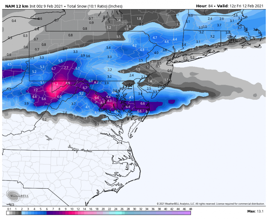
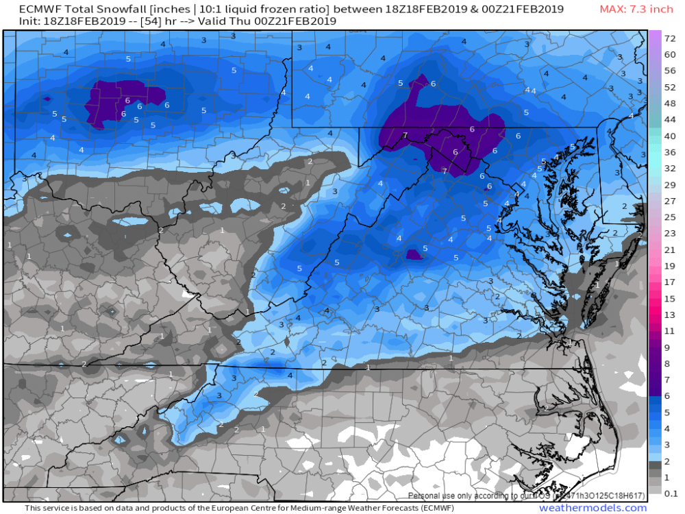
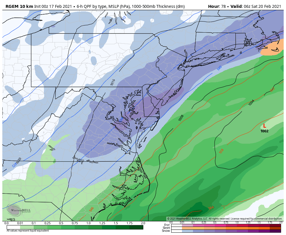
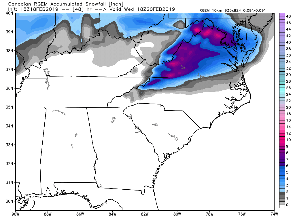
18z RGEM snowfall through 1 PM Wednesday.


-
6
-
-
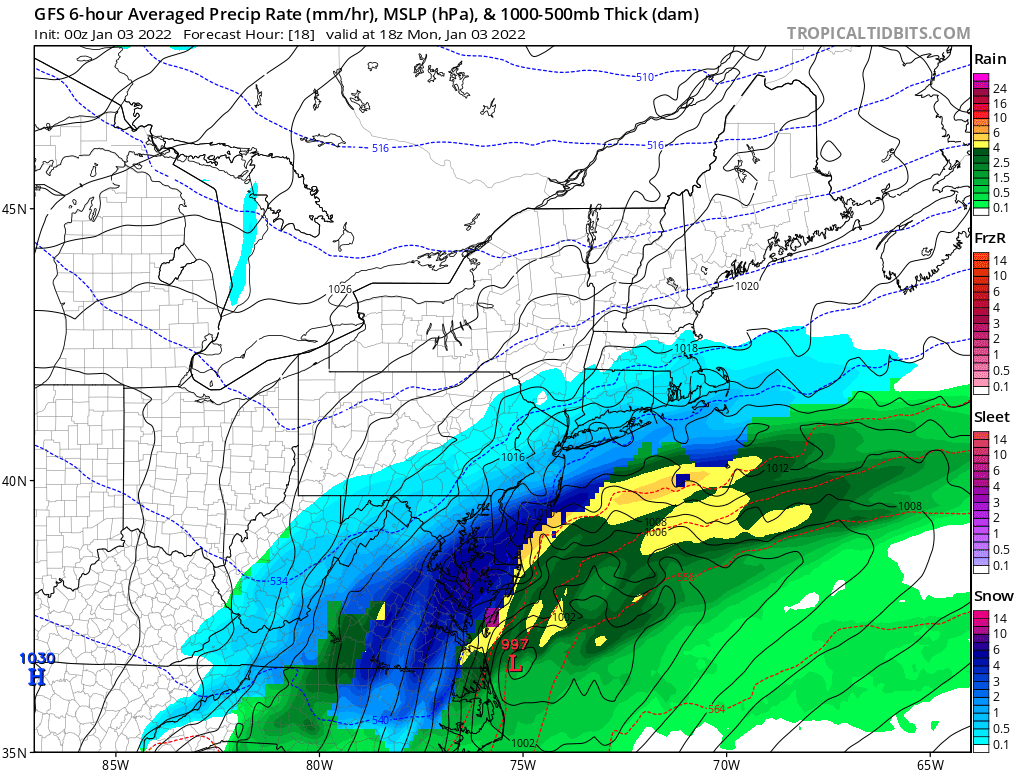
32 minutes ago, jaydreb said:
Ukie anyone?
Even slower with precip. Hardly anything around at 12z Wednesday. I can’t see temp maps or snow maps so not 100% sure but it does not look good when you compare to 00z.


Jan 21 - 22 Weekend SE VA and Eastern Shore Snow
in Mid Atlantic
Posted
Post your snow totals! Would love to see them. I’m the local ABC Met here in SBY. Enjoy the snow!