

TugHillMatt
-
Posts
10,356 -
Joined
-
Last visited
Content Type
Profiles
Blogs
Forums
American Weather
Media Demo
Store
Gallery
Posts posted by TugHillMatt
-
-
8 minutes ago, MJO812 said:
Gfs is nice in the mid to long range
Wow, you went at least 5 minutes without "snow"man weenieing you. So petty... lol
-
 1
1
-
-
40 minutes ago, Bubbler86 said:
No offense to any poster but we are good at pointing out the issue of the day and complaining about it. I agree that we get plenty of sun here on a yearly basis.
When the weather is boring, it's easy to get annoyed. As an avid winter lover, I remember many sunny, windy days of looking to the skies NW of Lancaster and watching the puffy lake effect clouds evaporate into thin air. I am the opposite of most people, and hated the weather in Lancaster. So hot in the summer and mundane, blustery days in the winter.
31 minutes ago, Atomixwx said:
I hate how little sunshine I see up here.
Sent from my motorola edge 5G UW (2021) using Tapatalk
Yeah, the winters in Clearfield county are quite similar as far as cloudiness. Those clouds form and get hung up along the ridges.
15 minutes ago, pasnownut said:Yeah anywhere downwind of the lakes, can be quite cloudy during cooler periods when winds are outta the W/NW. We see it at the cabin as well (maybe not as pronounced mind you) - but its no joke. While I love those episodes, i could understand the mental wear n tear it may have one ones well being if I lived there.
whatchu end up w/ from this recent event?
People get absolutely miserable here. Snow helps to brighten everything up and it used to be very common in the Great Lakes region. Lately...........
Are you asking about last week's event? I got about 4 to 5 inches of snow that hung around a couple days before the weekend warmup. (I'll see if I can post a few pics later.)
6 minutes ago, pasnownut said:you "lake enhanced" folk live in a different world from many of us southers. Your statement is not a complaint...just a fact. As you know, my best friend grew up near you, and after moving down here, he said he loves it....cause "the sun shines down here" and that during colder periods, he'd shovel/wisp snow from cars/driveways many days from Nov/March.
Yeah, most of the people I know from DuBois who move go to Lancaster. I did the opposite. I had never experienced what it was like to have doors freeze shut during the day or have to brush snow off the car multiple times in one day until moving up there. The summers were glorious as well, with MUCH less humidity than Lancaster. Although, I've noticed even the mountains are now getting 90 degree days with whatever this new climate is.
-
 1
1
-
-
3 hours ago, Jns2183 said:
Will there be any sun today
Sent from my SM-G970U using Tapatalk
Some of you guys would be tortured if you lived somewhere like Upstate NY during the cold season months. It is SO CLOUDY here from November through March. We can go weeks without a day of sunshine. There's a reason so many take extra vitamins...including myself... The Lower Susq. Valley actually gets quite a bit of sunshine compared to other locales. Those NW winds off the mountains do their magic...
-
2
-
-
53 minutes ago, pasnownut said:
Hey Matt. Hope all is well up north. We are a pretty decent bunch, and are typically cool about outsiders comin in to chat up weather. I'd say most of us are totally cool w/ that, but of late there's been a decent amount of trolling by a few, and its just gettin under some of our skins. You've been here and know how we roll. I guess a few of us (maybe I'm one of the aholes...dunno) are just calling it out, and trying to keep the chill vibe flowin and not muddied up (like some of the other retional forum threads). I weed through tons of sports chatter to find weather snippets, and as many here are sports junkies, I roll w/ it as its not my board, but if/when we start chattin up weather and get trolled or are told to "wait till the storm happens" so that the same poster can tell us daily about warm climate stats...I hope you see the point.
If we want to have off topic banter, we should separate threads, but that's also been shot down, so we have one big basket that all of our chat falls in, and if that's how its gonna roll....sometimes ya just gotta take out the trash. That's all.
Lookin forward to seeing more of your posts in the winter months.
Hey, weather brother. You are absolutely NOT one of those aholes. The fact you took the time and thoughtfulness to write back proves that. I have always enjoyed your conversation. I am glad you guys are still able to do that, as we were no longer permitted to do so. (Although Bx sort of threatened it.) You have any plans to go up to the Northern Tier to find more winter this upcoming season?
42 minutes ago, Bubbler86 said:It has been an unpleasant week but always enjoy your contributions.
Thanks, Bubbler. I look forward to discussing our local mulch-whiteners this upcoming season!
 37 minutes ago, Atomixwx said:
Please feel free to post more here. I mean, if I *have* to scroll past the local weather rundown at Bam Margera's house, I'd be more than happy to read about the goings-on in the upstate. In fact I'd prefer it.
I know, I could always visit, but @canderson travels so much in real life that we pleebs can't even travel digitally to offset his movements, so I'm stuck here.
I'll put a gate in the wall for folks like you.
Sent from my motorola edge 5G UW (2021) using Tapatalk
The real question is...will you give me the key?
") The wife and I will be coming to your neck of the woods a couple times throughout the winter to visit our family and friends in DuBois. Let us in!
The wife and I will be coming to your neck of the woods a couple times throughout the winter to visit our family and friends in DuBois. Let us in!
-
2
-
1
-
-
Hey, all! It's been some time since I last posted...ever since the mission of the board admin. to be total jackwagons to our Upstate NY sub forum. (We all have a much better, "safe" space now..lol)
I have always loved coming here to check up on conditions in my home state of PA and hometown of Lancaster. What's happened to you guys? You've always been a friendly, charming bunch. It seems recently there's a much more jaded, cynical, pissed off vibe. Maybe it's the crappy winters...or a few posters I've noticed who display pompous, a-hole behaviors to everybody. Don't let them dictate the tone of your subforum.
P.S. Climate Changer does the same thing on the now-dead Upstate NY subforum. It's quite humorous, as it appears he is talking to himself. Anyway, here's to hoping for a snowy winter for you all and a White Christmas for my visit to Danville during Christmas week!
")
-
7
-
-
2 minutes ago, jm1220 said:
Exactly, rug could still get pulled and this trends back north at the last minute.
I think, for a change this year, we're seeing some blocking involved to limit how much more north this can go. Tricky, because at the same time, these have ended up tracking farther north at go-time than modeled.
-
This could end up being a great week of winter for you guys! Would you have preferred futility or most of you excited for the chances?
-
4
-
-
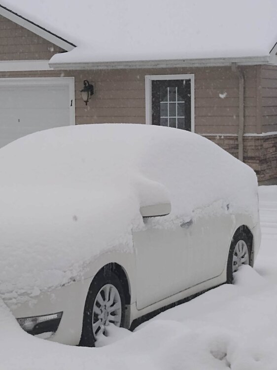
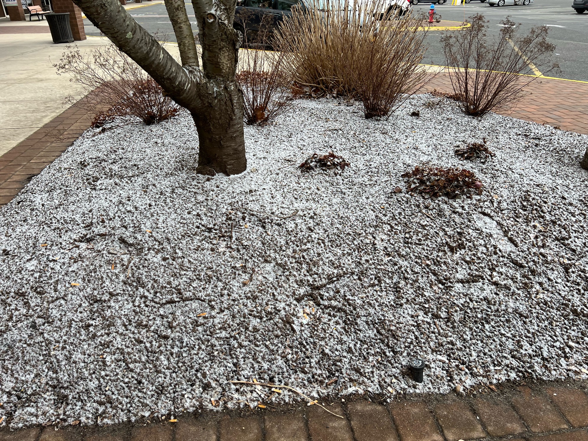
Hey, all! I'm back in Upstate NY now. Sorry there wasn't much fun winter to talk about when I was there. Came home to lake effect falling yesterday and then we had another 3 to 4 inches fall today. Thought I'd share the winter wonderland on my car from the past couple days.
Hopefully you guys can get some of this during the upcoming week!
-
6
-
-
8 minutes ago, Cfa said:
Middle Island:

No accumulation anywhere else.
Hurry up! Build a Snowmulchman!
-
 1
1
-
-
6 minutes ago, jm1220 said:
So far here it was a brief burst of flurries that didn’t even accumulate from what I see, so another trace and from here it looks like we’re stuck in a virga hole. But good for those who do have snow on the ground.
That's discouraging when it looks good on radar and then...virga.
 Euro trended much better for you guys to get an area wide snowfall. New Englanders aren't happy, but maybe it will benefit you guys.
-
Wow, what a change from days ago. The Euro has been awful this year. The "upgrades" they do with these models are questionable. Perhaps it ends up being close to correct here, or hopefully things end up better.
-
2 hours ago, Nibor said:
This snow is fluffy af.
Living in the lake effect belt, I have lots of experience with fluffy snow. At this time of the year, once the sun comes out, it obliterates a shallow layer of fluffy snow...so get out there and enjoy it!
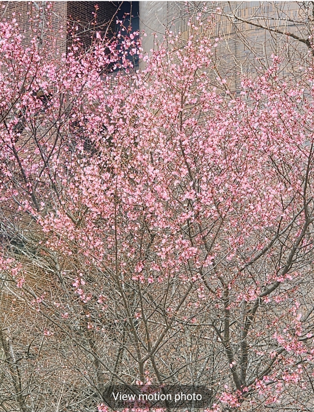
2 hours ago, dWave said:Lots of budding for sure. Some Cherry blossoms have bloomed too. Lasts night low 20s, dropped some though. Any flowers you'd typically see sprouting up in March to early Apr started showing up soon after that brief early Feb artic cold shot. Around the city, this winter has been almost devoid of freezing lows temps outside of 2 short cold shots
Here's lower Manhattan near 1 PP yday.
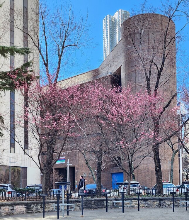

Wow, thanks for sharing! It's been so mild this winter, there was bound to be new vegetation sprouting down there. I am assuming within the urban corridor that most plants will be ok even if we do actually winter in March.
1 hour ago, SnoSki14 said:Unfortunately we don't have a cold air mass ahead of this. That's a bigger problem than anything
Well, there is a cold air mass. It, like any other cold air mass this winter, is just sliding out super fast.
To everybody else in the NYC sub who got snow, congrats!!!! I'm excited for all of you and the opportunity to actually enjoy something other than eternal November.
-
1
-
-
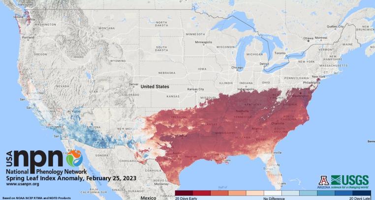
Saw this map...do you guys really have "leafout" there in NYC already?
-
1
-
-
5 minutes ago, Bubbler86 said:
Yep, basically the same here until one of your NY brethren corrected me. That one map I posted suggested Williamsport was not actually in the main Susquehanna Valley at all. But, like @Itstrainingtime said if the local NWS uses their own designation maybe there is more than one interpretation.
Yeah, obviously there are different interpretations. Williamsport is sort of in its own little world. The Scranton stations include them in their news and weather reports, but they're sort of far over from there. It sort of gets "semi-included" in the newscasts out of Harrisburg, Scranton, and Elmira. I would almost consider them more a part of the Corning/Elmira/Mansfield area. But considering it is located ALONG the West Branch of the Susquehanna, it's ridiculous that some think it is not part of the Susquehanna River Valley.
-
4
-
-
1 hour ago, Bubbler86 said:
You mention USV and I was corrected on that earlier this year so curious what you guys call the USV? Apparently the USV is actually in NY per a NY'er that corrected me. I never knew that, but I think my view was PA specific.
Interesting! I have never truly lived in Danville, as my parents moved here after I was an adult. They've been in this area 19 years. I always remember WGAL when I was growing up in the 80s and 90s in the LSV referring to this area up here as the "Upper Susquehanna Valley" when discussing winter storms and referring to their snowfall maps.
-
Snowing heavily here in Danville in the Upper Susquehanna Valley! HUGE flakes covering everything.
-
4
-
-
What an April day here at my parents place in Danville. Rain in the morning, then Gusty winds and sunshine, then all of a sudden several rounds of thunderstorms...and then finished the day with clear skies. The northeastern counties near Scranton had a layer of fresh snow from snow showers this morning and then Severe Thunderstorm warnings this afternoon!
-
2
-
-
6 hours ago, Bubbler86 said:
On the EC, @TugHillMatt seemed to be in line to watch a moderate ice storm, in his home territory, from our snow desert (late this week). He is stat padding!
Haha...yup! At least if it's another flop it won't be hard to take since I'm down here.
61 degrees here in Danville today.
-
1
-
-
9 hours ago, franklin NCwx said:
That's 100xs better than 30s and rain
Yeah, that's been our winter up here.

-
52 minutes ago, Itstrainingtime said:
Winter must also be defined by more than just snow. In addition to almost being shutout snow-wise, it has NOT been cold. My lowest temp for the entire month of January was 25 degrees- that is an AN temp for virtually the entire month and that was the coldest morning.
Some of our other snowless winters featured some cold weather. Outside of the couple of days around Christmas it's been warm.
You had more winter than most of Lancaster... in ARKANSAS.

-
2 hours ago, Snowfreak09 said:
libertybell- see what i just did there- its called the multiquote function-- please use it.... lurker here, but its beyond obnoxious that 75 percent of the posts in these forums is you feeling the need to reply to every post like your Santa esp in the mornings.. you wake up to read the forum seeing a million posts and think wow, must have been good overnight runs... but... nope... just libertybell posting a million times!
you!
-
1
-
-
2 hours ago, Snowfreak09 said:
libertybell- see what i just did there- its called the multiquote function-- please use it.... lurker here, but its beyond obnoxious that 75 percent of the posts in these forums is you feeling the need to reply to every post like your Santa esp in the mornings.. you wake up to read the forum seeing a million posts and think wow, must have been good overnight runs... but... nope... just libertybell posting a million times!
Thank
-
1
-
-
By the way, I'm joining you guys for the week of heatwave, as I'm visiting my parents in Danville for Winter Break. Hello, all yas, yous, yinz Pennsylvanians!
-
4
-
1
-
-
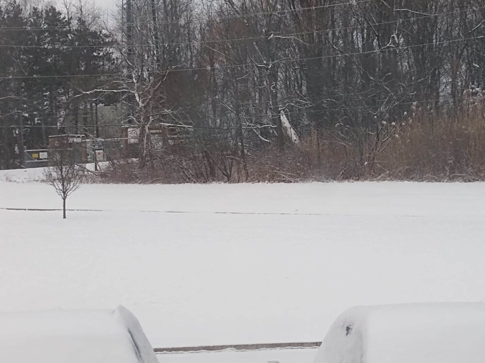
7 hours ago, Bubbler86 said:
It is surprising/amazing places like Syracuse and Albany have that much with what has transpired.
4 hours ago, canderson said:Rochester is the worst. That’s insane.
Here in Syracuse we actually have the largest deficit for what is normal though. We're 55 INCHES below normal to this date. Did get a couple inches of lake effect overnight, so make that 53 inches below normal. lol
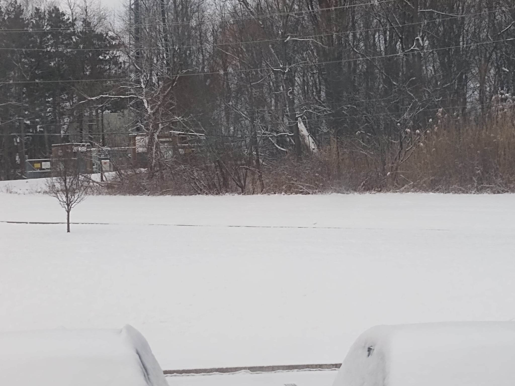
Nice view this morning:
-
3
-


Central PA Winter 23/24
in Upstate New York/Pennsylvania
Posted
Hey, Central PA Weather friends! I've been following what's going on and was hoping the Lancaster county crew would luck out and get more. This storm is a reminder of why I searched for a snowier destination. I can't believe you guys had less than a few inches of snow total last year. Geesh! Hopefully you can join in more on other systems this season.