-
Posts
5,187 -
Joined
-
Last visited
Content Type
Profiles
Blogs
Forums
American Weather
Media Demo
Store
Gallery
Posts posted by Harry
-
-
They have 2-4 here and looking at the radar I am not seeing it.
-
2 hours ago, beavis1729 said:
^Yeah, that lobe of cold air is well into MT now. Cut Bank had a high temp (!) of -25F today...and that was at midnight. PM temps never got above -27F, and it could drop to -45F tonight with wind chills near -65F.
Crazy stuff...
How does anyone live there? I would never leave the house!
-
 1
1
-
-
1 minute ago, Lightning said:
Trust me I am thinking about the LES. I really hope the LES bands set up right. Could be big considering the cold temps and very mild Lake MI.
And deep moisture to boot! Grr even mentioned the potential for a i96/I94 band getting going as the flow to the north is wnw to nw and south of there is wsw wrapping in the cold.
-
 1
1
-
-
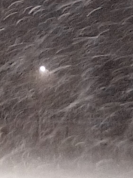
Well for a short bit I felt like I was back east with the heavy snow and big fat flakes..
Hope to score on some fatty's tomorrow/tomorrow evening before the very cold stuff arrives and kills the flake size tomorrow night..
Surprised there is not more talk about the lake effect because it's supposed to go till Sunday at least ( per GRR ) with the winds etc we should see cross state bands that should reach the Detroit area..
-
 1
1
-
-
Now to wait for the backside and lake effect..
-
 2
2
-
-
It is dumping here!
-
 3
3
-
-
-
This might be the strangest storm I have seen out this way. Too see Chicago with rain while to the east the rain/snow line has been nudging south ( Near Ft. Wayne ) and a slp nearly over Chicago? At worst it looks like the so called dry slot will be paying a visit here later on.
-
Have had about 3" so far with some heavy stuff about to move in.
-
 2
2
-
-
19 minutes ago, Harry Perry said:
You and I both. There’s such a wide range of possibilities with this it’s ridiculous. GFS has been very consistent with this system, but wouldn’t mind a bump southeast.
HRRR and other short range guidance giving us another cold Eurythmics special.
It has but was as well with last system which as we know ended up a bit se of gfs track.. That's our hope anyways. Shouldn't be worrying about to far NW with a damn Nino as is... Ugh. Climate change for you..
-
I just know with past experiences that with a nino the trend tended to be se close in vs Nina and the nw trend.
And with this type of system I want the slp at least 100 or more miles to my south and east. Just not east of Toledo/Detroit.. But that's me of course.

-
 1
1
-
-
7 minutes ago, Chicago WX said:
Hate being on the fringes. Knew I wasn't going to be in the main snow swath couple of days ago, but just hoping for some scraps at the tail end. Like, cover the grass tips. I have serious doubts that'll happen, based on prior experience with these marginal pieces of crap. But, one can always hope.
Wish I could add better insight but there has been not much to follow since the model upgrades other then the last system and I am not betting anything on one system. Just hope that is the case with this.
-
17 minutes ago, Chicago WX said:
No two storms the same, but the short range meso models (ARW, NSSL, etc) were way too far northwest with the last system at this stage.
Current 0z runs of both, for this upcoming storm, have the slp in and near LAF at 48 hours (971mb ARW, 974mb NSSL).
Probably meaningless, alas...I'm grasping at straws. Just want a little snow cover before the arctic hounds visit.
Good seeing you! Hope all has been well!
Time for me to raise the shields to keep this thing se of Ft. Wayne and Jackson! Time for that crap nw of there to end! Keep the mixed/rain crap east of here!
-
 1
1
-
-
48 minutes ago, Stebo said:
That being said I think SEMI gained a bit tonight on the models but its is incredibly tenuous and could easily go back the other direction. I would love to be in SW MI for this, they look to get absolutely bonecrushed.
If I see the track east of here/Jackson I'll feel better about that.
The saving grace here with the further west track is that the lake effect gets going quicker.
-
1 hour ago, WestMichigan said:
RGEM and ICON buth have less QPF and even with the RGEM east solution snow totals are much lower in MI.
Then we get a ton of lake effect till Sunday night anyways.
How has all been?
Happy New Year!
-
9 hours ago, WestMichigan said:
1.91" at home, 1.68" at GRR through midnight, close to 3" at Grand Ledge and numerous totals in the 2" range. Overall I'd say GRR forecasted this one pretty well.
This area is where the bust happened again. Forecasted 1-2 inches of rain and ended up with .75!
Good news is the grass is green again thanks to the recent rains that has fallen here.
-
-
Can't get squat with this crappy heat and humidity so may as well cool back down! Bring it on!
-
17 minutes ago, Lightning said:
Just had one of the cells go through here. Quick heavy rain and some winds (nothing that strong here). I wasn't expecting the stronger ones to be up there either.
As usual everything missing here left and right while same areas keep getting hit. Sigh..
-
Hoping I can Atleast get a decent rain out of one of these storms that seem to be firing everywhere.
-
Wasn't expecting to see two severe thunderstorm warnings and a tornado warning going in the thumb area.
-
Finally starting to get some decent rains around here.
-
This is the worst yet with the smoke. All I taste is smoke.. ugh..
-
1 hour ago, Harry said:
So far 5 days of 90+ here and it could be 6. Last ob showed 89..
Make that 6 days at/above 90.


Did Someone Say Clipper(Hybrid)!?! 1/18-1/19
in Lakes/Ohio Valley
Posted
I believe this is the first time I seen a band from Superior make it here.
21" total from everything going back to last Wed. Thus the two slop fest storms and lake effect.