stormtracker
-
Posts
64,400 -
Joined
-
Last visited
Content Type
Profiles
Blogs
Forums
American Weather
Media Demo
Store
Gallery
Everything posted by stormtracker
-

Jan Medium/Long Range Disco 2: Total Obliteration is Coming
stormtracker replied to Jebman's topic in Mid Atlantic
Y’all want a thread today after the euro or tomm? Pros get a little more weight. -
Jan Medium/Long Range Disco 2: Total Obliteration is Coming
stormtracker replied to Jebman's topic in Mid Atlantic
Reppin our crew. You go boy. Just don’t let him read this forum. -
Jan Medium/Long Range Disco 2: Total Obliteration is Coming
stormtracker replied to Jebman's topic in Mid Atlantic
Human pendulums up in here -
Jan Medium/Long Range Disco 2: Total Obliteration is Coming
stormtracker replied to Jebman's topic in Mid Atlantic
6-8 area wide...and I mean AREA wide from HGR down to cape -
Jan Medium/Long Range Disco 2: Total Obliteration is Coming
stormtracker replied to Jebman's topic in Mid Atlantic
Still snow at 135 with costal directly on the....coast in NE -
Jan Medium/Long Range Disco 2: Total Obliteration is Coming
stormtracker replied to Jebman's topic in Mid Atlantic
IMPROVED vs 6z -
Jan Medium/Long Range Disco 2: Total Obliteration is Coming
stormtracker replied to Jebman's topic in Mid Atlantic
heavier precip over the cities...heaviest axis shifted SE over 1-95 -
Jan Medium/Long Range Disco 2: Total Obliteration is Coming
stormtracker replied to Jebman's topic in Mid Atlantic
FOLKS... -
Jan Medium/Long Range Disco 2: Total Obliteration is Coming
stormtracker replied to Jebman's topic in Mid Atlantic
So far a bit more S and E than 6z. Still some light snow at 117 -
Jan Medium/Long Range Disco 2: Total Obliteration is Coming
stormtracker replied to Jebman's topic in Mid Atlantic
Ok, light snow at 105 -
Jan Medium/Long Range Disco 2: Total Obliteration is Coming
stormtracker replied to Jebman's topic in Mid Atlantic
I do what I can. It's better than whining like a petulant toddler tho. -
Jan Medium/Long Range Disco 2: Total Obliteration is Coming
stormtracker replied to Jebman's topic in Mid Atlantic
I'm present -
Jan Medium/Long Range Disco 2: Total Obliteration is Coming
stormtracker replied to Jebman's topic in Mid Atlantic
I wish it was Monday night and we saw this map -
Jan Medium/Long Range Disco 2: Total Obliteration is Coming
stormtracker replied to Jebman's topic in Mid Atlantic
All these pages need to come to a standard damn measurements. They vary wildly -
Jan Medium/Long Range Disco 2: Total Obliteration is Coming
stormtracker replied to Jebman's topic in Mid Atlantic
"biggest" snow totals from I-95 S and E. Looks like 3-5. N and W 1-3 ish -
Jan Medium/Long Range Disco 2: Total Obliteration is Coming
stormtracker replied to Jebman's topic in Mid Atlantic
Snow, starts at 135. still going at 144. Low is stronger, LOOKS like it's still gonna just miss to our east -
Jan Medium/Long Range Disco 2: Total Obliteration is Coming
stormtracker replied to Jebman's topic in Mid Atlantic
1012 SFC low just on the GA coast at 135 -
Jan Medium/Long Range Disco 2: Total Obliteration is Coming
stormtracker replied to Jebman's topic in Mid Atlantic
just misses us with the main slug to the SE and it's warm Edit: Manages to guess with with some snow at 144 in the backlash -
Jan Medium/Long Range Disco 2: Total Obliteration is Coming
stormtracker replied to Jebman's topic in Mid Atlantic
still same scenario at the sfc tho.broad weak low pressure scoots up the coast -
Jan Medium/Long Range Disco 2: Total Obliteration is Coming
stormtracker replied to Jebman's topic in Mid Atlantic
This was close to something big. @Heisy? But as of now, weak area of broad low pressure moving NNE off the coast..we have some light snows, but nothing impressive light snows over the area from 132 to 150 -
Jan Medium/Long Range Disco 2: Total Obliteration is Coming
stormtracker replied to Jebman's topic in Mid Atlantic
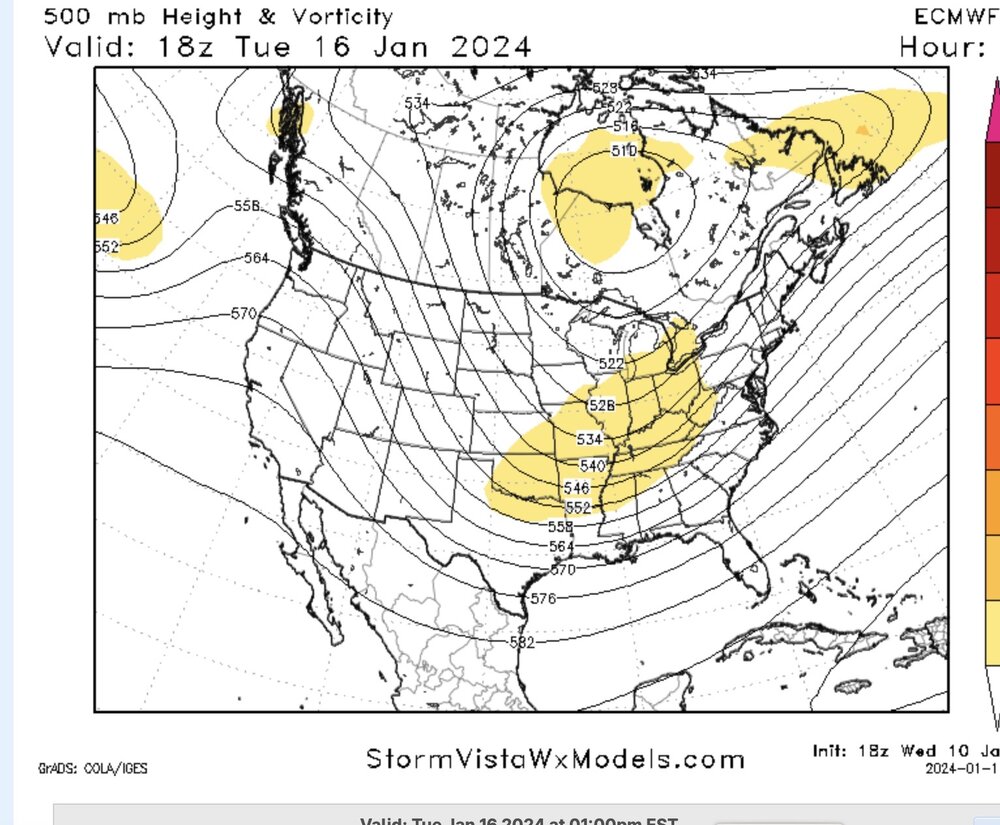
Regardless of outcmes these are good changes on th h5 map so far. I'll et the pros comment on how good -
Jan Medium/Long Range Disco 2: Total Obliteration is Coming
stormtracker replied to Jebman's topic in Mid Atlantic
H5 is vast different. Trailing S/w sharper and heights a bit higher -
Jan Medium/Long Range Disco 2: Total Obliteration is Coming
stormtracker replied to Jebman's topic in Mid Atlantic
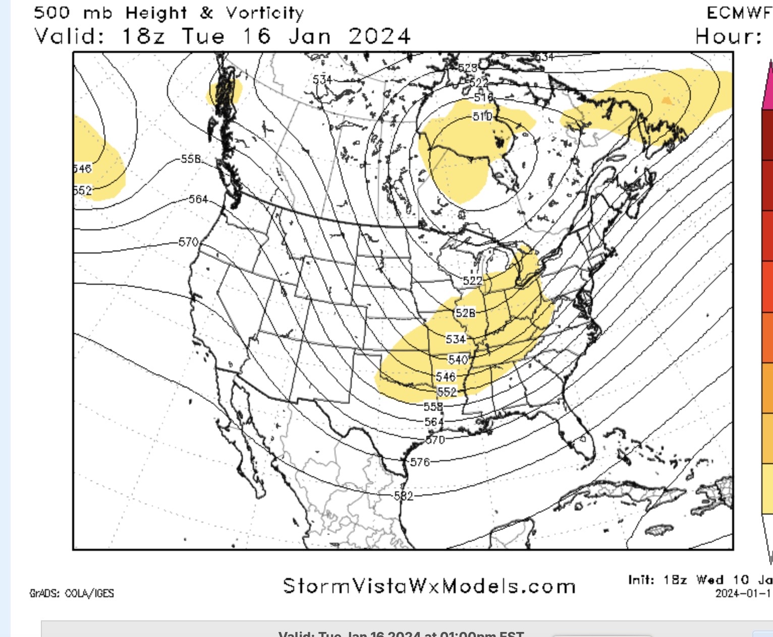
There are some changes at H5 vs 18z. Sharper s/w here on 0z than 18z over NM -
Jan Medium/Long Range Disco 2: Total Obliteration is Coming
stormtracker replied to Jebman's topic in Mid Atlantic
Ok..just a little late. Good luck, us -
Jan Medium/Long Range Disco 2: Total Obliteration is Coming
stormtracker replied to Jebman's topic in Mid Atlantic
144 hour EPS