

kevlon62
-
Posts
977 -
Joined
-
Last visited
Content Type
Profiles
Blogs
Forums
American Weather
Media Demo
Store
Gallery
Posts posted by kevlon62
-
-
A few strong punches in the last twenty minutes. Some peas mixed in. Maybe a few low-end severe gusts.
Nice to have some daylight and bright sky staying put to the northwest for contrast in the sky.
Maybe one or two more quick hits but nothing crazy here. -
Meteors and northern lights tonight.

-
 14
14
-
-
Just before the main line moved in to O'Hare, etc., it was interesting watching that outflow boundary push to the southwest through northern Cook County, extending southeast toward downtown, from the cells that had fired in the northern tier counties and moved out over the lake.
Brother out by Des Plaines was in the backyard and commented how much cooler it felt just after that feature pushed through.
We figured it would stabilize things some - perhaps the confluence points with the main line ended up being evident with that Bensenville/O'Hare spin up area, along with that rotation just west of downtown over 290.
Interesting to think how things would have gone had that boundary not pushed inland - perhaps less/perhaps more effects say I-290 north.
Separately, saw some scattered tree damage this morning a few blocks north of Bensenville but nothing too crazy.-
2
-
-
Heavy precip parked just west for the past hour+

-
2
-
-
Gusts held off until rain moved over. A bit of pea size. Nice timing with sunrise.
-
Coming in hot
-
Made it to southwest side of Janesville just after 7 p.m. Positioned four miles NW of JVL.
Stayed in the same spot for 30 minutes and watched a meso approach from the west. As it got closer, it finally tightened. It was time to hightail it back east.
Closer to town, a rotating wall cloud was readily apparent as it went tornado warned and sirens sounded.
We diverted south of the airport, which led to trees and a tough view but it was apparent things were rocking just to the north.
Home an hour later after a drive where we flirted with the edge of the bowing severe complex and some very impressive gusts.


-
15
-
-
Why not.
Running over to west of Janesville. -
Grabbed a handful of frozen chicken pot pies at that general store in Big Bay on an epic 250 mile ride a few years back.
As I recall, we were wrapping up a sit-down lunch in L'Anse close to 3 p.m.
By the time we made it back to Munising late on that Wednesday night, most all local options were closed but for the lobby microwave and my Big Bay chicken pot pies.-
1
-
-
A later show around 11:30 last night. Consecutive nights makes it a lifetime first.


-
4
-
-
Shoots at 9 p.m. and 3 a.m.


-
10
-
 1
1
-
-
Yeah gonna be a night.
Curtains now.
Getting simultaneous flashes of lightning on the far lower horizon from the SoWisc storms.
Need a real camera
-
9
-
-
Clouds just blocked the show, but had gsome final clearing to the northeast and pinks showing through the deck. Will look for some clear pockets next hour or so and then set the alarm for 2 a.m.

-
7
-
-
Early evening afterglow, brightened up with the fresh blanket. Looking good out there. 5ish on the ground.
-
Bro just reported thundersnow in Mount Prospect.
-
3
-
-
Great to see the upgrade out west.
Edit: And now through our own neck of the woods. -
The hose is open.

-
5
-
-
4-8 in the point. Oustanding day for tourney and get out for some play later on.
-
1
-
-
SoWis tornado warning - radar indicated rotation.
-
1
-
-
Looking NNW toward the Wisconsin action.
Temp went up a degree or two here. A burst of rain drops with the slightest bit of ice chased me inside.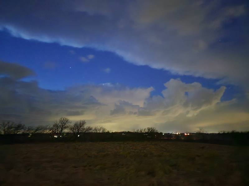
-
1
-
-
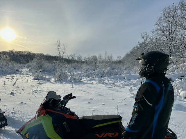
Tomorrow morning marks a full week of trails open in McHenry County. Groomers out.
It's been an absolute top shelf, paradise treat.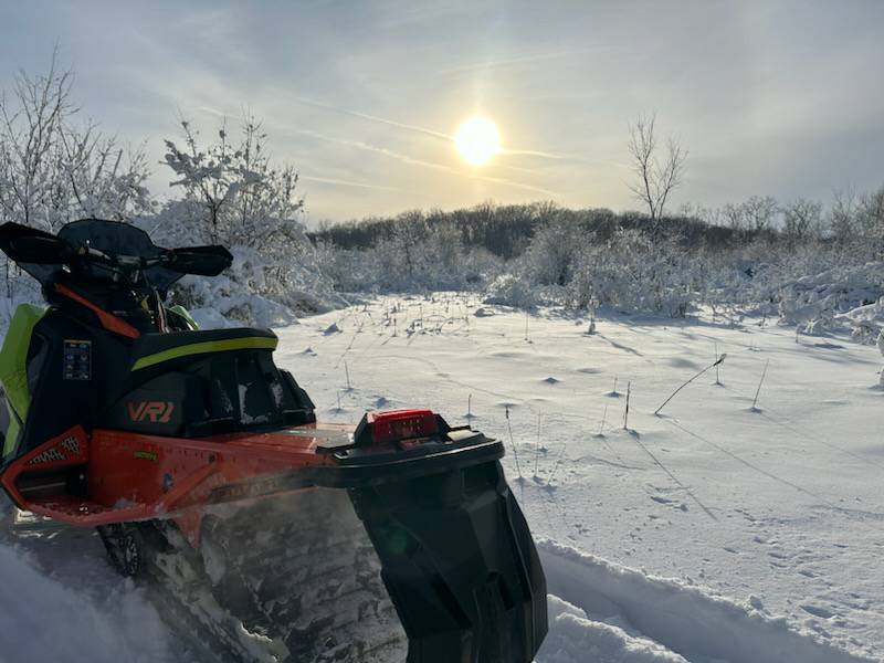

-
12
-
-
Snow continues at home. Power out for last thirty minutes.
-
6" in town. Heavy, full flakeage again.
-
1
-
-
Measured about 5" at 8 a.m.
Sleet in the lull and now flakes mixing back.


-
4
-
5/15(northern half) & 5/16(southern half of subforum) Severe Wx Threats
in Lakes/Ohio Valley
Posted
P cool structure on the inbound SVR.