J.Spin
-
Posts
6,421 -
Joined
-
Last visited
Content Type
Profiles
Blogs
Forums
American Weather
Media Demo
Store
Gallery
Everything posted by J.Spin
-
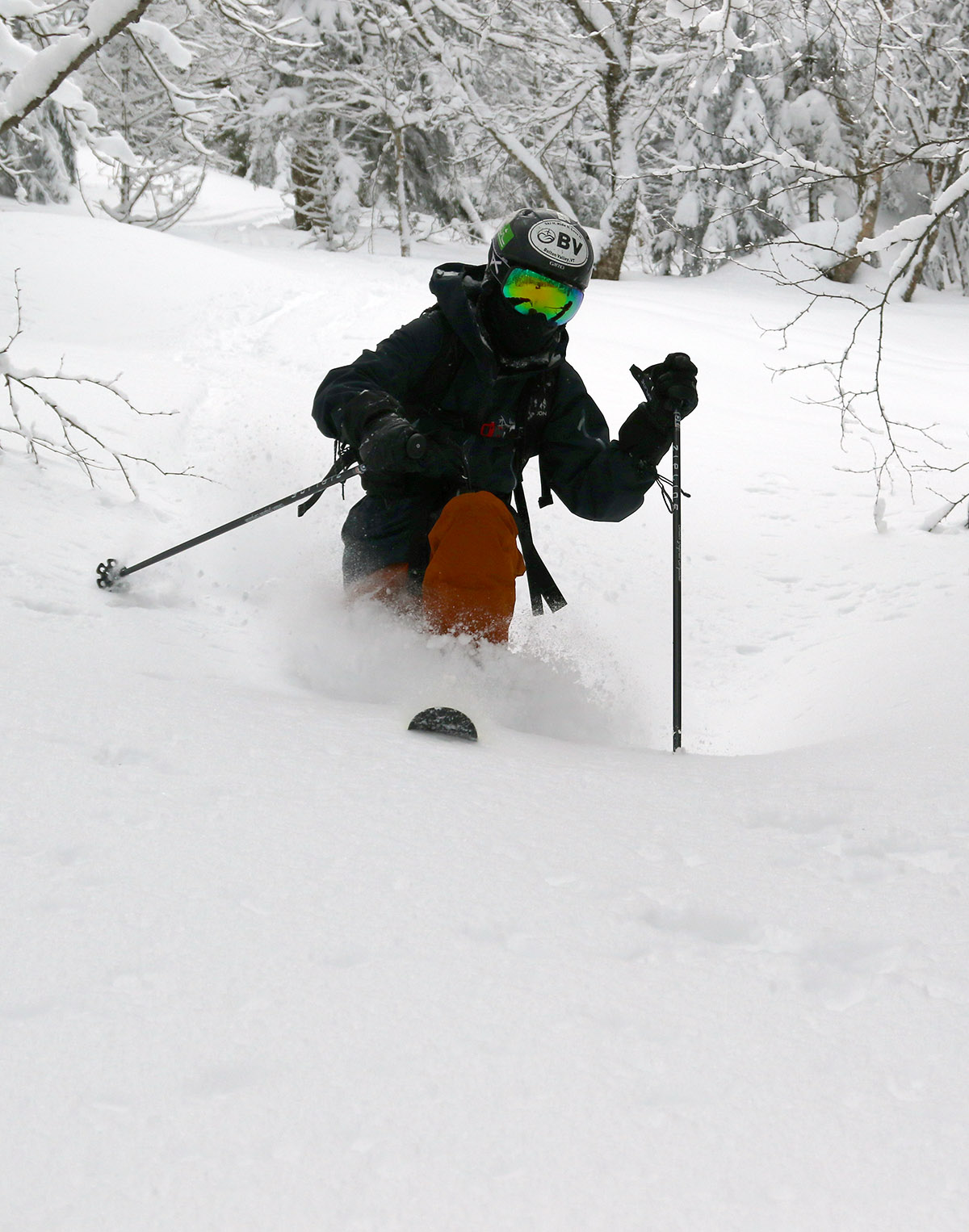
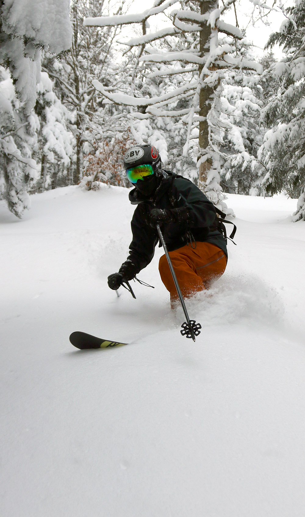
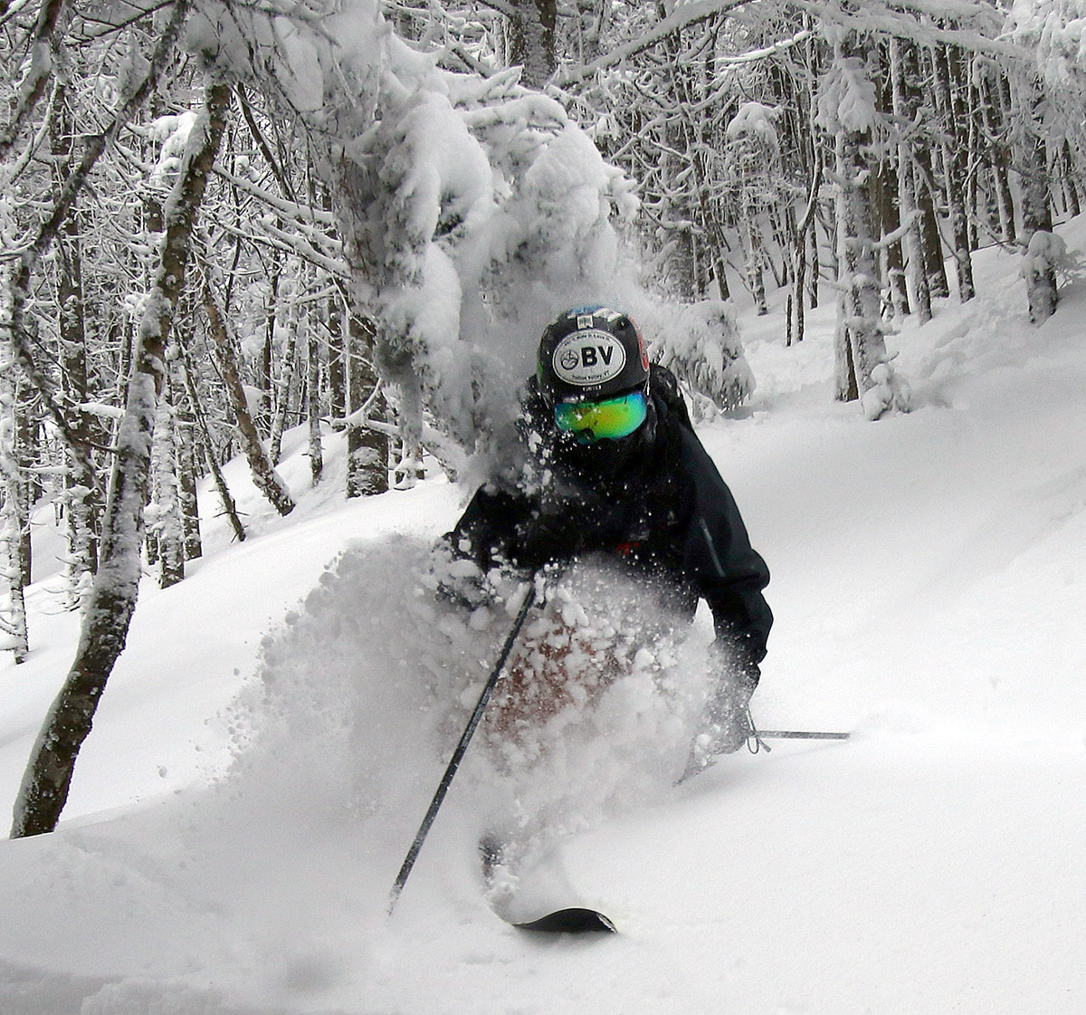
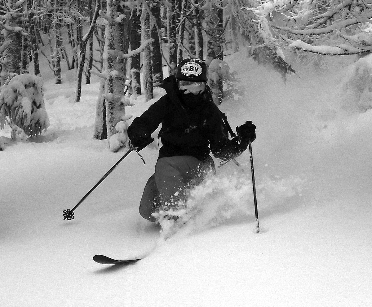
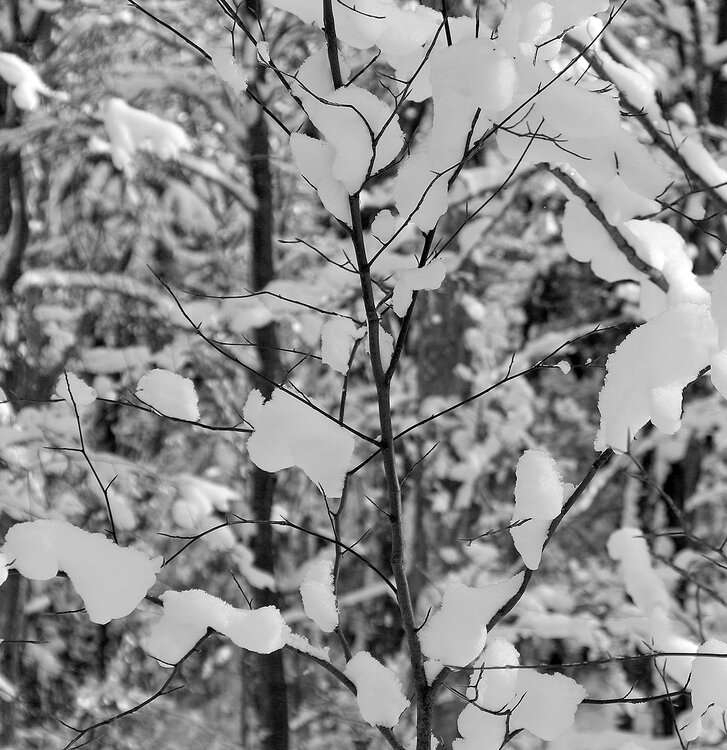
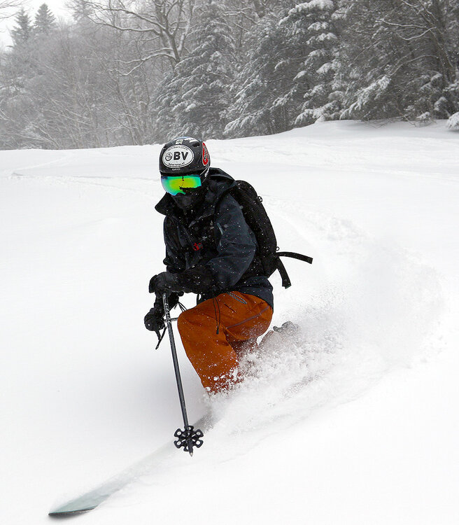
Well, you were absolutely right to be gun shy with respect to that type of forecast – how often do we actually get upslope-style snowfall ratios with surface temperatures around 0 F? I will say that thankfully, temperatures did come up quite a bit today – we got up to 15 F in the valley, which felt really nice. While that may not seem all that warm, without any wind it’s dramatically different from temperatures below zero F with brisk winds. Anyway, we certainly doubted whether or not Mother Nature could pull off those higher snow totals in the forecast at those temperatures, but she did. We just hit 20” on the storm as tonight’s snow is rolling through, and low and behold, we are just about to hit 0.75” of total liquid equivalent. So, it was just like the upper end our ~10”-20” point forecast range here suggested, and the overall snow to liquid ratio is around 27:1 for the storm. Kudos to the BTV NWS for their forecasting as usual. And for folks that got our for powder turns today, if you were wondering why the quality of the powder seemed like it was off the charts good… well, you weren’t crazy. The quality of the powder was off the charts. OK, well maybe it wasn’t quite off the charts, since I can, actually, chart out just why the powder skiing was of such incredible quality around here. As noted earlier in the discussion, the storm started off Sunday afternoon with a couple inches of 11.1% H2O/ 9:1 snow, then during Sunday evening, the snow to liquid ratio more than doubled, for another 7 to 8 inches of 4.2% H2O/24:1 snow. Then overnight, the ratio nearly doubled again, leaving about a half foot of 2.4% H2O/42:1 snow. Then through the day today there was another half foot of snow that fell in the 1-3% H2O range. Even for around here, that’s some impressively dry powder, and with the way that right-side-up density gradient came together, it skied really well. This certainly wasn’t an especially large storm by Northern Greens standards, but the very high quality of the powder that fell was definitely noticeable.
-
Well, the modeling certainly knew what it was talking about with the snow growth potential. At least when snowfall rates were on the higher side, I was seeing flakes up to 20-30 mm in diameter, but midnight observations here still had flakes up to 20 mm. I wasn’t sure if that 6 PM to 7 PM snow ratio would be maintained for the whole 6 PM to 12 AM block, but LOL, no worries there. This most recent block’s snow density just came in at 4.2% H2O for a 24:1 ratio – that impressive for an entire snow collection period, and indeed it’s right up there with the quality of upslope snow. This has certainly been some of the loftiest snow I’ve seen with temperatures hovering around the 0 F mark, so some unique conditions have come together with this system. At 24:1, even 0.75” of liquid produces 18” of snowfall, so the forecast numbers certainly aren’t crazy for areas that are in the banding.
-
The tenor of the snowfall had changed so much that I decided to run a quick liquid analysis on the new snow at 7 PM – it came in at 5.5% H2O for an 18.3:1 ratio, so indeed the snow to liquid ratio had essentially doubled from what it was earlier.
-
The snow thus far in the storm has seemed fairly dense, and indeed the 6 PM liquid analysis came in at 11.1% H2O for a 9:1 ratio. Flakes were generally in the 1-3 mm range this afternoon, but with that said, flake size has been increasing over the past hour or two. With that band that’s moved into the area, the snowfall rate has jumped up to the 1-2”/hr. range and I’m seeing flakes up to 10 mm in diameter. That’s more in line with the type of snowfall that would be needed to hit those higher end totals, and if I were to run another liquid analysis right now it would be much higher ratio snow. I’m not convinced that these snowfall rates and ratios would continue to be the norm overnight, but it’s nice to hear that some of the modeling is suggesting the potential is there.
-
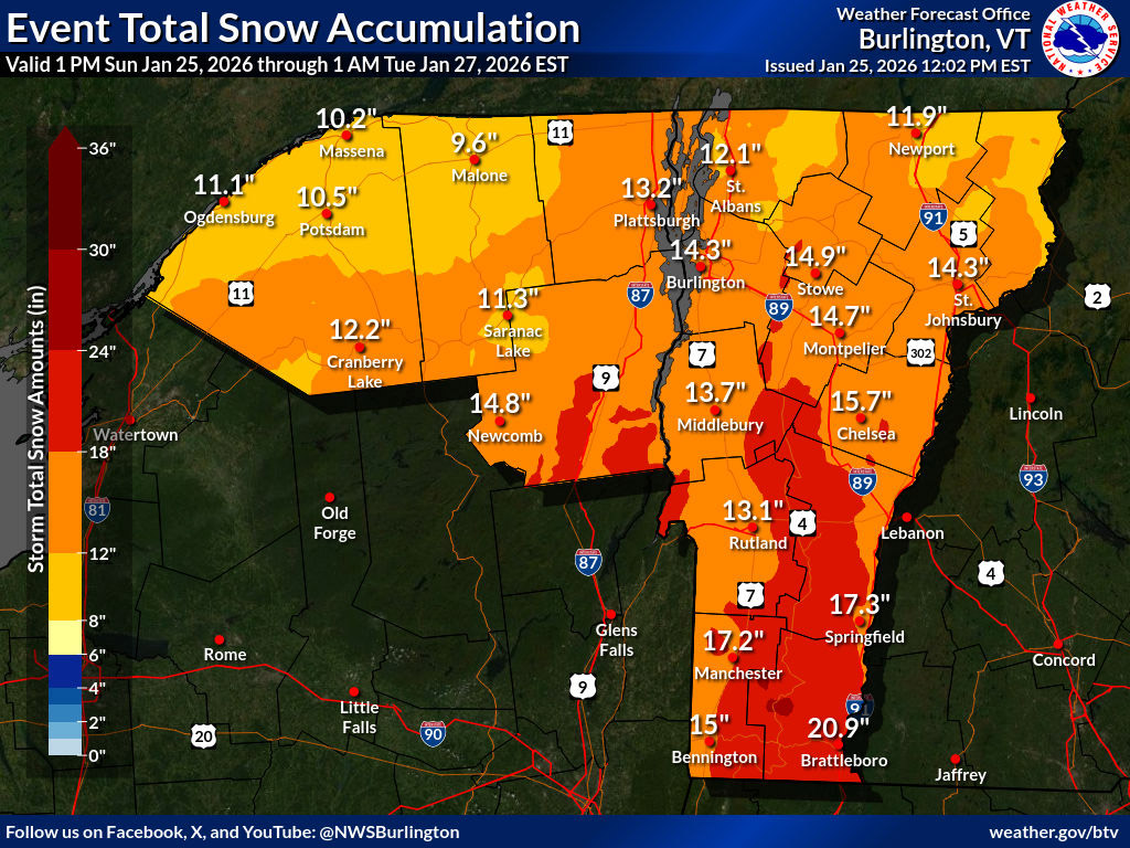
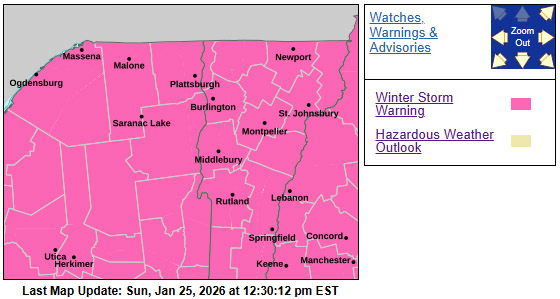
Well, it’s wall-to-wall Winter Storm Warnings on the BTV NWS alerts map now that those cold weather alerts are gone, and that’s typically a good sign for a storm. I see that the latest Event Total Snow Accumulation map update has some areas of that 18-24” shading up here along the spine, and there’s a bit of that 24-30” shading down in the Southern Greens. The forecast here at our site does come in around that 10-20” range through tomorrow night, and the mountains are a bit more than that. Those numbers generally match up with the accumulations shading, but it’s a little tough to envision the high end of those numbers with the liquid equivalent that I’m generally seeing in the models (which seems to top out in the 0.75”-1.00” brackets). Accumulations could get there with some high snow to liquid ratios, but I’m not used to getting great snow ratios when the air is this cold – we often get that relatively dense arctic sand. The ratios are being mentioned a lot, so the dendritic growth zone setup must be there, and I guess we’ll see if this event is different and gives some lake-effect/upslope style snow ratios. What’s in the forecast is certainly a moderate resurfacing event, but it’s not even as large as Winter Storm Ezra from a few weeks back, which brought 1.24” of liquid here in the valley and even more to the mountains. This should be a nice addition of liquid equivalent to the snowpack in any case – I’m not sure if we’ve had a storm in the 1.0” liquid equivalent range since Ezra? And it’s always great to add to the snowpack when it’s already in really good shape and the surface conditions are relatively good as well – the ski conditions should only get better. This system (Winter Storm Fern) is rightfully getting a good amount of attention though because it’s affecting a relatively large amount of the country and some big population centers.

-
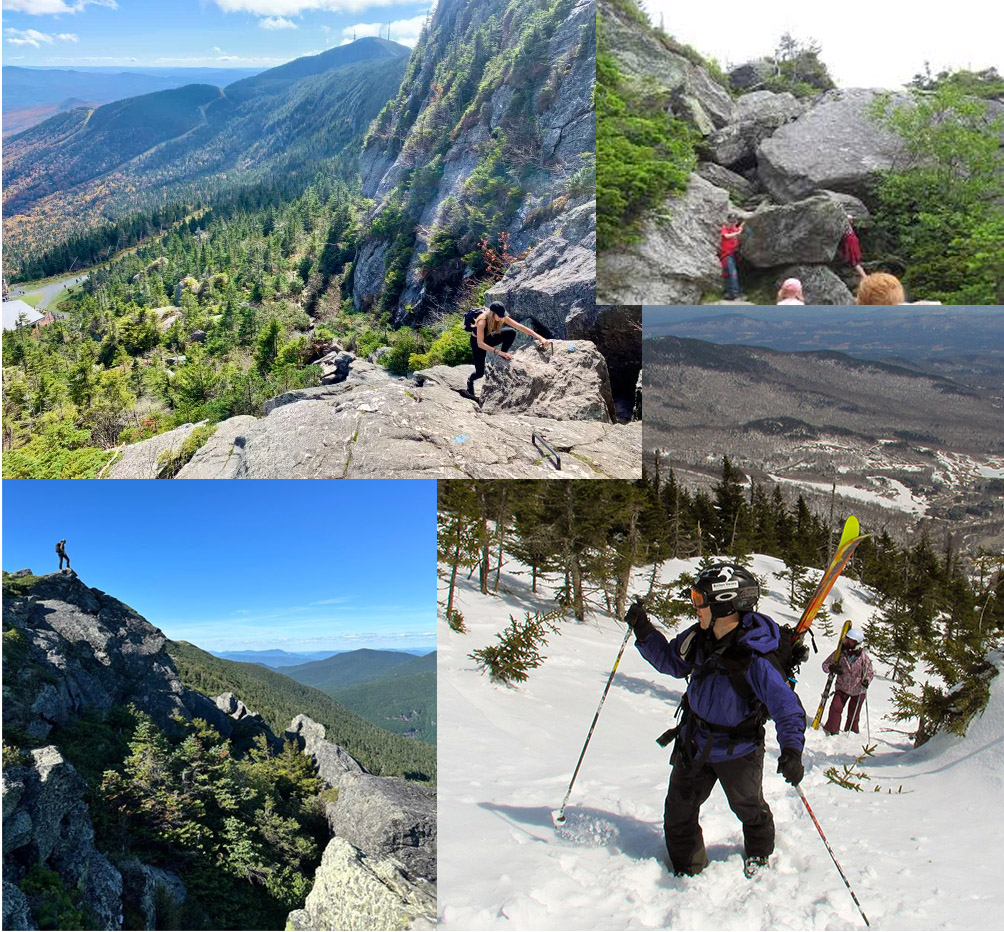
Hitting 70-80” snowpack depths is pretty typical for Mt. Mansfield and similar elevations in the Northern Greens in most seasons as the Mt. Mansfield Stake data suggest, with 80-100” depths a bit less common. Strong seasons will hit 100”+ snowpack depth with either the right combination of liquid equivalent and/or lack of large storm cycles with substantial warmth – I think last season was just above the 100” snowpack mark at its peak. With everything so evenly covered and buried, it can be difficult to get a sense for the depth unless you are in areas that have sharp wells to the ground as PF discussed or dig a pit like backedge showed. One approach that has always helped set up the perspective for me is warm season hiking above Stowe’s Cliff House, not too far from the area that PF describes in his post. When you hike up there in the summer among the car, truck, or even house-sized boulders and realize that many of those areas are actually smoothed over into snowfields that you’re skiing in the winter, it sort of hits home. Once you get up in that 100”+ range of depth, you’re at that height of a one-story building, so it’s not hard to see how all those huge obstacles can get covered. The image below shows summertime shots of some of the types of terrain features there that are covered, and then the bottom right of the collage is a shot of what it looks like in the winter when we were out with some of the kinds in our school’s ski program guiding them in the alpine. The next image is a great representation of how smoothed out it gets, and there are more winter shots of the area in my web page archives.

-
PF, am I seeing the recent snowpack depth report numbers correctly to suggest that the current snowpack (74”) at your High Road Plot at 3,040’ is coming in deeper than the snowpack (70”) at the Mt. Mansfield Stake at 3,700’? Those two spots aren’t all that far away from each other, they aren’t too disparate with respect to elevation, and they both represent similar leeward aspects of the mountain, but is that true and does the lower elevation depth outpace the higher elevation depth frequently? I’ve never routinely followed the snowpack depths at your snow study plots because I typically only see them when you bring them up in a forum post, but now that Matt Parrilla appears to have them on his Mt. Mansfield Stake page, I’m seeing them all the time (he also monitors some lower elevation CoCoRaHS sites around here in the Northern Greens like ours in Waterbury). I didn’t know your daily depths from the plots were even available – where does he get them from? Or (it’s hard to imagine) are his 3,040’ and 1,550’ numbers coming from somewhere else other than your High Road and Barnes Camp plots?
-
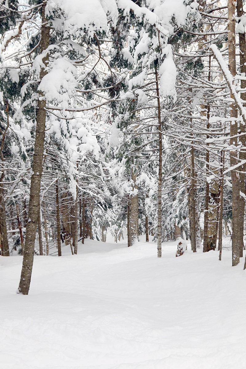
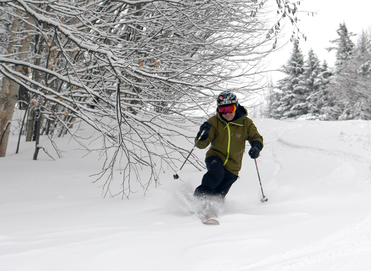
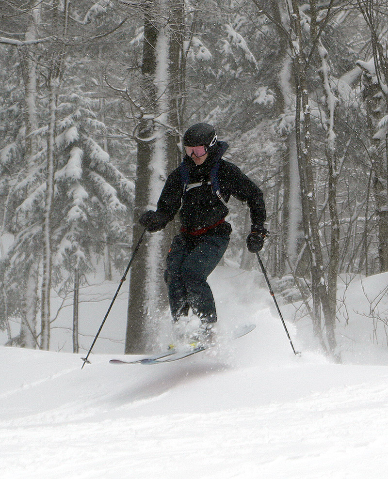
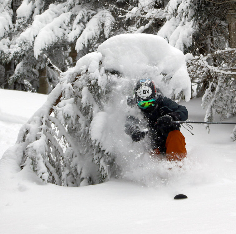
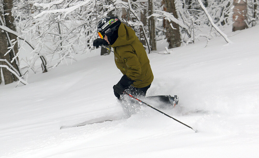
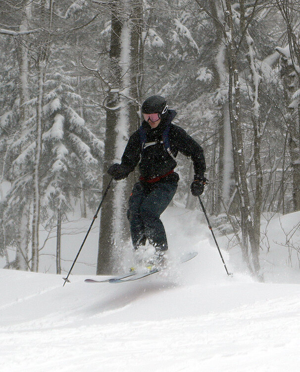
I wouldn’t describe our recent weather pattern as much of a classic Northern Greens bread and butter setup with Alberta Clipper systems driving right though the area every other day or so; it’s been much more a hodgepodge of systems passing fairly far to the north, cold fronts, lake-effect snows, squalls, and stuff like that. Those types of events are certainly a big part of our usual winter snowfall, but it just hasn’t seemed like the locked-in consistency has been there recently the way it was often around in November and December. In any case, the past couple of days have certainly delivered as PF’s images show, and Bolton Valley’s snow report speaks to that, with 10 inches reported in the past 48 hours. I hadn’t planned to ski today with no notable systems in the area, but my older son was up at the mountain yesterday and was quite impressed with the amount of new snow he encountered. He’d brought some fairly narrow alpine skis, expecting generally packed/groomed snow, but he was up there when some of the recent squalls started hitting, and the inches built up rather quickly. When he was telling me about it later in the day, he said that he should have brought fatter skis because he was getting into boot top powder quite often. His report was enough to get me out for a ski tour this morning, and the timing was also good with respect to temperatures –the mountain was in the teens F today, which is much better than it looks like it’s going to be over the next couple of days. I was last out on the hill on Monday, and at that point I was already impressed with how much the powder conditions below 2,500’ had improved relative to the prior few days. These past couple days of lake-effect snow, fronts, and squalls have definitely continued that improvement to the point where I didn’t even notice any difference in the quality of the powder skiing above and below 2,500’ today. I toured in the 2,000’-2,800 elevation range today, and while the powder does get deeper with elevation, the subsurface has improved so much with settling/drying, and the depths/total liquid equivalent at even 2,000’ have increased enough that the quality of the skiing doesn’t drop off as you descend. Here are the approximate powder depths that I measured during today’s tour 2,000’: 6-8” 2,500’: 8-10” 2,750’: 10-12” There were even more rounds of squalls today with decent accumulations, as well as a potentially larger storm on the way toward the end of the weekend, so the quality of the conditions should continue to get even better going forward.


-


-
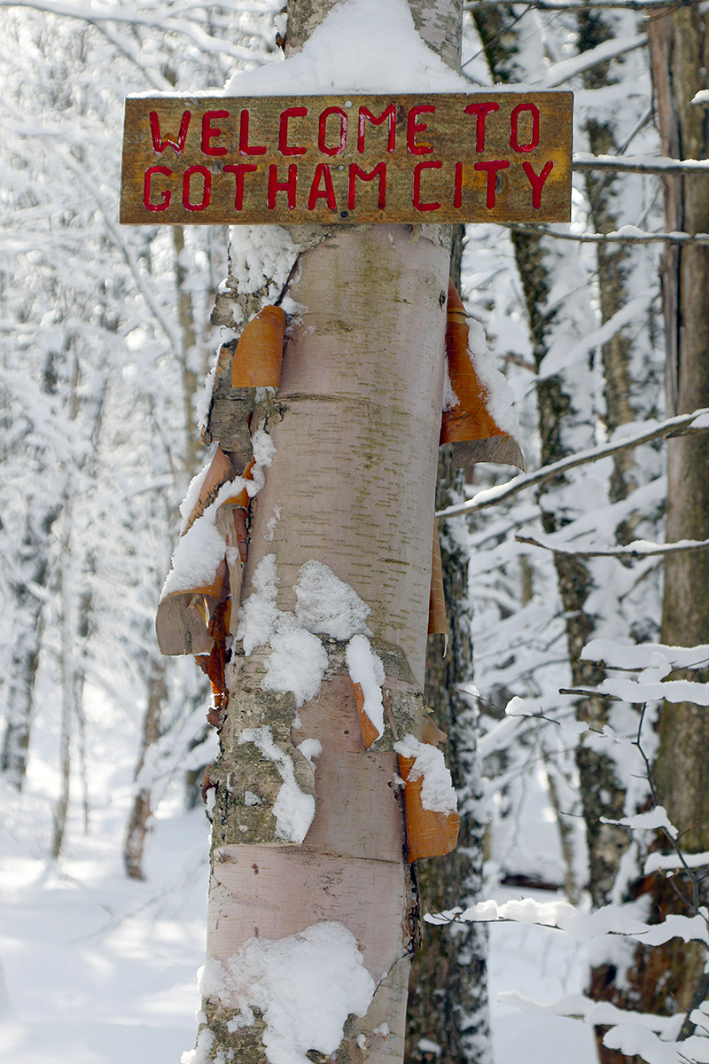
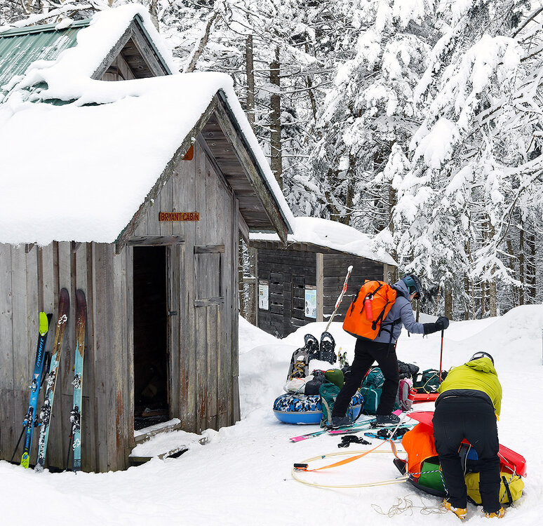
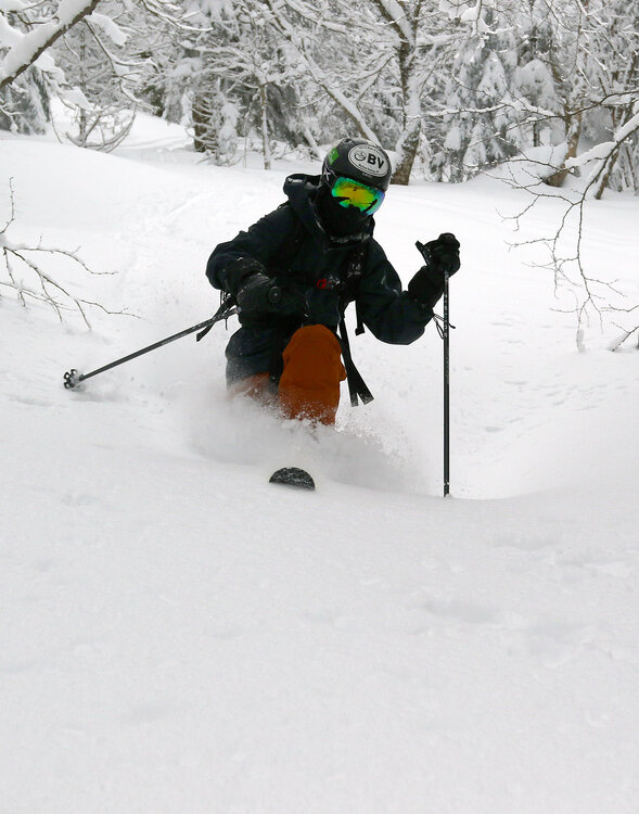
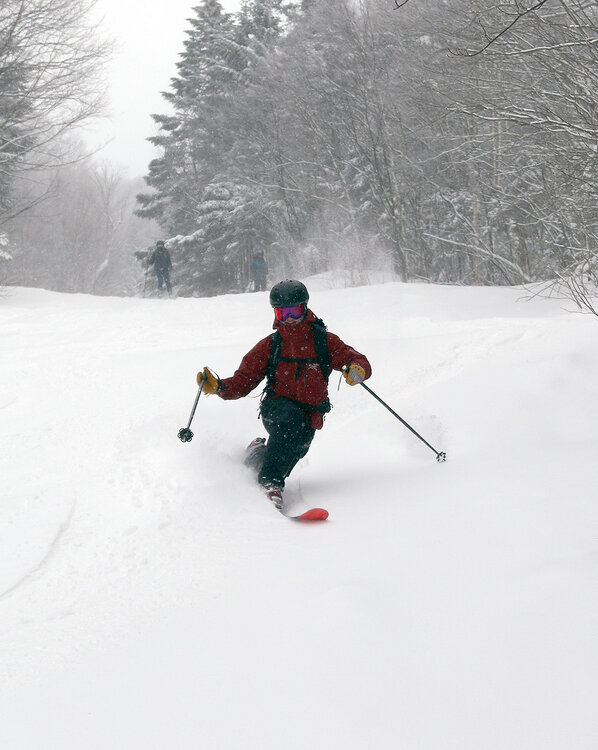
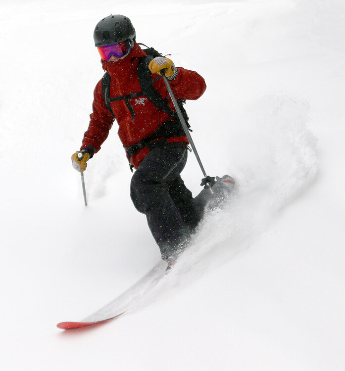
I hadn't had a chance to get out yesterday's mountain report, but I'm posting it now - conditions should be fairly similar today with the cold temperatures keeping everything well preserved. Although we’re currently between defined weather systems here in Northern Vermont, snow continues to fall, with a few tenths of accumulation down here in the valley and a couple of new inches reported up at Bolton Valley. In sessions on the mountain over the past few days, I’ve found the powder conditions to be quite respectable, especially at 2,500’ and above, and with temperatures remaining fairly comfortable today in the 20 F range, it seemed another outing was in order. The Village parking lots filled up by mid-morning yesterday, requiring my older son and I to do a bit of shoveling to create a parking spot, so I headed out a bit earlier today to make sure I wouldn’t need to park down at Timberline. Based on the rate at which parking spots were filling up this morning, it was feeling less busy than yesterday, and that’s not too surprising because visitors from out of state frequently use the holiday Monday as a travel day vs. a ski day. Today I was shooting for a smaller tour than yesterday, but I also wanted to spend a decent amount of time above that ~2,500’ level where the deepest/best powder conditions have been found. So I headed up the Bryant Trail to the Bryant Cabin, then continued my ascent with a traverse above Gardiner’s Lane that topped me out around 2,800’ in fairly short order. I made my descent through a fun combination of four or five different glades, with a big chunk of that being through some of the terrain in the JJ’s area. I also made it out to Gotham City and skied the Alchemist glade. I was initially a bit leery about skiing Alchemist, since it faces somewhat south and is below that 2,500’ level, but it wound up delivering some excellent powder turns. Its pitch and tree spacing fit the available powder very well, and the entire eastern section of terrain was untouched, so it was first tracks through there. I’d say relative to the past few days, there was an interesting transition in conditions today that I hadn’t expected – that demarcation line for the best skiing at around 2,500’ has definitely begun to blur. The additional snow probably altered things a little, but between the powder settling and the subsurface drying out and appearing to become more frangible, the quality of the powder skiing above 2,500’ dropped down subtly, and the quality of the powder skiing in the 2,000’ to 2,500’ elevation range has come up somewhat. The skiing is still the best where the powder is deepest at those higher elevations, but I’d say it was quite good everywhere in the 2,000’ to 2,800’ range I skied today, with those subsurface changes appearing to play a big role.

-

-
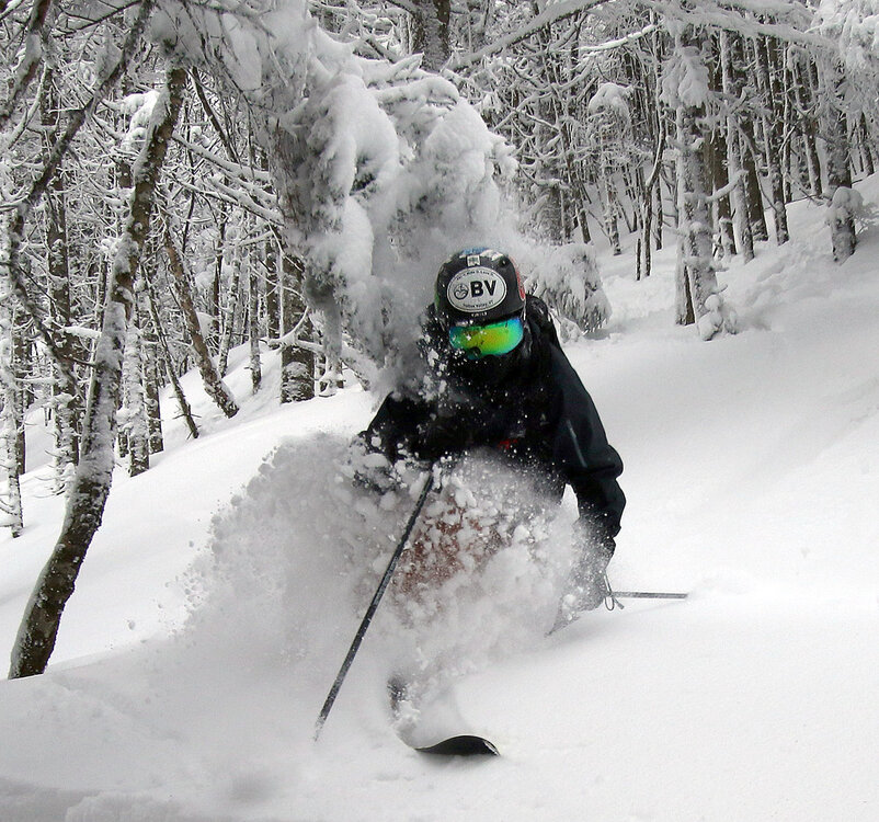
Overnight we picked up another 2-3” of snow in the valley, and ski conditions have been respectable enough in my past couple of outings that I decided to head out for more turns today. My older son had the day off, so the two of us went for a tour on the Bolton Valley Nordic and Backcountry Network. With decent conditions, comfortable temperatures in the 20s F, and a holiday weekend, we weren’t surprised to find the Village parking lots filling up by mid-morning. We arrived just about the time when people had to start parking down at Timberline, but we were able to dig ourselves a parking spot in the northwest corner of the Village lots and start our tour from there. Today we toured in the 2,000’-3,200’ elevation range, topping out on the Network by the Catamount Trail Glades. The skiing was generally good throughout that elevation range, but at least in the Bolton Valley area, there’s a definite shift in conditions at 2,500’. Above that point, the powder depths are sufficient for bottomless turns, with 12”+ around 3,000’. Below 2,500’, you’re looking at roughly 4-6” of settled powder, and there’s just not enough liquid equivalent in it yet to avoid touching down on the subsurface at times. So, the powder skiing is still fine, but you’re occasionally hitting that subsurface, and it’s soft enough to be breakable if you’re carving with enough force. In some respects, it’s nice that it’s not a rock-hard subsurface, but you do need to be on your guard in case you break through to the softer layers below. There’s some excellent skiing out there above 2,500’ though, and on our ascent of the Bryant Trail we saw a group that was just finishing a run in some of the glades near the Bryant Cabin and putting their skins back on for another lap. They were starting right around that 2,500’ mark, which probably wasn’t just coincidence. Although there aren’t any huge storms coming in the immediate future based on what the weather models are showing, it looks like we’ve got another couple of moderate systems in the queue for this week, so with no big warm-ups in sight, those storms should continue to keep the conditions good and add to that liquid equivalent above the subsurface.


-
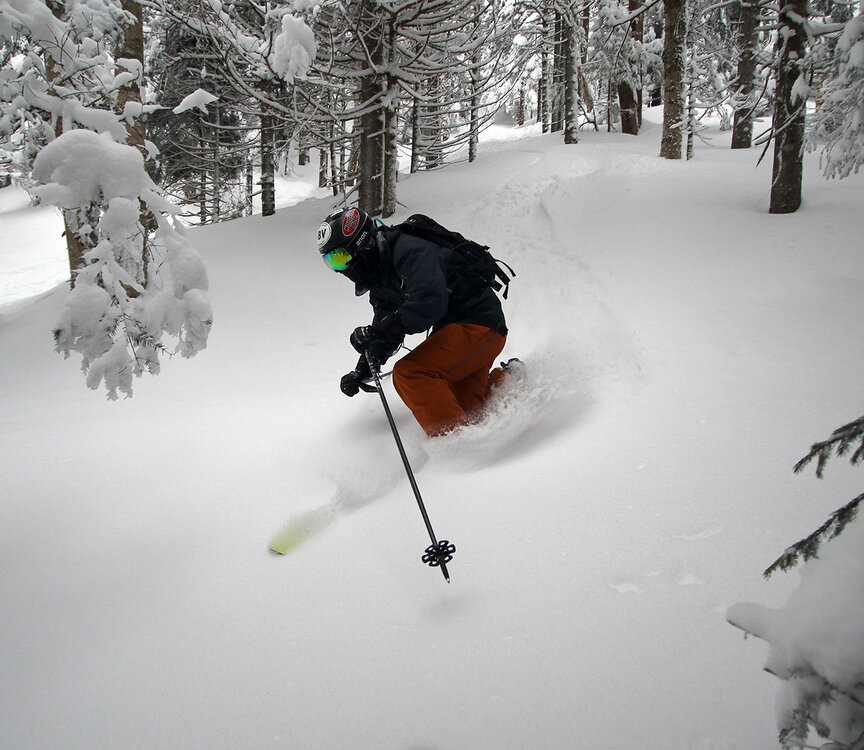
Thanks to some of our recent snows, the conditions I encountered on yesterday’s ski tour at Bolton Valley were certainly decent above 2,000’ and getting quite good above 2,500’. With some additional snow overnight, and temperatures expected to reach up into the 20s F today, it was enough to get me thinking about heading out again. My wife also had some time to ski, so the two of us headed up to Bolton for a morning session. With all lifts running, we were able to park down at Timberline, but based on the elevation dependence I’d seen in the snow accumulations and quality, we headed right up to the main mountain for most of our skiing. The additional of some new overnight snow helped all around, but there were still dramatic differences with respect to the quality of conditions at various elevations. I hadn’t gotten up above 3,000’ yesterday, but I did today, and the depths of the surface snow were impressive. I was finding 12-15” of powder in undisturbed areas at the top of Wilderness, so there really are some impressive areas of good skiing once you get up at to those elevations. We didn’t do much skiing in the lower elevation terrain of Timberline until we were heading back to the car, but skiing off piste down near the 1,500’ elevations range made it clear that it wasn’t worth spending a lot of time down there. Even in untouched areas on the lower slopes of Spell Binder there were just a couple inches of powder above the hard subsurface, so there’s no real chance of getting any sort of bottomless turns, even on lower angle terrain.


-
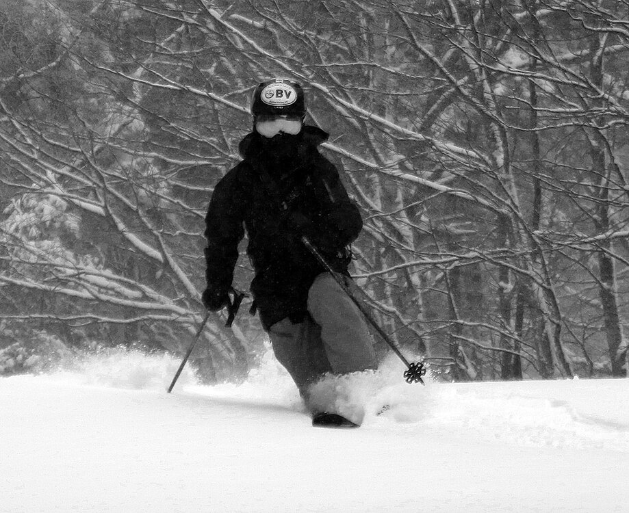
This Thursday/Friday stretch has certainly been looking like the top period to target for turns over the past week or so, and it seems like the storm delivered about what the weather models predicted for the Northern Greens. Here in the valley, the system delivered 0.34” of liquid equivalent, so with the mountains perhaps getting twice that amount at elevation, that’s a decent resurfacing. I headed up to Bolton Valley this morning for a tour, so I can report on some of the conditions there. I had planned on Friday morning to get out for turns with this storm, but the downside was that frigid air was returning on the back side of this system. By the time I ascended to the Bolton Valley Village this morning, the temperature had dropped to 0 F, and there were winds of 10 to 20 MPH, putting wind chill values around -20 F. Needless to say, with those temperatures and winds, my plan was to tour instead of riding the lifts. My ski tour was in the 2,000’ to 2,700’ elevation range today using the Wilderness Uphill Route, and as discussed earlier in the thread, there was a definite benefit to getting up toward that elevation where the storm was 100% snow and all that liquid equivalent was put toward resurfacing. Below is the elevation profile I observed today for total powder depths; essentially everything below roughly 2,000’ only caught accumulations from when the snow levels finally dropped to the valleys, which typically meant an inch or two of new snow. It’s easy to see how static the accumulations were below approximately 2,000’: 340’: 1-2” 500’: 1-2” 1,000’: 1-2” 1,500’: 2” 2,000’: 4-5” 2,500’: 5-7” 2,700’: 7-8” I wouldn’t be surprised if powder depths continued to increase a bit more as one headed up toward 3,000’, but I didn’t get a chance to head that high today. Bolton Valley was reporting 7 inches of new snow in the past 48 hours in their snow report, so that’s probably an approximate number for their storm total, and thus this storm was likely a substantial contributor to the total powder that’s out there right now above the subsurface snow. Obviously, there were decent turns to be had all the way from 2,000’ and above, but the quality of the powder and potential for bottomless turns was definitely best above 2,500’ – that’s probably getting in the range where most of the liquid equivalent from the storm fell as snow. Low-angle terrain was good to go anywhere above 2,000’, but once you were above 2,500’, even medium-angle terrain was coming into play for bottomless turns. If options exist for hitting upper-mountain lifts or lapping/touring from 2,500’ and above, I’d recommend that to get in the best turns. What really surprised me today was that despite air temperatures of 0 F and below, the snow was still quite decent with respect to its glide. Sometimes these cold temperatures simply wreck the glide, but depending on the snow’s crystal structure, density, composition, etc. sometimes the glide holds up, and today was apparently one of those days. There’s more snow moving in tonight with one system, and then another system moving in Monday into Tuesday, so there should continue to be some pretty decent turns in low-traffic areas at those higher elevations.
-
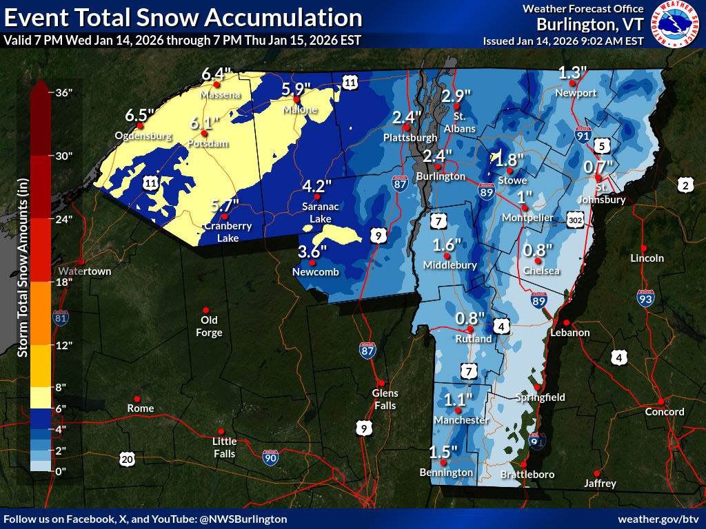
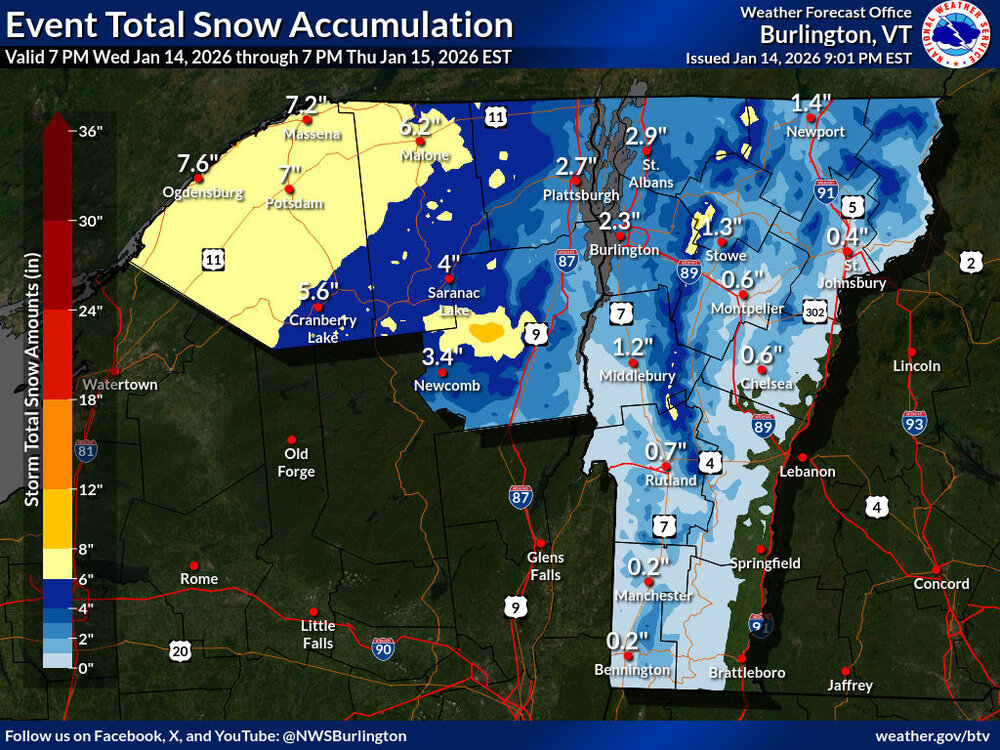
Thanks for that update – as noted in the BTV NWS forecast discussion below, it looks like it’s snow right from the start of this system at 3,000’ and above. I’m sure the 2,000’ – 3,000’ elevation band should do fine as well though based on the way the snow levels were already down to 2,300’ as of this afternoon. There hasn’t been much of a change with respect to expected accumulations in the valleys, but the BTV NWS point forecasts have given a bit of a bump in accumulations for the mountains (~6-12” in the Mansfield point forecast), and I see that there are a few shots of that 8-12” shading making its way into the Event Total Snowfall Accumulation Map now. Area Forecast Discussion National Weather Service Burlington VT 653 PM EST Wed Jan 14 2026 Lets start with what we know, its currently 26F at Whiteface, 28F Mt Mansfield, 30F at Little Whiteface, SLK 39F and 45F here at BTV, indicating elevations above 3000 feet should see an all snow event, producing a sharp elevation dependent snowfall from valley floors to summits, especially in VT. …a sharp elevation dependent snowfall is expected with a dusting to 3 inches Champlain Valley 8 to 10 inches atop Mt Mansfield to Jay Peak and similar amounts over the northern Dacks.
-
The current Winter Weather Advisories don’t quite extend into the Northern Greens, but I saw that the BTV NWS has a headline and Event Total Snow Accumulation map posted, and this next potential event does appear to be the most substantial one in the storm queue for the next few days. Temperatures look a bit warm to maximize snow in the valleys, but the higher elevations are poised for all snow with 4-8” or so of accumulation in the point forecasts, and the current map seems generally in line with that. Many of the models have liquid equivalent getting up toward that 0.50-0.75” tier, so it’s certainly worth keeping an eye on later Thursday into Friday for some turns and a potential resurfacing of low or even moderate-angle terrain. The BTV NWS forecast discussion does say to watch out for potential changes in the valley accumulations, so that would also be something to keep an eye on with respect to travel: Areas from the Champlain Valley eastward are far trickier as the changeover to snow is later and will occur near sunrise and/or into the daylight hours on Thursday. We`ll also start to see drier air intrude during the day Thursday, which could serve to lower overall precipitation amounts. Newport, for example, the 25th percentile is about 1.5 inch, the 75th is nearly 5 inches, and the 90th goes all the way to 7+. Note that our official forecast tends to lie on the lower side for areas from the Champlain Valley eastward through VT, often down near the 25th percentile. Confidence in snow amounts is lower here than further west, and there`s the potential for them to go up should things trend colder and/or wetter. Please stay tuned as we continue to refine the forecast going forward.

-
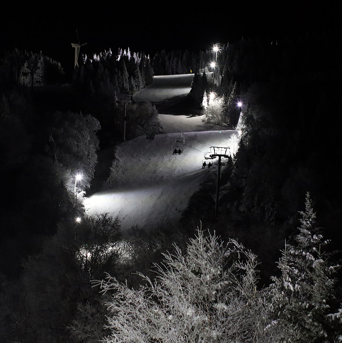
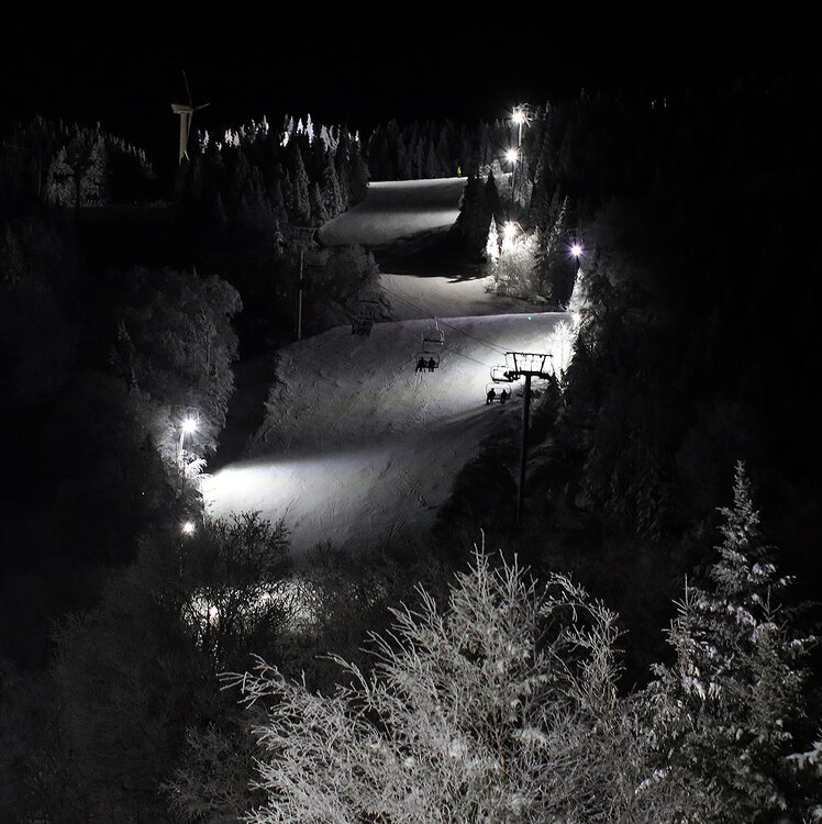
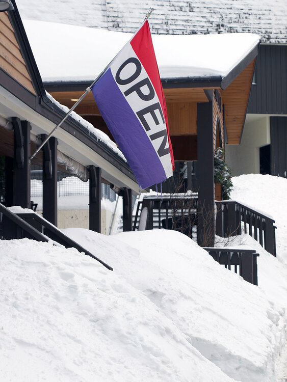
Yesterday I’d hoped to get up to Bolton for some afternoon turns and take advantage of some of the warmer temperatures, but I couldn’t get up to the mountain until after dark. That did allow me to get my first lift-served ski session of the season under the lights. It turns out that while temperatures crept above freezing in the valleys, the mountains stayed below freezing, so the snow never really had a chance to soften up. I was only able to sample terrain with manmade snow, since that’s most of what’s available under the lights, and it was about what one would expect on busy terrain. I’d say it was fairly middling in terms of typical manmade conditions that had seen plenty of skier traffic – not horribly icy, but certainly not universally soft by any means. It was decent snow for carving turns, and temperatures in the upper 20s F made it comfortable to be out. All the main Village parking lots were rather full when I arrived, and when I was leaving the mountain around 6 PM or so, cars were just streaming up the access road. I wouldn’t be surprised if Thursdays are one of their busier nights, but I’d definitely say that the night skiing scene at Bolton is alive and well. The fact that midweek night skiing tickets are only $29 is probably a factor in getting folks up to the mountain for turns as well – that’s just a fraction of the price for a typical daytime lift ticket.
-
That’s interesting, because it clearly shows that there was quite some variability in the effects from that storm, even within the same town. I was actually referring specifically to our observations site when I wrote “minimally degraded the snowpack here or resulted in a net gain in snowpack liquid equivalent.”. So the focus was our site and the mountains; I didn’t mean to imply “here” in the more regional sense. I cored the snowpack before the storm on December 15th and there was 1.26” of liquid in it, and then I cored it again after the storm on December 20th and there was 0.70” of liquid in it. So, we lost about ½” of liquid from the snowpack over the course of the storm, which I felt was fairly minimal relative to the event as a whole (the totals for the storm were 0.91” of liquid equivalent and 0.5” of snow). There’s definitely some room for debate about just how minimal/moderate one considers that, but if that’s what happened at our site in the valley, then the mountains must have incorporated all that liquid and hardly missed a beat. The other warm event I was considering in that post (Winter Storm Ezra) was later in the month, and it brought 1.24” of liquid equivalent and 3.2” of snow. In association with that event, the snowpack at our site went from 1.63” of liquid on the 28th to 1.93” of liquid on the 30th. Aside from the snow “quality” issue after that storm, that seems quantitatively like a gain for the snowpack at our site in the valley, and if that’s what happened down at our site, the mountain snowpack should have had the capacity to just gobble up everything that storm had to offer (which should have been 1 to 2 inches of liquid equivalent). When we’re talking the 12-14” of liquid that PF measured in the higher elevation snowpack, I’d think both of those events would have minimal effects.
-
Since it looks like temperatures will go above freezing with this next system, I cored the snowpack for liquid here at our site in the valley for this morning’s CoCoRaHS report. Our snowpack currently contains 2.42” of liquid, which is the highest I’ve recorded so far this season. We’ve really only had a couple of notably warm storms, since maybe all the way back to some point in November? And those events either minimally degraded the snowpack here or resulted in a net gain in snowpack liquid equivalent. And with the deep snowpack in the mountains, they easily just incorporated any of that liquid for a net gain. We saw how much liquid was in the Mansfield snowpack from PF’s report a few weeks ago (12 to 14 inches), so it’s got to be even more than that now. It should be interesting to see how things go with this next system based on the most recent modeling.
-
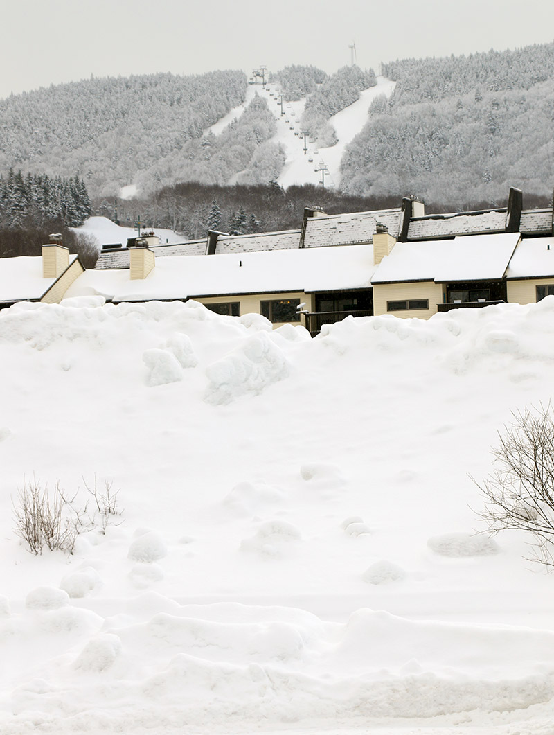
Bolton Valley was reporting another 3-5” of snow in their morning report, and 10” in the last 48 hours, so I figured it was time to head back up to the hill to see how much progress there had been in the ski conditions. The first thing I noticed when I reached the Village was how incredibly warm temperatures in the mid to upper-20s F felt – it was so warm that it seemed like the snow should be melting. I started off with a ski tour on the Wilderness Uphill Route to the Wilderness Summit. Being a Wednesday, they were running the Timberline Quad instead of the Wilderness Chair, and that meant skier traffic on Wilderness was quite low. Conditions have improved quite a bit since I was last out on the mountain six days ago. Low-angle terrain has seen a full resurfacing, so unless the terrain had been recently groomed, you were not contacting any of the underlying hard surfaces. You could actually get bottomless skiing on any pitch of terrain if it hadn’t seen skier traffic, but that was quickly lost anywhere that had seen many skiers, so we’re not talking about a limitless resurfacing of all terrain. The skiing was so good that I decided to stay around for some lift-served skiing as well. On my first ride up the Vista Quad Chair I rode with Will, another Bolton Valley regular. We wound up both skiing Cobrass, and after he told me about an adventure he’d had that brough him down the back side of the resort and required skinning back out, I showed him some of the terrain around Maria’s so that he had a good sense of how far you could go without ending up on the east side of the range. I continued on down to Timberline, since it was my first chance this season to get in some lift-served skiing there. Not everything on Timberline is open quite yet, but skier traffic has been much lower there and fresh snow abounds. The off piste terrain in the 1,500’ - 2,000’ elevation range needs just a bit of additional base to be ready for prime time, but as with the main mountain, from ~2,000’ and above there’s plenty of snow for off piste adventures. This most recent storm put down some fairly dense snow, and that played a big part in stepping up the conditions. My liquid analysis from the storm so far have indicated that the snow has come in right around 10% H2O. The off piste conditions out there right now are generally quite good, but there’s plenty of variability with respect to elevation, aspect, wind, and the predominant types of trees. Some areas are simply fantastic with mid-weight powder available, while others have a crust buried between layers of powder, and there’s some upside-down snow spots. Wide skis are a good choice to smooth out some of those irregularities. There was definitely deeper powder with elevation, and here’s what I generally observed for powder depths out there today: 1,500’: 5-7” 2,000’: 5-7” 2,500’: 9-10” 3,000’: 12-24” There certainly wasn’t two feet of powder everywhere up around 3,000’ or so, but in places that had not been skied or scoured, a foot plus was the norm. I did find some areas with up to two feet of powder atop the old base however, so some spots have picked up quite a bit over the past week.

-
Thanks for the update PF – and well put with regard to explaining what’s out there. As you can see in my Bolton report from my post above, our experience was very much the same yesterday, but we didn’t even go near any high-angle terrain because I knew it just wasn’t really worth it. The base is clearly there, and there’s plenty of terrain available, but we’re going to need a solid resurfacing to get back to the generally excellent conditions we’ve seen over the past several weeks. That will require a solid large storm cycle, or a good number of bread and butter systems based on the subsurfaces I’ve encountered. We’ll need a system or two with some meat in them. There are some storms out there in the models, but it doesn’t look like a real slam dunk bread and butter pattern for the next couple of weeks as far as I can see, so it might be a little while before the mountains get back to pleasant surfaces. I’m OK with a bit of a slow down in conditions though – looking at my records I see that I’ve had almost 30 ski outings so far this season, and that’s a lot to pack into a couple of months with everything else going on in life. That’s well ahead of my typical November/December pace, since the seasons don’t always take off quite this fast with such prodigious snowpack. It’s easy to get out during the holiday period but packing it during the fall takes a lot of planning. We’ll roll with whatever Mother Nature decides to give us though, and having that fantastic snowpack in place means that conditions should be good to go as soon as that liquid equivalent comes along.
-
With the mountains picking up several inches of additional snow from our most recent clipper system, the family along with some friends headed up for some holiday season turns at Bolton Valley yesterday. Temperatures were cold – it was in the upper single digits F on the mountain for the start of the day, and it was only expected to get colder as the day went along. With that in mind, we decided to just head up for a quick tour in the morning via the Wilderness Uphill Route before the Wilderness Chair started loading. Up at the resort it was quite windy in exposed areas, and snow was still falling, so here was certainly a January feel. Based on my reconnaissance tour on Wednesday, I recommended we just stick to lower-angle terrain because even with the new snow, I didn’t think there were be enough liquid equivalent to support good turns on anything steeper than that. So the six of us toured up to ~2,700’ on Cougar and descended from there. Despite the additional snow for yesterday’s tour, I think that turns might have been a bit better on Wednesday. We were actually one of the first groups hitting that terrain for the day, so we had access to plenty of untracked snow, but the perceived slight drop in ski conditions might have been due to additional traffic on the earlier snow. Temperatures in the single digits F meant that the snow was somewhat slow as well, so that was kind of a knock against the skiing – you just didn’t glide that well, and that can be important on lower-angle terrain. After our tour, my younger son and his friends decided to hop on the Wilderness Chair for a lift-served run while the rest of us hit the base lodge, and they had fun, but the conditions weren’t good enough that it was worth hanging around to brave more of those cold temperatures and winds. Overall, it was great to get out for the tour, but even with the couple rounds of snow we’ve seen in the past few days, there’s just hasn’t been enough liquid equivalent set down yet to be anywhere near a real resurfacing. That, and the relatively cold temperatures mean that the skiing is there, but it’s just not back to anything great yet. The snowpack is quite robust though, so as soon as we get that resurfacing, the local resorts should be set up for some excellent skiing again.

-
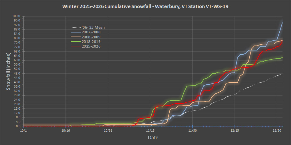
Data collection for December 2025 is complete, so we can see how it played out via the red trace in the updated snowfall progression plot below. Around mid-month, December had accumulated about 30 inches of snow, but the productive bread and butter pattern from the first half of the month slowed down a bit, and we hit that relative lull you can see after the 15th for about a week. That lull broke for the last week of the month though, which delivered roughly another 20 inches and ensured that December snowfall ultimately wound up above average. This season, the combo of November and December delivered between 70 and 80 inches of snow, which is solid, but still at the end of that +1 S.D. range. The plot nicely shows how the last week of the month allowed 2025-2026 to pull away from 2018-2019 (green trace). It looked like it was making a run for some of those top seasons, but it ultimately fell short of surpassing 2008-2009 (orange trace) and well short of catching 2007-2008 (blue trace). Overall though, this season has certainly had a solid start relative to average as the plot shows.
-
That overnight snowfall played out similarly here at our site – the underlying snowpack is currently consolidated enough that we picked up 4 inches of snow, and the snowpack depth went up the same amount. We’ve had a lot of continuously settling snowpack over the past couple of months with the types of systems we’ve been seeing, so each round of new snow has typically been compressing the underlying snow. This snow from this recent clipper was fairly dry down here (4 to 6% H2O), so it’s already settled an inch since yesterday.
-
With the approach of our next system, winds already began shifting to a more southerly direction, and that pushed some lake moisture and accumulating snow into the area this afternoon. I see the BTV NWS has us in the 3-6” shading here in the valley with some 4-8” shading farther north along the spine toward Mt. Mansfield, and that generally seems to mesh with the point forecasts I’ve seen. Some modeling gets the mountain areas up toward half an inch of liquid equivalent in the Mansfield area, but most seem to be more in the 0.2” to 0.3” range. As noted in my previous post, every bit of liquid equivalent that comes with this system will do that much more with respect to improving the quality of the snow surfaces, so it will definitely be interesting to see how the mountains fare.