J.Spin
-
Posts
6,440 -
Joined
-
Last visited
Content Type
Profiles
Blogs
Forums
American Weather
Media Demo
Store
Gallery
Everything posted by J.Spin
-
It was cold out there today – midwinter cold. By the afternoon we’d reached the upper single digits F in the valley, but I knew it was colder than that in the higher elevations. I wasn’t too excited to get out in those temperatures to ski, but Bolton had reported another 5-7” of new snow from the Christmas Day storm, and on top of all the recent snowfall, there was likely going to be some really great skiing out there. I ultimately decided to head up for a quick ski tour and was planning to get on the Bolton Valley Nordic & Backcountry Network from the Village, but I figured I’d at least take a look at Timberline on the way up. A woman I rode the chair with on Wednesday said that the resort was working their way toward getting Timberline skiing underway during the holiday week, and indeed they were blowing snow at Timberline, so that made the decision easy to head up to the Village. By the time I’d ascended to the Village, the temperature was down to 2 F, which is about what I’d expect based on the valley temperatures. I’d geared up with my usual dual base layer setup for cold temperatures, so I was actually nice and warm on my ascent. The fact that there was no wind actually helped make it quite comfortable, and my older son was up riding the lifts and giving ski lessons to some beginner friends, and he commented about the lack of wind as well. For a change of pace I ascended part of the Bryant Trail and connected over via Cliff Hanger for a descent of Prayer Flag. The powder depths I measured in undisturbed areas were typically 12-15” at the 2,000’ level, and 15-16” in the 2,500’ range. The subsurface just continues to get buried under deeper and deeper layers of powder, and the descent of Prayer Flag was one of the better ones I can remember. I was worried that the skiing might be on the slow side with the cold temperatures, but the composition of the powder out there made for great gliding. It also didn’t hurt that only one or two other skiers had toured in the Prayer Flag area, so the snow was mostly unracked. Once I was back down to the Broadway bridge I made another ascent up to the top of World Cup and descended through some of the glades in Telemark Practice Slope area. It looks the current conditions are going to make for some fantastic skiing this weekend, with some additional snow expected tonight, and much warmer temperatures for the next couple of days.
-
Our most recent clipper system dropped about 10 inches of new snow in the local mountains as of this morning’s reports, and on top of the new snow that was already in place yesterday, it meant that today was definitely a good one to get out for turns. There was quite a temperature gradient with respect to elevation this morning – it was in the mid-20s F in the valleys, but it was in the mid-teens F up in the Bolton Valley Village at ~2,000’. It was probably in the low teens up above 3,000’, and with brisk winds it was downright cold in exposed areas. It turns out those winds would have quite an effect on how my morning session played out at the hill. I arrived around opening time for the Wilderness Chair, and was surprised to see that it was running, but there was a queue of probably 50 people or so still waiting to get on. I paired up with a guy who filled me in on that latest – the Vista Quad had been running earlier, but it had gone on wind hold not too long ago, and naturally everyone headed over to ride the Wilderness Chair. From the Wilderness Summit, I worked my way over toward Fanny Hill since the Vista Quad was down, and I found great conditions with plenty of untouched snow all the way back to the base. I was thinking of taking a couple of runs off the Snowflake Chair, but much to my surprise, I pulled up to the Vista Quad, and it was loading skiers. Since it hadn’t run that long before it went on wind hold, conditions off Vista Peak were fantastic. Alta Vista yielded an excellent groomed surface, and Vermont 200 offered up some steep, soft turns with untouched powder along the sides and especially down near the bottom where the trail fans out. On yesterday’s outing it was clear that many lower-angle slopes were offering good conditions, and the extra snowfall overnight bumped that right up to include just about any terrain. You could still find slick areas on steep terrain where skier traffic had pushed away the new snow, but snow that hadn’t been touched by other skiers was dealing out beautiful turns. In general on the upper mountain I was finding 12”+ of powder available in untouched areas, with some places hitting 24” where snow had collected well. Down in the valley we picked up another half inch of liquid equivalent from this latest clipper, and I’d say between these last few systems, the mountains should have picked up an inch or two of liquid in the snow. It’s represented a decent resurfacing, and it’s definitely having an effect on conditions - this latest system was the one that pushed them over the top.
-
The weak mid-level trough that came through the area yesterday dropped about 3” of snow in the valleys around here, and I saw that Bolton Valley was indicating 4” new in their morning report. Combined with the snow from Sunday’s cold front, it seemed like it was time to head up to the mountain and check out how the resurfacing was coming along since the most recent consolidation storm that we had over the weekend. Temperatures were well up into the 20s F and there was no wind, so it was very comfortable out on the mountain, and although it wasn’t snowing, the skies were cloudy ahead of the next incoming clipper system. The Wilderness Lift wasn’t loading until 10:00 A.M., so I started the morning off with a tour up to the ~2,700’ elevation using the Wilderness Uphill Route. Conditions were excellent on Lower Turnpike, with several inches of powder above the old base. Turns weren’t 100% bottomless, but I was probably getting 50% bottomless turns on lower-angle terrain in untouched areas of snow. And even for turns that touched down to the subsurface, the base was nice and soft. I followed up the tour with some lift-served runs, and I can say that moderate and high-angle terrain are nowhere near being resurfaced yet. The new snow was quickly pushed around by lift-served levels of skier traffic, and it’s going to take another inch or two of liquid equivalent to get the high-angle slopes back to something respectably soft for lift-served skiing. There is an increase in powder depth with elevation, and here’s roughly what I found for depths out on the mountain today: 2,000’: 3-4” 2,500’: 4-5” 2,700’: 5-6” 3,150’: 7-8” The best turns were in areas of untouched snow, which were thankfully fairly plentiful ahead of the lift opening, but there’s just not enough liquid equivalent in the surface snow yet in any terrain area to hold up to lift-served skier traffic. The current system affecting the area is even more robust than the last one however, so it certainly should bring the snow surfaces up another notch by tomorrow morning.
-
The numbers are probably too borderline for a Winter Storm Warning down here in the valley (the most recent update is more like accumulations of 5-8" without yesterday afternoon's snow included), but this is often the way they do it when the more substantial accumulations are localized right along the spine – it’s too small a geographic area to focus the alert.
-
At some point during the day today Alexa alerted me that we’d been put under a Winter Weather Advisory, and it looks like the BTV NWS advisories start up at 7:00 A.M. tomorrow morning and cover a good chunk of the state outside the Champlain Valley. The most recent Event Total Snow Accumulation map shows totals in the 8-12” shading for the higher elevations of the spine around here. Down in the valley our point forecast suggests something in the 5-10” range through tomorrow evening, and the map has us in that next tier of 6-8” shading, so those projections seem to correlate fairly well.
-
Yeah, I find the GFS is the best mid-range model out there with respect to telling us what’s likely to happen up here in the Northern Greens when looking ahead a week or two. It seems to see the terrain well and it knows what to do with it. When it comes to modeling, I think we sort of have an advantage around here in that this is an incredibly snowy climate, so basically any impulse, piece of energy, or system that gets near the spine is typically going to produce some snow. All a model has to do is assume that it’s going to snow and it’s generally going to be correct. Also, our classic “bread and butter” patterns are often based on a single northern jet stream, so there’s not a lot of concern about lining up perfect phasing, etc. Looking back at my post from earlier in the month, the GFS suggested 7 to 9 systems coming through the area through about this time period, and this current system is #7 or #8. We’re right around 30” of snowfall for the month so far here at our site, so it will be interesting to see if we end up above average for December. If we kept the snowfall pace we had through the first half of the month, that would have been a slam dunk, but the pattern doesn’t look quite as prolific for the remainder of the month. The GFS shows roughly 6 potential systems in the queue through the rest of December, so we’ll see how thing play out. This current system isn’t really a big one for snowfall, with probably just a few inches on the back side, and then there’s a system tracking along to our north over the weekend – it seems a bit far north to hit us with too much snow, but there will potentially be some effects and the BTV NWS talks about that in their discussion. Then there’s a potential system in the Tuesday timeframe. That one has that look on the GFS with the lingering upslope precipitation, which definitely suggests some decent potential at first glance. That one is still a bit in the distance, but the BTV NWS certainly touches on that in their discussion as well: Area Forecast Discussion National Weather Service Burlington VT 1233 PM EST Fri Dec 19 2025 LONG TERM /SUNDAY NIGHT THROUGH FRIDAY/... The next system will approach Tuesday afternoon. Although temperatures during the day will climb near to just above freezing, we`ll likely remain all snow for precipitation. Our weather pattern will feature us on the fringe of a very warm air mass to our south and cool air off to our north. Small fluctuations in the pattern could spell a wide range of scenarios. On a day-by- day scale, these kind of weather patterns tend to have lower predictability since systems move fast between stronger winds between these sharp thermal gradients and the lack of amplification means these smaller systems can be more difficult for global models to resolve. It`ll certainly be active, with likely breezy conditions and precipitation opportunities every other day or so.
-
My colleague Mark was still in town for work yesterday and my older son had the day off, so the three of us headed out for another tour on the Bolton Valley Nordic & Backcountry Network. Mark was looking for a tour that would have an ascent in the backcountry potentially followed by some rolling backcountry terrain, finishing off with a descent on some groomed alpine terrain where he could work on his Telemark turns. When he described what he was looking for, I had just the route he needed. We ascended via the Bryant Trail to the Bryant Cabin, then traversed back toward the alpine trails on the rolling terrain of North Slope and finished off with a final descent down Lower Turnpike. Temperatures had crept up into the 30s F in the valleys, so I was unsure what was going on up at the resort, but temperatures dropped as we ascended to the Village. The temperatures were below freezing at Village level, so all the snow was still in midwinter form. My younger son had been out for some lift-served skiing in the morning, and he felt the off piste snow had settled somewhat, so I was surprised to find that the powder was just as fluffy as usual out in the backcountry. We didn’t ski a ton of untracked powder on the backcountry route we took, since it had a lot of rolling terrain without many big descents, but the powder that we did hit was excellent. Just as impressive as the powder off piste was the quality of the turns we found during our final descent on Lower Turnpike. I hadn’t been there in quite a while, but I’d say it had the highest quality packed snow I’ve seen during this recent stretch. Even with lift-served traffic on Wilderness, we couldn’t find a touch of firm snow on Lower Turnpike, so it wound up being a highlight of the trip and a fantastic surface for Mark to use for practicing his Telemark turns.
-
Since the snow depth for our VT-WS-19 CoCoRaHS site is reported each day, SDD for our site is actually something that can be obtained publicly. SDD isn’t something that CoCoRaHS reports directly though, so it would require some offline analysis (unless it’s available in one of the various CoCoRaHS analysis tools – I haven’t explored all the features in those tools exhaustively). You could even explore some of the data for a CoCoRaHS site closer to you if you wanted something that might be more relevant to compare to your location. It looks like southern Franklin County has relatively poor coverage on CoCoRaHS, but the one active site in that area is in Fairfax: VT-FR-21: Fairfax 4.9 WNW. Anyway, I have all my data in a spreadsheet, so it’s really quick for me to calculate SDD. If one is looking for relative snow retention/snow cover, SDD is certainly going to be helpful, but I could also envision the total number of days with snow cover being another important parameter. There could be a season with a solid number of SDD through mid-December, but it all happened to come from one notable storm that fell in the last week of November and hung around for several days, but the rest of November and the first half of December had bare ground. Or, there could be a few inches of snow cover right from the start of November that never melted and the ground was white the entire time. It’s hard to say which one of those is “snowier”, so I made plots for both of those parameters. There are three plots below covering data from the start of the snow season (Oct 1) through Dec 15: the first one plots SDD, the second is total days with snow cover, and the third is the sum of those two (sort of a way to blend those two parameters into a more comprehensive parameter for integrated snow depth & snow cover – the numbers are generally within an order of magnitude of each other, so a straight up sum seemed reasonable). As you can see from the data, this season is solid, but not really a standout that jumps from the pack of other decently performing seasons in either SDD, days with snow cover, or the combined parameter. I’ve never really explored these numbers until you inquired, so it’s interesting to see the season that does jump out here is 2018-2019. It’s actually the top season on all three plots, but boy does it absolutely soar above everything else with respect to SDD. It’s not surprising to see that 2018-2019 is one of the comparative seasons I’ve been tracking in my snowfall progression plots (I added that latest plot at the bottom here for reference). Coincidentally, there is currently a discussion on First Tracks!! Online Ski Magazine about the strong start to the ski season here in Northern Vermont, and in that discussion, Tony Crocker has a post showing that as impressive as this start has been with respect to open terrain – through December 8th, the 2018-2019 season was even better than this one.
-
What one considers a “big” storm is sort of arbitrary/subjective, so there’s certainly room for pushback. But your comments help to make the point – I can’t even tell you when those two 20” cycles occurred. I’m not sure if anyone in the forum other than you knows when they happened. Most likely they were “nothing” events in terms of their impacts on the majority of the Northeast. There have only been three TWC named winter storms so far this season, and they all impacted us and are in the list below, but none of them were named for their impacts in our area because their effects here were minor as you can see by their accumulations at our site. Alston and Bellamy earned their names because of impacts in the Midwest, and Chan was named because of impacts off to our south. If you look at this list below of the 18 storms that have hit our site so far this season, it’s loaded with Clippers, cold fronts, and shortwaves. My main argument was that the Mansfield stake has reached record depth without being in the sweet spot for any major synoptic storms. If someone told me that Mt. Mansfield had reached a record snowpack depth for mid-December, I’d assume there had to have been at least a couple of major synoptic storms in which our area was in the perfect position to cash in and get a ton of snow. But that hasn’t been the case. And, what’s more interesting is to consider that perhaps the record depth wasn’t achieved just in spite of not getting hit by those big synoptic storms, but the record depth was actually achieved because we were in a pattern that wasn’t conducive to creating big storms. What has transpired so far this fall just proves that it’s not necessary to have multiple perfectly placed coastal storms to achieve a record mountain snowpack around here - that’s the part I find most counterintuitive and intriguing. Below is the list of accumulating storms that have affected our site so far this season, and it should be just about the same list for the local mountains. The description of each storm is included, and none of them were big coastal systems. The closest to a typical nor’easter was Winter Storm Chan, but it was still quite weak, and its effects this far north were fairly minimal (only 4.8 inches for a storm total at our site).
-
Now that we’ve hit the mid-month period, I’d been meaning to put out an update on the seasonal snowfall progression and check where things stand with respect to other seasons. As the data show, this season’s snowfall progression (red trace in the plot below) is clearly running above average. But as much as everyone has been talking about how outstanding this season has been, its snowfall is really just running in a similar manner to how 2018-2019 progressed (green trace in the plot below). In fact, this season has generally been running behind the 2018-2019 snowfall pace. And for even more perspective on this season’s snowfall, it’s now well behind the 2007-2008 pace (blue trace in the plot below). At this point, the second half of December would have to put on quite a snowfall performance to even be in the same league as 2007-2008. That was a season which essentially stacked a 20-inch November with a 70-inch December, so it’s not surprising that it holds the current snowfall record for that combo in my data set. As of mid-December, all of the resorts along the spine of the Northern Greens have recorded 100”+ of snowfall on the season, and Jay Peak is approaching 200”. But, this season’s snowfall is basically running in line with what we saw just had a few season’s back, and well behind 2007-2008, so why does it seem like such a strong start? The deviation from average snowfall pace may be a bit more in the mountains than the valleys, but I think a big factor in making this feel like such a strong start to the season has been the temperature consistency. Indeed temperatures have been well below average over this stretch, but they don’t have to deviate much if at all from average to get good snow at this time of year – especially in the higher elevations. I’m sure there are seasons that can attest to that, but I really think it’s the temperature consistency that has been helping to get us to where we are. Temperature consistency has clearly been a positive, but somewhat inseparable from that factor in this great start to the ski season has been the general pattern/storm track. And one could argue that the process of getting all the snow we’ve seen has been a bit counterintuitive. The local resorts have reached 100”+ of snowfall in just a month or so without any huge coastal systems, and without even getting any of our classic stacked lows sitting in the Maritimes. All this snow has basically been achieved through modest bread and butter systems without a highly amplified pattern. What’s certainly impressive is that we’ve gotten to where we are with a generally progressive flow of Clippers and similar events, but the more important part is that without a highly amplified pattern, we haven’t had to deal with many warm storms passing to our west. We’ve seen few rainy systems, and even few mixed precipitation events over the past month or so. If you ask me, that’s why Mansfield has achieved this record snowpack – it’s avoiding the “two steps forward… one step back” type of sequence that comes with those more amplified patterns and huge systems. I don’t think it would be strange at all for someone to assume that if you’re going to get to a record Mansfield snowpack, you’d need to do it with the help of a monster system or two… but this season flies right in the face of that idea. Cleary, the type of pattern we’ve been seeing is something notable/special if it’s tied or beaten out snowpack depths from the past 70 to 80 years of record keeping. We obviously know about the critical importance of these types of patterns up here with the fact that we use the “bread and butter” terminology, but I’ve come to appreciate them more and more every year. Growing up, we were always on the lookout for “nor’easters”, since they obviously make a big splash in the news, and everyone talks about them, but as kids we wouldn’t have known any better. If this type of less amplified/more progressive weather pattern that we’ve been seeing is indeed going to become more common around here as some of the meteorologists are suggesting, one has to think there’s going to be improving chances for more stretches like this. It’s definitely going to be interesting to see (and ski) if we get more of these stretches going forward.

-
Yesterday I was up at Bolton Valley for some lift-served skiing with a couple of colleagues who were in town for work, and that was a nice change of pace after several days in a row of touring. Apparently Bolton is doing $50 lift tickets on Mondays, so that’s a nice incentive for folks who don’t have season’s passes. Indeed the mountain was fairly quiet with a relatively small number of visitors, so I can see why the discounted tickets make sense. It was fairly cold, with temperatures probably in the upper single digits F at Village elevations, and they must have been near zero F up at the summits. I knew from the temperatures and blustery conditions in the valleys that it was probably a day I wouldn’t have gone out for lift-served skiing, but having my colleagues heading out for turns was enough to tip that balance in favor of a visit. The resort was running both the Vista Quad and the Wilderness Chair, as well as the lower mountain lifts, so they had quite a solid amount of terrain open now that they are operating during the midweek periods. Conditions were decent, with manmade snow on the main routes of Vista Peak, and all natural snow over at Wilderness. Both areas saw substantial weekend skier traffic, and you could tell the snow had seen some wear and tear. There were some slick spots on the manmade surfaces, and some areas of imperfect coverage on the natural snow terrain at Wilderness. This has obviously been a strong early season for snowfall and natural snowpack, but natural snow depths still aren’t quite at the level yet where coverage will really remain fully pristine on steep, ungroomed slopes. The temperatures were also cold enough that the groomed skiing was a bit slow It would be nice to get back up into the 20s F, and it seems like the coldest weather has passed and we’ll be warmer for the rest of the midweek period.
-
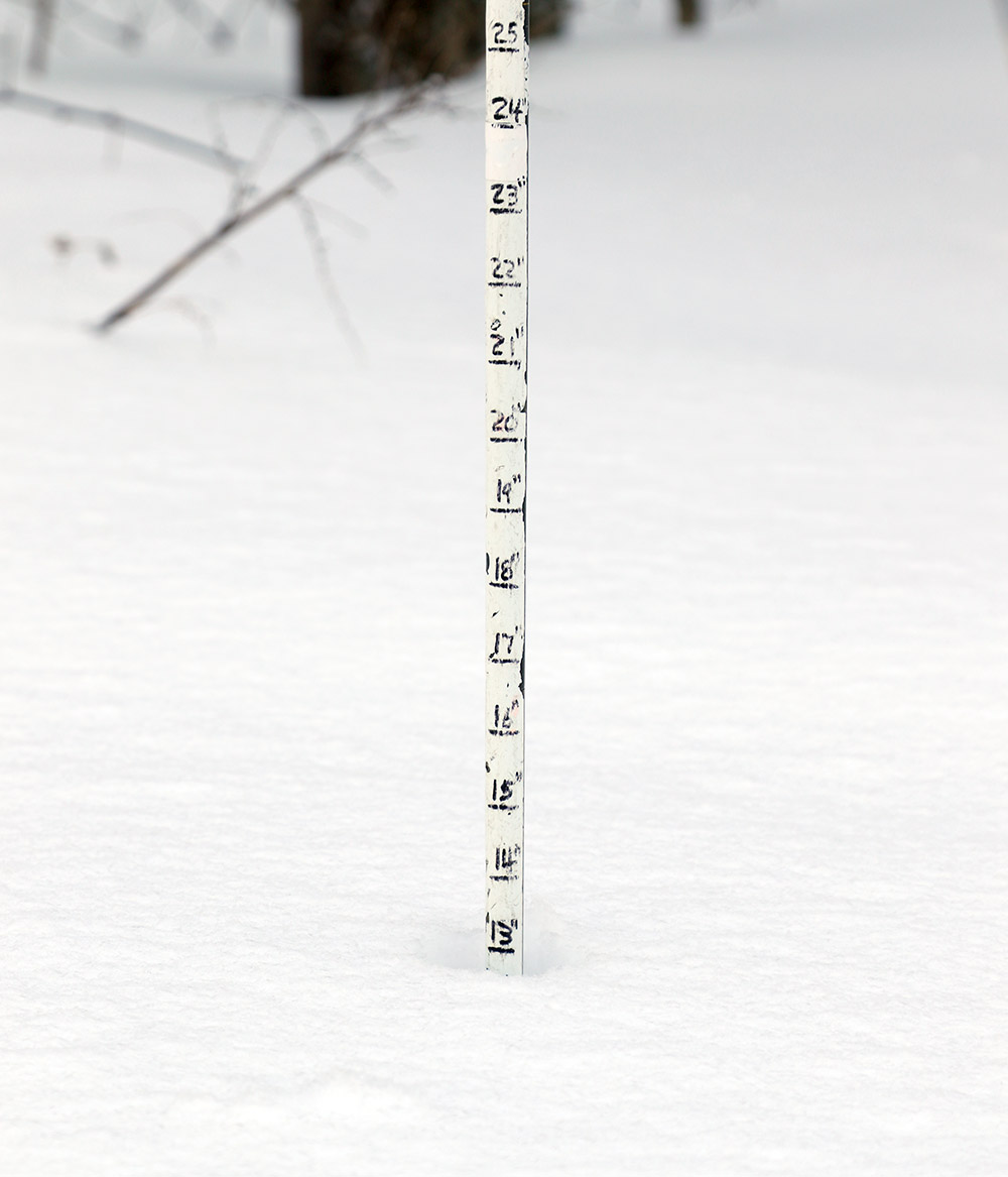
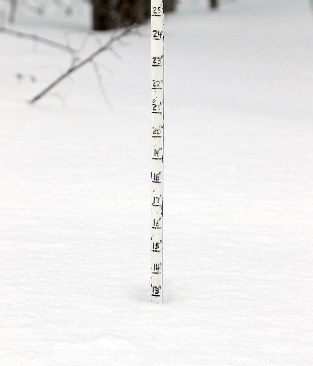
A couple more shots from Sunday's outing that I hadn't had a chance to get in with the first batch of images:
-
The local mountains keep picking up a few inches of powder each day, so my older son and I headed up to Bolton Valley for a tour yesterday. We headed up to Bryant Cabin and did a slightly longer tour than the one I did on Saturday with my colleague who was visiting for work. There’s not much to add with respect to describing the fantastic conditions, since Mother Nature keeps the snow refills coming, that just about cancels out the settling of the powder, and the powder skiing stays great. Indeed, powder depths continue to top out around 30 inches in the 2,000-2,700’ range, and the main problem certainly isn’t in finding deep, dry, untracked powder, the bigger issue is often finding steep enough pitches to support the depth of all that snow.
-
My colleague Mark arrived at UVM yesterday for some work in the proteomics core, and after we spent the morning in the lab getting some samples ready for analysis, he was wondering if I wanted to head out for a backcountry tour at Bolton Valley. Mark is a big Nordic skier, but he also likes to get out for some Telemark skiing from time to time, and with current conditions around here, this was definitely one of those times. He knows Bolton’s Nordic terrain quite well, but I was more than happy to bring him on a fun tour through some of Bolton’s classic backcountry glades. I would probably have been heading out for an afternoon tour anyway, even if he hadn’t asked – the conditions are just so good right now that it’s simply a great time to get out for turns. We headed up to Bryant Cabin as I’d done yesterday and took a slightly different descent that brought us through the Gotham City area and down to the Telemark Practice Slope. The resort was reporting another few inches of snow since yesterday’s snow report, so in terms of conditions, just tack on another few inches to the depths that were out there yesterday. We were still touring in the 2,000 – 2,700’ elevation range, and my depth checks on the powder were hitting 30 inches. Skiing in powder in that 2 to 3-foot range is definitely a different experience than your typical 1-foot powder day, and fat skis are undoubtedly your friend on days like these. Mark was on mid-fat boards with 85 mm at the waist, and they did fine, but he could see the benefits of having 100+ mm skis with more rocker for the depths of powder we were dealing with. The weather was great today, with temperatures in the mid-20s F and light snow falling for much of the tour to keep that snowpack topped off. Being a Saturday, the Nordic & Backcountry Network was busier than yesterday, but there are still tons of untouched lines out there in most glades, and we’ve got another system affecting the area tonight that could add accumulations of another inch or two.
-
As of yesterday morning, Bolton Valley was reporting 14 inches of new snow from our latest clipper system, and 2 feet total for the week up to that point, so another visit to the mountain seemed in order. Being an early season Friday, I expected the usual spattering of early season visitors at the resort, but I was quite surprised when I arrived at the Village to find a multitude of cars – I wound up parking down in the 4th tier of the main parking lots. As I made my way toward the base of Wilderness to start my ski tour, I realized why all the visitors were at the mountain – the Wilderness Chair was running! I hadn’t checked the snow report that morning, but apparently along with the Vista Quad terrain the resort was running the Wilderness terrain on 100% natural snow. That’s certainly a sign of how thing early season has gone thus far – to have the entirety of Wilderness open for lift-served skiing before even hitting the middle of December is definitely ahead of the usual seasonal progression. I quickly shifted gears and decided to tour on the Backcountry Network. Based on my visits to the mountain so far this season, it was obvious that the backcountry had been skiable for quite some time, but this was my first chance to really see how the terrain was doing with the current snowpack. I wasn’t sure how far I was going to go, but I started up the Bryant Trail, and before I knew it I was at the Bryant Cabin. I made a descent in some of the untracked terrain between JJ’s and Big Blue, then switched over to Coyote and finished with some of the lower glades. Despite all the visitors to the resort, it was clear that the new lift-served offerings were the big draw – I saw very few people while I was out on the Backcountry Network, and untracked snow was a very plentiful commodity. Although not as intense as what I experienced on Friday, light to moderate snow was falling during my tour, so the snowpack just continues to get topped off with fresh coatings. In term of describing the snow and ski conditions, you can pretty quickly run out of superlatives, but the numbers don’t lie. I toured in the 2,000’ – 2,700’ elevation range, and the untouched areas offer powder depths of 2 to 2½ feet atop the most recent subsurface layer. Based on the Mt. Mansfield Stake, the snowpack in the higher elevations of the Northern Greens has now topped 5 feet, so even for some of the steepest terrain, coverage is getting quite good. You can tell that the snowpack is still settling, so coverage isn’t quite the same as a snowpack of that depth that’s had a couple of months to settle and consolidate, but it’s pretty darned good for the first half of December. On my way back to my car at the end of my tour, I was met by a Bolton Valley employee who was checking passes, and he was able to get me my backcountry tag for the season right there by electronically entering my pass information. The tags are yellow this year, and I’m not sure if it was just coincidence that I had my pass checked on my very first backcountry day, but it made me wonder if they are going to increase the vigilance on monitoring tickets on the Nordic & Backcountry Network this year. In any event, those who are heading out right now are definitely getting their money’s worth in terms of snowpack depths and snow quality.
-
As of yesterday morning, we’d already picked up 7 to 8 inches of snow in the valley from our most recent clipper, and Bolton Valley was reporting 8 inches in the past 48 hours. So, consistent with what PF had mentioned, it didn’t seem like there wasn’t a huge elevation gradient for accumulations up to that point in the storm. We were actually in a snowfall lull at that point – the front side of the storm had wound down, but the back side precipitation was quickly moving into the area. Indeed, as I ascended the Bolton Valley Access Road in the morning, I drove right up into heavy snowfall as the first bands of snow from the back side of the storm were hitting the mountain. I geared up for a tour at the Timberline Base amidst huge flakes of snow falling in the range of 1 to 2 inches/hour. Clothing and gear were getting covered so fast that I was constantly having to shake off the snow. During my previous outing on Monday, I’d found powder depths of roughly 8-12” around 1,500’ at the Timberline Base and 12-16” up near the 2,500’ level. Yesterday I’d say you could tack on a couple more inches to those general powder depths. Even though a lot more snow fell than that, my liquid analyses revealed that we had a solid period of 10-11% H2O snow during the day on Wednesday with all those small flakes, so that would have compressed the existing powder a bit. Fortunately, the density of the snow had dropped down to around 5-6% H2O by Wednesday night, so if there had been any perturbing of the powder grading with that denser snow, it had been largely restored by Thursday morning. Coinciding with that denser snow that fell Wednesday, this most recent storm did have the advantage of bringing more liquid equivalent to the snowpack. Whereas our previous Clipper brough a bit more than a quarter of an inch of liquid equivalent here at our site, this one had already brough a half inch as of yesterday morning, which would likely mean that between a half inch and an inch of liquid equivalent fell in the mountains. So although the powder skiing yesterday wasn’t quite as light and airy as it was on Monday, it was still right-side-up, and the added liquid equivalent more than made up for it with the ability to charge a bit harder on steeper terrain.
-
It looks like the Winter Weather Advisories in this area start up at 7:00 A.M. tomorrow, and the forecast here in the valley suggests accumulations in the 3-6” range. That seems to line up well with the BTV NWS Event Total Snow Accumulation map through Thursday morning. The forecast also calls for a few inches of snow beyond that period, which is probably covered in the longer period map that mreaves posted.
-
As of this morning we’d picked up 6-7” of snow in the valley from our most recent Clipper, and Bolton Valley was reporting 10” of new snow in the last 48 hours. Based on my tour up at Bolton yesterday afternoon/evening, I knew that all the additional snow that fell overnight was going to create some excellent conditions. Temperatures were in the single digits F this morning, so I considered touring at Timberline with its lower elevations and typically warmer conditions, as long as the snowpack looked like it was ready. Indeed the base depths and powder seemed fine even down at 1,500’. In terms of powder depths, I was finding 8-12” around 1,500’ at the Timberline Base and roughly 12-16” up near 2,500’. The snow was quite dry (liquid analyses for the storm revealed an average of 4-5% H2O), and that was helpful, because it was deep enough that you needed to be on moderate to steep pitches for good speed. The cold temperatures made the snow even a bit slower, so low-angle areas weren’t enough if you were in untracked powder. With bright sun and no wind, the temperatures were actually quite comfortable for touring, and the feel was much different than what single digits F feel like with clouds, snowfall, and wind.
-
I hadn’t had a chance to put together the November precipitation summary for our site, but December is already rolling along, so I figured I should get it done. We had 23.5” of snow and 6.52” of total liquid. It was a solid, above average November for snowfall as the red trace in the plot below shows, and it was jostling for record progress just after mid-month, but the second half of the month couldn’t hold that same pace that we saw in the first half of the month. That’s what would have needed to happen for this November to challenge for a snowfall record - the total would have needed to be up around 40” of snow to get into contention. It was still up there with some of the other notable Novembers we’ve seen, and it continues to hang with some of those other strong early snowfall seasons as we head into December.
-
I’ve been waiting on these past couple of systems to let some fresh snow build up before heading out for turns, and I went on an afternoon/evening ski tour today, so I can pass along some conditions updates. As of this morning we’d picked up about an inch of snow in the valley from the disorganized cold front that hit the area, then we had a brief lull in snowfall during the morning today before snows from the next clipper started to fall around midday. We’d picked up another inch or two in the valley by the time I popped up to the mountain in the late afternoon. The flakes this afternoon had been on the smaller side, so accumulations didn’t come on too quickly, but we were getting a medium-weight snow with some density to it. Up in the Bolton Valley Village at 2,000’ they were similarly receiving those fairly small flakes, although the snowfall intensity was certainly a notch up from what I’d seen in the valley. I toured in the 2,000 – 2,500’ elevation range using the Wilderness Uphill Route, and you can really feel the way that the pattern of system after system has been building that surface snow. My depth checks in that elevation range revealed that untouched areas generally have 15-18” of powder above the old subsurface from the last thaw. I’m sure the surface snow is a bit deeper up around 3,000’ and above, and the total snowpack depth is presumably in that ~50” range based on the latest depth report from the Mt. Mansfield Stake. In areas that had seen some skier traffic, I was generally skiing in 5-6” of powder, and that seems to match up fairly well with the 6 inches of new snow that Bolton Valley is reporting in the past 48 hours as of this afternoon’s snow report. There should be at least a few more inches reported as of the morning report the way it’s been snowing down here in the valley. With the small flakes falling while I was up at the mountain, the powder density was in the light to medium range, so it offered some resistance. In untouched areas of powder you really need moderate to steep slope angles because the powder is just too deep for really good movement on low angle slopes, but those areas with about half a foot of powder skied well on any slope angle. I was on mid-fats for today’s tour, but I suspect one could go with anything in the mid-fat to fat range by tomorrow morning. Based on the accumulations n my car when I got back from my tour I’d say it was snowing in the 0.5”/hr. range or more. It may not have felt like the snowfall was that robust, but if you’re accumulating in that range with such small flakes, you’re certainly getting some liquid equivalent down. My tour took me from late afternoon light to dusk to December’s early darkness, and there was all that snowfall on top of it that further reduced visibility. For once I’d planned ahead and had a clear lens on my goggles and a full charge for my headlamp, so even with the snowfall I had really good visibility for my descent. There were numerous other skiers out there touring by headlamp, and after this evening’s great experience with the snow quality, visibility, and temperatures, I’m definitely looking forward to more headlamp powder skiing. It was so much fun that I’m starting to think about getting a dedicated headlamp for these types of tours – with LEDs you can get them so bright now compared to a decade or two ago. The storm had progressed to much larger, upslope-style flakes by the time I got home, and the density of the accumulating snow had definitely come down. My evening liquid analyses revealed that the afternoon portion of the storm produced snow with an average density of 5.6% H2O, so the snow was certainly getting fluffier as the system progressed.
-
I’m seeing roughly 2-4” of new snow projected along the spine of the Greens through tomorrow with a bit more at elevation and a bit less in the lower valleys, but it looks like the snow starts tomorrow morning and lasts into tomorrow night. A quick scroll through the most recent run of the GFS shows 7 to 9 potential systems in the queue out through mid-month or so. A couple of them look a little warm, but the mountains will do their thing and get snow as long as there aren’t any heavily wound up systems passing to our west. That’s the beauty of a somewhat safe “zonal” flow. It’s not a textbook Northern Greens bread and butter pattern showing very discrete clippers lined up, but it’s certainly in that neighborhood and it looks like there are a lot of systems poised to come through. Now that we’re into December, average snowfall here in the valley is jumping up to 1 to 2 inches per day, and that means probably 2 inches per day for the local mountains, so that’s sort of the average baseline snowfall to think about. As it stands on the modeling, the GFS shows 2 to 3 feet of projected accumulation for the mountains at 10:1 SLR through the next couple of weeks, which would probably be about an average pace. That’s with the caveat of course that some of that projection is at long lead time and SLR ratios might be substantially higher than 10:1 depending on how much upslope snow is in the mix.

-
Yeah, with the addition of this latest round of snow from Winter Storm Chan, I was expecting the ski conditions to take another bump upward. With that in mind, I definitely wanted to get out for some turns to see what this new snow had done, so I headed up to Bolton Valley for a tour this morning. I was a little worried when I saw temperatures in the single digits F as I neared the top of the Bolton Valley Access Road, but I got out of the car in the Village parking lot and found that it was very comfortable. With full sunshine, zero wind, and dry air, it felt like the temperature was in the 20s F. For new snow accumulations, there did seem to be some elevation dependence in the Bolton Valley area. In terms of settled new snow depths this morning, I measured 3-4” at the Timberline Base at 1,500’, and up at 2,000’ in the Village I found roughly 4-5”, similar to what I’d measured for accumulations down at our house in the valley. Those new snow depths definitely increased as one went up toward 3,000’, but it was hard to tell exactly how much snow was new with the powder from previous rounds of snow also sitting atop the old base. The Bolton Valley Snow Report is indicating 5-6” new for today, and that would easily make sense above 2,000’, especially since I was there in the morning after settling. This snow fell light and dry around here, in line with what a lot of folks have been saying. My liquid analyses for Winter Storm Chan down at our site revealed an average snow density of approximately 6% H2O, and that’s a fantastic ratio for powder skiing as long as you have enough of it and its fallen into an appropriately right-side-up snowpack. Thankfully, the accumulations from this storm are bolstered by the accumulations from the past couple of systems, so in areas that haven’t been touched in the past week, I was finding powder depths of around a foot. All you had to do was seek out that untouched snow and you could reel in some fantastic powder turns. The total liquid equivalent in the surface snow above the base isn’t enough for bottomless turns on high-angle terrain just yet, but it was game on for moderate and low-angle terrain. I was on my 115 mm fat boards, and they easily floated me in those terrain areas. And boy, the Bolton Valley faithful definitely got after it early this morning. I was out there in probably the 8-9 AM range, and all the middle terrain on the common descent routes on Wilderness had been skied. There was still plenty of untracked powder along the trail edges and off the beaten path, but people had really been out early in numbers. In Bolton’s case, the resort doesn’t start full 7-day operation until next week, so I bet some folks who might have opted for lift-served skiing went touring today instead. But this storm did hit the valleys quite well and announce itself, so that could have been another factor in people getting out to the mountain.
-
Winter Storm Bellamy hit parts of the Midwest fairly hard on Saturday to become TWC’s second named storm of the season, and then the system continued its eastward trek and started to affect our area by early Sunday morning. Throughout the day it brought light snow to the area, and by the afternoon we’d picked up about an inch of accumulation in the valley. Coupled with the accumulations from the midweek system, I figured it would be worth a quick ski tour to see how the powder was building up in the higher elevations, so my older son and I headed up to Bolton Valley in the mid to late-afternoon. We toured on the lower 2/3 of Wilderness and found a general 3 to 4 inches of powder coating the existing base in untracked areas. That seemed about what one might expect based on picking up a couple of inches from each of these past couple of systems, and conditions were actually a bit better than I’d expected because I was worried that the wind might have blow the snow around and left us with little powder to ski. Indeed the snow was fairly light and dry (my liquid analyses from the two storms averaged out to snow in roughly the 5% H2O range for liquid equivalent), so it was nowhere near enough for a resurfacing, but it definitely offered up some nice turns on lower angle terrain. Most turns weren’t bottomless, but you’d get some bottomless turns here and there where the powder had settled in a bit deeper. This was certainly a case where denser snow would have made a huge difference in resurfacing, but there was only so much liquid equivalent with these past couple of systems in this area, so they could only do so much to cover the subsurface. The next storm in the queue has been named Winter Storm Chan, and it looks like it could add a more substantial shot of snow to the slopes – Winter Storm Warnings and Winter Weather Advisories are up throughout the area. So, on top of the snow that’s already fallen in the past few days, it definitely holds the potential to kick the conditions up another notch.
-
Those snow totals through Saturday morning certainly appeared to fall off south of Stowe. Checking Bolton’s snow report, they weren’t reporting any new snow, so I wasn’t planning on making any turns, but my younger son and his friend were looking to get out for some runs with me and my wife, so we ended up heading out for a morning session. It turns out that the resort did pick up at least a couple of inches of snow based on what we saw, but the accumulations varied a lot with the wind and perhaps their standard measurement spots didn’t hold onto any of the snow to a degree that they felt confident enough to report it. The resort is working on beefing up the manmade base on their main Bear Run beginner route on the lower mountain, so there was no beginner terrain in play yesterday, and I think that helped to keep the number of visitors lower than they might have been. Conditions on their main Sherman’s Pass/Beech Seal route were decent, with some manmade snow of course, but some natural mixed in and a nice amount of loose snow that gave you something to carve on. The relatively low skier traffic kept the morning groomed surfaces lasting longer than they typically might, but by late morning the skier traffic was starting to pick up, and you could tell that the surfaces were getting a little firmer. Bolton Valley has been putting up some impromptu mini terrain parks near the base these past couple of weekends with just a feature or two, and it seems like folks are having a lot of fun with that. They’re short enough that you can literally hike back up in 20 seconds and hit the features again. My son had fun with the one they have set up near the Mighty Mite and made a couple runs down the rails on our way out.
-
The clipper system that came through the area over the past couple of days was relatively weak, but in general agreement with the forecast, we still picked up close to 2 inches of new snow at our site down in the Winooski Valley. I was up in the Bolton Valley Village on Sunday, where it was snowing at a decent clip, and as of their snow report that evening, they indicated that they’d already picked up 3 inches of new snow. I’m not sure how much more they picked up overnight into yesterday, but at the pace the snow was falling, it seemed like it was worth taking a tour to check things out. Valley temperatures were marginal for parts of the event, and as I headed up the Bolton Valley Access Road yesterday morning, there weren’t any substantial signs of new snow until I’d reached roughly 1,000’ of elevation. After a couple of tours from Timberline’s lower base elevation over the past several days, it was clear that the better play with this system would be to start my tour up at the Village. The cloud ceiling as I ascended was around 1,800’, and above that point, everything was socked in with dense clouds and lightly falling snow. At ~2,000’ in the Bolton Valley Village, I found 1-2” of new snow accumulation. From my visit to the mountain on Saturday, I knew that temperatures above freezing had affected the snowpack, at least up to the 2,500’ elevation. So, the new snow from our small system certainly wasn’t going to resurface that snowpack, but I was curious about what was going on in the higher elevations. The accumulations of new snow did increase the higher I went, but more importantly, at some point between 2,500’ and 3,000’ you reach a level where it’s clear that the temperatures haven’t gone above freezing in quite some time. The snow quality there is excellent aside from areas affected by the wind or some sort of skier of resort vehicular traffic. I did my best to estimate the accumulations from this latest system at various elevations, but once you get up to the point where there’s no consolidated melt layer to mark the surface of the old snowpack, it becomes difficult. In any event, here are the estimates for accumulations I found from this event at various elevations in the Bolton Valley area: 340’: 0” 500’: 0” 1,000’: 0-1” 1,500’: 1” 2,000’: 1-2” 2,500’: 3-4” 3,000’: 5-6” All the snow from these November storms has really been accumulating on the trees, and in places where it hasn’t gone above freezing to melt some of it off, it’s a lot of weight on the evergreens. In fact, I saw several evergreen trees that had fallen onto the trail along the Wilderness Uphill Route. There’s also a layer of ice on the trees that accumulated from whenever we had some mixed precipitation earlier in the month, and that is definitely adding to the weight the trees are bearing. While I was up at the Wilderness Summit, I watched a small section of trees on Ricker Mountain just collapse from the weight of the accumulated snow and tear away a large chunk of soil as they tumbled down the slope. In any case, many of the evergreens in the higher elevations are absolutely caked with midwinter levels of snow.