

2001kx
-
Posts
2,260 -
Joined
-
Last visited
Content Type
Profiles
Blogs
Forums
American Weather
Media Demo
Store
Gallery
Posts posted by 2001kx
-
-
2 minutes ago, Atomixwx said:
I think half of that has fallen in the last hour. I just floated to Pizza Hut and back. Shit sucks.
Sent from my motorola edge 5G UW (2021) using Tapatalk
Yeah it sucks..
-
My rain gauge shows 8.04" so far for april.
-
Heavy snow..
-
 1
1
-
-
46 minutes ago, Itstrainingtime said:
I like how he says thankfully not much snow
")
-
1
-
-
On 2/15/2024 at 3:55 PM, Atomixwx said:
Mondays total has been exceeded here already.
Sent from my motorola edge 5G UW (2021) using Tapatalk
Been snowing here for the last hour or so.Ground is whitening.
-
1
-
-
4 hours ago, Atomixwx said:
Not that I didn't believe you, but Jesus H. Christ. Woodland was the cutoff.
Sent from my motorola edge 5G UW (2021) using Tapatalk
Yeah..right on the edge lol
-
37 minutes ago, Atomixwx said:
Ground at least caved here. About half an inch.
Sent from my motorola edge 5G UW (2021) using Tapatalk
0" here...nothing.
Had a few flakes but that has stopped.
-
No rain here.. Started as snow but very light.
Just arrived home from sandy ridge and it was all snow all the way to here.
-
From the penthouse to the outhouse in 24hrs.

-
 1
1
-
-
Yeah not looking goodBoy if we see this all the way through with where things are at currently this would be one of the biggest shifts south in the short term I’ve seen for around here anytime lately. Some of that high res guidance suggests several of those northern most warned counties don’t even see a flake of snow and folks like atomix and 2001kx are right on the edge.
Sent from my Pixel 7 Pro using Tapatalk
-
2 minutes ago, Blizzard of 93 said:
Lol, I’d be happy with half of this!

Id be happy with double that!!
-
1
-
 1
1
-
-
Most models Look great for my area / Atomix
Hope it holds.
-
2
-
-
NWS SC Take
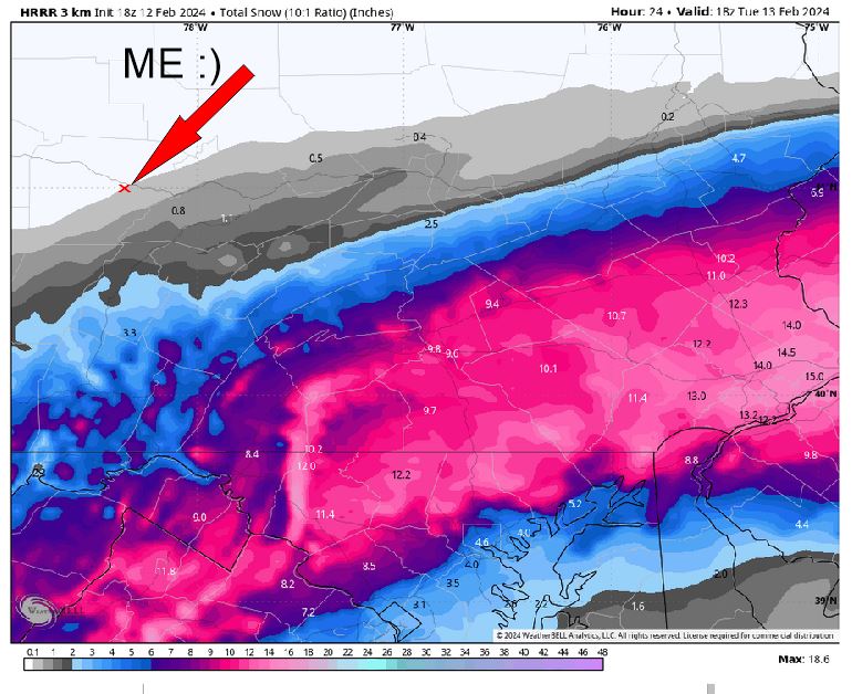
LONG TERM /SUNDAY NIGHT THROUGH FRIDAY/...
*Increasing potential for plowable to possibly heavy snow Monday
 night into early Tuesday | February 12-13th

The latest 09/12z GEFS/ECMWF mean guidance are reasonably
clustered and show a deepening sfc low tracking ENEWD from the
Central Appalachians (NC/TN/VA/KY/WV borders) to the southern
DelMarVa Monday night and off the southern New England coast by
early Tuesday. This remains generally in line with the earlier
09/00z and 09/06z model guidance, but with a slightly more
amplified and deeper (less progressive) run/run trend.

Given the marginal to potentially "manufactured" cold air due
to dynamic wet-bulb cooling, the GFS/EC operational model runs
seem to be at least somewhat overdone with cranking out swath of
heavy snow. There will also likely be a significant snowfall
rate and elevation dependency that further adds to the ptype
complexity of the impending storm system. While just outside the
gridded snow accumulation period with this cycle, the
probability for a stripe of 3-6" of snow continues to increase
over central PA with higher amounts possible. The north/south
position of the axis remains uncertain, but latest guidance
favors the central portion of the forecast area extending ENE
with wrap-back and banding into the Poconos. To further
contextualize the model spread, the NBM 25th-75th percentile for
State College currently ranges from 0 to 4 inches. Timing has
come into better agreement with the heaviest precip rates
occurring Monday night into early Tuesday. Still plenty of
details issues to be resolved with the most likely travel
impacts and disruptions centered in the Monday night to early
Tuesday timeframe.

The potential phasing of the upper jet and rapid coastal
intensification response could result in strong northwest
winds across the area on the backside of the storm and trigger
lake-enhanced/upslope snow showers across the western
Alleghenies.

The pre-Valentine`s Day storm will trigger a pattern reversal
back to seasonable winter cold for the rest of next week.
Additional chances for snow appear limited outside of some snow
showers downwind of Lake Erie and with a couple of clipper-type
systems.
-
-
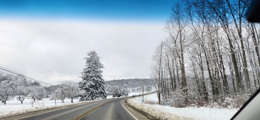
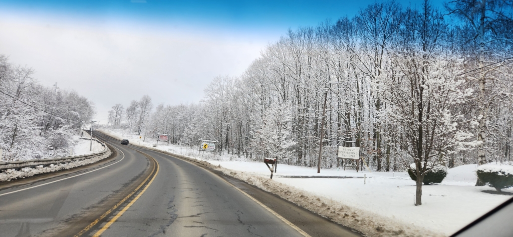
Still some nice snow up in elk county at 2300'
Pics were taken yesterday 1-31-24


-
7
-
-
3 hours ago, Atomixwx said:
-
Nice..looks like the good stuff is done here but it was a nice little event..4pm obs: Moderate snow and 27ºF. Right at the 6” mark (1.2” last hour) so that makes it the first warning event here since at least the 21-22 season.
Back edge of the good stuff is lurking pretty close to here, gonna have to see if anything tries to backfill a bit the next couple hours.
Sent from my Pixel 7 Pro using Tapatalk
-
4.25" and counting.
Sent from my Pixel 7 Pro using Tapatalk-
1
-
-
-
3 minutes ago, canderson said:
Well yea it’s Saturday but what are your snowfall rates like?
")

-
1
-
-
Into the heavy stuff now.
-
2
-
-
Right at 1" here
-
37 minutes ago, Bubbler86 said:
Hey, it has been a lot of months since I remember seeing you post welcome back. Lol
Thanks. Usually just come on to read once in a while.
21 minutes ago, canderson said:Hey nice to see you posting! Hope all is well.
All good here thanks for asking.
-
2
-
-
1 hour ago, canderson said:
My call:
Clearfield: 9”
CTP: 8.4”
Mag-ville: 7.1”
MDT: 3.25”
Bubbler and Cash: 2.9”
Lancaster: 2.5”
York: 1.75”I hope so.....
Im calling 5" for here.
-
1
-


Central Pa. Spring 2024
in Upstate New York/Pennsylvania
Posted
Picked up another 1.12" of rain so far today and counting.