
frostfern
-
Posts
1,984 -
Joined
-
Last visited
Content Type
Profiles
Blogs
Forums
American Weather
Media Demo
Store
Gallery
Posts posted by frostfern
-
-
On 8/13/2024 at 1:01 PM, Stebo said:
Such a boring stretch it has been
CAD summer.

-
So boring…

-
On 7/31/2024 at 1:10 PM, SolidIcewx said:
DTW crew over here like what’s a solid MCS lol
The ratio of actual thunder vs thunder in the forecast has been low lately over here.
-
 1
1
-
-
On 7/16/2024 at 9:48 AM, rainsucks said:
not even close to that being the case this year. And even in the last decade, the big heat has had a tendency to center itself west of the Rockies.
Yea. I meant in the brief periods the heat gets east of the Rockies, it doesn't really reach the Great Lakes. This year the upper Midwest has been persistently troughy and it looks to return to that pattern over the next week. I like this somewhat active pattern better than having a trough over New England that puts the GL in a boring "cool drought", but it seems hot and active summers are a thing of the past.
-
18 minutes ago, HillsdaleMIWeather said:
Models show it building up into Wisconsin as it moves further east in 2-3 hours
Have to wait. There’s still a lot of CIN, but maybe the nocturnal low level jet breaks it. I’m guessing mostly garden variety, but with isolated hail or spinups possible given the shear. Don’t need a derecho IMBY.
-
Miss south for Michigan unless the bookend peels north. Meh.
-
Nudged enough N to get me excited.
-
I got about 2" last night IMBY. For once I-94 got the screw-zone instead of I-96.
-
1 hour ago, Spartman said:
Now, all 90-degree highs have been dropped for the upcoming week. No more for the foreseeable future. Time to write off the rest of the month.
The real ridge sticks to the plains most of the time the last decade or so it seems. At least in July and August.
-
1
-
-
Fairly impressive local rainfall in GRR with this MCV. “warm advection wing” band of convection has been parked overhead for a while now.
-
It's destabilizing pretty good behind the MCS wake over WI extending now over Lake MI.
-
18 minutes ago, Lightning said:
Awesome. Sounds like a fun storm. Not looking good on radar for me you can see it splitting apart east of Lansing!!. Oh well nothing I can do to change it

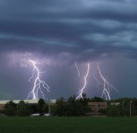
How was the lightning with it??
The best lightning was with the small cluster ahead of the bow. There were quite a few positive CGs estimating about 2 miles to my SW. The big shelf that rolled in from the NW didn’t have much other than soft IC rumble and moderate rain. It wasn’t surface based. I see the winds did penetrate to the surface some areas though.
-
Stable surface layer saved me. The cell / cluster that formed out ahead of the bow meant business though. Continuous thunder with booming positive CGs going off like bombs off to my SW. I got a pretty big gust out of the south too. I was waiting for the main show to hit from the NW, but the shelf surged over with little fanfare. Stable surface layer definitely saved MBY this time, though still got a big branch down due to tree rot.
-
8 hours ago, Lightning said:
Drought raging IMBY. Not surprised as this is a terrible pattern for my area.
It was the same here until yesterday, and then this morning. Thankfully it wasn’t quite as bad as expected due to the overnight stable layer. Oddly, a cell that formed out ahead of the bow produced a severe gust out of the south (estimating around 60 mph) that took down a huge branch right on the house. Locust tree has major rot going on in the lower branches, so stuff was just waiting to come down. The main rear inflow jet stayed aloft at MBY though. I saw the shelf race overhead from the north right after that initial cell moved east, but hardly any wind at the surface.
-
I got an unforecasted quality garden variety boomer last night at 1 am. 0.5" of rain. Grass still looking some brown but slowly clawing out of the flash mini-drought.
-
Figures rain all misses south.
 Ready 2 drought indeed.
-
4 hours ago, A-L-E-K said:
Cell went up overhead and moved over the lake, sad
Same thing here. Cells popped up 10 miles southeast. Goose egg.
-
 1
1
-
-
Ready 2 drought.
-
Bad timing and lake suppression here again. 30% POP forecast usually means 0% coverage here. Really need one of those stalled out warm fronts with nocturnal convection to get any rain here.
-
4 minutes ago, Lightning said:
Winds and heavy rain were the best part in Allegan; lightning was so so.
edit. Looks strong at GRR.
The power flickered. Gusts around 50 here. The lightning is IC dominant though. Soft rumbling.
-
1
-
-
3 minutes ago, Lightning said:
Storm was nice today here in Allegan. Nothing grand but much better than nothing
")
Very dark shelf cloud. Could be some strong gusts.
-
3 hours ago, Lightning said:
How was the storm this morning in your area? Unfortunately they are dying out as they approach here (not surprised).
It was a good one, though I was half asleep. Could have used a little more rain than what I got but the thunder was nice and loud.

-
1
-
-
2 hours ago, Lightning said:
Yep with these big systems (that track well to the NW) the t-storms split at LM going north and south into ILL,IN and OH. It is nothing new. I have learned to ignore the models that think MI is a target in April and May with these big systems. I know some models still want to re-ignite in MI tonight
 I would not bet on it but we will see. FYI ... This is meant to be an observation and not a complaint. I have had some decent storms so far just commenting about the 2 large storm systems that have gone NW into ND / northern MN.
If the system on Sunday is far enough east I might chase. The problem is storms often don't get into Indiana until after dark. East central Illinois is easier to get to than northwest Illinois because I can go south around Chicago.
-
3 hours ago, Malacka11 said:
Downstream looks good here at least for some garden variety I hope
I don’t know what the definition of “garden variety” is. I just want a non-severe storm in the mature stage with real downpours and frequent thunder cracks for once as opposed to decaying scraps and light stratiform. Michigan is being Michigan though.
-
1
-

5/15(northern half) & 5/16(southern half of subforum) Severe Wx Threats
in Lakes/Ohio Valley
Posted
The northern edge of that 90 degree heat bubble could get interesting.