
.JPG.79118a3ad1baaeec7c8450bdb03170d6.JPG)
BuildingScienceWx
-
Posts
419 -
Joined
-
Last visited
Content Type
Profiles
Blogs
Forums
American Weather
Media Demo
Store
Gallery
Posts posted by BuildingScienceWx
-
-
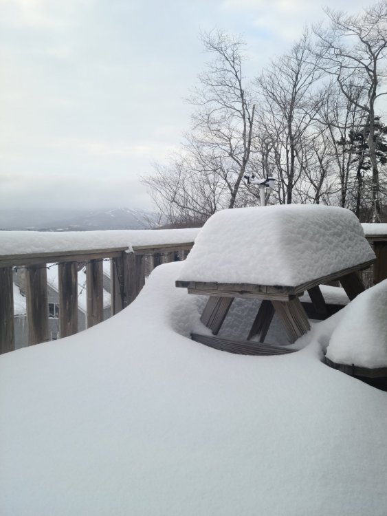
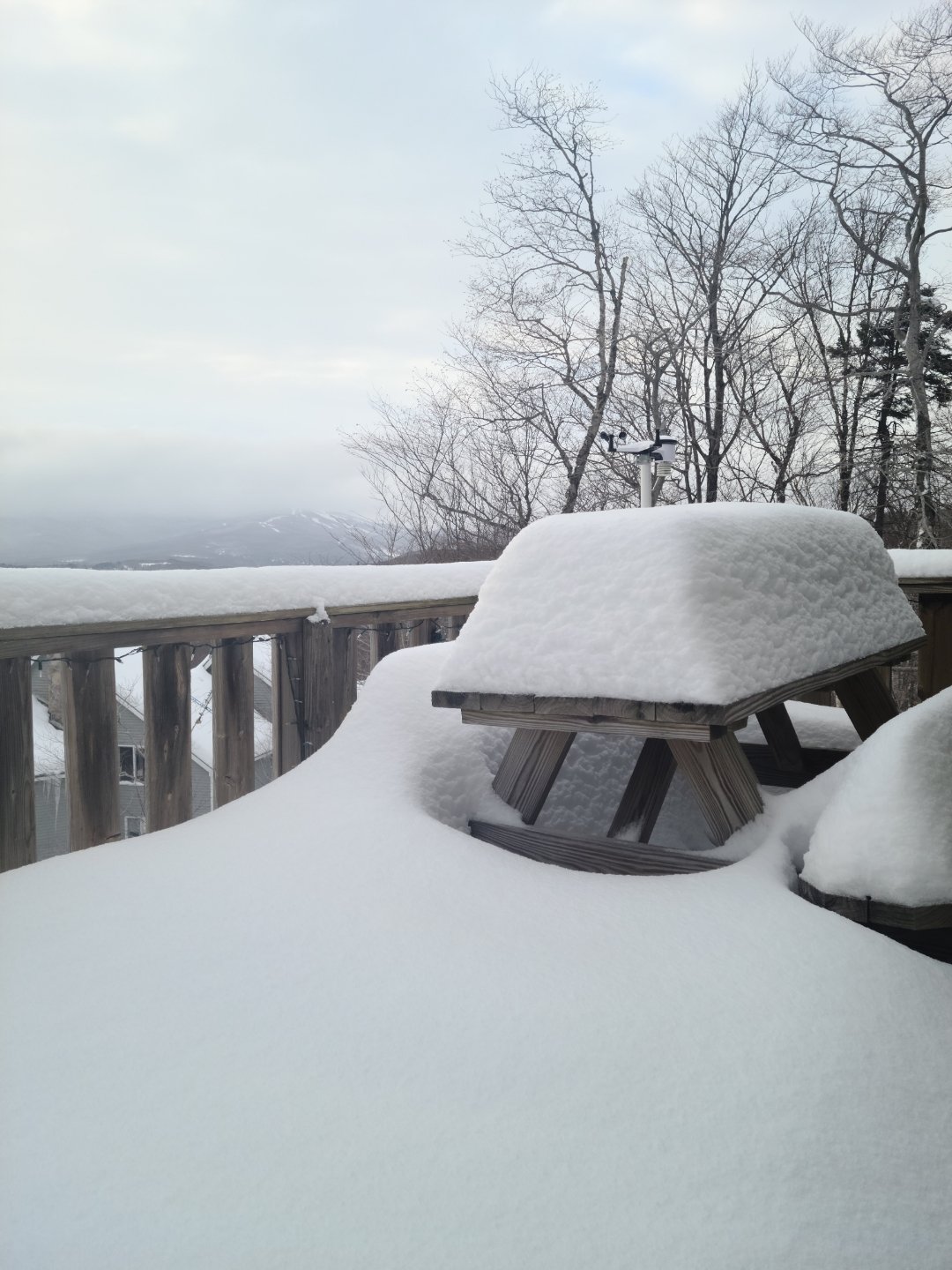
Made it up to the VT house. Feels great to enjoy real winter again.
-
 9
9
-
-
Snowing at a pretty good clip here now. Closing in on an inch. 23.2/22.6. VT house
-
11.0" here, light to moderate snow at 20F
-
1
-
-
11.0" as of 6AM. Temp down to 20F. Northern fringe of that band running through HVN, light to moderate right now.
-
9.5" with light to moderate snow. Temp hasn't moved for the duration, stuck at 22. Wind is really gusting and some drifts are getting impressive.
-
9.5" with light to moderate snow. Temp hasn't moved for the duration. Wind is really gusting and some drifts are getting impressive. Turning in for a few hours. Good luck everyone.
-
Heaviest snow of the storm, puking outside under this band. 7.9" +S
-
4 minutes ago, wxmanmitch said:
I literally have goosebumps right now after seeing the RDPS (RGEM) and the radar. Death band incoming and I may very well be very close to or under the pivot point. It's already pounding snow, although flakes are small to medium. 9.4° F.
Enjoy man, you're going to crush. I wish I went to my place in West Dover, but CT looked like a lock for soo many days. Let us know how you do. I have a remote camera and weather station up there as well. 9.7/7.2.
-
SN+ Pounding right now, great snow growth. 6.3" 22F
-
1
-
-
SN+ Pounding right now, great snow growth. 6.3" 22F
-
That band that's lifted north of here meant business! 4.8" 22F. Intensity has really let up and snow growth is mehh
-
Heavy snow. 2.2" 22F. Great snow growth as well regardless of the wind.
-
7 minutes ago, Sn0waddict said:
Might be some sleet in Greenwich per CC. Unlike most storms it’s actually random patches of sleet that eventually wash away. Odd storm.
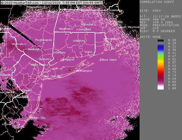
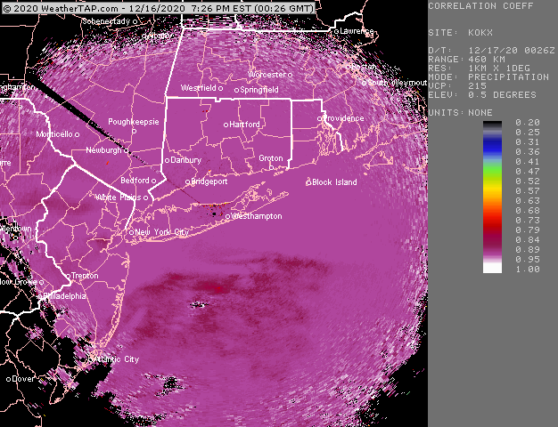
You can see it clearly here:

-
9 minutes ago, tavwtby said:
What is a better radar site, intellicast has gone the way of WU, and it is not great tbh anymore...what's the one you guys are always posting here? TIA
I use WeatherTAP
-
1
-
-
1 minute ago, dave0176 said:
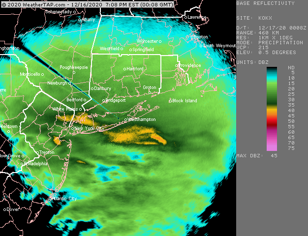
The snow sleet line is moving pretty quickly north on the radar, seems to be around northern Monmouth county.
Correlation Coefficient radar for spotting sleet:
-
1.0", temp sitting at 22F.
-
Looking good upstream. Heavy snow about to move in here.

-
1
-
-
First inch on the board. 1.0" exactly. Moderate Snow, 22F. Awesome out there already!
-
3 minutes ago, Bostonseminole said:
What of the radar remained liked this?

Sent from my SM-G965U using Tapatalk
WAKANDA FORCEFIELD FOREVER!
-
 2
2
-
-
Light flakes started just before 6pm. 0.2" and coming down moderately. Temp 22F and falling. Frequent wind gusts already whipping around the dry snow.
-
1
-
-
2 minutes ago, HVSnowLover said:
Keeps trending NW with the best totals but RGEM can be over amped at this range
I'd have to agree with that. Very similar to 0Z Nam where there is an axis of heaviest snow right to the north of the H700 low. It's going to be key to get that south a bit in future runs. I like where we are though right now as confluence will likely keep flexing.
-
1 minute ago, WarrenCtyWx said:
Isn't it always though? It's just a matter of where it is.
I agree with your point, but in this potential scenario, the confluence to the north will really create a sharp cutoff.
-
1 minute ago, Hoth said:
Is that donut south of Block Island the low?
There's a broader circulation it appears to the SW. Not sure.
-
Snow growth went from great to not to much pretty quick. This thing is winding up, excited for you guys to the NE.
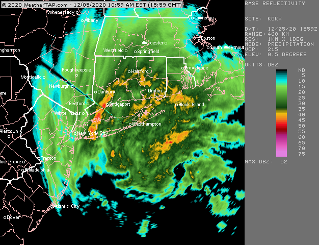
What is that structure curling S of Montauk? Mesolow?
Watching closely .. February 1-3rd for moderate to major coastal event
in New England
Posted
Agreed, I feel like this is almost always the case (save a couple storms throughout the years). Too much data to look at!
Will someone, maybe Tip, be starting an obs thread? Leading precip is working its way in to the Northeast Kingdom...