cfbaggett
-
Posts
135 -
Joined
-
Last visited
About cfbaggett

Recent Profile Visitors

-

Central PA - Winter 2021/2022
cfbaggett replied to Bubbler86's topic in Upstate New York/Pennsylvania
Oh the irony that the warmest locations this morning may be the snowiest tonight...
-
Central PA - Winter 2021/2022
cfbaggett replied to Bubbler86's topic in Upstate New York/Pennsylvania
So amazing! Hoping for the best for all of us here in Central PA the next 36 hours. Regardless of how it turns out, one has to enjoy the majesty of it all. -
Central PA - Winter 2021/2022
cfbaggett replied to Bubbler86's topic in Upstate New York/Pennsylvania
This is an eye opener... Days upon days with the possibility of subzero lows... -
Central PA - Winter 2021/2022
cfbaggett replied to Bubbler86's topic in Upstate New York/Pennsylvania
Wow, I didn't even notice the difference over the OH Valley. And that snowfall is within ~100 hours now for people who don't get much snow! Probably shouldn't post these images in the Central PA forum, but they do, at least for me, help me stay grounded and not worry about individual models or particular runs, even at these relative short ranges. -
Central PA - Winter 2021/2022
cfbaggett replied to Bubbler86's topic in Upstate New York/Pennsylvania
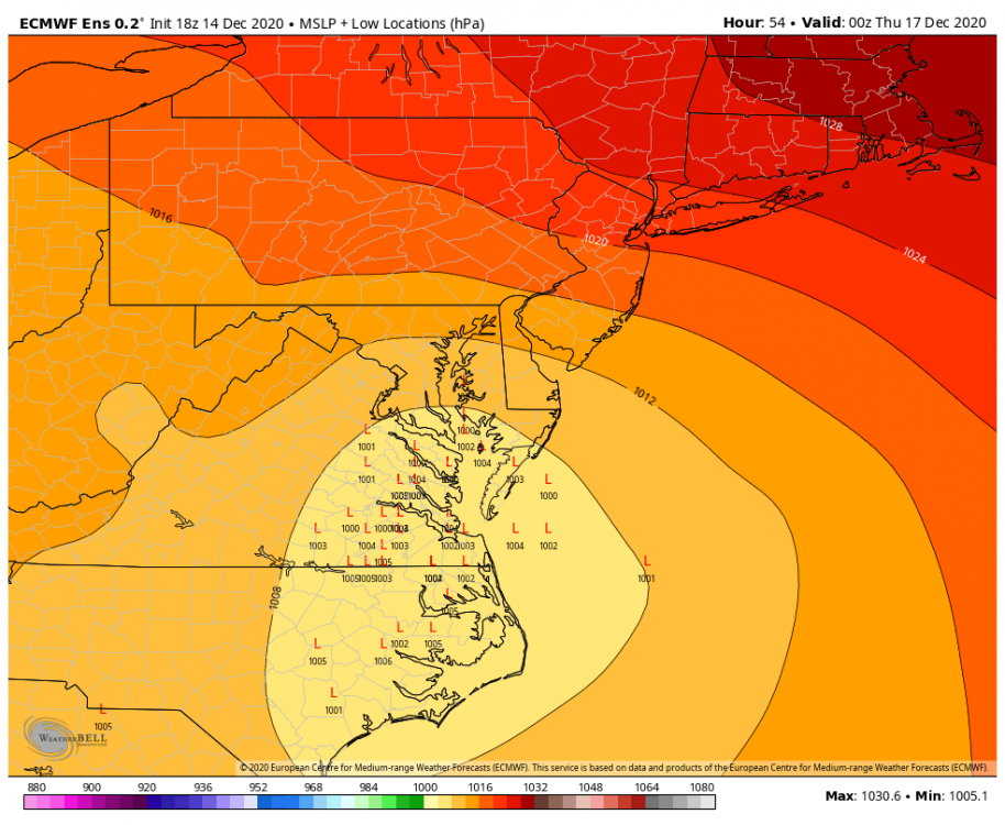
12Z GFS MSLP operational vs 12Z GEFS MSLP ensemble members. Operational still on the northwestern envelope of the ensemble spread. but maybe not as far NW as the 6Z run. -
Central PA - Winter 2021/2022
cfbaggett replied to Bubbler86's topic in Upstate New York/Pennsylvania
There's not a one-size-fits-all answer to your question. There's also the possibility that the stronger low will allow stronger upward velocities which will cool the column more, allowing more snow. -
Central PA - Winter 2021/2022
cfbaggett replied to Bubbler86's topic in Upstate New York/Pennsylvania
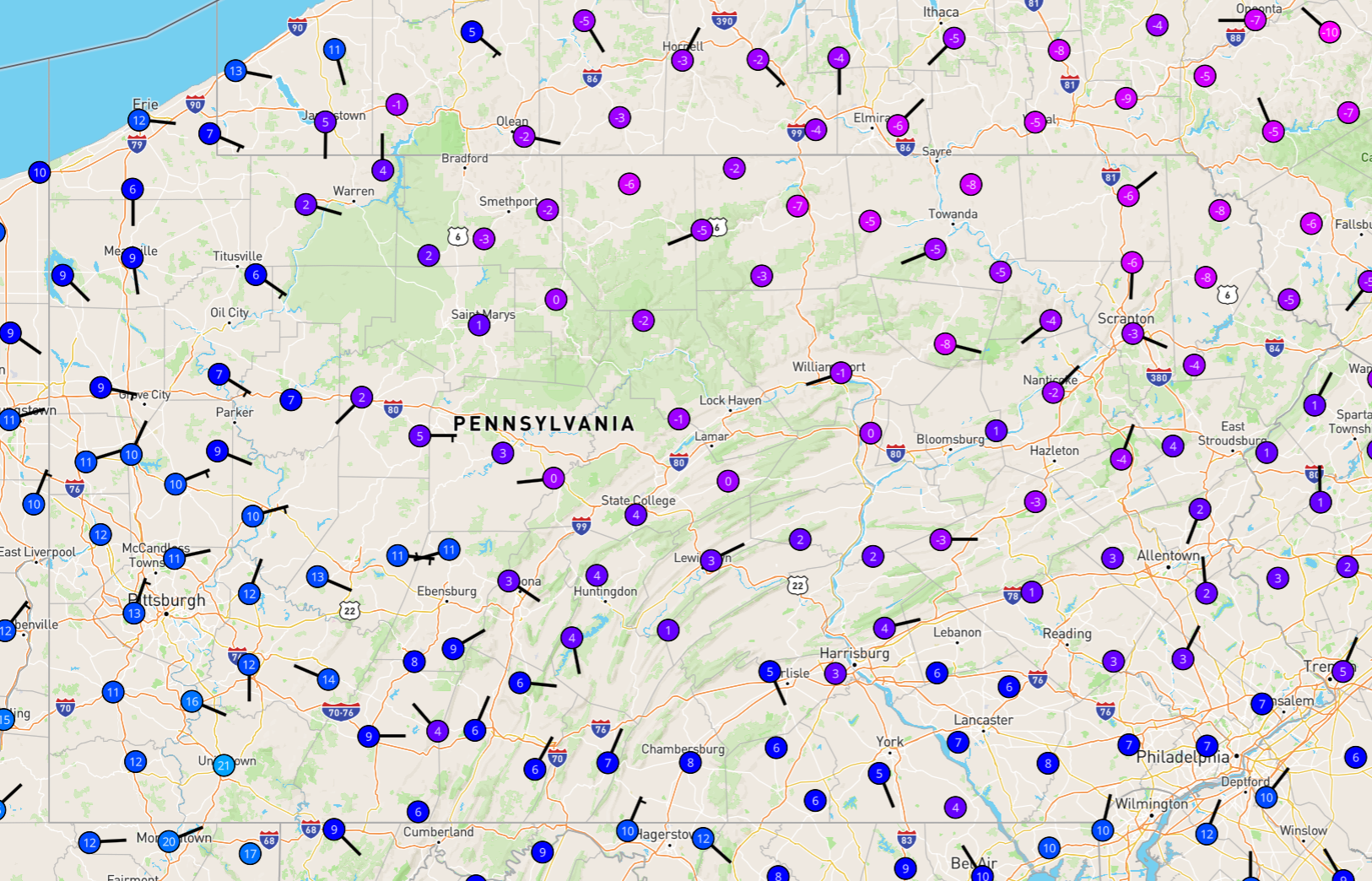
6Z GFS operational low location versus GEFS individual ensemble members. Operational is really on the fringe of the spread. -
Central PA - Winter 2021/2022
cfbaggett replied to Bubbler86's topic in Upstate New York/Pennsylvania
Amazing change in the GFS ensembles in just 24 hours. 6Z yesterday versus 6Z today. Shame this thing is still ~5 days out. -
Central PA - Winter 2021/2022
cfbaggett replied to Bubbler86's topic in Upstate New York/Pennsylvania
ECMWF 06Z Control Run: -
Just a couple of thoughts: 1) I am in awe at the duration of this event. Usually these storms last 9 to 15 hours and done. 48 hours or longer for this one? The end time of this storm is still pretty deep into the model integrations, so there could still be significant error in the models for the second half of the storm. 2) It wouldn't surprise if the heaviest totals end up north and west of currently advertised, as they did significantly with the December storm. First, the models seem to be trending toward tucking the low tighter and tighter into the Delmarva. That makes sense for baroclinic reasons. Second, I have a hypothesis that the models do not advect snow as it falls through the column. It just piles the precipitation up where it falls from the cloud. Assuming the snow falls 1000 m from cloud base at a downward velocity of 1 m/s in a background wind of 20 m/s, the snow could easily be blown 20 km to the west as it falls in the strong easterly winds.
-
The summers are quite pleasant.
-
Lewistown.
-
And there may be timing differences amongst the members, so some that are east, could have been further west an hour or two earlier. Anyway, it all looks really exciting, regardless.
-
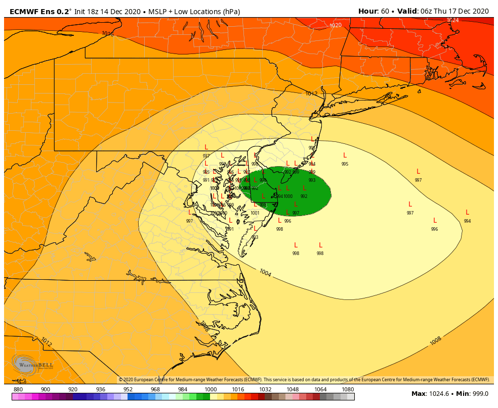
The green is a mean, median longitude is a tad west.
-