Thunderblizzard
-
Posts
1,400 -
Joined
-
Last visited
Content Type
Profiles
Blogs
Forums
American Weather
Media Demo
Store
Gallery
Posts posted by Thunderblizzard
-
-
A tick NW if anything on the Euro.
-
 2
2
-
-
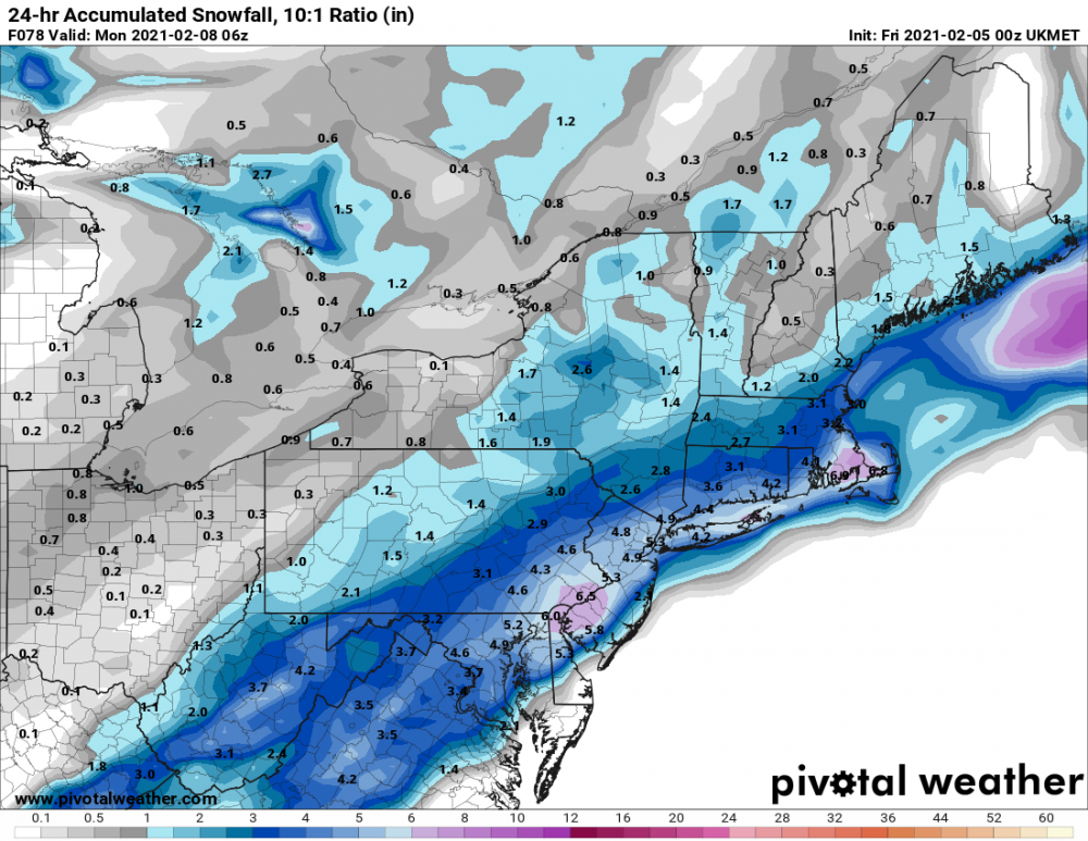
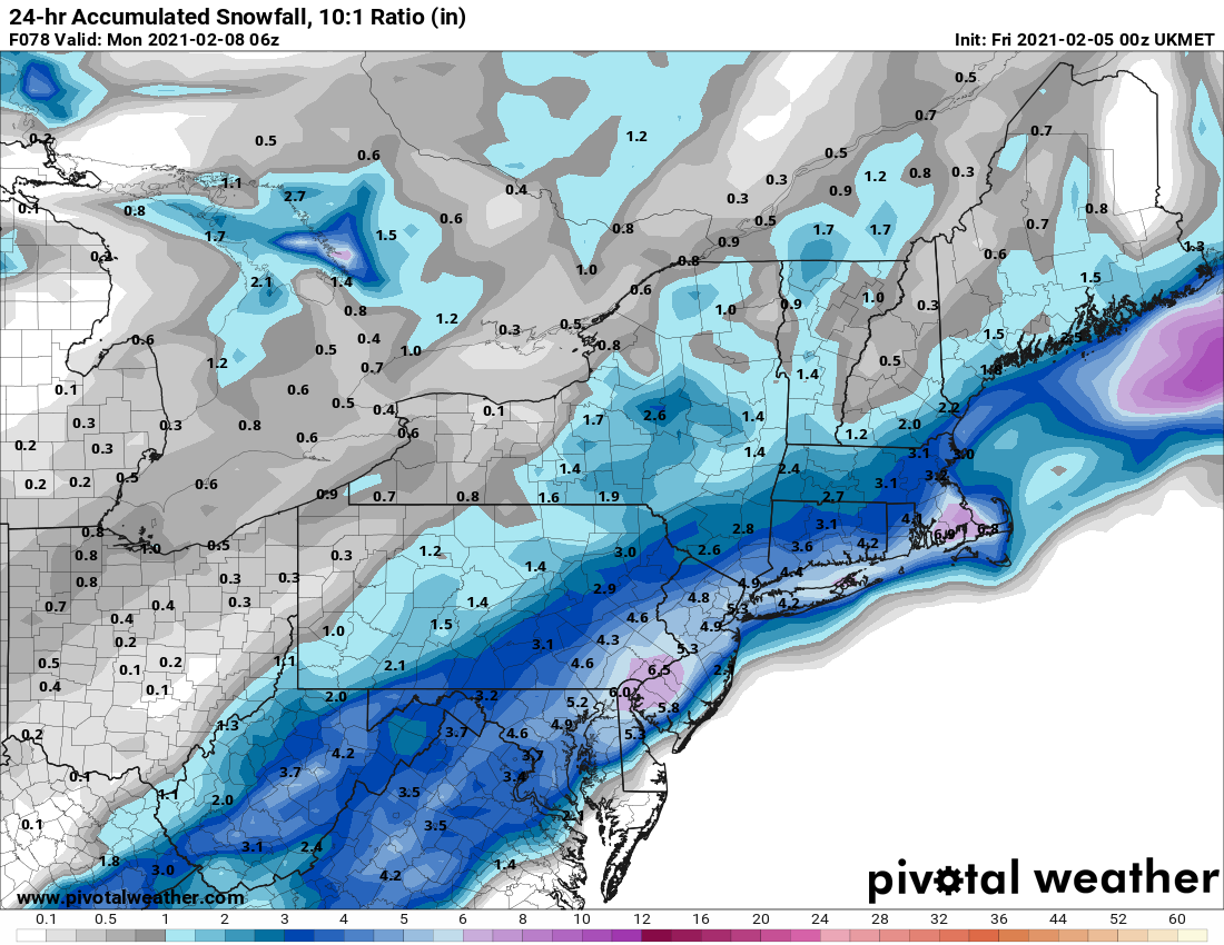
UKMET a bit SE as well.
-
Big shift NW on the UKMET from 12z.
-
1
-
 2
2
-
-
NAM looking a bit less amped so far
-
10 hours ago, CT Valley Snowman said:
I'm not feeling some of the 7" reports near here and the 5" in East Windsor while 12" was the BDL total and Springfield was general 10-11. Something seems off.
They tossed a bunch of CoCoRaHS in it last night... a good chunk of them seem low or incomplete, aside from the Southington one sticking out like a sore thumb.
-
Just a dusting from that, not too different from this morning. 15.8" remains the total... not a chance that 20.5" report on PNS happened.
-
Lightly snowing again here.
-
Was an extra coating here this morning... not much left of it now.
-
Looks like Euro will be well SE.
-
GEFS look like quite a jump NW from 18z
-
Lightly snowing here, but looks to be short lived.
-
6 minutes ago, WinterWolf said:
Well according to that map, NWS has my town at 17.5” so I was 1.5” low with my measurements According to their spotter. 2nd highest on that map in the state only to Roxbury. Lol. Was a great storm for sure.
I had 15.8 so it lines up with the 16 pretty well. Gotta imagine the 17.5 was maybe on a hill on the west end of town... slightly more there, probably. I believe Wolcott had 17-18.
-
1
-
-
4 minutes ago, Kitzbuhel Craver said:
Holy crap this stuff is heavy...
How much in Meriden? My first clearing around 5 PM or so yesterday was mostly fluff but the 4-5 inches afterwards was not pleasant... compacted a bit and it's quite a meaty pack now.
-
Definitely compacted a bit with the overnight mix around 31-32F... 15.8" total snowfall @The 4 Seasons
-
1
-
-
Light snow grains continue under these low level echoes... not accumulating much more, likely still ending this in the 15 range.
-
Light snow grains. 30F
-
1 minute ago, RUNNAWAYICEBERG said:
Congrats man. ORH county the NewEng winners.
Wouldn't be a proper New England snowstorm without it.
-
1
-
-
Still managing to hold on to a steady rate but definitely lighter now... about 0.9" new in the past 2 hours with the grainy snow for 15.4" storm total.
-
Still coming down at a good clip, but the slot is pushing in very soon. About to get all showery. 29F
-
Another nice burst outside... you love to see it.
-
1
-
-
Now around 14.5" here as of 8:15 PM with another 1.5-2" or so since 6:45 PM... finish above 16" and it's the biggest since Feb 2013 here. Steady moderate snow.
-
Wind really starting to crank. Moderate snow continues with occasional heavy bursts. 28F
-
Intensity down a bit again but still solid... radar continues to look good for at least the near future.
-
Consistent heavy snow, radar filling in a bit to the south... a few more inches would make this the biggest since 2013.
-
2
-
Quick Hitter Coastal Threat, Feb 7-8th
in New England
Posted
It seemed a little NW overall. A hair better than the RGEM