
Kay
-
Posts
1,912 -
Joined
Content Type
Profiles
Blogs
Forums
American Weather
Media Demo
Store
Gallery
Posts posted by Kay
-
-
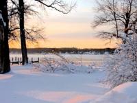
Dang this .5 is uniform...Smithsburg, Westminster, Parkton, here, HdG. YOU get a half inch, and YOU. get a half inch, and etc
eta street caving!
-
 1
1
-
 1
1
-
-
15 minutes ago, wxmvpete said:
I also have a half inch northeast of Westminster. Quite a few cars spun out on the road going home.
12 minutes ago, mappy said:Nice to see rates and flakes size increase after a steady pixie snow all day. Enjoy!
Also have a half inch here in SE Harford, and seconded! 26/24
-
3
-
-
light powdery dusting so far here
-
3
-
-
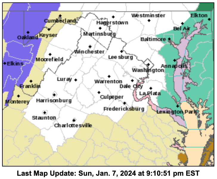
Coastal flood watches up both sides of the bay
-
1
-
-
Got a SWS!!1!!1! PUMMELED
Back to a prior topic, not to make heads explode but I've noticed this before - LWX referring to Baltimore as northeast MD.
Special Weather Statement
Special Weather Statement
National Weather Service Baltimore MD/Washington DC
927 AM EST Sat Jan 6 2024

MDZ008-011-508-061700-
Cecil-Southern Baltimore-Southeast Harford-
Including the cities of Elkton, Baltimore, and Aberdeen
927 AM EST Sat Jan 6 2024

...WINTRY MIX THIS MORNING...

A mix of snow, sleet, freezing rain, and rain will affect
northeast Maryland this morning. While temperatures are slowly
rising, a few locations remain below freezing, especially
northwest of Interstate 95. This may lead to slick spots on
roadways. Use caution and reduce speed if traveling or walking
this morning, as surfaces that appear wet may actually be icy.
-
Sleet 32/31
-
Wishing my N/W sisters and brothers the best of luck. Post pics!

-
3
-
-
-
-
25 minutes ago, WxUSAF said:
Could about walk from places with <1” to 8”. Razor thin gradient.
That does it, I'm chasing gradient.
-
2
-
2
-
-
1 hour ago, mappy said:
I am trying to think of who may have called NE MD a snowy area. There's a long running joke about NE MD PUMMELED, because it never is lol
This is ofc one of my favorite forum jokes. I can't remember the poster's name but feel like it was someone in or around Bel Air (?) If a model run favored the area it was a NE MD PUMMELING / NE MD PUMMELED -- always all caps. The all caps is very important
 59 minutes ago, SnowenOutThere said:
Alright my math teacher is making me get up in front of the class and present about the weekend storm, anyone have any idea on what to say because all I got right now is that there are currently 3 scenarios (strong storm but too warm EURO/ICON, strong storm and cold RGEM/CMC, weak and cold/weak and warm GFS/NAM) and there no way to know which one will happen. I have till 11:08 to prepare my statement...
Stand there sweating, hands shaking, barely able to stand upright, and warn them about the dangers of addiction
-
3
-
-
6 hours ago, 09-10 analogy said:
Coming back from Spain Wednesday and will be depressed after a great trip. But the chance (emphasis) of a MECS over the weekend will help take the sting out. Doesn’t snow much in Barcelona. But what a great city!
3 hours ago, WxUSAF said:Haven’t been to Barcelona, but I love Spain. It’s wrongly way too low on American’s European travel destinations.
Agree with you both. I've gone once but just to Barcelona/Catalonia. Great city! Loved the whole area.
-
Just now, Wxtrix said:
i think you did. or maybe i’m connecting you with your other name, if that’s what you used? same difference.
Either way, that is cool that you remember me
") I definitely remember you on Eastern, and many others of that crew/era who are still around.
I definitely remember you on Eastern, and many others of that crew/era who are still around.
-
2
-
-
2 minutes ago, Wxtrix said:
i remember you from eastern.
I was trying to remember if I used this sn there (not my name). Maybe I did!
-
NE MD PUMMELED lol
-
2
-
1
-
-
6 minutes ago, gunny23 said:
I was on Eastern then joined this forum in 2011. I don't know enough to post but I sure do enjoy reading all of the analysis. I used to wake up at 2am to turn the weather channel on for updates; my husband is grateful I only now just need to read my phone and not wake him up in the middle of the night anymore. haha. Thanks to all (most) of you!
Same. No one remembers me from Eastern as I mostly lurked. I think I joined in 2009 bc, you know, but had already been reading. Have learned so much reading over the years.
-
2.8". Aberdeen COOP had 2.49", highest I see in this morning's NWS reports
-
Flood Warning
Flood Warning National Weather Service Baltimore MD/Washington DC 937 PM EST Wed Dec 27 2023 MDC015-025-280845- /O.NEW.KLWX.FA.W.0047.231228T0237Z-231228T0845Z/ /00000.0.ER.000000T0000Z.000000T0000Z.000000T0000Z.OO/ Cecil MD-Harford MD- 937 PM EST Wed Dec 27 2023 ...FLOOD WARNING IN EFFECT UNTIL 345 AM EST THURSDAY... * WHAT...Flooding caused by excessive rainfall is expected. * WHERE...Portions of northeast and northern Maryland, including the following counties, in northeast Maryland, Cecil. In northern Maryland, Harford. * WHEN...Until 345 AM EST Thursday. * IMPACTS...Flooding of rivers, creeks, streams, and other low-lying and flood-prone locations is imminent or occurring. * ADDITIONAL DETAILS... - At 937 PM EST, Doppler radar indicated heavy rain. Between 1.5 and 2 inches of rain have fallen. Flooding is ongoing or expected to begin shortly in the warned area. - Additional rainfall amounts of up to 1 inch are possible in the warned area. - Some locations that will experience flooding include... Elkton... Aberdeen... Havre De Grace... Aberdeen Proving Ground... Calvert... Bel Air South... Bel Air North... Riverside... Kingsville... North East... Pleasant Hills... Rising Sun... Perryman... Charlestown... Cecilton... West Nottingham... Farmington... Bay View... Octoraro... Richardsmere... - Please visit www.weather.gov/safety/flood for flood safety and preparedness information PRECAUTIONARY/PREPAREDNESS ACTIONS... Turn around, don`t drown when encountering flooded roads. Most flood deaths occur in vehicles. Be especially cautious at night when it is harder to recognize the dangers of flooding. Please report observed flooding to local emergency services or law enforcement and request they pass this information to the National Weather Service when you can do so safely. -
raining mostly-heavily for like 45 minutes
-
pouring
-
This is an age-old, circular, meta debate on all forums ever, which will never be solved, but imho it is better to mute posters than to post 15 times a day on how and why other people's posts suck, how they have always tended to suck, and how you expect them to suck going fwd. Not everyone is into using ignore features and that's fine. But, again only imho, the complaints, if excessive enough, become as annoying as the trash posts. Some complaining is cool though, like I am doing here
-
3
-
4
-
-
Happy Anniversary, mappy! Enjoy. None of us will ever forget your wedding day...
-
 1
1
-
-
1 minute ago, Eskimo Joe said:

Wind still whipping. KMTN W 24 G 37 recently, sounds about right
-
1
-
-
1.8" in the gauge this morning for a total of 3.5"

-
4
-
January 2024 Banter
in Mid Atlantic
Posted
I'm still kind of in awe that it's snowing here. Like many said earlier today. It has to sink in a bit that it's actually snowing, and accumulating. Here. Seriously considering coffee.