
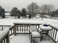
Deck Pic
-
Posts
27,095 -
Joined
Content Type
Profiles
Blogs
Forums
American Weather
Media Demo
Store
Gallery
Posts posted by Deck Pic
-
-
I think the reason is the existence of this board, so now there's a whole community to get stressed with
 and the availability of all of this info we have now- radar, short-term models, etc.
 We were much younger in '96, so I relied more on what the TV weathermen were saying. And they weren't worried about the light mix period. It was the first mega one since '83 so the whole experience was amazing. Then in 2/03, the sleet was in the final forecasts, so I just accepted the changeover.
agreed. I was fearing the dryslot for a few days, because the east solutions with an Apps dryslot didn't make any sense to me. It was pretty clear to me that Winchester/Martinsburg/Westminster would get smoked. I never once doubted that. And the 0z Euro Thursday night confirmed the dryslot fear. So I was prepared, but I just didn't think it would be for so long. It would have been cool to make a run at 25-30 for the city. But in the end we got raked with the Baltimore band. But I agree with you. In some ways we know too much.
I want to add that I am not a totals junkie. I know I am rarely going to do as well as the North and West folks, and I love snow whether it is 3" or 10". I wanted to witness the crippling of infrastructure. That was more my morning disappointment than anything. Not being able to see something unique in terms of downtown paralysis. In the end I saw it. Based on both the experience at the time and the post-mortem, I have no doubt in my mind that downtown DC experienced its biggest snow since 1922, and perhaps equal to 1899. This was undoubtedly bigger than 79/83/96/03/09/10 in my location. The 22" white house and 4th and L totals may be a tad inflated, but I think I cleared 20" easily. I also think DCA got at least 19 and maybe more.
-
For DC/BAlt and extended suburbs and exurbs, it is a no brainer call - January 2016. For my backyard it is a little tougher. I need to marinate on it more. For some reason the 6 hour lull was more painful than the 96/03 flip, even though it snowed the entire time and I picked up 1-2" during it. I also got paid back handsomely as the 2pm - 6pm period was epic, and I really got hit flush, and picked up 5-6" additional inches. I have video from 3pm Saturday that is as good as anything from any of the other big storms. I didn't think I would lull for so long, but in the end it all worked out and I nailed my forecast. I think ultimately I will lean toward January 2016. I got close to as much snow as 96/10 and more snow than 09/03, and I was in a downtown location which was really cool in terms of experiencing the impact. Every storm except 2009 had its drawbacks and I got more snow than 09.
-
Is WDOR a lock at this point (for DCA at least)?
-
Anyone remember when Greaseman called Air Florida on air shortly after the accident? Wow. I was 13 at the time so unfortunately I thought it was funny...now...notsomuch.
I think it was Howard Stern, no?
-
June 2015 at DCA is now up to 11.01 inches of precipitation, making it the third wettest June in DC history, and the 11th wettest of 1734 months overall.
2nd now...11.81"
-
So, March is now winter and May is now summer. Yeah, Spring-pril.
without exaggeration we had a 34 day Spring this year...sad
-
May ended up warmer than 14 Junes since the recording station moved to DCA....as recently as 2003
-
Still a toss-up at DCA for warmest May on record.
looks like a lock, though didn't dig into the hundredths of a point. Still even if the 72.9 now is 72.85, today should push us to 73.1...what a vile month...
-
-
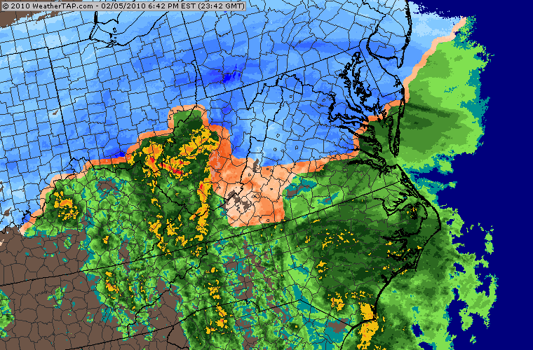
Tale of the Tape, Blizzard 1996 vs 2/5/10,
Location
1996 - Silver Spring at DC Line - 300',
2010 - Mt. Pleasant DC (4 miles due south of 1996 location) - 200'
Totals
1996 - 21"
2010 - 22"
Temperature at onset/min temp during storm
1996 - 20/15
2010 - 34/24
Duration
1996 - 36 hours
2010 - 30 hours
Max Sustained/Gust
1996 - 29/37
2010 - 25/35
Sleet?
1996 - Yes
2010 - No
Minimum Viz
1996 - 0.1 mi
2010 - 0.1 mi
For me, I give 1996 a slight edge. Much colder storm. Stuck to Beltway immediately (I was on it at 11pm). Drier snow. More Drifting. And in terms of intangibles, the 3-4" I got the next day made digging out futile.
-
If people recall, many of us were freaking out right about now, because it wasn't sticking to the street and it was 33 degrees....
-
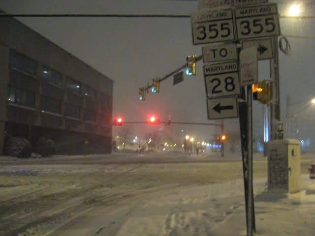
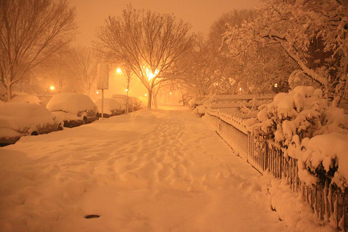
Gaithersburg around 4:30

Radar
Rockville around 7:30

DC around 11pm

-
at 25 straight days 70 or above...wonder what the record is
-
MSP's records at the time were right downtown. It could be argued that the UHI was more acute in the 1930s than at the airport location now. Of course, since the dust bowl was partly anthropogenic, you wade into other territory...
yes...there are too many factors to properly isolate and parse out cause and effect.
-
nice article...I'd like to see CWG cover some aspects of the heat of the last 4 years without referencing AGW (not referring to the above article)....I don't know the answer, but it would be interesting to discuss the pattern driven and indice driven aspects of the big heat....MSP's top 8 max mins are all dust bowl.....9 of Denver's top 10 are dust bowl or 1880's....all of DC's are fairly recent...and of course the frequency too.....So if it isn't JUST UHI, why aren't places like MSP and DEN shattering their max min records?
-
In Mt Pleasant I had two 1+ year gaps since the 97-99 gap
2/11-12/06 to 2/13-14/07 and 1/17/08 to 1/27/09
-
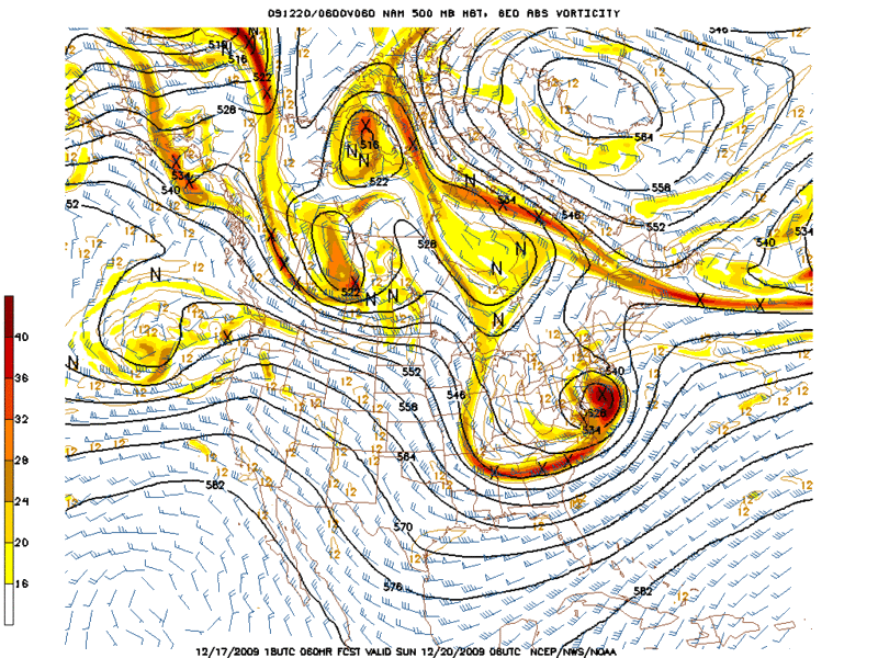
This one definitely had a lot of similarities to Feb '83...I remember thinking that too when the progs were about 72h out. Up here, it under performed compared to '83 due to more advection of dry air from the north...but definitely not down in that region.
pretty similar...Though 2009 was a bit longer duration event...1983 was about 24 hours and about 5-7 degrees colder in the averages...2009 was about 8 hours longer and mostly in the mid to upper 20s
-
why is that? it was just about perfect minus maybe a few tenths liquid. i think i actually liked the feb 5-6 event better tho i'm not really sure why, maybe just because i went down to the mall.
Pivot!!
I like the storm better from a synoptic perspective...that it was a rare DEC storm that nobody thought was climatologically possible...the block was better....the evolution was better...I think everyone remembers the Feb block keeping everything south but it was more the monster displaced vortex over Quebec
-
seems like a split flow happens in almost every big storm....
-
probably my favorite storm of all time
-
Thanks. 71.6 for May 1944 is indeed consistent with the daily figures that I have for that month. I would guess that the difference between the old 70.8 figure and the new 71.6 figure for May 1944 is the difference between using the old Weather Bureau at 24th and M Streets NW or (Reagan) National Airport for the official numbers. Weather records have been kept at National Airport since July 1, 1942, but the last I knew it was not the official source until July 1, 1945. Has that now changed?
There is some uncertainty about the early 40s and where Obs were taken. 24th and M? DCA? The old airport off 395? I know snow for 43-44 just changed out of nowhere. When I used to have the written data it was confusing and inconsistent. So not sure. I think they were split at one point and/ or may have gone back and forth. Ian or Jason Samenow might know
-
I still believe recent trends speak for themselves we have moved into a warmer period.
We've had 3 discernible warm periods that have lasted 3 yrs plus. 1930-33, 1973-1975, 2006-2008
Presumably 2010-2012 will be the 4th. 5 years is tough and we do our biggest cold anomalies in November through April. So assuming this next winter sucks and 2013 is warm, there is strong evidence based on a number of factors that 2013-14 will be cold and probably snowy. That is the way I would lean. 2012-13 will probably be a 3rd year nina or neutral negative and will be warm.
-
CWG is helping to memorialize the anniversary by giving voice and encouragement to people who hate snow and cold....

Two years ago at 1 pm: 27 degs, heavy snow, N wind at 17 mph; today at 1 pm: sunny, 47 with a SW wind at 14 mph. Which do you prefer?
-

Best Mid-Atlantic winter storm of the last 40 years
in Mid Atlantic
Posted
Looking back, you might be right but I think it is close. The problem is the lack of data and the imprecision of measuring. In 2010, the Reservoir was 2" more. Otherwise we aren't comparing apples to apples. Anacostia is at 30' and 1 mile south is up to 300', so assuming those are 2 different locations, I don't think you can compare, especially if we don't know the elevation. I think if we take the Reservoir measurement at face value (26") there are going to be some 26-27" amounts in upper NW, especially above 350' (Reservoir COOP is at 150'). I think a poster on the Chevy chase line measured 26". I don't really know why AU didn't do better than the reservoir in 2010, but perhaps I am overanalyzing. I wish we had more measurements from 2010. If we are going to take the White House*, 4th and L NE, Crystal City, and 17th and T measurements at face value - - all stations under 100'), then we are talking about downtown DC getting 19-22" which I think is more than 2010 (I got ~22" in Mt Pleasant a couple miles to the north at 210').
My wild guess, is that 2010 was slightly better in elevated areas of DC, and 2016 was slightly better in UHI hell because it was a colder storm and wasn't 33-34 degrees for the 1st 10 hours. There was less gradient this year which is why the Woodley Park/Zoo spotter* can get the same amount as 2 stations to his SE that are 200' lower.
*The Woodley park guy is a classic overinflater. I've told LWX not to use his totals, but maybe he behaved this event because his total seems reasonable, maybe even a tad low.
**The White House is a horrific place to measure snow. I worked a block away for a couple years, and just walking several blocks to my northeast the difference was noticeable. If the 22" total is legit at 30' just off of the mall, then I think downtown did better than 2010.