

forkyfork
-
Posts
26,347 -
Joined
-
Last visited
Content Type
Profiles
Blogs
Forums
American Weather
Media Demo
Store
Gallery
Posts posted by forkyfork
-
-
6 hours ago, bluewave said:
So which June weather pattern shows up in the Arctic this year? The record dipole pattern of 2007-2012 or the more favorable lower pressure regime of 2013-2016. The other option is an intermediate pattern between those two extremes.
the gfes is solidly on the dipole train going into june

-
that is a pretty favorable melt pattern after day 7. we'll see if it's real
-
why would you post a 6z run four hours after the 12z run came out
-
 5
5
-
-
what's a mehham
-
1
-
-
hotter just west of boston

-
that's june through august. one of nyc's warmest summers on record
-
after may 05 this happened:

-
if this euro run were translated to february we'd be looking at 2-4 feet of snow in a week
-
those maps shouldn't even exist
-
there's support for an eastern ridge to end the month. details TBD. sorry you don't like it
-
yeah let's look for whatever cold silver linings we can

-
haha

-
lowest dec volume on record

-
c'mon, don't you guys want to read day 10 gfs updates from metfan?
-
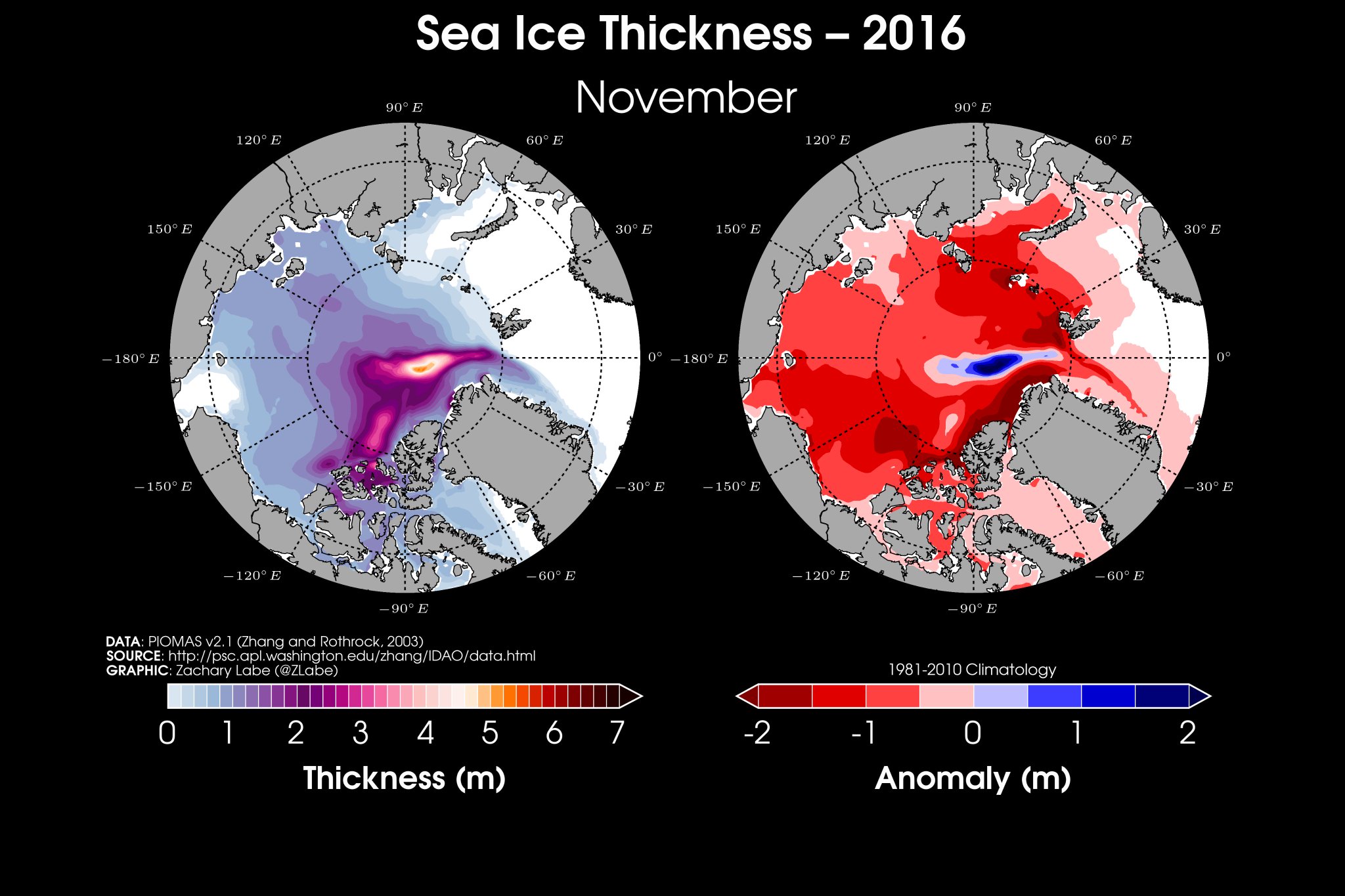
the thickest ice is supposed to be along the canadian/greenland arctic coast and it's well offshore instead. it's in a prime place to be exported out the fram
-
42 minutes ago, csnavywx said:
This is the latest I've seen the ESS stay open like this. We're now 400k+ below the previous record on extent.
IMO what's happening right now is just as wild as the 2012 min
-
what a crazy melt season. i guess these things are more prone to happening with thinner ice
-
some good animations/graphs here
-
18 hours ago, frontranger8 said:
You're confusing this with the musings of exceptionally early mins (before 9/5) we hear every year.
You think we'll see a min after 9/12?
what difference does it make? we got to second lowest without an extended summer dipole. that's more worthy of discussion
-
1 hour ago, ORH_wxman said:
CT SIA (or really NSIDC area) is something like 400k above 2012 actually.
i was using the amsr2 numbers from wipneus
-
area is only 44k above 2012 at this point
-
2 hours ago, chubbs said:
Big area losses in the CAB the past couple of days. With the stormy pattern forecast to persist for the next week, may get open water close to the pole.
-285k in two days
-
not having CT area data really stinks. i hate using extent
-
it's trended warmer

vs

Model Mehham
in New England
Posted
july is always supposed to be above normal?