

WestTennWX
-
Posts
87 -
Joined
Content Type
Profiles
Blogs
Forums
American Weather
Media Demo
Store
Gallery
Posts posted by WestTennWX
-
-
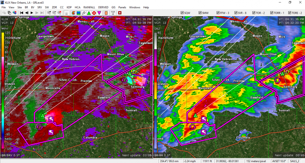
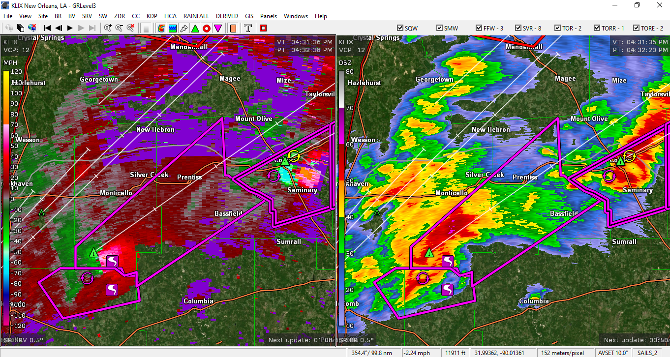
Circulation right on the heels of the Bassfield cell.
-
2 minutes ago, jpeters3 said:
Unfortunately you can't view KULM on radarscope...
Is it available via placefile...etc on GRLevel3, or GR2 analyst only?
-
Almost a doughnut hole appearance with this circulation....impressive.
-
Anyone else having trouble with their Allisonhouse feed? I lost updates on all sites, about half an hour ago.
-
Trailing edge of precip shield leaving my area right now, ended up with somewhere around .15 in or so of freezing rain. A few areas without power but nothing major. Strangely, never really had a changeover to sleet and no snow at all here. Best of luck to all of you in the East!!
-
 2
2
-
 3
3
-
-
3 minutes ago, *Flash* said:
Keep me posted as a western chase is better logistically for me than an eastern one. Just light freezing rain in the Bluff right now. Roads are fine ATM.
Will do. It's 31 here now, roads are pretty much ok, aside from overpasses. It will be interesting to see when the changeover to sleet occurs...it's been a steady rain for the better part of this evening, and still coming down steadily now.
-
4 hours ago, Carvers Gap said:
Looks like we have some snow in NW TN/SW KY/AR. Who do we have out there? Tag them if you know them.... @Will (little rock), you seeing anything yet?
All ZR here in Union City so far`, and no snow yet. Only sticking on elevated surfaces, for now. Memphis just upgraded us to WSW.

-
2
-
2
-
-
Some great links in there...I have been trying to learn more concerning model guidance and how to interpret it. So glad there is a TN valley forum now, I hope to contribute to it in any way I can!
Here are a couple of links to Beau's website and social media- he is a bit north of the TN valley but still includes West Tn and Western Ky in his discussions, he offers some interesting analysis and has quite a large following over there.
http://www.weatherobservatory.com/

April 12 Severe Event
in Southeastern States
Posted
Overlapping Tornado Emergencies issued.....has this ever happened before?