

SN_Lover
-
Posts
4,596 -
Joined
-
Last visited
Content Type
Profiles
Blogs
Forums
American Weather
Media Demo
Store
Gallery
Posts posted by SN_Lover
-
-
Just now, tramadoc said:
I see the lemmings racing to the edge of the cliff.
It's a emotional time here right now.

-
 3
3
-
-
Many are jumping ship too early. Let the run finish.
-
4
-
-
4 minutes ago, Chattownsnow said:
00Z NAM is booting up. So far out to 00 the low is a tick north and temps are a touch cooler...
")
For anyone wanting model start times and status of the united states models here is a dandy link:
http://www.nco.ncep.noaa.gov/pmb/nwprod/prodstat/index.html#TARGET
-
1
-
-
I'm expecting snow, but light on the accums. Any Snow right now is a win for all of us!
-
This is turning more into a miller a than a zipper low. Someone is gonna get their 6in or foot.
-
Just now, Met1985 said:
Actually with the way things have trended we are left high and dry. No moisture around.
buddy, the fun begins after this system. Lake effect like crazy and a bonus clipper!
-
Even though Piedmont might see some snow, the mountains are going to cash in this weekend. debating on a trip this weekend!
-
This is what is happening currently with this weekends system...
-
2
-
-
1 hour ago, Wow said:
18z GFS still trending more separation with the southern wave by 45
ICON agrees!!

-
22 minutes ago, LovintheWhiteFluff said:
Jose seems to already be moving east according to the water vapor loop. The 18z GFS didn't have it pushing east until 12hr.
Was thinking the same thing. looks like a trough is digging in currently. Could be the kicker for Jose.
-
5 minutes ago, jbenedet said:
18z GEFS says Carolina's, especially North Carolina, needs to watch Maria closely...
Only out to hr 60, but can already tell this will be west of 12z...
Still a lot of time though, we're still looking at ~5 days before any potential LF....
Scary honestly, nobody in RDU is even talking about Maria in relation to a possible landfall. Could be a CAT 2 or 3 if it landfalls. This country can't afford another disaster.
-
3 hours ago, winterymix said:
Jose is functioning somewhat like a cut off low. It is a hybrid with slight residual tropical characteristics. The baroclinic zone
associated with the Gulf Stream provides enough latent heat to keep a system going. Jose has several levels greater vorticity
than a weak depression or open wave. Jose is a picture of equilibrium, slowly weakening with very weak steering currents.
As Jose weakens, it will become less stacked much like a decaying mature cut off low where the various upper levels loose register with
the SLP.
Jose is still warm core as of present. Will continue to weaken.

-
Maria was just ramping up before 1st landfall. High winds maybe didn't mix down to the surface. Winds sure will with PR landfall.
-
WOW. Catastrophic for the entire island!
-
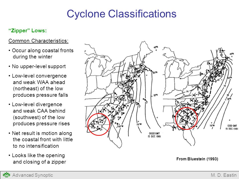
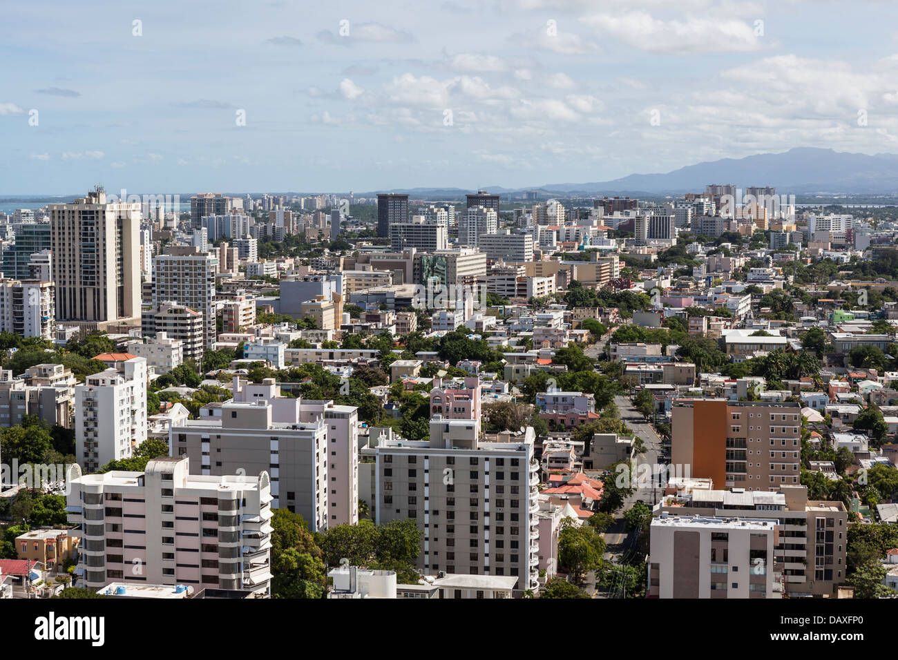
The after images will be horrifying
 Metro pop over 2M+
-
1 minute ago, jbenedet said:
The ridging over the western Atlantic and eastern CONUS, ex Jose is just all-around stronger this run.
Yup, run looks more Climo and better than yesterdays runs.
-
Jose over cool waters in the 18Z GFS allowing Maria to nudge more West.
-
1 hour ago, shaggy said:
Then the cruising industry should be donating huge sums of cash to the relief and rebuilding efforts. The cruise lines have made a fortune on the backs of these islands and I hope they remember that now in the lesser Antilles biggest time of need.
Before you comment, maybe go to their website and see the donations.
https://www.royalcaribbean.com/cruise-ships/hurricane-disaster-relief
Also, the road goes both ways. The islands would have not have gotten where they are without tourism revenue. I hope the ports open soon so money will begin bringing local economies back to normal.
https://skift.com/2013/09/25/the-caribbean-islands-most-dependent-on-cruise-business/
-
1
-
-
It's 80 in my place. I refuse to turn on the air in Feb! I'm scared for the summer. 100's?
-
The dogwoods are blooming old leaves are falling off of the trees.spring is in the air!
-
Run and get your gas and bread!!!
-
GSP seeing the trend and added Northern counties
 The trend is real folks.
-
1 hour ago, No snow for you said:
The model hugging has begun.
Beware of the 48 hour modeled jackpot zone. Those in it will not get what is predicted.
-
lol the
 's are realizing heavy snow isn't coming anymore. maybe the Ukrainian model will save the day!
Charlotte: enjoy your dusting to 2 inches
The December to Remember 7th-8th blue turd winter threat thread.
in Southeastern States
Posted
It's the SW that turned more negative near the lakes allowing the lakes low to be more dominant. This caused the gulf low to be weaker and pull more warm air to the lakes low.
#Lakeslow